Classic EBC Trek
- EBC + Gokyo Trek
- Jiri to EBC
- 3 Passes Trek to EBC
- Island Peak and EBC
- Acclimatisation
- Packing List
Get a Trek Quote
Three passes trek to everest base camp .
This guide covers the clockwise variation of the Three Passes Trek circuit by providing a detailed itinerary, route maps as well as answering questions on cost, packing, best times to trek and more.
The Three Passes Trek to Everest Base Camp is arguably the most complete trek in Nepal as it covers most of the Everest region on its circular route. The trek is more challenging than the classic Everest Base Camp Trek and its other variations as it involves traversing the three high passes that lend the trek its name – Renjo La, Cho La and Kongma La – each over 5,000m.
The trek begins in the popular starting point of Lukla before heading north along the classic trek to Namche Bazaar. Here, the route veers west as it splits from the main trek and heads up the Dudh Koshi valley, where you will encounter the first of the Three Passes – Renjo La (5,370m). After reaching the high point, the trail descends to the idyllic Gokyo Lakes and further on to the village of Gokyo .
The route then turns east as you make your way to Everest Base Camp by crossing the second pass called Cho La Pass (5,420m). After the second pass you will have the opportunity to explore the intricacies of Everest Base Camp life as well as soaking up some of the best views of Everest and the surrounding peaks when you climb the iconic viewpoint of Kala Patthar .
The inwards leg of the trek involves traversing the final of the Three Passes – Kongma La Pass (5,545m) – to join up with the classic Everest Base Camp Trek route that will take you down to Lukla, where the trek ends.
We do not sell tours, we simply provide impartial advice . If you would like an exact quote from our recommended tour operator click Get a Quote.
[adinserter block="2"]
Three Passes Trek
Regional map.
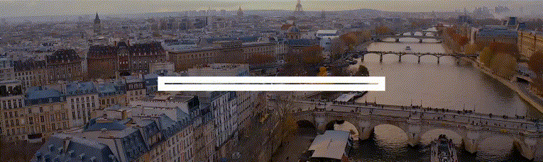
The Three Passes Trek is situated in the Everest or Khumbu region of Nepal as indicated by the orange block on the map below. Your journey will begin with a flight into the international airport in Kathmandu, the capital city, followed by a domestic flight to Lukla where the actual trekking begins.

Instead of flying to Lukla – an experience itself – you can trek the Jiri to Everest Base Camp variation . This involves taking a bus from Kathmandu to Jiri where you trek through the Solu Khumbu Valley up to Lukla before re-joining the main trek. This variation can be used for any trek that starts in Lukla, but will add at least 6 days onto the trek.
[adinserter block="3"]
Trekking Map
This simplified map below shows the Three Passes Circuit and the major towns and villages it goes through. Both the clockwise and anticlockwise variations of the trek start with the 2-day trek to Namche Bazaar where you will spend a day exploring to acclimatise to the high altitude .
The clockwise variation, detailed in this guide, follows the route north-west through the Dudh Koshi valley and the village of Thame before reaching the first pass – Renjo La. You will pass through Gokyo as you move east towards the second pass of Cho La, which takes you to the town of Lobuche. From Lobuche you will trek north to Gorak Shep – your base while you visit Everest Base Camp and Kala Patthar viewpoint.
The trek back to Lukla crosses the third and final pass of Kongma La, reaching Chhukung before joining up with the classic route back to Lukla. The last few days of the trek involve the relatively easy descent back to Lukla where your flight will be waiting to take you back to Kathmandu.
[adinserter block="4"]
Recommended Guidebooks

The Three Passes Trek is quite challenging as it involves traversing very high passes over 19 days of trekking. For this reason, we do not recommend trekking solo or without a guide who will have extensive knowledge and experience of trekking in the region.
A good guide book with a map, however, can be very useful when wanting to learn more about the area or when searching activities to do on your rest or acclimatization days.
The Lonely Planet Trekking in Nepal Himalaya guide is a regularly updated and informative guide that will include maps and sightseeing opportunities for a variety of treks in the region.
In terms of a map we recommend Nepa Maps – Three Passes and Everest Region map.
Detailed Itinerary
As with all treks, your journey to trek the Three Passes will start with an international flight into Kathmandu. A short flight to Lukla will precede the start of the trek that takes you through the Dudh Koshi valley before looping around through Gokyo and heading to Everest Base Camp. The inwards leg will take you east over your final pass and back to Lukla.
Most tour operators will list the Three Passes Trek as an 18/19-day trek. Of these days, usually 15 will be spent trekking with a further 1 or 2 acclimatization days, meaning 14 days of actual trekking can be expected.
Day 1: Arrive in Kathmandu
Arrive in the capital of Kathmandu after what is sure to be a long flight from home. Make your way to the hotel where you can relax for a bit before setting out to explore some of the vibrant city.

Vibrant streets of Thamel, Kathmandu
Day 2: Fly from Kathmandu to Lukla. Trek to Pkadking
An early morning flight will take you to Lukla, the starting point of the trek. Despite being only 35 minutes, the flight is a memorable one! Try to sit on the right-hand side of the plane for the best views of Everest as you approach Lukla.
The trek starts with fairly short descent to Phadking, where you will pass stone walls decorated with prayer inscriptions – called Mani in the local language. You will spend the night in Phadking.
Day 3: Trek to Namche Bazaar
The trek to Namche Bazaar will see you enter the Sagarmatha National Park , a UNESCO World Heritage Site. The village of Namche Bazaar is the central trading post of the region and is always bustling with life.
Day 4: Acclimatisation Day
Day 4 is an acclimatisation day spent in Namche Bazaar. Explore the village, stock up on some much-needed snacks for the trek ahead and be sure to check out the bakery – one of the best! The market on a Saturday is also a major attraction.
Day 5: Namche to Thame
The trail now splits from the popular base camp route and heads north-west through the small Sherpa village of Thamo before reaching Thame, where you will be staying the night. Take some time to learn a bit about the local traditions and their intrinsic connection with the mountain on which you are standing.
Day 6: Thame to Lumde
4-5 hours of trekking will see you cross the Bhote Koshi river before heading up the valley to Lumde. As you start to gain altitude you should get some great views of the snow-capped peaks in the region.
Day 7: Lumde over Renjo La to Gokyo
Today you will encounter your first of the Three Passes – Renjo La. The route starts off easy but will soon turn into a hard day of hiking as you near the end of the ascent of Renjo La. Try to think of the magnificent views you will get at the top to motivate you!
After the pass, you will descend to the third of the Gokyo Lakes and then trek onto the village of Gokyo for the night. After some rest you can even climb up the ridge to get some amazing views of the lakes, the highest freshwater lake system in the world.
[adinserter block="5"]
Day 8: Gokyo Ri (Acclimatisation Day)
Today you climb your first peak Gokyo Ri for fabulous views of Cho Oyu. You will do this climb early and then have the rest of the day to rest.
Day 9: Gokyo to Thaknak
Cross the Ngozumpa Glacier – the largest glacier in Nepal – over the course of an easy day’s trekking. Once again, keep your camera close as you trek through this beautiful part of Nepal!
You will reach Thaknak where you will go on a small acclimatization hike before lodging for the night.
Day 10: Over Cho La to Zungla
Often considered the hardest day of the trek, today involves traversing the second pass of Cho La. At over 5,300m, reaching the top will require some effort.
You will spot the famous prayer flags as you near the top of the pass, after which you descend over the other side of the pass to reach Zungla.
Day 11: Zungla to Gorak Shep
Start the day with an easy downhill portion to reach Lobuche, one of the major stops on the classic Everest Base Camp Trek. Join up with the crowds of trekkers as you make your way to Gorak Shep.
You will be afforded great views of the famous Khumbu Glacier as well as the peaks of Everest, Lhotse and Nuptse. Spend the night in the busy Gorak Shep.
Day 12: Gorak Shep to EBC and back
A short trek following the ridge of the Khumbu Glacier will take you to the Everest Base Camp. Make the most of your time here, as trekking groups are not typically allowed to stay overnight at the base camp.
Feel the buzz and excitement of the place, packed with potential future summiteers of Everest! Descend later that day down the same ridge back to Gorak Shep for some much-earned rest and sleep.
Day 13: Kala Patthar hike and then onto Lobuche
An early morning start is needed to summit the trekking peak of Kala Patthar – the iconic viewpoint of Everest. After snapping some pics, head back to Gorak Shep for a quick meal before descending further to Lobuche for the night.

View of Everest, EBC and Khumbu Glacier from Kala Pattar
Day 14: Kongma La Pass and onto Chukkung
You leave the classic base camp route today as you head east through the Khumbu Glacier to reach the third and final pass of the trip – Kongma La Pass. At 4,700m the pass is the highest of the three and lacks any shops or tea houses along the way.
After a tiring ascent to the top, descend into the Chukkung Valley and eventually to the village of Chukkung where you will stay in the lodge overnight.
Day 15: Chukkung Ri and then to Dingboche
Today you will climb Chukkung Ri (5,550m) and trek to Dingboche (4,410m)This peak is the hardest of the three you can attempt on this treks and involves some easy scrambling near the summit. The views from the top down the Khumbu Valley are superb. You descend to Dingboche where you will stay in a lodge overnight
Day 16: Dingboche to Namche Bazaar
A downhill trekking day will take you through the verdant fields and rhododendron covered hillside on your way to Namche Bazaar. Pass through the village of Khumjung where you can eat lunch before completing the descent to Namche Bazaar where you will stay overnight.
Day 17: Namche to Phakding
You continue through Namche Bazaar, descend Namche Hill and cross the Dudh Koshi. You are now sauntering back along familiar paths to Phakding. Overnight lodge.
Day 18: Phakding to Lukla
The last day of trekking will take you through some lovely pine scented forests before reaching Lukla where a cold drink and a hot meal await you!
Day 19: Fly back from Lukla to Kathmandu
Weather permitting, catch the morning flight back to Kathmandu to end off what is sure to be the trip of a lifetime.
Day 20: Depart Nepal
After your last night in Nepal, make your way to the airport to hop onto your flight back home, where you can tell all your friends and family about the time you had!
Altitude Profile
The altitude chart below shows the typical progression of the Three Passes Hike through the major stopping points along the way. The three spikes of the passes are clearly visible along with the spike of Kala Patthar – the iconic viewpoint.

The ascent profile of this trek is slightly harder than the classic Everest Base Camp trek because it involves rapid ascents of the passes.
Three Passes Trek FAQ
How much does the three passes trek cost.
Tour operators will charge in the region of £1,200 to £2,500 for a guided Three Passes Trek. We definitely recommend using a tour operator for a trek of this difficulty and length – preferably a western tour operator whose guides and equipment will be of a higher standard.
The cost will include all board and lodging for the 18 days, all domestic travel and domestic flights, meals, shared equipment and knowledgeable guides. For a detailed breakdown of costs on the classic Everest Base Camp Trek, read our article here .
When is the best time to trek the Three Passes?
As with all treks in the Everest region, it is advisable to avoid the winter months as well as the peak summer months during the monsoon season. The shoulder months of February-May and September-October provide the most stable and dry weather conditions for trekking.
Our detailed article on the best time to trek in the Everest region will give a much more in-depth analysis of the conditions faced in different months.
How difficult is the trek?
The Three Passes Trek is considerably harder than the classic Everest Base Camp Trek so we recommend you have a good fitness level before embarking. Ascending the high passes involves long days of strenuous trekking that would not be encountered on the classic base camp trek and other variations.
6/7 hours of trekking per day is to be expected and altitudes of up to 5,500m are reached on the trek. That being said, the trek is still very popular among people wanting a bit more of a challenge. Read our training article to get an idea of how much you should prepare for a trek in Nepal.
Will I get altitude sickness?
Despite crossing some very high passes, the trek has been designed to follow the principle of trek high, sleep low. That means that you will not be spending extended periods of time at altitudes above 5,000m. The itinerary also has acclimatisation days as well as nights spent at lower altitudes to help the acclimatisation progress. If you follow the guide you should not have a problem.
That being said, altitude sickness can affect anyone regardless of age or level of fitness so we recommend doing some preparation reading. Our detailed article on altitude sickness and acclimatisation is a good starting point.
What gear should I pack for the Three Passes Trek?
The packing list for a trek of this length can look quite long! For this reason, we have dedicated an article to help you tackle the challenge that is packing. In our Everest Base Camp Trek packing list we provide list of clothing and equipment that you should bring, as well as some brands that we recommend based on our experience of using them.
What insurance do I need?
The short answer is yes. Trekking in Nepal at high altitudes comes along with various risks that are not covered by typical travel insurance. We recommend taking out insurance that covers trekking to altitudes up to 6,000m as well as medical evacuation from the mountain.
We have a detailed article to help to find the best policy that will suit your needs. Alternatively, use the quote calculator below from our recommended partner, World Nomads. They offer insurance that covers guided hikes up to 6000m and include a premium for Helicopter Evacuation in Nepal.
Route Variations

One of the more popular variations of the Everest Base Camp Trek , the Gokyo Lakes Trek, also starts at Lukla and follows the classic base camp trek to Namche Bazar where it forks north-west.
The trek proceeds through the towns of Dole and Machhermo before reaching the stunning Gokyo Lakes. From there you ascend to the peak of Gokyo Ri in the north, before traversing Cho La Pass and re-joining the classic trek at Lobuche.
The detour adds 2/3 days onto the trek but provides the wonderful opportunity to summit a peak while also avoiding some of the busier parts of the trek.
Gokyo Lakes Trek

One of the more popular variations of the Everest Base Camp Trek, the Gokyo Lakes Trek, also starts at Lukla and follows the classic base camp trek to Namche Bazar where it forks north-west.
Jiri to Everest Base Camp

This variation of the classic trek offers an alternative to flying into to Lukla from Kathmandu to start the trek. The Jiri variation starts with an 8-hour bus ride from Kathmandu to Jiri, where the trek begins.
The variation adds an extra 5/6 days onto the trip as you trek through the Solu-Khumbu region and make your way past Lukla, where the trek then follows the same route as the classic Everest Base Camp Trek.
It involves a scenic, yet very long, bus ride as well as a lot more exposure to the Tibetan and Sherpa cultures. Expect to trek through more forests and streams as you start at the relatively low altitude of 1,800m and work your way up to Lukla and beyond.
Island Peak Climb

The variation trek that involves summiting Island Peak is significantly harder than the classic Everest Base Camp Trek. The climb to the peak is somewhat technical although and requires basic knowledge of using crampons and ice axes. Standing at just under 6,200m, however, altitude can be the real challenge.
Most climbers of Island Peak use the traditional base camp trek as a means of acclimatising before heading to the Island Peak Base Camp via Dingboche on the main trail, or by traversing the Chongma La pass. Summiting from the base camp typically takes two days and the whole variation will add around 4 days onto the classic trek.

Mark Whitman
Hi, I'm Mark! Welcome to EBC Trek Guide - the Web's No.1 Trekking Guide to Everest Base Camp. I have trekked all over Nepal, but the Everest region remains my favourite. I hope you find all the answers you are looking for on this site. If you have any questions don't hesitate to drop a comment below! Happy Trekking!
Leave a Reply
Your email address will not be published. Required fields are marked
Thank you. How slippery or rocky is the terrain on cho la pass? I don’t feel comfortable boulder hopping or walking on slippery terrain. You can train for uphill or distances but being able to balance on icy or scree surfaces is something else. We are looking at going in october . Any comments would be most welcome.
Hi Brigitte, the Cho La Pass consists of mix terrain that can vary quite considerably depending on prevailing weather conditions during the week you go. In general through you can expect mixed rock / scree terrain with areas that can be a little slippery with black / blue ice. Careful footing throughout is important. Show cover is quite likely too so it is worth taking basic yak tracks just in case you need additional grip. Hope this helps!
Is the path traveled and visible? Are there cairns, that Point the pass? Are there some kind of signs along the path? Is it easy to get accommodation for the night? Thank you
Hi Francisco, the three passes trek does follow a well defined route but it is not very well signposted. I would recommended taking a guide and / or getting a detailed map of the region. Accommodation throughout the route is not a problem, there are many small villages on the route and all have teahouse accommodation for trekkers. All the best!
What do you do for food along the route? The 3 peak pass in particular. Do you buy food for the day at every tea house? Thanks
Hi Frank, there are lots of teahouses along the Three Passes trek. In terms of lunch you can usually find a teahouse to stop at half way through your daily trek, or take a snack with you and only stop for dinner.
Thanks for the reply Mark!
Thanks for the useful information. Is this trek possible late December-early January? I did ACC last year late Dec-early Jan (including Tilicho), and it was wonderful, although desperately cold at higher altitudes. I assume this trek is colder as I would spend more time at higher elevation. I also appreciated that although less crowded that time of the year, there was good company in the higher teahouses and passes. Although I have no problem trekking alone, I would not feel completely comfortable spending days around 5000m completely alone. So my question would be, is this trek less crowded generally and colder than Annapurna Circuit?
Hi Daniel, I would say this trek will be colder than the Annapurna Circuit in Dec/Jan as you spend a lot more time at high altitude. The passes are also prone to closing in the winter if the weather is bad and there has been a lot of snow fall. I would definitely recommend taking a guide if you plan to trek the three passes.
I am planning for three pass trek in the first week of may. I have 15 days Itinerary. Is it possible to get it done including island peak. I am fit and I have plan to walk 9 hours per day. Plz let me know.
Thanks & Regards, Gopal
Hi Gopal, it’s possible to complete the 3 passes trek in 15 days, but the risk of altitude sickness (unless you are pre-acclimatised) is pretty high. Adding in Island Peak in addition would be a big ask, but doable if you are super fit and deal with the altitude well on the passes trek.
Hello there. I’m planning on attempting the 3 passes trek November 20-Dec 9 of this year. Is there a reason that you suggest clockwise? Most of the other places I have seen are suggesting counterclockwise. Any info would be greatly appreciated. Thanks!
Hi Murphy, thanks for getting in touch. I have no strong preference for either format. The reason why I suggest the clockwise route is because this is the I followed when completing the 3 Passes. The counterclockwise is equally as valid though.
Hi Mark, I am thinking about doing the Three Passes Trek. I have done Kilimanjaro one year before and further I do sport (mostly running, climbing, cycling) 3-4 times a week. However, I have never trekked for 19 days at high altitude and I don’t do a lot of trekking in my free time. Neither do I live in a place where my body is accustomed to higher altitude. I wonder if this is a trek I could do? Thank you in advance for your thoughts.
Hi Elene, you definitely sound fit enough to complete the 3 Passes. The key is to pace yourself, build in enough acclimatisation days to get accustomed to the high altitude, and make sure to look after your health with a good diet throughout. If you completed Kilimanjaro, you can definitely do the Three Passes. All the best!
Hi Mark thanks for all your useful information. I’m hoping to complete the Three Passes soon. I have years of experience. When would you suggest is the earliest I can expect to safely complete it. Mid-February OK?
Hi Rick, mid Feb can still be quite snowy and the passes may be closed. If you can push your dates a little bit further out – to mid March – then the probability of closed passes reduces (obviously there are no guarantees though). All the best!
Get a quote from the best local trek operator in Nepal!
Ask me your questions.
Get your EBC questions answered
Join my Free Facebook Group
Get my recommendations on the Best EBC trek operators

Details of Everest Three Passes Trek Map And Itinerary
- Last Updated on Dec 2, 2023
We at Mountain Rock Treks provide you with the best and most interactive maps and itineraries for the Everest Three Passes trek of the Everest region. Our Updated Everest three passes trek map and itinerary provides all the trekkable routes in the Khumbu region.
Our Everest three passes trek map offers all the new updated routes. Likewise, we have uploaded the map in its original and high quality, where the trekkers can experience an exact print copy of the Everest three passes geographic map online. Our map beautifully demonstrates the various trails and landmarks. Also, there is a feature of zooming in and out to discover the places and highlights you have been searching for in the Everest Three Passes trek.
Therefore learn more about the Everest Three Passes Trek Map and Itinerary.
Table of Contents

Everest Three Pass Trek | Booking Cost for 2024-2025
Understanding everest three passes trek map.
Talking about the Everest Three Passes trek is one of the most recognized treks close to the world, tales mountain- Everest. Many trekkers venture to the Everest region after a short flight from Kathmandu to Lukla to make a circuit trek successful. If you are considering completing the Everest three passes trek, remember to carry your Everest three passes trek map and itinerary with you provided by Mountain Rock Treks.
It is a modern ear, and technological gadgets are a must to make your trek in any place more hassle-free. Similarly, these technological gadgets are helpful, as you can learn and plan the route you will be taking in advance, allowing you to complete your trek more easily and quickly. However, one example of such technical gadgets is Handheld GPS, which has taken over the market recently.
However, the electronic device can fail, so to prevent you from being stuck, you can always carry a paper Everest three passes trek map and a compass or backup from Mountain Rock Treks. In fact, we, too, provide our guests with one full piece of ma before trekking to Everest three passes trek.
Everest is the tallest peak in the world, with its peak rising above 8,848.86 m (29,031 ft). and trekking to its base camp or around means trekking to the famous area, which is visited by almost thousands of travelers every year.
The trek through Everet's three passes gives you breathtaking views of the famous peaks rising above 8000m, 7000m, and 6000 m. Likewise, it also means trekking through the multiple Sherpa villages in g with the multiple landscapes and diversity of flora and fauna of Sagarmatha National Park. In simple words, Everest three passes is a trek to the area of Mt. Everest. Using our trek to Everest does not rise in its glory alone. There will be several peaks like Makalu (8,516m), Lhotse (8,516m), and Ama Dablam (6,812m) to accompany you as you second higher with the help of our Everest three passes trek map itinerary.
The trail of this trek is somewhat tricky as you need to pass through three high passes of the Everest region: Cho La Pass, Renjo la Pass, and Kongma La Pass. So if you are just a beginner in trekking, do some serious physical endurance training and more.
In addition, there are many routes for Everet's three passes to choose from. With this in mind, you can not opt to take on a regular Everest three passes trek and pick different starting points and ending points for this trekking. Therefore Mountain Rock Treks Everest's three passes trekking route and itinerary help you to decide about the track, which is very consuming and equally adventurous, so you do feel guilty about not taking the conventional route of Everest three passes trek.
With the help of this map, you can learn about the distance, altitude, places, etc., which is an essential piece of information. Following this map, many people have finished their trek quickly.
Our Everest three passes trek map and itinerary are carefully planned for trekkers. It provides information about altitude, distance, and various places (famous and remote). Everest’s three maps and itinerary have guided trekkers around the Everest region.
Everest Three Passes Trek Summary
Everest Three passes trek which officially takes place in the Everest region and contains some of the major attractions to visit, like Renjola Pass, Gokyo Lake, Khong Ma la Pass, Chola Pass, Everest Base Camp, Kala Patthar, and More. Therefore with our three passes trek maps and itinerary, you will take the same route as the standard Everest base camp trek but with many bonuses.
Everest three-pass trek map guides you to the remote and off-the-beaten path, which only 5-10% of the 60,000 EBC trekkers have followed.
The Everest Three Passes trek's standard starting point is the same as the Everest base camp trek , which you can see below on the map. Trekkers will first take a 35-45 minute flight to Lukla referred, the most dangerous airport in the world. The treks now start after you land in Lukla. Lukla airport is colored a most dangerous one probably because of its weather, altitude, size, and location.
Trekkers can choose from many route options as the trek lies within the Everest region's off-beaten paths. But trekkers should be considerate and choose the trails to reduce the risks of high altitude sickness gradually. If you choose the clockwise route from the Namche Bazaar to Thame, you will reach your first high pass in two or three days. This route has both advantages and disadvantages. The disadvantage because this could be risky as the highest pass is located above the 5000m elevation here, and the advantage is it's the perfect route if you want to avoid overcrowding.
If you go with the Everest Three Passes Trek clockwise, the route will include at least one acclimatization day in Mirlung. This will increase your trek success ratio without causing any sickness issues.
Clockwise Everest three passes trek is a fast way to complete the trek, but we at Mountain Rock Trek offer you the counter-clockwise route, which is far better than the clockwise route. This being said, you will follow the Everest three-passes trek map that takes you along the EBC trail up to Dingboche . You take another route from Dingboche to your first high pass, called Kong Ma La Pass, at 18,209 ft / 5,550 m. This route map is better for proper acclimatization before hiking through high passes. The only disadvantage is that trekkers may have to deal with overcrowding for the first few weeks.
Everest Three Passes Trek Map Explanation
Our Everest three passes trek map is an updated and high-quality map that will accurately describe the Everest three-pass trekking route in the Everest region. Trekkers have many options, from the starting point to the ending point.
For example, instead of taking a direct flight to Lukla from Kathmandu, you can travel by land from Phaplu or Jiri and then to Lukla for a more gradual ascend. Many options like this may confuse you, so we provide You with Mountain Rock Treks' detailed Map below, which will help you choose the best route, clockwise or anti-clockwise, for Everest three passes trek.
What is included in the Everest Three Passes Trek map?
Our Everest three-pass trek map shown above is the exact digital copy of the print version. With the coordination of the experiment, map developer Mountain Rock Treks has brought this Map online to provide its trekkers with the best experience during their Everest hike.
Our Everest three passes trek map is well-designed and presents both the physical features and terrains of the Everest region and the three passes. Our Map also shows the highest and lowest elevations, along with the. Moreover, you can also see many colorful symbols representing mountains, trails, driving trails, waterfalls, glaciers, roads, etc.
Our Everest three passes trek map includes:
- A comprehensive list of local villages is in blue, along with their respective elevations.
- The simple symbol represents the detailed mapping of all flights you will take.
- Identification of panoramic viewpoints along hiking trails, marked in numbers ensured in yellow circles.
- Collection of mountain names in the Everest region, along with their elevations, denoted by the mountain's symbol.
- Identification of temples.
- Provision of a map indicating alternative side trips apart from the classical route represented by a blue dotted line.
- A red flag represents the list of all high passes within the Everest region.
- Our map also shows the avalanche area denoted by the white mountain encircled in the blue circle.
Note: This representation of the Everest Three Passes trek Map allows you to zoom in and out for convenience. Just right-click on our map to enlarge it.
Everest Three Passes Trek Outline Itinerary
Day 1: arriving in kathmandu.
- Kathmandu Elevation- (1,400m / 4,593ft)
- Airport to Thamel Driving Time- 20/30 minutes
- Accommodation- Hotels
Day 2: Fly Kathmandu-Lukla and Trek-Phakding
- Lukla Elevation-(2,850m / 9,350ft)
- Phakding Elevation- (2650m / 8562ft)
- Flight Hours- 40 Minutes
- Trek Distance- 6.2km / 3.8miles
- Trekking Hours- hours
- Accommodation- Tea Houses
Day 3: Trek Phakding-Monjo and Namche Bazaar
- Monjo Elevation- (2,835 m/9,301 ft)
- Namche Bazaar- (3,440m / 11,285ft)
- Trek Distance- 7.4km / 4.6miles
- Trek Hours- 6 hrs
Day 4:Acclimatization Day
Day 5: Trek Namche Bazaar - Tengboche
- Tengboche Elevation- 3,870m/12,697ft
- Trek Hours- 5/6 hrs
Day 6: Trek Tengboche-Dingboche
- Dingboche Elevation- 4,360m/14,305ft
Day 7: Trek Dingboche- Chukung
- Chukung Elevation- 4,730 m/15,518 ft
- Trek Hours- 4 hrs
Day 8: Trek Chhukung to Kongmo la pass - Lobuche
- Kongmo la pass Elevation- 5,550 m/ 8,209 ft
- Lobuche Elevation- 4,940 m (16,210 ft)
- Trek Hours- 7-8 hrs
Day 9: Trek Lobuche - Gorakhshep
- Gorakhshep Elevation- (5,164 m/16,942 ft)
Day 10: Trek Gorekhshep-Kalapathar-Dzongla
- Kalapathar Elevation- (5,644.5 m/18,519 ft)
- Dzongla Elevation- (15,846 ft / 4,830 m)
Day 11: Trek Zongla-Chola pass and to Thagnak
- Cho la pass Elevation- (5,420m/ 17,782 ft)
- Thagnak Elevation-4700 m/ 15419 ft
- Trek Hours- 3/5 hrs
Day 12: Trek Thagnak to Gokyo
- Gokyo Elevation- (4,750 m/ 15,583 ft)
Day 13: Rest day
Day 14: trek gokyo to renjo la pass- marlung.
- Renjo la pass Elevation- (5,360 m / 17,560 ft)
- Marlung Elevation- (4,210m/ 13812 ft)
- Trek Hours- 8/9 hrs
- Trekking Distance- 9.5 km / 5.6 mi
Day 15: Trek Marlung to Thame-Namche Bazaar
- Namche Bazaar Elevation- (3,440 m / 11,286 ft)
- Thame Elevation- (3820 m/12,533 ft)
- Trek Hours- 7/8 hrs
Day 16: Namche-Phakding-Lukla
- Trekking Distance- 17.6 km / 10.7 mi
Day 17: Fly Back to Kathmandu
Day 18: final, departure or onward for the next program, details itinerary of everest three passes trek.
Today, we will pick you up from Tribhuvan International Airport and transport you to your hotel in Thamel, a bustling and lively district of Kathmandu. The journey from the airport to the hotel takes approximately twenty minutes or thirty.
Once you are all settled in and want to explore Kathmandu and Thamel, we can help you. The central lanes of Thamel are exclusively designated for pedestrians, creating a perfect environment for leisurely exploration, especially at night.
Day 2: Fly Kathmandu-Lukla and Trek-Phakding
Your official journey begins today with a short flight to Lukla, about 35-45 minutes. After landing at Lukla, we trek toward the Phakding past Chaurikharka village.
Today will be a short trek, which also helps in acclimatization. Overnight will be at one of the teahouses in the Phakding. During your leisure time here, feel free to venture out and discover the attractions in and around Phakding. Phakding lies in the lower elevation; you still enjoy the facilities like shops, hotels, swimming pools, and restaurants. Moreover, there are also famous local monasteries around here. Among them, the one not to miss is the monastery named Rimishung Monastery.
Today's trek will be harder than yesterday's and will take us up the Dudh Kosi Valley. Along the way, we will encounter the enchanting Toktok Waterfall near the park's entrance, providing an ideal spot for a brief rest.
As we trek, one of the most exciting aspects of today's journey will be many bridges that span the river, creating a fascinating crisscross pattern. Also, these suspension bridges are adorned with vibrant prayer flags and often tower high above the rushing waters. The Edmund Hillary Suspension Bridge is the main highlight, towering 125 meters (410 feet) above the river and stretching 140 meters (459 feet). We will reach Namche Bazaar shortly after crossing the bridge and stay the night there.
Day 4: Acclimatization Day
Today just enjoy your rest day at Namche Bazaar. Acclimatization at Namche Bazaar allows your body to acclimate to the increased altitude. However, there are numerous activities you can opt for, such as exploring the Sherpa Museum or the nearby monastery. Additionally, you can go on a short day hike to the Everest View Hotel, where you can relish a refreshing beverage and indulge in a delightful snack. Or you can watch Everest and enjoy the day at Namche Bazar.
After a whole day at Namche Bazaar, you will trek towards Tengboche (a village near Pheriche Valley). We will gradually reach the northeast following a smooth and level contour path. Eventually, the trail today will lead us down to the valley floor before ascending to Tengboche.
As we reach the Tengboche mountain peak, rising above the clouds like Tawache, Everest, Nuptse, Lhotse, Ama Dablam, and Thamserku will greet us. We will also visit Tengboche monastery, the largest one in the Khumbu region. This monastery is surely worth visiting due to its 20-foot Buddha sculpture. Likewise, you also get to learn about detailed wall hangings, Buddhist culture, and more. We will stay the night at Tengboche.
Leaving Tengboche, we will ascend to the Imja Khola valley passing through the woods and views of peaks rising above 700m and 8000m in front of us. After trekking for around three kilometers from Tengboche, we will pass by Pangboche (3,985 m), the highest year-round settlement.
Just before reaching Dingboche, there is a separation in the road. Those following the traditional EBC trek continue on the left path, leading to the village of Pheriche. However, we take the right path and cross a bridge, followed by a challenging ascent to Dingboche. We will spend the night in one of the tea houses. The surrounding Dingboche is beautiful, with mountain peaks like Kangtega, Cho Oyu, Ama Dablam, and Taboche.
Today, we will take on a less challenging journey, following a gentle slope along the Imja Khola valley floor towards the village of Chhukung (or Chukhung). This section of Sagarmatha National Park is notably peaceful, resulting in a less crowded trail than the route leading up to Tengboche.
Along the way, we will pass by fields enclosed by stone walls and eventually venture into the moraine area before reaching Chhukung.
Chhukung, originally established as a village of teahouses (lodges), serves as a convenient stopover for trekkers en route to Kongma La and climbers aiming to reach the peak of the Island Peak.
Day 8: Trek Chhukung to Kongma la pass - Lobuche
Today we will hike through our first high passes called Kongma La. Also, it surpasses the elevation of Everest Base Camp. Kongma La pass lies more easternmost and is the highest among the three passes and Everest base camp.
Considering these challenges , today calls for unwavering focus, crampons, and trekking poles, as a significant portion of the route is rugged and uneven. However, there are also stretches of the trail that are remarkably smooth during the ascent.
Upon reaching the summit, a feast for the eyes unfolds with awe-inspiring vistas for trekkers to the east and west. These panoramas make the difficult climb entirely worthwhile. Thus, proceeding slowly and at one's own pace is crucial. There is no need to rush.
As we are ned of the high pass, e ill pass the Khumbu Glacier, the same glacier that flanks Everest. Also, it is the largest glacier in Nepal. After crossing the Khumbu Glacier, we will reach Lobuche, where we will also spend the night.
Day 9: Trek Lobuche - Gorak Shep
Gorakshep lies ahead, trail winds through Khumbu Glacier's lateral moraine. Passing the pyramid signpost, we glimpse Everest's north ridge, Pumori, Mahalangur, Lingtern, Khumbutse, and Nuptse. Likewise, ThangmaRiju unveils a 360-degree vista of snow-clad peaks.
A top Changri glacier, Kala Patthar, reveals beneath Pumori's green knoll. Gorakshep offers a view of snow-capped mountains, including Everest. The trail leads to Everest base camp via Gorakshep Lake, Indian army memorials. At base camp, we will witness treacherous Khumbu icefall, Nuptse, and Khumbutse dominating colorful mountaineers' tents.
Kala Patthar tops everyone's list as it provides a breathtaking view of Everest. Today, we will head north for the climb. It's not too difficult, but the altitude makes it tiring for us to move.
After capturing Everest's beauty and other peaks, like Lhotse and Makalu, from Kala Patthar, we return south via the traditional Everest Base Camp trail. Passing through Lobuche, we will divert west near the Imja Khola River, heading to Dzongla village. The path to Dzongla is clear, offering incredible mountain vistas. Peaks like Arakam Tse, Cholatse, Taboche, and Chola Tsho Lake greet us.
Today we will go for our second high pass, Cho La, at 5,420 m / 17,782 ft and 5,420 m / 17,782 ft. Crossing Cho La Glacier during the ascent makes this pass quite challenging. But, reaching the summit grants us breathtaking panoramas in both the eastern and western directions, where many peaks surround us. On the way down, the descent proves to be even steeper than the ascent, so we need to be more careful during this section.
Once we successfully conquer the pass, our trek takes us through the picturesque village of Thangnak, which is nestled close to the base of the pass. This remote and stunning portion of Sagarmatha National Park remains hidden from the view of many.
Our third high pass is still uncrossed, so we will leave Thangnak early in the morning and hike toward Gokyo. Gokyo is a small village that proudly resides in the majestic presence of Mt Cho Oyu (8,150 m / 26,739 ft), famed as the sixth-highest mountain.
Ngozumpa Glacier is located directly above the village, and it stretches out, showcasing its magnificence as the longest glacier in the entire Himalayan range, spanning an impressive distance of 36 km (22 mi). Adding to its allure, Gokyo finds itself graced by one of the most remarkable features in the world—the Gokyo Lakes.
This pristine freshwater lake system sits at the highest altitude globally. These lakes hold deep significance for Buddhists and Hindus, with approximately 500 Hindus embarking on an annual pilgrimage to immerse themselves in their sacred waters every August.
Today holds a momentous occasion as we hike on a thrilling expedition to conquer the summit of Gokyo Ri (Peak), granting us extraordinary panoramic vistas. Our journey encompasses a relatively straight path leading us to the peak and back to Gokyo overnight.
From the pinnacle of Gokyo Ri, our eyes feast upon the majestic spectacle of Gokyo IV (or Tonak Pokhari), the largest among the Gokyo Lakes, sprawling beneath us in the north. Towards the southwest, the mesmerizing sight of Renjo La captivates our gaze, anticipating our forthcoming traverse. Extending beyond, to the north and east, an unending procession of illustrious peaks unveils itself, including four towering giants that surpass the formidable 8,000-metre mark: Everest, Lhotse, Makalu, and Cho Oyu!
Today, we will pass on the third and final leg of our trekking route, Renjo La (5,360 m), a pass lower than the previous two we conquered. Interestingly, you might encounter local people with their yaks along the way as they populate this path. Renjo La is relatively quiet compared to other passes, with only some trekkers passing through.
We begin our journey by leaving Gokyo behind and heading west, walking alongside the lake's northern edge. And as we gradually ascend the pass, the view behind us unfolds, revealing the breathtaking beauty of Gokyo and Ngozumpa Glacier. The higher we climb, the more magnificent the panorama becomes. The terrain leading up to Renjo La is rugged and uneven, making it a perfect day for using trekking poles.
Our overnight stop is Marulung, one of the few settlements in Sagarmatha's less densely populated area.
Today we trek from Marlung to Namche Bazaar. For this, we started our journey early and walked alongside the Bhote Kosi River. The valley initially presents a steep terrain but gradually widens as we continue t trek. Unlike some other regions, this serene valley remains relatively untouched by the effects of tourism, so we see very few travelers here.
Our journey takes us through the picturesque village of Thame, once inhabited by renowned Sherpa mountaineers such as Tenzing Norgay and Apa Sherpa. Visiting Thame Monastery, situated above the village, is highly recommended if time permits.
We will return to Namche Bazar from the very different path we took the previous time. This path will reward us with breathtaking scenery as we traverse along the contour of the northern bank of the Bhote Khosi, a tributary of the Dudh Khosi. Those fortunate enough to be in Namche on a Saturday can explore its vibrant market.
We again retrace our steps back to Lukla from the Namche bazaar.
We took a two-day journey from Lukla to Namche Bazaar during our ascend expedition, with a brief overnight stay in Phakding. However, on our way back, we will cover the same distance in a single day, allowing our bodies to relax and hike simultaneously. We will stay overnight at Lukla.
Today we will wake early and have our breakfast in Lukla. If everything goes well, we will board a plane for a 40-minute flight to Kathmandu. This flight will be relaxing with the landscapes and forest views below you. After reaching Kathmandu, you can relax in your hotel or just stroll around the Vibrant Thamel for some shopping.
As the last day arrives, you bid farewell to Kathmandu and take a flight back to your homeland, cherishing the remarkable memories of an extraordinary trekking expedition in the Everest region of Nepal.
- Latest Update

Dipak Pande
Dipak starts to step up from potter, guide, and trekking leader to the company owner. Sometimes he share his experience with others as well as wrote in local travel news. Most of time he spend his time on mountain and his company.
Drop a message
Recent posts.
- Early Bird Booking or Low Deposit Holidays in Nepal
- Manaslu Circuit Trek in Spring 2025 on March, April and May
- Female Trekkers Safe to trek in Langtang valley?
- Shamanism Tour in Nepal - Spiritual and Meditation
- Why Manaslu known as a killer mountain in Nepal?
- Top 20 Winter Things to Do in Nepal - Hiking & Tour
Related Posts
- Everest Trek Guide
- Latest News and Update
- Map and Itinerary
- Nepal Trekking Cost
- Peak Climbing
- Tour in Nepal
- Trekking in Nepal
We use cookies to ensure that we give you the best experience on our website.
Halfway Anywhere

Guide to Nepal’s Three Passes Trek

The Three Passes Trek in Nepal is in the Everest Region (Sagarmatha National Park) and takes trekkers across three high passes, Kongma La (18,209 ft / 5,550 m), Cho La (17,782 ft / 5,420 m), and Renjo La (17,560 ft / 5,360 m) – hence, the Three Passes Trek. It’s a lollipop loop that can be done starting at Lukla (that scary mountain airport that you fly into) or further down the mountains at Jiri, Shivalaya, Salleri, or Phaplu (I recommend starting at Jiri if you have the time – it will also save you on having to buy plane tickets to/from Lukla).
If you’re only going to Nepal once in your life – as you should – and you’re intent on hiking (not doing a meditation retreat or growing dreads and hanging out in Pokhara), then you need to do the Three Passes Trek. And ideally, you need to hike in from Jiri. Fuck Everest Base Camp, fuck the Annapurna Circuit, fuck the Manaslu Circuit , and fuck Poon Hill. Three Passes Trek from Jiri. This is what you need to do. And if Everest Base Camp is really important to you, it can easily be done as a detour from the Three Passes Trek (normally this will add one day – if you’re slow, maybe two; if you’re fast, maybe none).
Are you required to have a guide for the Three Passes Trek? No. Do you need a guide for the Three Passes Trek? Not really (do not buy into all the fear-mongering in Kathmandu – these are just people trying to get you to hand over your rupees). Is hiking the Three Passes Trek expensive? No. Do you need to bring a tent, sleeping pad, or winter sleeping bag? No. Is it expensive to fly to Nepal? Usually, yes, but once you arrive, everything is cheap!
Three Passes Trek Facts
- (Unofficial) Capital: Namche Bazaar
- Language: Nepali
- Currency: Nepalese Rupee, NPR
- Time Zone: NPT (UTC+05:45)
- Calling Code: +977
- Drinking Age: 18
- Drinking In Public: Yes
- Drinking Tap Water: No
- Flushing Toilet Paper: No
- Vaccinations Required: CDC
- Credit Cards: Carry cash
- Tipping: Not expected
- Emergency Number: 100
- Outlets: Type C / D / M (230 V / 50 Hz)
- Visa Requirements: External Link!

Three Passes Trek Basics
On the Three Passes Trek, almost everyone you meet will have some English language abilities (talk to the kids – they’re very interested in you), so don’t fret if your Nepalese or Hindi is rusty. The two words that you’ll need are namaste (hello) and dhanyabad (thank you). The Sherpa language, called Sherpa, is also spoken by some people. Sherpa is unwritten, which accounts for the various spellings of many of the villages (e.g. Dzonglha/Dzongla/Zonglha), so don’t worry if you’re confused by different spellings on your map versus the menu in your tea house versus your guidebook (which is probably too heavy to be carrying in the first place).
The route to the Three Passes Trek heads north into the mountains until Namche Bazaar. From here, hikers can choose to hike either clockwise or counterclockwise. Counterclockwise is the more common route and the one I recommend (particularly if it’s your first time at altitude). The Three Passes trek takes trekkers through four valleys in addition to the three passes, Kongma La (18,209 ft / 5,550 m), Cho La (17,782 ft / 5,420 m), and Renjo La (17,560 ft / 5,360 m). Kongma La is generally considered the most difficult (longest), Cho La requires you to cross a glacier (microspikes are helpful here), and Renjo La is commonly thought to be the easiest. Granted, this can all change depending on weather and conditions. For more on the Three Passes Trek route, check this post .
The tea houses (i.e. lodges) scattered throughout the villages along the Three Passes Trek are where you will (probably) stay each night (if you wanted to camp, you could, but it’s totally unnecessary and absolutely not required). During peak season, these can (apparently) get crowded. However, if you’re awesome and you go in the winter (more on this below), you shouldn’t have any trouble finding space in a lodge (as practically half of all the buildings in any given town are lodges). The tea houses usually cost between 100 and 400 rupees per night (~$1-$4) and have hot meals and beverages for purchase.
As much as you may imagine “trekking through the Himalayas” to be an exercise in solitude, this idea errs wildly on the side of “nope, sorry.” On the the Three Passes Trek, you will be constantly met with other trekkers, locals, pack animals, and, most exciting of all, villages. Depending on your route, you may pass through as many as five or six villages in a single day. They all (at least on the Three Passes Trek) have food, accommodation, and friendly mountain-dwellers to aid you on your way up into the mountains. If you go up alone and decide you need a guide, hiring someone from one of the villages to go with you on your trek will also be possible.
The most popular season for the Three Passes Trek is the same as Everest Base Camp, the fall (September to November). The second most popular season is spring (March to May), also the peak season for Everest climbers. The summer months are monsoon season in Nepal, so unless you are a huge fan of trekking through the rain with limited views, it’s probably best to avoid this time (unless you are willing to trade views for solitude – but maybe you’ll get lucky with the weather). Winter generally has limited crowds and great weather, but it is cold (I like the winter – more on this below).

Three Passes Trek Route
The Three Passes Trek trail is very well-defined. The scale of the mountains makes navigation much different than what you would find in a heavily forested area. Most of the time, you walk up, down, or across a valley and have few options for where to go. It’s not like you will suddenly make a wrong turn left and accidentally go over a 23,000 ft / 7,000 m. You can get a paper map in Kathmandu for the region, which should help you with the big junctions (if you somehow find yourself alone and with no locals to ask for directions). For more on the Three Passes Trek route, check this post .
As stated above, the passes are Kongma La (18,209 ft / 5,550 m), Cho La (17,782 ft / 5,420 m), and Renjo La (17,560 ft / 5,360 m). Again, Kongma La is generally considered the most difficult (longest), Cho La requires you to cross a glacier (microspikes are helpful here), and Renjo La is commonly thought to be the easiest. Granted, this can all change depending on weather and conditions. It’s wise to get an early start on the days you plan to cross each pass to give yourself adequate time and avoid the afternoon weather (typically worse than what you wake up to).
Everest Base Camp
This is completely doable if you want to detour to Everest Base Camp and/or Kala Patthar. The first village west of Kongma La (the second village east of Cho La), you can make it to Everest Base Camp and back in a day (via Gorak Shep). If you also want to hike Kala Patthar, you could either do one huge day back to Lobuche or stay the night in Gorak Shep and do Kala Patthar the afternoon before your stay or the morning after. For more on Everest Base Camp, check this page .
Hiking from Jiri
Taking a bus or jeep to Jiri (or Shivalaya, one village ahead) and then hiking to Lukla (instead of flying to Lukla) is a challenging and rewarding section of the region that is not as heavily trafficked as the trail above Lukla (where most trekkers start). If you’re short on time, instead of starting from Jiri, you can save yourself a day or two and take a bus or jeep to Salleri or Phaplu, which puts you about two days close to Lukla from Jiri.
Turning Around
Every time I have been up in the Everest Region, there has been much fear-mongering about the passes. “The passes are closed, there is too much snow” or “The passes are closed because ‘I don’t know why I just heard somebody say that.'” Listen, friend, if you’re in Nepal to hike the Three Passes, go and hike the Three Passes. Go and see for yourself. Start early in the morning, and if the trail, pass, or the weather turns out to be too much, turn around. In absolute terms, the passes really aren’t that far from the nearest villages. Don’t be afraid to go and check out the conditions for yourself, but don’t be afraid to turn around if things look above your experience level.

Three Passes Trek Food
Food on the way to Three Passes Trek is far more plentiful than you may imagine. Many lodges have many options, and you could easily eat something different every night (or be like me and stick to Dal Bhat, pizza, and momos). Check out this post for more on food on the Three Passes Trek.
Dal bhat is perhaps the most plentiful dish on the road to the Three Passes Trek and is certainly one that you should be eating to fuel your marathon mountain march. This traditional meal consists of rice, lentil soup (dal), and vegetables (and/or some meat if you’ve opted to eat animals on this trek). In addition to typically being one of the cheaper options on the menu, dal bhat also means refills. You get complimentary refills on your rice, lentil soup, and vegetables. It’s easy to see why this is what the guides and porters usually eat. Remember, “Dal Bhat power, twenty-four hours.”
There’s not a huge debate surrounding the quality of meat on the way up to Base Camp (that I’m aware of), but it’s something trekkers should consider. As much as I love eating roasted animals, I do not eat meat in the Himalayas. Do I have a scientific reason for this decision? No. It’s simply because I don’t know how many days in the sun each meaty meal spent on the back of a porter (and because the meat is generally more expensive). Also, since eating beef isn’t really a thing in Nepal, and since cows are my favorite animals (to eat), it’s not worth the risk.
As with meat, alcohol is something I avoid whilst hiking (upward) in the Himalayas. This is a personal decision, but drinking alcohol (especially in excess) can hinder your acclimatization efforts – and altitude sickness is not something to be taken lightly. A night of partying in Namche is not worth turning your Three Passes Trek adventure into an expensive (but probably awesome) helicopter ride back to Kathmandu.
So now that you’ve sworn off the bottle, it’s time to get serious about hydration. Water should be something you’re constantly ingesting on the Three Passes Trek. Chances are that your body will be in nonstop and desperate need of water to fend off the effects of altitude sickness, dehydration, and the possible fallout from your third helping of dal bhat last night. I bring a SteriPEN with me on my hikes in Nepal and purify water that I get from the tea house’s tap (you usually have to ask for this). Buying plastic water bottles contributes to the garbage problem in the mountains (and we all know plastic bottles are evil).

Three Passes Trek Tips & Tricks
Yes, “Winter in the Himalayas” may sound scary, but the truth is that it’s probably the best time to visit (this is based on my having been there twice in winter and once in spring). You may expect the Himalayas’ winter months to bring a ton of snow, but this is not the case. Most days, you can expect clear skies with very little precipitation. Just make sure to bring an extra base layer because it’s cold.
Yes, with the civilization in the Himalayas, you will also find wi-fi. Generally speaking, once you get above Namche Bazaar, getting free wi-fi will be difficult (if not impossible). Generally, you must buy cards from the lodges with passcodes to access the “EVEREST LINK” wi-fi network. These cards are sold in different denominations, the most expensive being 1,000 NPR (~$10 US) for 24 hours of use. These cards may not always be available, and lodges may not always sell them at face value. Also, many lodges turn off the electricity after a certain time (which means no more wi-fi), so be sure to ask beforehand. You will probably get a cell signal in many places if you have a SIM from Kathmandu (Ncell is what you want).
Lukla Flight
I highly recommend taking a bus to Jiri and beginning your hike from there, but if your time is limited, then a flight to Lukla may be your only option. The flight to Lukla is commonly referred to being “the most dangerous flight in the world”. This is largely because of its being placed on under-researched lists of random internet blogs (there have been three fatal accidents involving airplanes at the airport – the most recent of which was in 2010). Yes, the flight to Lukla is an adventure, but it’s certainly not a death sentence. The flight will cost around $150 each way – more on the flight here.
Yes, there are ATMs in the Everest Region. As of writing this, there’s one in Lukla and two in Namche Bazaar. None are guaranteed to work, so I would bring cash from Kathmandu to avoid headaches. Ninety-five percent of places do not accept cards. If the ATMs aren’t working, places in Lukla and Namche offer cash advances with a credit card. Some places in Namche Bazaar accept cards, but few places above Namche will take anything besides cash. Ensure you have enough money for the way up (and back down).
For more on the Three Passes Trek, visit my Three Passes Trek page .
Similar Posts

Three Passes Trek Day 13: Thame to Lukla

Today may very well be the final day of my Three Passes Trek. Before setting out on this adventure, the sometimes not-so-trusty internet indicated that…

Everest Base Camp Day 1.5: Lukla to Phakding
Starting elevation: 9,100 ft / 2,800 m Ending elevation: 8,563 ft / 2,610 m Starting oxygen: 72% of sea level Ending oxygen: 74% of sea…

Three Passes Trek Day 5: Pangboche to Dingboche
I’m blaming the altitude, but the dutch oven that is my sleeping bag this morning is out of control (there’s probably some pills I could…

Everest Base Camp Night 2: The Dogs Of Namche Bazaar
Susan of the Everest Bakery (and Pizza Hut) has graciously allowed me the use of his porch for the night (saving me yet another dollar’s…

Everest Base Camp Day 10.5: Gorak Shep to Tengboche
Starting elevation: 16,863 ft / 5,140 m Ending elevation: 12,687 ft / 3,867 m Elevation change: -4,176 ft / -1,273 m Starting oxygen: 54% of…

A Beginner’s Guide To Nepal
Nepal is one of those places I long imagined myself going to, but never really thought I would make it to. Thankfully, I managed to…
44 Comments
Hello, starting Three Pass trail on May 25 from Salleri. Reading that I might need Ice Axes for some passes, is it true? Very experience hiker but I don’t do climbing.
It’s possible that conditions could warrant using ice axes and protection. This has never been the case when I’ve been there, but that doesn’t mean it’s impossible.
What a fantastic article on the Everest Three Passes trekking in the Everest region! It provides extensive information about the breathtaking natural landscapes, towering mountains, and vibrant Sherpa cultures.
Glad you enjoyed it!
Thank you very much for the great post
Thank you for reading!
Thanks for sharing such an amazing post, The Everest Region is the hub for adventure, and adventure people complete their passion for adventure in this province. Your blog helps people plan their trip at the right time and the pictures are awesome.
This is very informative. Thank you for taking time in sharing your experience. I have just decided to do it in March 2024 as a solo backpacker, without a guide or porter. In case anyone here is going in the same month I’m more than happy to buddy up instagram handle: ikaterox
Thanks for the great blog. I will be retuning to Everest region in March 20224 and am trying to figure out of I can take on the 3 passes as a solo trekker (no guide, no porter) as a reasonably fit 56 yo woman. The other option is to repeat the amazing trek I did when I was 29 yo from Jiri to Gokyo Ri. Ideally Id like to do something differeint thoigh and dealing witht he throngs of trekkers heading to EBC is not really my thing. I’m wondering aboit path finding – how clearly marked are the passes? Im aware that I can most likely buddy up on the passes or even hire a guide for them but would love your thoughts. THANK YOU!
The trails over the passes aren’t well-marked (although they’ve added more markers since I first did this hike as I saw when I went up Kongma La once more a few years later). The passes themselves are fairly well marked as they’ve been covered in prayer flags.
Thank you Mac! Thinking for me either take a guide or choose an easier better marked trail.
Hi! What an amazing and encouraging trip report! I have done a similar trek in Peru called the Ausangate circuit that went over 4 high altitude passes, but it only took me about 6 days. I have a question about meat eating, however. Did you find plain meats available in the villages at all? I eat a keto low carb diet due to autoimmune issues. I’m fat adapted, so I fuel off of animal fats + meats. I’m planning on bringing pemiccan bars and jerky. I’ve heard I might be able to find yak butter available. Do you know if I can find any dried meats to carry, even in Katmandu?
I avoided meat in the mountains although it was generally available. I am not sure about the availability of dehydrated meals in Kathmandu as I didn’t eat any of these myself. Honestly, if you have a restricted diet I would suggest bringing as much as you’re comfortable with from home.
Thanks so much. Ya, it’s pretty complicated for me because I can’t handle any nuts, grains and seeds in my diet. I’m really hoping I can find dried meats at the very least in Katmandu. I’m a full time nomad so carrying foods from “home” won’t really be possible for a longer trek in Nepal. Anyway, thanks again for this amazing report!
@crystal , Hi im a sherpa living and studying in new york to be a nurse. In our culture we have a dehydrated meat called “sukuti” . In the past sherpas didn’t have a way to keep meat edible and not rot. We didn’t have fridges back then and still we don’t really have them. Sukuti is a goat/lamb dried meat , thats really chewy and tasty in my opinion. you can do a google search on it. Most tea houses and homes in this area will have sukuti , but its usually reserved for their family . Not really sold . BUT I am sure if you ask kindly , they might sell it to you and I think some places sell it to tourists anyway.
Wonderful information! I’m here now getting ready for my first trek. I’ll look for some sukuti in Katmandu!
Hi there, my brothers and I will do the Three passes, starting late March this year. Do we need crampons during this trek because we have to cross a glacier? If so, how big is the distance we have to cover through this glacier? I’m in doubt if my hiking boots (Hanwag tatra II) are suitable in case we need crampons.
Thanks in advance!
I used microspikes to cross the glacier on the east side of Cho La. If in doubt, it’s best to bring some traction with you – worst case you don’t use it.
Thanks for the advise.
I’m going to hike the three passes loop starting from Jiri. I’m traveling solo and would love to meet others to hike with. I’m planning on starting early March 2023. Anyone interested in joining me? I’m female and would prefer to travel with women or a combo.
Hi — I am considering this trip and leaving in the next few days. Have you already arrived / have a group together?
I am leaving for Nepal on 3/20 so will start hiking from Jiri probably on 3/24. No group, going to start solo and hopefully meet up with friendly trekkers. What is your plan???
A complete guide for Everest 3 High Pass Trek. Thanks for sharing your experiences here. Keep on sharing and inspire other people to trek in the Himalayas.
It’s a beautiful place to trek!
Hi there, I am looking at tackling the Three passes trek solo this upcoming late Feb, early march. I have scoured the web and haven’t been able to find any beta on potential snow conditions. Any idea what I may encounter? I am okay with some post holing but I am just curious about avalanche hazards and snowbound conditions. Any insight would be greatly appreciated thanks 🙂
I’ve been up there in March and there was little snow. The mountains get most of their precipitation in the summer months while winter is typically the dryest When I was there I went up Kongma La and there was a bit of snow (it had snowed three days before I hiked), but it was completely manageable.
Thanks for your speedy reply! I really appreciate it. That is good to hear. Any other high pass trekking you would recommend as well?
Hey Mac, Thanks for all the information and great website. There is one thing that is not clear to me about this route. Do I take a satellite/gps device or not? Does gps navigation on phone (with downloaded offline maps in Komoot) will suffice? I have always navigated this way but since the Himalaya are new to me… Is it necessary to have satellite reception on the pass in case of emergency? Hope to hear from you! Best Funs
GPS navigation on a phone will function so long as you’re familiar with it; phone apps will work the same in the Himalayas as they do elsewhere so long as you have the maps downloaded for offline use. When you ask “satellite reception on the pass in case of emergency” are you talking about calling for help? If you need to call for help with a phone you will need (and not have) reception. It’s best to bring a PLB for times like this.
Nowadays we can see many people blogging without information but this article is really informative which is important for travelers.
That’s the goal!
I’m doing the three high passes in October this year! You definitely have the most detailed blog I’ve found. I’m just curious what you do with your toilet paper if you can’t flush it? Do you carry a garbage bag full of toilet paper around? Thank you!
Throw it away or pack it out (bring extra Ziplocs).
I still remember when we met at Tengboche while you were doing this trek. We had some beautiful conservation went on and you were so adventurous. I follow you on Facebook as well love to see your post on there too. And Keep posting such a piece of great information to everyone who wishes the adventure in Nepal.
I remember when we met, too – I can’t wait to make it back to Nepal!
As a trekking guide, i have done this Everest three-pass trek couple of times every time i go there i feel more energetic and fantastic. Reading this article now while staying in the home because of the coronavirus and no trekkers in Nepal for the trek recall all my walking experience in those places.
It’s an awesome post, and really useful to get the information of an Everest Three Passes Trek. Thank you so much for publishing such a nice article.
Thanks for the feedback!
Amazing Trip.
Highly recommended!
It is a great guide Mac. We have a similar 3-passes trek in Indian Himalayas.
I have yet to get there – what’s it called?
Auden’s Col – Mayali Pass – Patangini Dhar trek
I would love to know too. Waiting for reply. Thanks!
Leave a Reply Cancel reply
Your email address will not be published. Required fields are marked *
EVEREST THREE PASSES TREKKING ROUTE

EVEREST THREE PASSES
ROUTE GUIDE

Pin Tweet Share WhatsApp
A GUIDE TO THE TRAIL
In this guide we share detailed trail notes about the Everest Three Passes trekking route. This includes section distances and estimated trekking times, plus info about food, services, and accommodation options along the way. There is also a description of the trail and we offer a downloadable route map for online or offline use. As a visual accompaniment to this written guide you can watch our Everest Three Passes film, and for everything else you need to know to plan your trek, check out our Essential Guide To The Everest Three Passes Trek .
TREK OVERVIEW THREE PASSES FILM MAP & GPX DOWNLOAD THREE PASSES ITINERARY ELEVATION PROFILE
TREKKING ROUTE LUKLA → MONJO MONJO → NAMCHE BAZAAR NAMCHE ACCLIMATISATION DAY NAMCHE → PANGBOCHE PANGBOCHE → DINGBOCHE NANGKARTSHANG HIKE DINGBOCHE → CHUKHUNG CHUKHUNG RI HIKE CROSSING KONGMA LA LOBUCHE → GORAK SHEP KALA PATTHAR HIKE EVEREST BASE CAMP GORAK SHEP → LOBUCHE LOBUCHE → DZONGLHA CROSSING CHO LA DRAGNAG → GOKYO GOKYO RI HIKE CROSSING RENJO LA THAME → MONJO MONJO → LUKLA
*Some of the links in this post are affiliate links – if you purchase a product or service via these links, we may earn a small commission at no extra cost to you . This helps offset the cost of running this blog and keeps us travelling so that we can continue to produce great content for you. We greatly appreciate your support!*
EVEREST THREE PASSES TREK OVERVIEW
- DISTANCE | Approx 160 km (incl. acclimatisation/day hikes)
- DURATION | 17 – 22 days (incl. flying to/from Lukla)
- START/END | Lukla
- PERMITS REQUIRED | Khumbu Trek Card 2000 NPR; Sagarmatha National Park Fee 3000 NPR (SAARC nationals 1500 NPR / Nepali nationals 100 NPR)
- TREKKING SEASON | Best Seasons: April to Mid-May , October to Mid-November ; Shoulder Seasons: March, Late May, September, Mid-November to December ; Avoid: June to August, January to February
- TREK DIFFICULTY | Challenging
- ELEVATION GAIN/LOSS | +/- approx 13500 metres (incl. acclimatisation/day hikes)
- MAX ALTITUDE | 5611 m (Kala Patthar) or 5514 m (Kongma La)
- GUIDE MANDATORY? | Khumbu Pasanglhamu Rural Municipality has stated that it is NOT mandatory to trek with a guide in the Khumbu region
- ACCOMMODATION | Teahouses/Guesthouses in villages along the trail
- TREK COST | $34 – $140 USD per person, per day (budget independent trekker to fully inclusive package)
- RECOMMENDED TREKKING AGENCY | Himalayan Masters , Quote HOGG5 for 5% discount
DISTANCE Approx 160 km (incl. acclimatisation/day hikes)
DURATION 17 – 22 days (incl. flying to/from Lukla)
START/END Lukla
PERMITS REQUIRED Khumbu Trek Card 2000 NPR Sagarmatha National Park Fee 3000 NPR (SAARC nationals 1500 NPR, Nepali nationals 100 NPR)
TREKKING SEASON Best Season April to Mid-May October to Mid-November Shoulder Seasons March, Late May, September Mid-November to December Months To Avoid June, July, August January and February
TREK DIFFICULTY Challenging
ELEVATION GAIN/LOSS +/- approx 13500 metres (incl. acclimatisation/day hikes)
MAX ALTITUDE 5611 m (Kala Patthar) or 5514 m (Kongma La)
GUIDE MANDATORY? Khumbu Pasanglhamu Rural Municipality has stated that it is NOT mandatory to trek with a guide in the Khumbu region
ACCOMMODATION Teahouses/Guesthouses in villages along the trail
TREK COST $34 – $140 USD per person, per day (budget independent trekker to fully inclusive package)
OUR RECOMMENDED TREKKING AGENCY Himalayan Masters , Quote HOGG5 for 5% discount
EVEREST THREE PASSES TREKKING FILM
Get a sense of the Everest Three Passes trekking route in our ‘silent hiking’ style ambient film.
Watch the behind the scenes version of our Everest Three Passes trek on Instagram stories
Watch the behind the scenes version of our three passes trek on instagram stories .
Everest Three Passes Trek Stories
MAP & GPX DOWNLOAD
EVEREST THREE PASSES TREKKING ROUTE //
We have created a detailed Everest Three Passes digital trekking map to accompany this guide. The full trekking route is marked, including Everest Base Camp and Gokyo Lakes, along with day hikes around Namche Bazaar and Gokyo, and to Nangkartshang, Chukhung Ri, Kala Patthar, and Gokyo Ri. Alternative routes avoiding the passes are also marked, as is the overland route between Salleri and Lukla.
Detailed stats and an elevation profile are included for each route section. Guesthouse settlements and tea shops are also marked, as well as key sights and practical info such as checkpoints, hospitals, and transport hubs. Guesthouses as per our own trek itinerary are marked, including info about prices and services, phone numbers (where possible), and a copy of the menu. Photos are included with almost every pin.
You can use the digital map online, or download it for offline use with a mapping app such as Organic Maps, Maps.me or Gaia GPS. This is very helpful for navigation assistance on the trail. It allows you to quickly pinpoint key places and services along the way and calculate distances and elevation differences between destinations.
Note that while we’ve tried to be as accurate as possible when recording and mapping the route, changes on the ground are inevitable (especially on routes crossing glaciers) and this map should not be solely relied upon for navigation.
EVEREST THREE PASSES TREK ITINERARY
TREK ITINERARY
We have outlined below what we feel is an ideal itinerary for the Everest Three Passes trekking route. This is a 19 day itinerary which includes flying to and from Lukla. We have noted the trekking distance and an approximate trekking time for each day (excluding lunch stops, breaks, etc), as well as stats on elevation gain/loss and sleeping altitude.
Note that this itinerary outlines an anti-clockwise trekking route, crossing Kongma La first, and Renjo La last. You can read more about our thoughts on why this is the best direction to trek in the ‘Is it best to do the Everest Three Passes trek clockwise or anti-clockwise?’ section of our guide.
For a few alternative route options which you may wish to consider, check out this section of our guide .
If viewing on a mobile device or tablet, scroll to the right to see the full table or flip your screen to landscape mode
*On days 10 and 11 the standard itinerary that most people follow is to visit EBC after lunch at Gorak Shep, then hike up Kala Patthar in the dark for sunrise the next morning (when it is bitterly cold). If you swap these two around as per the above suggested itinerary, you are guaranteed to have a less busy experience at both EBC and on the trail up Kala Patthar. As the skies are usually clearer in the morning you are also likely to have better views at EBC, however it is possible that the views from Kala Patthar will be obscured by afternoon clouds. If you’re lucky and have clear afternoon skies, then you will be treated to a fiery sunset glow on Everest and the surrounding mountains. If you hike up Kala Patthar in the morning, your mountain views will be brief as the sun rises directly behind Everest and you’ll soon be looking directly into the sun.
OUR RECOMMENDED TREKKING AGENCY
We partnered with Himalayan Masters for our Langtang Valley, Gosainkunda, and Everest Three Passes treks, and found them to be very professional and committed to a high level of service
To enquire about booking your own trek, get in touch via email at [email protected] and mention the code HOGG5 to get a 5% discount off the cost of your trip
EVEREST THREE PASSES TREK ELEVATION PROFILE
ELEVATION PROFILE
The image below shows the elevation profile of the Everest Three Passes trek, starting and ending in Lukla and going in an anti-clockwise direction, crossing Kongma La first, Cho La second, and Renjo La third. The route shown here includes the various acclimatisation and side hikes outlined in this guide. Elevation is displayed in metres and distance in kilometres.
 with acclimatisation and side hikes")
3D ROUTE MAP
Watch our 3D relief map video of the route to visualise the landscape and get a sense of the Everest Three Passes trek.
EVEREST THREE PASSES TREKKING ROUTE BREAKDOWN
ROUTE BREAKDOWN AND TRAIL DESCRIPTION
Below is the breakdown of the Everest Three Passes trekking route as outlined in the itinerary table above. Each day includes an overview, distances, elevation gain and loss, estimated trekking times without breaks, a detailed description of the trail, and info about food, services, and accommodation options.
The following route breakdown starts and ends in Lukla. For detailed information about the various ways of getting to/from Lukla, check out the the ‘How to get to Lukla’ section of our guide.
DAY 1: LUKLA → MONJO
Everest three passes trekking route day 1:, lukla → monjo, 12.6 km | + 1117 m / – 1148 m | 4.5 hours, + 1117 m / – 1148 m.
Today is a straightforward introduction to the trek. There are no lengthy ascents or descents and mostly wide stone paths to walk on, although there are plenty of short ups and downs throughout the day. There are a couple of checkpoints along the way and regular villages with guesthouses where you can eat or stop for tea. You’ll no doubt encounter plenty of pack mules and yaks – when letting them pass, be sure to wait on the side of the trail without a drop-off.

PLACES ON THE LUKLA TO MONJO ROUTE
The table below details the main guesthouse villages and services available along the route from Lukla to Monjo. On this section, there are also many smaller settlements and guesthouses that lie between those mentioned in the table. The distances and times noted cover the sections between the stops, not the total from the start.
If viewing on a mobile device or tablet, scroll to the right to see the full table or flip your screen to landscape mode.
Lukla → Phakding
7.5 km | + 472 m / – 687 m | 2.5 hours, + 472 m / – 687 m.
From the airport, the route leads through the town of Lukla, a bustling place with shop-lined streets and plenty of guesthouses and restaurants. Pass through the Pasang Lhamu Gate (celebrating the first Nepali woman to summit Everest) and at the bottom of the steps you’ll reach the Khumbu Trek Card registration desk.
It takes around 2 hours to trek from here to Phakding. The route leads downhill from Lukla before climbing towards Phakding, although there are plenty of flatter sections and some short ups and downs. The trail is mostly on wide stone paths, with a few bridges to cross along the way. You’ll pass through villages regularly and there are plenty of options for tea or food stops. There are also a number of mani stones and prayer wheels – be sure to walk on the left when passing these.
Phakding is a busy lunch spot and also a popular overnight stop for trekkers heading to Namche Bazaar. You’ll come to the main part of the village first, with a few more guesthouses situated across the bridge on the opposite side of the Dudh Koshi. Phakding is bigger than Monjo and tends to be the busier accommodation option. Continuing to Monjo means less people to share the trail with come morning.

Passing mani stones on the left between Lukla and Phakding

Phakding → Monjo
5.1 km | + 645 m / – 461 m | 2 hours, + 645 m / – 461 m.
The trail from Phakding to Monjo includes more uphill sections than before Phakding, but it isn’t too challenging. The route is similar: passing through various villages, walking on stone paths, and crossing a couple of bridges. There is another Khumbu Trek Card checkpoint at Toc Toc.
The village of Monjo is situated on a hillside and there are numerous guesthouses spread throughout, most with good views looking towards the impressive tree-covered cliffs opposite.
OUR MONJO ACCOMMODATION
NAME | Hotel Mini Tibet
ROOM | Two single beds, table, sheet and pillow, blanket + attached bathroom
ROOM COST | 1000 NPR
BATHROOM | Attached bathroom; sit down toilet; hot shower (solar)
DAL BHAT | 600 NPR (see full menu in our e-map )
SHOWER | 300 NPR for gas shower (no charge for solar shower in attached bathroom)
CHARGING | 200 NPR
WIFI | 300 NPR
PHONE SIGNAL | Phone signal, weak data
DAY 2: MONJO → NAMCHE BAZAAR
Everest three passes trekking route day 2:, monjo → namche bazaar, 5.1 km | + 983 m / – 390m | 3 hours, + 983 m / – 390m.
Today you’ll enter Sagarmatha National Park. You can enjoy lovely river and forest views and get to experience the thrill of crossing the 125 metre high Hillary Suspension Bridge (along with a couple of others). There is only one village along the way, Jorsale, which is around 40 minutes’ walk from Monjo. There are no teahouses after this however pop-up vendors can be found at a couple of spots on the climb to Namche, serving soft drinks, biscuits, fruit, face masks, strepsils, cigarettes… all the essentials ; ) Make sure you have enough water with you to last until Namche Bazaar.

PLACES ON THE MONJO TO NAMCHE BAZAAR ROUTE
Climb up through Monjo and you’ll reach the Sagarmatha National Park entrance on the edge of the village, where your permit will be checked.
Pass through the decorative gate and descend the wide stone staircase before crossing the Dudh Koshi on a suspension bridge and entering the small village of Jorsale. There are a few guesthouses, small shops, and cafes here.
Shortly after Jorsale you’ll cross a second suspension bridge and follow a wide trail alongside the river where you can enjoy increasingly beautiful views. About 1 km from the second suspension bridge you’ll reach a wonderful viewpoint where you can look up at the Hillary Suspension Bridge, the third and most impressive of the day.

The Hillary Suspension Bridge as seen from the valley floor, with the old bridge still in place below

From here you’ll be climbing all the way to Namche Bazaar, an ascent of about 700 metres. A wide stone staircase leads up to the bridge, where you may need to wait a few minutes depending on how busy the trail is. The Hillary Bridge can be pretty nerve wracking to cross, given its height from the ground (125 metres), and also if it’s especially windy and/or crowded.
After the bridge the climb continues up through pine forest on a rock and dirt trail which can get quite dusty, and which is also fairly steep in parts. This section can be a bit of a bottleneck, with lots of yak and mule trains, porters, and groups of trekkers moving in both directions. Look out for a convenient side trail favoured by porters which leads slightly uphill to the right shortly after the public toilets. This route runs parallel to the main trail for a while before rejoining it near the top, and it’s usually less busy. You’ll need to show your Khumbu Trek Card at the checkpoint on the outskirts of Namche, after which it’s just a short distance to the town itself.
Namche Bazaar has a mix of guesthouses and local homes, dotted up the terraced hillsides in a horseshoe shape. It’s a bustling place and the main hub for the region, with trekkers and climbers converging here on the way up and down to Everest Base Camp, the Three Passes, Gokyo Lakes, and elsewhere. There are lots of shops, bakeries, cafes, and even an ATM or two (although it’s best not to rely on this and bring cash from Kathmandu). If you need to pick up any extra gear, there are at least three genuine gear shops stocking Icebreaker, Osprey, Sea to Summit, Black Diamond, Salomon, La Sportiva, Katadyn, The North Face, etc, plus the usual fake gear shops.
OUR NAMCHE BAZAAR ACCOMMODATION
NAME | Hotel 8848
ROOM | Two single beds, table, sheets and pillows, blanket + attached bathroom
ROOM COST | 1500 NPR (attached bathroom); 1000 NPR (shared bathroom)
BATHROOM | Attached bathroom; sit down toilet; hot shower (solar and gas)
DAL BHAT | 750 NPR (see full menu in our e-map )
SHOWER | Free (rooms with attached bathroom); 500 NPR (rooms with shared bathroom)
CHARGING | Free in room with attached bathroom
WIFI | Free
PHONE SIGNAL | Yes
OTHER | Comfortable; great rooms (with attached bathroom) on top floor
DAY 3: NAMCHE BAZAAR ACCLIMATISATION DAY
Everest three passes trekking route day 3:, namche bazaar acclimatisation day, 5.6 km – 9.1 km | +/- 550 – 740 m | 3 – 6 hours, 5.6 km – 9.1 km, +/- 550 – 740 m, 3 – 6 hours.
It’s important to acclimatise properly throughout your Everest Three Passes trek. This allows your body time to get used to the ever-increasing altitude as you ascend to 5000 metres and above. Building in rest days, staying well hydrated, and going on acclimatisation hikes (where you climb higher during the day but sleep lower at night) are all good ways of helping your body acclimatise. Unless you are already acclimatised (for example you have been at altitudes of 4000 metres and higher within the previous week), spending a second night at Namche Bazaar is highly recommended, even if it seems like you feel physically fine. Use the extra day to go on an acclimatisation hike (no big backpack required!) and take the time to rest and hydrate.

The most common destination for an acclimatisation hike from Namche Bazaar is the Hotel Everest View (3880 m) , where you can get lunch or a drink and enjoy fantastic views from the terrace. It takes around 3 hours to hike up to the hotel and back down again.

Morning view of Namche Bazaar from the northeast

A must-visit on the way is Sagarmatha Next , a learning/experience/visitor centre and gallery championing waste management solutions for the Khumbu region. There are exhibitions on local culture, geography, history, climbing and trekking, flora and fauna, and the environmental challenges facing the region. There is also an art gallery showcasing artwork made from waste, a film salon showing documentaries, a VR experience, and a shop selling upcycled souvenirs made from waste plastic from the Khumbu, designed by Super Local. Check out this video to learn more about the great design project. At the Waste Lab artists and product designers work on upcycling projects, and workshops are held regularly. There is a cafe, too.
If you are interested in extending your hike for the day and seeing more of the local area, doing a loop via Khumjung village is a great option. Khumjung is the largest Sherpa village in the region, with an impressive monastery and a school founded by Edmund Hillary in 1960. The original classroom is now the Sir Edmund Hillary Visitor Centre , another great place to visit and learn about the Khumbu region. The loop hike (including Hotel Everest View) is around 7.5 km, and you should allow up to 5 hours for the hike. If you are interested and have the energy you could also include a visit to Khunde village (home to another monastery). This would extend the route to around 9.1 km and you should allow up to 6 hours.
SEE MORE FROM NEPAL

Everest Base Camp Trek: The Essential Guide

Everest Three Passes Trekking Route Guide

Everest Three Passes Trek: The Essential Guide

Gosainkunda Helambu Trekking Route Guide

Gosainkunda Trek: The Essential Guide

Langtang Valley Trekking Route Guide

Langtang Valley Trek: The Essential Guide

What To Pack For Trekking In Nepal

Upper Mustang Trek: The Essential Guide

Upper Mustang Trek Itinerary: A Day By Day Account

Annapurna Circuit Trek: The Essential Guide

Annapurna Circuit Trek Itinerary: A Day By Day Account

Manaslu Circuit Trek: The Essential Guide

Manaslu Circuit Trek Itinerary: A Day By Day Account
Day 4: namche bazaar → pangboche, everest three passes trekking route day 4:, namche bazaar → pangboche, 13.6 km | + 1541 m / – 1020 m | 6 hours, + 1541 m / – 1020 m.
This day offers fantastic mountain scenery and a beautiful trekking trail, with a mix of open hillside and forest paths. The start and end of the day is mostly straightforward, with a big climb in the middle section between Phunki Thanga and Tengboche. The monastery in Tengboche is well worth visiting, so be sure to allow enough time if you are interested.

PLACES ON THE NAMCHE BAZAAR TO PANGBOCHE ROUTE
Namche bazaar → tengboche, 9.5 km | + 1197 m / – 753 m | 4.5 hours, + 1197 m / – 753 m.
After climbing the steep steps through Namche Bazaar, the trail follows a fairly flat, wide dirt path that leads around the hillside. There is a bit of up and down but it’s generally easy going up until Kyangjuma (about 4 km). You’ll pass the Tenzing Norgay memorial chorten on the way, a great spot where you can see Ama Dablam, Lhotse, Everest, and other famous peaks. There are a few guesthouses in Kyangjuma and the views are nice. This makes a good tea stop, or a quieter alternative to overnighting in Namche.

Trekkers enjoy mountain views from the Tenzing Norgay memorial chorten

From Kyangjuma to Phunki Thanga it’s mostly downhill on a pleasant forest trail, passing through the small teahouse village of Lawi Schyasa a little beyond the halfway point. The options for food and accommodation are better at Phunki Thanga, and this is a common early lunch stop, good for fueling up before the big climb to Tengboche.
From Phunki Thanga, cross the Dudh Koshi on the suspension bridge and stop at the checkpoint before tackling the big climb. It’s around a 600 metre ascent up to Tengboche, a mixture of open hillside and forest. This can take about 2 hours. The first half is quite steep on dusty switchbacks while the second half is a bit more gradual.
Tengboche is dominated by the large gompa (monastery), with just two guesthouses in the village. The Tashi Delek bakery serves excellent cakes and real coffee along with the usual food menu items. The views from the balcony are wonderful, looking over to the monastery and up the mountainous valley. You can visit the monastery daily from 7am – 8am, 9am – 11am, and 1pm – 5:30pm. You can witness the monks chanting at 3pm, an option for those who choose to stay overnight in Tengboche.

The large monastery complex at Tengboche

Tengboche → Pangboche
4.1 km | + 344 m / – 267 m | 1.5 hours, + 344 m / – 267 m.
From Tengboche the trail descends about 150 metres to Deboche, a small settlement with a handful of guesthouses. From here the trail is fairly flat before climbing gently on a wide path through lovely forest, with trees dripping in Old Man’s Beard and views over the Dudh Koshi. After crossing a suspension bridge you’ll climb an open hillside on a mixture of paths and stone staircases, the final stretch to Pangboche.
Pangboche is a good sized village, quite attractive with a mix of teahouses and homes, and lots of farming fields stretching towards the river. There are fantastic mountain views when the skies are clear.
OUR PANGBOCHE ACCOMMODATION
NAME | Om Kailash
ROOM COST | 1000 NPR (attached bathroom); 500 NPR (shared bathroom)
BATHROOM | Attached bathroom with sit-down toilet and sink but no shower
DAL BHAT | 695 NPR (see full menu in our e-map )
SHOWER | 700 NPR for gas shower
CHARGING | 300 NPR (full battery charge)
WIFI | 600 NPR (Airlink for 24 hours)
DAY 5: PANGBOCHE → DINGBOCHE
Everest three passes trekking route day 5:, pangboche → dingboche, 5.7 km | + 602 m / – 250 m | 2.5 hours, + 602 m / – 250 m.
This is a short and easy day with wonderful views throughout. The trail climbs gently up the valley between the two villages of Pangboche and Dingboche. There are just a couple of short steeper sections, before Shomare and after the bridge.

PLACES ON THE PANGBOCHE TO DINGBOCHE ROUTE
Leaving Pangboche, a dusty trail climbs gently up the valley across scrubby hillside, with the river below and fantastic mountain views above. It takes about an hour to reach Shomare, with a bit of a climb at the end. Here you’ll find a number of teahouses.
The gentle climb continues and in less than 1 km you’ll reach the lone Sunrise Lodge, situated in a broad valley with braided trails approaching it. These eventually funnel back into a single trail which leads to a small metal bridge at the confluence of the Lobuche and Imje Khola rivers.

The trail leads down to a small bridge then climbs up and around the next hillside until Dingboche is revealed

The trail climbs a little more steeply after the bridge, up and around the hillside, but soon becomes a gentle incline once again. About 30 minutes beyond the bridge you’ll catch your first sight of Dingboche and arrive in the village shortly after.

First sight of Dingboche, a village with many guesthouses where people stay two nights for acclimatisation

First sight of Dingboche, a big village with many guesthouses where people stay two nights for acclimatisation
There are many guesthouses in Dingboche, as well as local houses, and the views of Ama Dablam from the village are wonderful. There are a few bakeries showing mountain-related films in the afternoon. Good options include the cosy Cafe Himalaya, which shows Sherpa at 2:30pm and has lots of old mountaineering photos and gear on display inside, and Cafe 4410, which has a large modern interior, a big food menu, and shows Sherpa and Everest from 2pm. The French Bakery (which also has a pharmacy) shows Free Solo , Meru , and a film about Helicopter rescues in the Himalaya on alternate days. Most of them also offer free device charging if you spend 400 rupees, which is more or less what it will cost to charge at your guesthouse.
OUR DINGBOCHE ACCOMMODATION
NAME | Mountain Heritage Inn
ROOM | Two single beds, sheets, pillows, blankets, carpeted room; spacious window ledge (no table); attached bathroom
ROOM COST | 1500 NPR (attached bathroom)
BATHROOM | Sit-down toilet and sink in attached bathroom, but no shower
DAL BHAT | 1000 NPR (see full menu in our e-map )
SHOWER | 800 NPR for gas shower
CHARGING | 500 NPR per device
WIFI | 24 hr/48 hr Airlink cards (700 NPR / 1500 NPR)
PHONE SIGNAL | No
OTHER | Spacious dining room and spacious rooms too; extra blanket charged at 200 NPR
DAY 6: NANGKARTSHANG PEAK DAY HIKE
Everest three passes trekking route day 6:, nangkartshang peak (5039 m) day hike, 5 km | +/- 766 m | 4 hours.
The hike up to Nangkartshang Peak (5039 m) offers fantastic views. It is also great for acclimatisation as you will climb high but descend to sleep at around 4300 m again. There is a clear path all the way to the top. The 766 metre climb should take around 2.5 – 3 hours, with the descent about half that. It’s best to start early (around 7:30am) for the best chance of clear views and calm conditions. Ensure you have plenty of water, snacks, and warm layers.

The climbing starts immediately from Dingboche, with the trail leading up from behind the French Bakery and Mountain Heritage Inn. You’ll pass under two white stupas with painted eyes near the start, then reach a series of small chorten on the ridge. From here you can see the classic Everest Base Camp trekking trail heading northwest to Lobuche. Alternative trails from the upper part of the village also lead to the chorten, skipping the stupas.
Continue climbing steadily uphill and you’ll pass some small prayer flags and rock cairns at various points. The views are fantastic, looking northeast up the valley towards Chukhung, across to Ama Dablam (6812 m), and to numerous other mountains all around. The final section to the top is a little steep so take your time, and there are some big rocks around the prayer flags with a steep drop-off on the eastern side, so take care.
After enjoying the views, follow the same route back down to Dingboche.
 from the prayer flags atop Nangkartshang (5039 m)")
Trekkers climbing towards the second stupa above Dingboche

People rest and take in the views from the prayer flags (5039 m) on Nangkartshang

Fantastic view of Ama Dablam (6812 m)
COME JOIN US ON INSTAGRAM

DAY 7: DINGBOCHE → CHUKHUNG
Everest three passes trekking route day 7:, dingboche → chukhung, 5 km | + 451 m / – 19 m | 2.5 hours, + 451 m / – 19 m.
Today you will depart from the classic Everest Base Camp trekking route, so you can expect the trail to be much less busy until you rejoin the EBC route at Lobuche. It is a short trekking day. You’ll climb gently up the valley on a dirt trail through scenic rocky, scrubby landscape to the small teahouse village of Chukhung, situated at 4730 m. There are no other villages or teahouses on the route, so be sure to have enough water with you for the duration of the walk.

Start today’s walk by heading up through Dingboche to reach the extensive terraces of walled fields at the northeastern edge of the village. Leaving Dingboche behind, the trail climbs gradually up the valley, with the Imja Khola flowing to the right. Ama Dablam takes on a different look with her two distinct peaks appearing side by side, and Island Peak will come into view as you get closer to Chukhung.

A memorial to climbers who lost their lives on Lhotse, with Island Peak in view behind and to the right

A memorial to climbers who lost their lives on Lhotse, with Island Peak behind to the right
There are just a handful of teahouses at Chukhung, and it’s usually much less busy than Dingboche as it’s off the EBC trail.
OUR CHUKHUNG ACCOMMODATION
NAME | Yak Land Lodge
ROOM | Two single beds, sheets, pillows, blankets; spacious window ledge to store stuff (no table)
ROOM COST | 1000 NPR (shared bathroom option only)
BATHROOM | Shared Bathroom: 1 x squat toilet, 1 x sit-down toilet, separate shower room; kept very clean; no indoor sink
DAL BHAT | 745 NPR (see full menu in our e-map )
SHOWER | 650 NPR for bucket shower; gas shower not working when we stayed
CHARGING | 500 NPR (phone); 1500 NPR (power bank)
WIFI | 24 hr Airlink cards (700 NPR)
OTHER | Very nice owners; warm dining room; highly recommend
DAY 8: CHUKHUNG RI DAY HIKE (5380 m or 5516 m)
Everest three passes trekking route day 8:, chukhung ri day hike (5380 m or 5516 m), 4.9 – 5.9 km | +/- 645 – 810 m | 3 – 5 hours, 4.9 – 5.9 km, +/- 645 – 810 m, 3 – 5 hours.
This is a fantastic day hike for both views and acclimatisation. The main viewpoint is at 5380 m, with a higher viewpoint at 5516 m. Both are accessed from the same saddle, with the lower viewpoint to the southwest and the higher viewpoint up a steeper and narrower rocky ridge trail to the northeast. Expect it to take around 2 to 3 hours to climb to the viewpoint at 5380 m, and around 1 hour to descend via the same route. It should take about an hour extra if you want to continue to the upper viewpoint at 5516 m. Leaving early in the morning gives you the best chance of clear views, and you can aim to return to Chukhung for lunch. Ensure you have plenty of water, snacks, and warm layers.

Head northeast out of Chukhung and cross a small metal bridge. The trail continues up the scrubby hillside, climbing steadily on a dirt trail for around an hour. After ascending approximately 240 metres, you’ll reach an open plateau where you can take a moment to appreciate the views.
Heading north, the trail climbs gently before becoming steeper on the far side of the plateau. From here you’ll climb to the saddle 200 metres above, on a long straight trail that turns to switchbacks nearer the top. The saddle is marked by numerous cairns and the ground here is made up of large slabs of shale. It’s absolutely worth continuing the short distance up the trail to the southwest (left) viewpoint, marked by more flags, cairns, and complete with stunning 360° views. In clear weather you’ll see Lhotse, Nuptse, Island Peak, Ama Dablam, and numerous other majestic snowy peaks. It’s a wonderful spot to relax for an hour or so and soak it all up.
")
Stopping to appreciate the views after the initial climb up from Chukhung

Looking up at the south face of Nuptse from the main Chukhung Ri viewpoint (5380 m)
")
Looking southwest down the valley towards Dingboche and beyond, from the main Chukhung Ri viewpoint (5380 m)
If you are confident on such terrain and have the energy, you can continue up to the higher viewpoint (5516 m). To get there, return to the saddle and follow the trail climbing northeast up the narrow rocky ridge (very steep towards the end).
When you’re done, descend to Chukhung the same way you came.
HOW ABOUT TACKLING THE MANASLU CIRCUIT?

THE ESSENTIAL GUIDE

DAY BY DAY ACCOUNT
DAY 9: CHUKHUNG → KONGMA LA (5514 m) → LOBUCHE
Everest three passes trekking route day 9:, chukhung → kongma la (5514 m) → lobuche, 9.8 km | + 973 m / – 792 m | 8 hours, + 973 m / – 792 m.
Today you’ll cross Kongma La (5514 m), the first (and highest) of the three passes on the Everest Three Passes trek. The day involves a long but beautiful ascent, followed by a steep and tiring descent, with a moraine glacier crossing at the end. Make sure you have plenty of water and snacks, and take a packed lunch with you. Leave early (around 6am) to have the best chance of clear views and less windy weather, and to ensure you arrive in Lobuche well before dark.

Chukhung → Kongma La
5.8 km | + 870 m / – 90 m | 5 hours, + 870 m / – 90 m.
From Chukhung, cross the bridge heading west and start climbing the scrubby hillside. It’s a fairly steep and steady climb, flattening out a bit at around 4750 m and then climbing again. The trail flattens out once more at around 5000 m, following the contour line of the hillside and curving into the next valley. From here, a gradual climb up the valley (with a few short steep sections) leads to an open expanse of grass where a big lake lies cradled by surrounding mountains.
Have a break and a snack here because the next section is the steepest climb of the day! The trail becomes narrow and climbs 150 metres on tight switchbacks over a distance of just 400 metres. From the top of the climb the trail heads north and becomes much more gradual until the final section immediately before the pass. There are a number of lakes up here, often frozen earlier in the year, and the views are wonderful. The final stretch up to the pass (marked by a cluster of prayer flags) is on a very narrow trail of loose dirt and shale, a fairly steep climb up the rocky slope.

The section before the final climb to the pass is fairly flat and offers the chance to catch your breath and use a bit less energy

The view of Kongma La as you approach from the east; the pass is at the lowest point of this ridge, reached by a short but steep rocky climb
The pass is fairly narrow but there’s still plenty of room, with lots of big rocks to sit on and soak up the incredible views. To the southeast, you can still see the distinctive form of Ama Dablam, to the north is the imposing Nuptse Lhotse massif, and to the northwest, you can see Lobuche far below on the western side of the Khumbu Glacier, a moraine glacier you’ll have to cross to reach your guesthouse for the night.

The eastern view from Kongma La, looking down over the route just trekked

Resting, having lunch, and enjoying views at Kongma La, with Nuptse visible to the north

The way down begins steeply on jumbled rocks before a clearer path descends to the valley floor and leads up onto the glacier, which you must cross to reach Lobuche
Kongma La → Lobuche
4 km | + 103 m / – 702 m | 3 hours, + 103 m / – 702 m.
The initial 200 metre descent from Kongma La is very steep. Care and concentration is required on the loose dirt, shale, and small rocks which can slide away underfoot. The next part of the descent (approx 400 metres) is still steep and slippery, but less challenging. It takes around 1.5 – 2 hours to reach the valley floor (4900 m). From here, there is a 50 metre climb up onto the rocky Khumbu Glacier. The route through this jumble of rocks and glacial lakes is marked by cairns and flags. It follows narrow dirt trails and crosses big boulders between two lakes, with a fair bit of up and down. When you reach the other side, it’s just a short descent down the grassy hillside to Lobuche.

The route down onto the glacier, where flags and small cairns mark the way

There are about eight guesthouses in Lobuche, a small teahouse settlement on the main EBC trail, situated below Lobuche East peak. It’s a busy place, packed with trekkers and climbers in peak season, and you should aim to arrive as early as possible to secure a room. If you are trekking with a guide, they may be able to call ahead and book a room for you, and if you are trekking with a porter, they may be able to go ahead and secure a room for you.
OUR LOBUCHE ACCOMMODATION
NAME | New EBC Guest House
ROOM | Two single beds, sheets, pillows, blankets; spacious room with table and big window
BATHROOM | Shared toilet (sit-down, bucket flush); sink with running water; toilet and sink on each floor
CHARGING | 500 NPR (phone); 1000 NPR (power bank)
OTHER | Large, warm dining area; comfortable rooms on top floor
DAY 10 (PART 1): LOBUCHE → GORAK SHEP
Day 10 (part 1):, lobuche → gorak shep, 4.5 km | + 316 m / – 70 m | 2.5 hours, + 316 m / – 70 m.
Altitude aside, the walk to Gorak Shep is pretty straightforward, although the up and down through the moraine glacier towards the end can be quite tiring. It’s common to check into a guesthouse, eat lunch, and then head off to Everest Base Camp in the afternoon, with most people climbing Kala Patthar for sunrise the next morning. However, if the weather is clear, we’d suggest climbing Kala Patthar for sunset (see Day 10: Part 2) and walking to EBC and back the following morning (see Day 11: Part 1) . This way you will avoid the crowds on both routes, and enjoy the best views.

PLACES ON THE LOBUCHE TO GORAK SHEP ROUTE
The initial 3 km is pretty gradual as you head up the valley from Lobuche, with one notably steep part towards the end of this section. You’ll pass the turn off for the Pyramid Hotel (also a research centre) about 900 metres beyond Lobuche. The Pyramid Hotel is a 15 minute walk off the main trail. It’s then possible to continue on a high trail from the hotel to rejoin the main route further up the valley.
Shortly after the steep section, you’ll set out across the moraine glacier. There is a fair bit of up and down on a narrow trail through rocky terrain, but spectacular mountain views abound. When you reach the edge of the glacier you’ll arrive at Gorak Shep, the highest settlement on this trek.

The route to Gorak Shep leads across a rocky and undulating path on a moraine-covered glacier

The route to Gorak Shep leads across a rocky, undulating path on a moraine-covered glacier
Gorak Shep is a small teahouse settlement with just four guesthouses. It can get very busy as almost everyone trekking to Everest Base Camp stays here. There is no good water supply, with water to serve all the guesthouses being carried from a small spring nearby. Therefore, you are unable to fill and treat water here. Instead you’ll need to carry enough with you from Lobuche or buy bottled water (approx 500 NPR per bottle). The elevation and lack of a good water supply unfortunately contributes to poor sanitation and services here.
DAY 10 (PART 2): KALA PATTHAR HIKE (5611 m)
Day 10 (part 2):, kala patthar hike (5611 m), 3.8 km | + 495 m / – 495m | 3.5 hours, + 495 m / – 495m.
Kala Patthar, translating as ‘Black Rock’, rises above Gorak Shep and offers wonderful views of Everest and other impressive mountains around here. It is the highest point you will hike to on the Everest Three Passes trek. It’s common for people to start the climb before dawn, watching the sun rise behind Everest from the top. It can be bitterly cold though, and once the sun has appeared you will be looking directly at it, obscuring the good views of Everest, Nuptse, and so on. A good alternative in clear weather is to climb Kala Patthar in the afternoon, for sunset, when the white peaks will be illuminated with an orange magic hour glow. A lack of crowds is an added bonus on an afternoon Kala Patthar hike.

Whether you decide to hike up Kala Patthar for sunset or sunrise, the climb starts directly behind Gorak Shep, with the trail leading steeply up the hillside above the settlement’s one water source. It soon levels out on a wide open hillside at about 5270 m, and Everest can now be seen from here.
Carry on up the trail, which climbs gradually for a while before a steeper section leads up to the flags at the first viewpoint. From here the final 30 metre ascent becomes rocky and difficult under foot. The top, at 5611 m, is festooned with prayer flags and there is also weather radar apparatus.
, with Pumori (7161 m) rising majestically behind")
Climbing the Kala Patthar trail; the blue roofs of Gorak Shep can be seen far below, sitting alongside the extensive Khumbu Glacier

Close to the high point of Kala Patthar (the prayer flags and antenna can just be seen on the left), with Pumori (7161 m) rising majestically behind
The clouds parting to reveal the massive bulk of Mount Everest, about 30 minutes before sunset
It takes about 2 – 2.5 hours to get to the top, and about an hour to descend the same way.
OUR GORAK SHEP ACCOMMODATION
NAME | Himalaya Lodge and Restaurant
ROOM | Two single beds, sheets, pillows, blankets
BATHROOM | Basic shared squat and sit-down (that you wouldn’t actually want to sit down on) toilets; not clean; bucket flush
SHOWER | No shower facilities due to scarcity of water
CHARGING | 350 NPR per hour or 2000 NPR for full charge of a power bank
PHONE SIGNAL | Phone signal; weak data
OTHER | Very basic accommodation; very unpleasant toilet facilities
DAY 11 (PART 1): EVEREST BASE CAMP
Day 11 (part 1):, everest base camp, 6.3 km | + 255 m / – 255 m | 2.5 hours, + 255 m / – 255 m.
Start the day with a return hike to Everest Base Camp (or Kala Patthar if you visited EBC yesterday).
")
Head northeast out of Gorak Shep, climbing gradually up the valley. You’ll soon reach the western edge of the Khumbu Glacier, which you’ll follow the whole way to base camp. The trail is rocky in places and there is a bit of up and down, but it’s a mostly gradual climb.
Fantastic views open up towards the Khumbu Icefall, and during the spring climbing season, a sea of yellow tents can be seen spreading up the glacier to the west. As you near base camp, a trail leads downhill onto the glacier, passing small glacial lakes and perhaps some striking blue ice pinnacles.

Everest Base Camp on an April morning during the spring climbing season

After a short climb you’ll reach the ‘Everest Base Camp’ rock, which sits at an altitude of about 5280 m (not the 5364 m painted on the rock). This should be quiet enough in the morning, but expect long queues for a photo in the afternoon! You can explore further up the glacier, wandering between tented camps during climbing season in April and May.
It takes about 1.5 hours to get to EBC and around 1 hour for the return to Gorak Shep, following the same route.
DAY 11 (PART 2): GORAK SHEP → LOBUCHE
Day 11 (part 2):, gorak shep → lobuche, 4.5 km | + 68 m / – 312 m | 1.5 hours, + 68 m / – 312 m.
Retrace your steps back down the valley to Lobuche.

The return route to Lobuche follows the same trail as the day before, traversing the rocky moraine near Gorak Shep then following an easier trail for the last 3 km to Lobuche.
PLAN A TREK IN THE LANGTANG VALLEY

PLAN YOUR LANGTANG VALLEY TREK WITH OUR COMPLETE GUIDE

DETAILED TRAIL NOTES AND OTHER INFO FOR THE LANGTANG TREK
DAY 12: LOBUCHE → DZONGLHA
Everest three passes trekking route day 12:, lobuche → dzonglha, 6.6 km | + 230 m / – 321 m | 2.5 hours, + 230 m / – 321 m.
The route from Lobuche to Dzonglha is scenic and easygoing, with moderate elevation gain and loss, and straightforward terrain. It’s a day with plenty of opportunity to rest. This is welcome after a few strenuous days, and it will give you the chance to prepare for the following morning when you’ll start early to cross your second pass – Cho La. There are no villages or teahouses along the way, so be sure to have enough water and snacks for the duration of your walk.
It’s possible to combine Days 11 and 12 if you don’t need the rest, you’re pushed for time, or the weather is due to turn bad. See here for more info.

The route to Dzonglha follows the classic EBC trail southwest of Lobuche for the first 1.2 km or so, after which the trail to Dzonglha branches off to the right – a signpost marked ‘Cho La’ points the way. Follow the trail around the hillside and cross the open expanse to reach the trail leading up the opposite hillside.
After an initial short climb, the trail becomes very easygoing for the next 2 km, curving around the hillside, undulating a bit, but mostly sticking to the 4850 m contour line. It then drops down a little into a valley, climbs up the other side, and continues again on a straightforward trail around the hillside.
After another kilometre or so, you’ll spot Dzonglha on the hilltop to the left. The trail leads down through an open expanse with large rocks and climbs 50 metres or so to the small teahouse village. There are 6 guesthouses here and the mountain views are fantastic.

The clouds part to reveal Taboche (6495 m) at sunset

Clouds part to reveal Taboche (6495 m) at sunset
Climbing the hill behind Dzonglha offers a great view of the village, and even better views of the surrounding mountains.
OUR DZONGLHA ACCOMMODATION
NAME | Cholatse Guesthouse
ROOM | Two single beds, sheets, pillows, blankets; spacious room
BATHROOM | Shared toilets: 1 x squat, 1 x sit-down; sink for hand washing inside; clean
DAL BHAT | 950 NPR (see full menu in our e-map )
SHOWER | Gas shower 800 NPR
CHARGING | Phone 800 NPR; power bank 1000 NPR – 1500 NPR (depending on size)
WIFI | 24 hr Airlink cards 600 NPR
PHONE SIGNAL | None
OTHER | Cosy dining room; well kept space and toilets; recommended
DAY 13: DZONGLHA → CHO LA (5368 m) → DRAGNAG
Everest three passes trekking route day 13:, dzonglha → cho la (5368 m) → dragnag, 8.6 km | + 653 m / – 803 m | 6 hours, + 653 m / – 803 m.
Today you’ll cross the second pass on the Everest Three Passes trekking route – Cho La (5368 m). The climb to the pass is a nice mix of gradual and steep rocky trail, with an impressive icy glacier to cross just before the pass. The surrounding landscape is hugely impressive, with jagged peaks and flashes of red stone across the dramatic rock faces. From the pass, the descent is steep and rocky initially, after which a gradual climb leads up onto the ridge of a hill. From here, the final stretch leads steadily downhill to Dragnag (also known as Thangnak or Thagnak).
It’s a good idea to pack microspikes for the glacier crossing to ensure good footing and rule out any potential slips. Be sure to have plenty of water and snacks with you as there are no villages or teahouses along the way. You might want to take a packed lunch too, although there’s every chance you’ll be in Dragnag/Thangnak by lunch time. Leave early (eg. by 6:30am) to ensure you have the best chance of clear and calm weather for crossing the pass.

Dzonglha → Cho La
4.1 km | + 557 m / – 22 m | 3 hours, + 557 m / – 22 m.
Head west out of Dzonglha and climb the trail up the hillside. This soon flattens out and turns a corner, heading north. The route leads gradually up the valley for about 45 minutes before starting to climb. You’ll gain about 100 metres of elevation before the trail becomes gradual once again. You’ll then gain another 50 metres by climbing a very steep rocky trail, after which another gradual climb awaits. At the top of the next steep section, the glacier comes into view.

Impressive scenery as you head up valley from Dzonglha

Impressive scenery as you head up valley
Follow the rocky trail to the right of the valley as it climbs gently to the edge of the glacier. The route across the glacier is marked by metal poles and a well trodden path is visible. The ice is usually crunchy and not too slippery, but microspikes definitely make this crossing (680 metres distance, 80 metres elevation) less taxing. The glacier ends just below the pass and a short steep rocky climb leads up to it, with a metal rope there to assist if needed.
The pass is fairly flat, not too narrow, and is marked by a ‘Cho La’ rock and the usual prayer flags.

Crossing the glacier towards Cho La

Climbing the final rocky section up to the pass
Cho La → Dragnag
4.5 km | + 96 m / – 781 m | 3 hours, + 96 m / – 781 m.
From Cho La, the initial descent (approx 250 metres) is very steep and rocky, although a welcome metal rope is there to aid you. This steep section then ends rather abruptly, after which a flat dirt trail leads you to a boulder field which is crossed via a mixture of trail and rock-hopping.

Passing a group of trekkers ascending from the west; the trail descends steeply from Cho La for about 250 metres, crosses the valley, and climbs about 100 metres to reach the next ridge

A fairly flat trail leads across the rocky valley at the bottom of the steep descent from the pass
Beyond the rocks, follow the trail up the hillside (you have about 100 metres to climb). After this it’s downhill all the way to Dragnag/Thangnak, via a narrowing grassy valley with jumbled rocks and a stream running through it.
Dragnag has five guesthouses.
OUR DRAGNAG (THANGHAK) ACCOMMODATION
NAME | Mountain Paradise Lodge
ROOM | Two single beds, sheets, pillows, blankets; spacious room with table
BATHROOM | Shared squat toilets; sink for hand washing inside; clean
SHOWER | 700 NPR
- CHARGING | Phone 500 NPR; power bank 1200 NPR
CHARGING | Phone 500 NPR; power bank 200 NPR
DAY 14: DRAGNAG (THANGNAK) → GOKYO
Everest three passes trekking route day 14:, dragnag (thangnak) → gokyo, 3.8 km | + 184 m / – 112 m | 3 hours, + 184 m / – 112 m.
A short day but with plenty of up and down as you traverse the expansive Ngozumpa Glacier that separates Gokyo from Dragnag/Thangnak. This part of the route varies over time due to changes in the glacier, but the trail is mostly rock and dirt, with no icy sections to cross. Gokyo lake makes a spectacular end point. There are no villages or teahouses along the route so be sure to have enough water with you for the duration of the walk.
It’s possible to combine Days 13 and 14 if you don’t need the rest, you’re pushed for time, or the weather is due to turn bad. See here for more info.

From Dragnag, take the trail heading northwest around the hillside. The trail climbs gradually for about 1.1 km before reaching the edge of the glacier. From here the view towards Gokyo Ri reveals just how expansive the glacier is. You need to traverse it for about 2 km and there is a lot of up and down.

Heading down onto Ngozumpa Glacier the morning after fresh snowfall

Cairns mark the route, but the route can and does change over time due to shifts in the glacier. In heavy snow it would be very difficult to find the way, unless a track has already been made by others. There is a steep descent to get onto the glacier and a steep ascent to get off it, with an undulating trail in between. You’ll pass by numerous lakes, some likely frozen, with others a brilliant blue.
After climbing up and off the glacier, the trail curves around the hill and a spectacular view of Gokyo Lake is revealed. Beyond the lake (west) is Renjo La and looming over its northern side is Gokyo Ri, with the guesthouses of Gokyo to the right, clustered around its northeastern corner.

First sight of Gokyo Lake: Renjo La is lost in the clouds, the bulky sloping hill is Gokyo Ri, while Gokyo village lines the shore on the far right

Gokyo Lake: Renjo La is lost in the clouds beyond the lake, the bulky sloping hill is Gokyo Ri, while Gokyo itself lines the shore on the far right
There are lots of guesthouses in Gokyo and a few bakeries too. Gokyo village sits on the shore of Gokyo 3rd lake, Dudh Pokhari (commonly referred to as Gokyo Lake), which is the largest in a string of six lakes dotted up the valley. The 1st and 2nd lakes are a little to the south and the 4th, 5th, and 6th lakes are to the north, all of them running parallel to the Ngozumpa Glacier.
OUR GOKYO ACCOMMODATION
NAME | Fitzroy Inn
ROOM | Two single beds, sheets, pillows, blankets; table and chairs; lake view; attached bathroom with solar shower
ROOM COST | 3500 NPR (attached bathroom, free in-room charging, hot shower: solar or gas if too cold); 500 NPR (room with shared bathroom)
BATHROOM | Attached bathroom with sit-down toilet, sink, solar shower; shared bathroom facilities include gas shower, sit-down toilets, and indoor sinks
DAL BHAT | 900 NPR (see full menu in our e-map )
SHOWER | 700 NPR for gas shower (free if paying for attached bathroom)
CHARGING | Phone 500 NPR, power bank 1000 NPR (free in-room charging if paying for room w/attached bathroom)
WIFI | 24/48 hrs Airlink cards (600/1000 NPR)
PHONE SIGNAL | No
OTHER | Lake view from dining room and some bedrooms
DAY 15: CLIMBING GOKYO RI (5340 m)
Everest three passes trekking route day 15:, climbing gokyo ri (5340 m), 3.6 km | + 605 m / – 605 m | 3 hours, + 605 m / – 605 m.
A fantastic hike offering one of the best views in the Khumbu, taking in Gokyo Lake, the Ngozumpa Glacier, and four peaks over 8000 metres (Everest, Lhotse, Makalu, and Cho Oyu). It’s not to be underestimated though, with the 600 metre ascent entirely on a steep zig-zagging trail that climbs the hillside over a distance of 1.8 km. Hiking up for sunrise is a popular option, but if you can’t face the pre-dawn cold, an early morning climb in the warmth of the sun is spectacular too. Just don’t leave it too late as the clouds are likely to obscure your view and the wind will pick up as the morning progresses.
Be sure to take warm layers and plenty of water and snacks, plus a headtorch if you’re departing before dawn. Further hikes up to Gokyo 4th and 5th lakes are also a possibility later in the day if you have the energy and inclination.

Gokyo Ri sits on the northern side of Gokyo Lake, the trail clearly visible and the trailhead clearly marked by a signpost. To start, walk around the lakeside from the village, cross the makeshift bridge of large stones near the helipad, and soon you’ll come to the signpost. From here the climb starts, a relentlessly steep dirt trail all the way to the top. The views are wonderful throughout, and you’ll likely hear (and perhaps see) snowcocks if you and any fellow trekkers are quiet.
The area at the top is quite spread out and is extensively covered in prayer flags. You can weave your way around the rocks to get various views in all directions.

Looking down on Gokyo Lake from just below the summit of Gokyo Ri

Prayer flags and mountain views atop Gokyo Ri

A hazy view of Mount Everest (back right)
The climb takes around 2 hours. If you’re fast you can descend in about 30 – 40 minutes, otherwise allow about an hour.
If you are keen to explore more today, a good option is to walk north to Gokyo 4th lake , a 5 km return hike from Gokyo which takes around 1.5 hours, or to the 4th and 5th lakes, a 12.5 km return hike which can take up to 5 hours. If you are planning to add a third night at Gokyo onto your trek itinerary, this hike to the 4th and 5th lakes is a great option for the morning of your extra day.
PLAN YOUR GEAR WITH OUR PACKING GUIDE

WHAT TO PACK FOR YOUR TREK
DAY 16: GOKYO → RENJO LA (5388 m) → THAME
Everest three passes trekking route day 16:, gokyo → renjo la (5388 m) → thame, 20.6 km | + 909 m / – 1872 m | 8.5 hours, + 909 m / – 1872 m.
The climb to Renjo La is largely straightforward, with just a couple of steep sections amidst a generally gradual ascent. We can’t testify to the views from the pass (having crossed in falling snow), but they are supposed to be spectacular in clear weather, with Gokyo Lake and the Everest Range on display. The descent from the pass is also largely straightforward, with an initial steep section on a wide stone staircase followed by a gradual trail down the valley, and a final short steep section before Lungden.
If you have the time and energy, we’d recommend continuing to Thame after having lunch at Lungden. It’s a relatively easy walk down the valley and shouldn’t take more than 3 hours. Thame is a large, attractive village with more comfortable guesthouses than at Lungden, and at 3800 m, it’s the lowest (and warmest!) you’ll have been in nearly two weeks! As with the other high pass days, it’s advisable to leave early (6:30 am) to ensure you have the best chance of clear and calm weather. Be sure to carry enough water and snacks to last until Lungden.

PLACES ON THE GOKYO TO THAME ROUTE
Gokyo → renjo la, 4.5 km | + 706 m / – 77 m | 3 hours, + 706 m / – 77 m.
From Gokyo follow the path along the northern side of the lake. Bypass the trail to Gokyo Ri, taking the left fork and continuing straight for Renjo La. The first couple of kilometres are gradual, climbing alongside the lake to a covered shelter. Shortly after the shelter, the trail climbs steeply, gaining 240 metres in elevation over a distance of 620 metres. It then levels out, climbing gently for about 1 km and curving round to the right in a northerly direction. After this you’ll come to a steeper section once again.
The location of the pass itself isn’t obvious until the final approach, which is on a steep and rocky switchback trail. You’ll emerge at a small flat area covered in the usual prayer flags.

Approaching Renjo La, the pass isn’t the obvious dip ahead but is hidden from view; the trail leads up across the rocky section and round to the right

Resting and refueling at Renjo La
Renjo La → Lungden
6.8 km | + 59 m / – 1080 m | 2.5 hours, + 59 m / – 1080 m.
The initial descent from Renjo La is on a wide stone staircase, dropping quite steeply for around 200 metres before the trail becomes more gradual. Although steep, the steps make it relatively easy and this is the least difficult descent of the Three Passes when trekking in an anti-clockwise direction.
After the steps, the route passes a large lake and continues down the valley. About 3.5 km beyond the lake you’ll reach a notable mound of stones with a few flags. From here the trail drops down to the left and descends more steeply for the last 2 km to Lungden. There are a handful of basic teahouses in Lungden offering meals and overnight accommodation. This makes a good lunch stop if continuing to Thame.
Lungden → Thame
9.3 km | + 144 m / – 715 m | 3 hours, + 144 m / – 715 m.
From Lungden the trail descends gradually down the valley to Thame, passing through, and by, numerous scenic villages surrounded by stone-walled farming fields. These are local villages and there are just a couple of guesthouses along the route – the River View Lodge just beyond Marulung, and the Yeti Valley Guesthouse shortly before Tarangar.
There is a little bit of climbing, but the trail is mostly downhill, sticking to the right side of the Bhote Koshi after crossing the bridge at Marulung. As the altitude decreases, shrubs and trees start to appear once again. Shortly after the stupas on the southern side of Hungmo, you’ll climb to the top of a rise where Thame comes into view below. Picturesquely situated in a narrow valley, it’s a lovely village with mountains rising behind and a gompa perched on the northern hillside.

The sizeable village of Thame (3800 m), its trees and green fields a welcome sight after so many days above 4000 m

The village of Thame (3800 m), its green fields a welcome sight after so many days above 4000 m
A short downhill walk takes you into Thame where there are lots of guesthouses and plenty of local homes too.
OUR THAME ACCOMMODATION
NAME | Yak Hotel
ROOM | Two single beds, sheets, pillows, blankets; table; shared bathroom
ROOM COST | 500 NPR (rooms with shared bathroom only)
BATHROOM | Two self-contained shared bathrooms, each with a sit-down toilet, gas shower and sink
DAL BHAT | 650 NPR (see full menu in our e-map )
SHOWER | 5 00 NPR
CHARGING | 500 NPR (according to menu) but there were free-to-use working sockets in the bedrooms
WIFI | Free (not very good)
OTHER | Very nice owners, excellent food, cosy dining room; recommended; porters also allowed to sleep and eat at the guesthouse which is unusual in the Khumbu region
DAY 17: THAME → MONJO
Everest three passes trekking route day 17:, thame → monjo, 13.9 km | + 910 m / – 1872 m | 5 hours, + 910 m / – 1872 m.
There is plenty of up and down on the trail between Thame and Namche Bazaar, but the route is very scenic, passing through numerous Sherpa villages and lovely forests. From Namche onwards you’ll retrace your route from the first couple of days of this Three Passes trek, descending steeply to the Hillary Bridge, then more gradually down the valley to Monjo.

PLACES ON THE THAME TO MONJO ROUTE
Thame → namche bazaar, 8.7 km | + 517 m / – 879 m | 3 hours, + 517 m / – 879 m.
Head down through the village to return to the main trail, following the path above the river. Pass through the decorative gate and stick to the left trail curving around the hillside, ignoring any other trails that branch off to the opposite side of the valley. You’ll reach a new suspension bridge over the Bhote Koshi, crossing above the old bridge and three paintings of Guru Rinpoche on the cliff face below. The trail sticks to the northern side of the river all the way to Namche.
You’ll pass through a number of scenic Sherpa villages as you work your way down the valley. The trail descends at first and then becomes more undulating before finally rising towards Namche. Keep a look out for the Himalayan Monal, the strikingly colourful national bird of Nepal, which can be commonly spotted between Thame and Phurte. There are also beautiful sections of rhododendron and pine forest to appreciate, along with a number of gompas, mani walls, and other cultural points of interest.
As you round the hillside by the Namche Helipad, you’ll be greeted by a wonderful view of Namche Bazaar, curving around the sloping hillside in amphitheatre-like fashion. After descending to the town (and stopping for lunch) the remainder of the trek (this day and the next) involves retracing your steps from Day 1 and Day 2, all the way back to Lukla.

The view of Namche Bazaar from the west as you round the corner near the helipad

Namche Bazaar → Monjo
5.2 km | + 393 m / – 993 m | 2 hours, + 393 m / – 993 m.
Shortly after leaving Namche Bazaar you’ll reach the Sagarmatha National Park checkpoint. From here, you’ll descend 550 metres on the 2 km forest trail back to Hillary Bridge. Memories of this steep climb on Day 2 will no doubt be jogged by the many sweaty out-of-breath trekkers coming the opposite way as they start their own trek. This section can be a bit of a bottleneck, with traffic jams caused by yak and mule trains. Look out for the convenient side trail favoured by porters, leading slightly uphill to the left near the start of the descent. This route is usually less busy and runs parallel to the main trail for a while before rejoining it near the public toilets.
After crossing the Hillary Bridge, descend the stone steps and follow the scenic riverside trail to the next suspension bridge, leading to Jorsale village. On the southern side of Jorsale, cross the final suspension bridge of the day and climb the steep stone stairs to the national park entrance. From here it’s a short walk to the many guesthouses in Monjo.
NAME | Mount Kailash Lodge
ROOM | Two single beds, sheets, pillows, blankets; table; attached bathroom
BATHROOM | Sit-down toilet; sink, solar shower
DAL BHAT | 700 NPR (see full menu in our e-map )
SHOWER | 500 NPR for gas shower (free solar shower if staying in room with attached bathroom)
CHARGING | 300 NPR (phone); 500 NPR (power bank)
WIFI | 300 NPR
OTHER | Nice coffee shop attached to guesthouse
DAY 18: MONJO → LUKLA
Everest three passes trekking route day 18:, monjo → lukla, 12.6 km | + 1155 m / – 1123 m | 4 hours, + 1155 m / – 1123 m.
Today you’ll repeat the trail from Day 1 of this Everest Three Passes trekking route, a section with plenty of up and down on stone pathways. You could easily make it to Lukla in time for lunch, or you could choose to stop at Cheplung or one of the many other villages along the way, before ending your trek in Lukla in the early afternoon.

PLACES ON THE MONJO TO LUKLA ROUTE
From Monjo the trail descends to Chumoa then crosses the suspension bridge to Benkar. There is a bit of up and down on stone paths as you work your way around the hillside to the permit checkpoint at Toc Toc. Descend the steps to the metal bridge and up the other side, continuing on to the next bridge at Phakding. It takes around 1.5 – 2 hours to reach the numerous guesthouses at Phakding, likely too early for lunch. The undulating trail continues to the small villages of Ghat, Thadokoshi, and finally, Cheplung, a good lunch stop before the final 45 minute climb to Lukla.
OUR LUKLA ACCOMMODATION
NAME | The North Face Resort
ROOM | Deluxe room: double and single beds, sheets, pillows, blankets; table; large attached bathroom
ROOM COST | 2000 NPR (deluxe, 24/7 hot water); 1500 NPR (attached bathroom, solar shower); 500 NPR (shared bathroom)
BATHROOM | Large attached bathroom (deluxe room), hot shower, sink, flushing sit-down toilet
SHOWER | 500 NPR for gas shower if staying in room with shared bathroom
CHARGING | In room (no cost)
That’s it for our guide to the Everest Three Passes trekking route. We hope you found it useful. If you’ve any thoughts or experiences to share, or any questions about this trek, drop them in the comments below.
THANKS FOR READING!
If you’ve found this guide helpful, please consider leaving us a small tip. Your support is greatly appreciated and helps cover the costs of running this blog.
Kim and Del Hogg
If you’ve found this guide helpful, please consider leaving us a small tip.
Your support is greatly appreciated and helps cover the costs of running this blog.
ORGANISE YOUR TRIP
Still not sorted your travel insurance it’s not too late get a quote now.
Liked This Guide? Pin It For Later!
3 leave a reply.
Great information. Whats the situation with the teahouses on the three passes trek? First come first served? Book in advance? Is booking in advance even possible? These question are all assuming hiking in season.

Thanks, glad you’ve found it helpful. Guides will often call ahead and book a teahouse in advance, or porters might go ahead of the rest of their trekking group and secure rooms. If you’re trekking independently it’s not so easy to call ahead (you might not have a number, there may be a language barrier, etc.) so it tends to end up being a first come first served situation for independent trekkers and you might need to try a few different teahouses to get a room. Sometimes, especially in places with fewer teahouses such as Lobuche and Gorak Shep, you … Read more »
Thank you for the information.

WORK WITH US
We use cookies to ensure we give you the best possible user experience on Going the Whole Hogg. By continuing to browse this site, we assume you're happy with this.
Cookie and Privacy Settings
We may request cookies to be set on your device. We use cookies to let us know when you visit our websites, how you interact with us, to enrich your user experience, and to customize your relationship with our website.
Click on the different category headings to find out more. You can also change some of your preferences. Note that blocking some types of cookies may impact your experience on our websites and the services we are able to offer.
These cookies are strictly necessary to provide you with services available through our website and to use some of its features.
Because these cookies are strictly necessary to deliver the website, refusing them will have impact how our site functions. You always can block or delete cookies by changing your browser settings and force blocking all cookies on this website. But this will always prompt you to accept/refuse cookies when revisiting our site.
We fully respect if you want to refuse cookies but to avoid asking you again and again kindly allow us to store a cookie for that. You are free to opt out any time or opt in for other cookies to get a better experience. If you refuse cookies we will remove all set cookies in our domain.
We provide you with a list of stored cookies on your computer in our domain so you can check what we stored. Due to security reasons we are not able to show or modify cookies from other domains. You can check these in your browser security settings.
We also use different external services like Google Webfonts, Google Maps, and external Video providers. Since these providers may collect personal data like your IP address we allow you to block them here. Please be aware that this might heavily reduce the functionality and appearance of our site. Changes will take effect once you reload the page.
Google Webfont Settings:
Google Map Settings:
Google reCaptcha Settings:
Vimeo and Youtube video embeds:
You can read about our cookies and privacy settings in detail on our Privacy Policy Page.

Everest Base Camp and Three Passes trek route
The Everest Base Camp and Three Passes trek winds through many beautiful and diverse sections of Sagarmatha National Park. Importantly, it takes you to the world's most famous base camp, but also up and over three incredible mountain passes.
EBC and Three Passes itinerary
As is the case with many multiday treks, the Everest Base Camp and Three Passes trek allows some flexibility in how you approach it. For instance, you can:
- walk the middle section in a clockwise or counterclockwise direction
- choose between different villages for your overnight stays
- decide how many acclimatisation and rest days you take
In this post we describe the EBC and Three Passes trek route itinerary that we use at Follow Alice. It's a trail of 124 km (77 miles), not counting the optional roundtrip hikes on the three acclimatisation and rest days.
Map of the EBC and Three Passes trek
Map of the EBC and Three Passes trek route
From the map above you can see that we walk the route in an anticlockwise direction. This is the ideal choice as it gives you enough acclimatisation time. Also, you climb the passes in the mornings with the sun on your back, which is nicely warming.
We also include three rest and acclimatisation days, which are really important for your health.
So let's tuck into all the juicy details of the trip ...
Day 1 – Arrive in Kathmandu
- Arrival: Tribhuvan International Airport
- Overnight: Thamel, Kathmandu
- Drive: Airport to Thamel (30 min)
- Accommodation: Arushi Boutique Hotel (or similar)

Kathmandu is chockfull of stupas and other religious monuments
Today we fetch you from Tribhuvan International Airport and drive you for about twenty minutes to the hotel in Thamel, a busy and vibey district of Kathmandu.
If you're not too tired from your trip, we encourage you to spend some time exploring Kathmandu. Even just walking the streets of Thamel – observing the architecture, mixing with the locals and trying some of the local cuisine – is a grand experience. The narrow lanes in the core of Thamel are only for pedestrians and are great for leisurely explores.
If you've forgotten anything for your trek, or want to hire something, Thamel has a wide range of trekking gear shops, so you're sorted on that front. You can also buy a cheap SIM card for your time in Nepal.
If you feel like the Nepali equivalent of a bus-top tour, we recommend hopping on a rickshaw for a fun way to see the sights of Thamel. Or if you'd like to visit somewhere a little less busy, $2 gets you entrance into the Edwardian-style Garden of Dreams . Wander around and admire the pavilions, pergolas, sculptures, fountains and lily pads, verandahs and birdhouses, or just chill with a book and a drink on the grass. If you've forgotten to bring along some reading material, Thamel actually has quite a few bookstores that stock English literature.
Tonight we enjoy dinner together as a group and chat about what to expect in the upcoming days.

Kathmandu is a busy and humming city, night and day
Day 2 – Drive to Manthali
- Drive: Kathmandu to Manthali (5 hr)
- Overnight: Manthali
- Accommodation: TBD

A lovely view of the district of Ramechhap as snapped by S. Pradhan
This morning we drive southeast in our private vehicle to reach the pretty district of Ramechhap so that we can catch a flight from Manthali Airport tomorrow to Lukla, the start of the EBC trek.
We can't unfortunately fly straight to Lukla from Kathmandu, as Tribhuvan International Airport is currently undergoing major construction that doesn't allow for domestic flights to take off and land there. This is why we've had to add another two days to this itinerary, to allow time to reach Manthali Airport in Ramechhap.
Day 3 – Trek to Phakding
- Flight: Ramechhap to Lukla (15 min)
- Starting point: Lukla (2,860 m / 9,383 ft)
- Overnight: Phakding (2,610 m / 8,562 ft)
- Accommodation: Teahouse
- Distance trekked: 8.2 km / 5.1 mi
- Hours trekking: 3 hours

We fly from Kathmandu to Lukla Airport, shown above
This morning we take a short and exhilarating flight east from Raemchhap in a small aircraft to the mountainside town of Lukla. The flight is a moment in itself, offering incredible views of the mountains. And landing at Tenzing-Hillary Airport is not something you sleep through – this short runway perched on the side of a mountain demands just the right weather conditions and a skilled pilot!
Flight done and dusted, we then hand over our duffel bags for transport via yaks, put on our daypacks, and get walking. 😀 We head northwest out of Lukla on the start of the famous EBC trail! Whoop whoop! The route today isn't that tough or long, and we follow a nicely worn footpath through Sherpa countryside.
This section of the trek is incredibly pretty. We soon enter the lush and forested Dhudh Kosi river valley and wind our way up the valley, with the river staying on our left. En route we pass by picturesque Sherpa settlements, like Surke (shown below).

The village of Surke near the river Dudh Kosi
What some might not realise is that the Everest Base Camp trek route is not a hikers-only path. Rather, the route followed by trekkers is the long-established 'highway' used everyday by locals. There's no road or larger route connecting the various towns and villages of the Sherpas – the EBC trek route is the main thoroughfare. So expect to share the path with tourists and Sherpas alike, as well as yaks, horses and mules.

The prettily situated village of Phakding
We spend our first night on the trail in the pretty riverside village of Phakding. Phakding is actually at a lower elevation to Lukla, so your body won't be challenged by an altitude increase just yet.
Day 4 – Trek to Namche Bazaar
- Starting point: Phakding (2,610 m / 8,562 ft)
- Overnight: Namche Bazaar (3,440 m / 11,286 ft)
- Distance trekked: 9.4 km / 5.6 mi
- Hours trekking: 6-7 hours
- Highlight: Cross the Hillary Suspension Bridge

Today is a day of multiple suspension bridge crossings
Today's trek continues up the Dhudh Kosi Valley. During today's hike we enter Sagarmatha National Park, a UNESCO World Heritage Site. We pass the lovely Toktok Waterfall near the park's entrance, and it's a great location for a little rest stop.
What's especially fun and noteworthy today are all the bridges we must use as we crisscross the river! The suspension bridges are draped in multicoloured prayer flags and are often high above the river. We share them with yaks and mules. The Edmund Hillary Suspension Bridge is the biggest showstopper: it sits 125 m (410 ft) above the river and is 140 m (459 ft) long – quite the daunting prospect if you struggle with heights!

We cross the Edmund Hillary Bridge en route to Namche Bazaar
Pro tip: Don't enter a suspension bridge if there are yaks or mules busy crossing it, as they could well knock you over.
After this bridge it's a steep and taxing climb up to Namche Bazaar, which sits on a high outcrop at the confluence of the Dhudh Khosi and its tributary the Bhote Khosi. Today is when the change in altitude can really be felt (we climb nearly a vertical kilometre!), and so taking a rest tomorrow is paramount.
Namche has so much to offer the curious trekker, though most are tired from the trek and leave the exploration for tomorrow. A great treat after arriving is afternoon tea at one of the cafés. For many, the German Bakery is a great choice as it offers a comforting taste of home in the form of cappuccinos and dark chocolate cake.

Namche Bazaar is a regional hub and the largest Sherpa town
Day 5 – Acclimatisation and Hotel Everest View hike
- Highlight: Hike to Hotel Everest View for tea
- Hotel Everest View elevation: 3,880 m / 2,730 ft
- Hike distance: 5.4 km / 3.4 mi
- Hiking time: 3 hours

Namche Bazaar is a town of steeply terraced buildings, so most of the buildings offer great views!
It's important to give your body time to adjust to the higher altitude, so today we stay put in Namche. That said, there's lots you can choose to do, like visit the Sherpa Museum or local monastery, or do a beautiful day hike to Everest View Hotel for a drink and snack.
There are plenty of shops in Namche Bazaar for stocking up on snacks and any other trekking whatnots you might need. There are a couple of ATMs in town, but they don't accept all cards and we wouldn't rely on them in case they're not working. The better option is bringing enough rupees with you, or exchanging dollars or euros at the local bank in Namche.
Some like to do a day roundtrip hike to Hotel Everest View , the famous hotel that opened in 1971. From here you can have drinks or a bite to eat while enjoying panoramic views that do, of course, include Mt Everest!

Hotel Everest View was built in the 60s and is one of the world's highest hotels
Day 6 – Trek to Tengboche
- Starting point: Namche Bazaar (3,440 m / 11,286 ft)
- Overnight: Tengboche (3,870 m / 12,696 ft)
- Distance trekked: 9.6 km / 6 mi
- Hours trekking: 5-6 hours
- Highlight: Visit Tengboche Monastery

Tengboche Monastery is the largest in the Khumbu region
Today we head in a northeasterly direction up the Pheriche Valley to reach the village of Tengboche. We walk a pretty smooth and flat contour path for a long way. Eventually the trail descends to the valley floor. And then, to reach Tengboche (or Thyanboche), which sits on a hill at the confluence of the Dudh Kosi and the Imja Khola, there's a big climb.
The views on today's hike of Lhotse, Everest and Ama Dablam are unforgettable!
Given its high position on a hill, Tengboche offers visitors a view of some amazing peaks, which include Tawache, Everest, Nuptse, Lhotse, Ama Dablam, and Thamserku. When viewed from Tengboche, Ama Dablam looks like a mother with outstretched arms. The mountain's name literally means 'mother's necklace'. It's a favourite among many who trek in the region for its striking shape and beauty. It also can be seen on many days of the EBC trek, almost like a mother keeping an eye on things!

Local Sherpas use the EBC trek route as their primary means for getting around the region
Tengboche Monastery – also known as Dawa Choling Gompa – is a Tibetan Buddhist monastery. It's the largest in the whole Khumbu region, and is most definitely worth a visit! It contains a 20-foot Buddha sculpture, as well as detailed wall hangings, clothes and musical instruments. Visitors can also observe a prayer ceremony.

Here you can see Ama Dablam behind Tengboche in a 1974 photo by clemensmarabu
Day 7 – Trek to Dingboche
- Starting point: Tengboche (3,870 m / 12,696 ft)
- Overnight: Dingboche (4,360 m / 14,304 ft)
- Distance trekked: 10.5 km / 6.5 mi
- Hours trekking: 6 hours
- Highlight: The view from Nangkartshang Peak

View of the beautiful Ama Dablam from Nangkartshang Peak above Dingboche
We climb up the Imja Khola valley, walking through woods and enjoying increasingly spectacular views of the snow-capped peaks towering around us. Ama Dablam and Island Peak in particular are breathtaking.
Three kilometres out of Tengboche, we pass by Pangboche (3,985 m), the highest year-round settlement in the valley. This green-roofed village is the base camp for trekkers climbing nearby Ama Dablam. Its monastery is the oldest in the region, and famed for its supposed yeti scalp.

Glaciers, moraines, the village of Pangboche and the Imja Khola river
A little way before Dingboche there's a fork in the road: those following the classic EBC trek keep left and head towards the village of Pheriche. We keep right, however, and soon cross a bridge, after which we tackle a steep climb up to Dingboche.

Welcome to Dingboche!
If you're a strong trekker who has made good time in reaching Dingboche, then we recommend taking on the additional climb to Nangkartshang Peak (which is a bit of misnomer, as it's more a sub-peak of a higher ridge). From here you have an incredible and rewarding vantage point of the surrounding mountains; you can see various beauties like Ama Dablam, Kangtega, Nuptse, Lhotse, Makalu, Cho Oyu and Taboche.

Dingboche with Island Peak in the centre distance
Day 8 – Trek to Chhukung
- Starting point: Dingboche (4,360 m / 14,304 ft)
- Overnight: Chhukung (4,730m / 14,334ft)
- Distance trekked: 5 km / 3.1 mi
- Hours trekking: 2-3 hours
- Highlight: Hiking the beautiful and quiet Imja Khola valley

Looking back on the trek route from Dingboche to Chhukung
Today we have an easier trek on our hands, walking a relatively gentle incline up the Imja Khola valley floor to the village of Chhukung (or Chukhung). This is a much quieter part of Sagarmatha National Park, and so the trail won't be as busy as it was until around Tengboche. We pass by stone-walled fields and eventually enter into moraine territory just before reaching Chhukung.
Chhukung developed as a teahouse (lodge) village to service those on their way to trek over Kongma La as well as climb Island Peak.

A view of Chhukung in winter with Ama Dablam looming above all
Day 9 – Acclimatisation and hike
- Starting point: Chhukung (4,730 m / 14,334 ft)
- Overnight: Chhukung (4,730 m / 14,334 ft)
- Highlight: Climb Chhukung Ri or visit Island Peak Base Camp

A night-time sky and Ama Dablam as seen from Chhukung
We stay put today and spend another night in Chhukung to help our bodies acclimatise to the ever-increasing altitude.
There are some options on the table: relax at the lodge with a good book and good companions, or head on out and do a day hike. Then, if we choose the hike, we can either climb Chhukung Ri or visit Island Peak Base Camp.
Chhukung Ri (5,550 m / 18,208 ft) is a taxing roundtrip of about four hours. It's great for helping the body to acclimatise, but you want to weigh that benefit against the possible need for a day of complete rest. Trekking fatigue is real. If you do choose to do the hike, the view from the top is simply incredible, letting you see Island Peak, Ama Dablam, Makalu and Nuptse, among other peaks.

The breathtaking view from Chhukung Ri
Island Peak is a whopping mountain at 6,160 m (20,210 ft). It earned its name in 1953 from an expedition team (which included Tenzing Norgay and Edmund Hillary) because they thought it looks like an island in a sea of ice when seen from Dingboche. In 1983 it was renamed Imja Tse, but many still refer to it as Island Peak. A great day hike of around eight hours is visiting Island Peak Base Camp (5,100 m / 16,732 ft) on the southern slope of the mountain. We pass Imja Tse lake en route.

Another amazing view from Chhukung Ri
Day 10 – Summit Kongma La
- Overnight: Lobuche (4,940 m / 16,210 ft)
- Kongma La elevation: 5,535m/18,154ft
- Distance trekked: 10.6 km / 6.6 mi
- Hours trekking: 9-10 hours
- Highlight: Views from the top, and crossing Khumbu Glacier

A November view while descending Kongma La
Today we tackle our first pass! Kongma La is a challenging mountain pass that's actually higher in elevation than Everest Base Camp. It's also the easternmost and highest of the three passes that make up the EBC and Three Passes trek.
With all that in mind, today is a very good day for concentration, crampons and trekking poles, as much of the route is rocky and uneven. But there are also some beautifully smooth sections of trail on the ascent.

Crampons are sometimes needed to help you navigate the passes
When you reach the top, you're rewarded with breathtaking views to the east and west. These make the climb worth every bit of effort! The descent is trickier than the ascent, as it's much steeper. So it's just about taking it slowly and at your own pace. There's no rush.

Celebrating having conquered Kongma La!
Near the bottom of the pass we cross over Khumbu Glacier, which of course is the same glacier that famously flanks Everest! It's also the largest glacier in Nepal. Having crossed Khumbu Glacier, we head to Lobuche for the night. And by doing so, link back up with the classic EBC trail.
Excitingly, we cross Khumbu Glacier during our descent from Kongma La.

Tonight we stay at the village of Lobuche
Day 11 – Visit Everest Base Camp!
- Starting point: Lobuche (4,940 m / 16,210 ft)
- Overnight: Gorakshep (5,164 m / 16,942 ft)
- Everest Base Camp elevation: 5,364 m / 17,598 ft
- Distance trekked: 10.8 km / 6.7 mi
- Hours trekking: ~ 4 hours
- Highlight: It's finally EBC time!

Everest Base Camp – in the quiet season, the prayer flags mark the spot!
Today is the BIG DAY! We head northeast after breakfast along a well-worn path to reach Everest Base Camp. Bring. It. On.
The climb season for Everest is spring (April to early June), so this is the time to plan your EBC and Three Passes trek if you really want to see the base camp in action. At other times of the year, the camp is deserted. Prayer flags and a large, spray-painted rock (that you can climb atop for a photo) indicate you've reached the internationally renowned spot.

A helicopter is a tiny speck against the enormity of Lhotse
Depending on the time of year, EBC will be pretty deserted, or a bustling hive of activity!
You can't actually see the peak of Everest from base camp. But you're standing amidst some incredible mountains, and you're also up close and personal with Khumbu Glacier, the world's highest glacier!
Having visited EBC, we travel the short distance back to the settlement of Gorakshep, where we spend the night. Gorakshep was actually the original EBC – it was used by Swiss mountain climbers in 1952 in their attempt to summit Everest.

An aerial view of Gorakshep
Day 12 – Climb Kala Patthar
- Starting point: Gorakshep (5,164 m / 16,942 ft)
- Overnight: Dzongla (4,830 m / 15,850 ft)
- Kala Patthar elevation: 5,645 m / 18,519 ft
- Distance trekked: 10.4 km / 6.2 mi
- Hours trekking: 8-10 hr
- Highlight: Epic view of Everest from Kala Patthar

The view from Kala Patthar in the direction of Lobuche
We head first to Kala Patthar, a tough climb with a massive reward: an unobstructed view of Mt Everest!
Kala Patthar means 'black rock' in Nepali, and you'll find it looks similar to a black sand dune.
Kala Patthar is on everyone's itinerary as it offers a fantastic 'full frontal' of Everest. So after breakfast today, we head north to tackle Kala Patthar. While it's not a massive climb, it's tiring, given the altitude, and so fresh morning legs are helpful here.
Having taken in the view of Everest and its mates like Lhotse, Makalu and Cho Oyu from Kala Patthar, we head back south along the classic Everest Base Camp trek route. We pass through Lobuche, and then later on, when the trail nears the head of the Imja Khola river, we veer west away from the main route and head towards the village of Dzongla (or Dzonglha).

'Touching' the tippy top of Mt Everest while standing on Kala Patthar!
The path we walk to Dzongla is well-defined and offers simply incredible views of the surrounding mountains – it's the stuff of day dreams. We can see peaks like Arakam Tse, Cholatse and Taboche, and also pass the lake Chola Tsho. There's a fair bit of up and down along the route, and a final ascent to the blue- and green-roofed buildings of Dzongla.
Day 13 – Summit Cho La
- Starting point: Dzongla (4,830 m / 15,850 ft)
- Overnight: Gokyo (4,750 m / 15,584 ft)
- Cho La elevation: 5,420 m / 17,782 ft
- Distance trekked: 12.5 km / 7.5 mi
- Highlight: View from Cho La of mountain, glaciers and lakes

These hikers tackling the glacier on Cho La look like mere ants
It's time now to tackle our second pass! This is a relatively difficult pass, as we cross Cho La Glacier on the ascent. The top of the pass rewards us with magnificent views to both the east and west. The descent is once again steeper than the ascent.
After conquering the pass, we trek through the small village of Thangnak (4,680 m / 15,350 ft) near its base. This is a remote and gorgeous section of Sagarmatha National Park that many don't get to see.
We then strike out for our night-time destination of Gokyo, a small village with an outsized boast:
- It sits in the shadow of Cho Oyu (8,150 m / 26,739 ft), the world's sixth highest mountain.
- Directly above the village is Ngozumpa Glacier, the longest glacier in the Himalayas at 36 km (22 mi).
- It's also on the shore of one of the Gokyo Lakes, the world's highest fresh water lake system.

The village of Gokyo can be seen here below Ngozumpa Glacier and on the shore of Gokyo Cho
The Gokyo Lakes are sacred to both Buddhists and Hindus. In fact, every August around 500 Hindus make a pilgrimage there to bathe in their waters. The most well-known lake is the one alongside the village of Gokyo, and is called Gokyo Cho (or Dudh Pokhari).
To reach Gokyo, we cross Ngozumpa Glacier, so you'll get to see this renowned glacier all up close and personal.
Day 14 – Acclimatisation and Gokyo Ri hike
- Starting point: Gokyo (4,800 m / 15,580 ft)
- Overnight: Gokyo (4,800 m / 15,580 ft)
- Gokyo Ri elevation: 5,357 m / 17,575 ft
- Hike distance: 4 km / 2.4 mi
- Hiking time: 3-4 hours
- Highlight: 360° view from Gokyo Ri

View of Gokyo, Ngozumpa Glacier, Gokyo Cho and more from the top of Gokyo Ri
Today is a special day as we're going to hike to the top of Gokyo Ri (Peak) for some sublime views! For the hike, we follow a roughly linear path to the peak and back.
Standing on Gokyo Ri, we can gaze down to the north on the largest of the Gokyo Lakes, called Gokyo IV (or Tonak Pokhari). To the southwest we can see Renjo La, which we cross tomorrow. And further afield to the north and east we have a seemingly endless line of famous peaks, including four that rise above the 8,000 m mark: Everest, Lhotse, Makalu and Cho Oyu!

Prayer flags atop Gokyo Ri
Day 15 – Summit Renjo La
- Overnight: Marulung (4,210 m / 13,810 ft)
- Renjo La elevation: 5,360 m / 17,560 ft
- Distance trekked: 9.5 km / 5.6 mi
- Hours trekking: 8-9 hours
- Highlight: View of Everest and other peaks from Renjo La

Looking back down towards Gokyo village
Today we tackle the third and final of the passes on our trek route! Renjo La (5,360 m) is not as high as the other two passes, and you might even see some locals with their yaks using the path. It's a very quiet pass in terms of trekkers.
To start, we leave Gokyo behind as we head west by walking along the northern shore of the lake. As we begin our climb up the pass, the view back to Gokyo and Ngozumpa Glacier is gorgeous, and just gets better the higher we climb. The terrain up Renjo La is rocky and uneven, making it another good day for trekking poles.

View of Everest from Renjo La
Needless to say, the views to both the east and the west upon summiting Renjo La are incredibly rewarding!
Descending the western side of the pass is a much steeper affair than its ascent. We head to Marulung for the night. This is one of relatively few settlements in this neck of the woods, as we're now trekking through a more sparsely populated section of Sagarmatha.
Day 16 – Trek to Namche Bazaar
- Starting point: Marulung (4,210 m / 13,810 ft)
- Hours trekking: 7-8 hours
- Highlight: Passing through Thame

We spend much of today walking alongside the Bhote Kosi
Today we trek alongside the Bhote Kosi. The valley starts out very steep and then widens further on. It's a quiet valley that's not as affected by tourism as some of the others in the region.
We pass through the pretty village of Thame, which was once home to the famous Sherpa mountaineers Tenzing Norgay and Apa Sherpa. Thame Monastery above the village is a must-see if there's time.

The village of Thame
We head back to Namche Bazaar, approaching it from the other direction to which we left it. The scenery is beautiful, as we walk a contour path along the northern bank of the Bhote Khosi, a tributary of the Dudh Khosi. Those who are lucky enough to be in Namche on a Saturday, can pay a visit to its market.
Day 17 – Trek to Lukla
- Overnight: Lukla (2,860 m / 9,383 ft)
- Distance trekked: 17.6 km / 10.7 mi

Namche Bazaar feels almost like a metropolis after the past few days' adventure
On the outward journey we travelled from Lukla to Namche Bazaar over two days, stopping over in Phakding for a night. On the return route, we cover the same distance in one day, our lungs drinking in all that oxygen-rich air!

It's time to descend in altitude
Day 18 – Transfer to Kathmandu
- Flight: Lukla to Manthali Aiport (15 min)
- Drive: Ramechhap to Kathmandu (5 hr)
- Overnight: Thamel district, Kathmandu
This morning we fly to Manthali Airport. You can expect beautiful scenery en route! It's just possible on the odd occasion that we can get a flight straight to Kathmandu's Tribhuvan International Airport. But given the major construction going on at that airport at present, it's highly unlikely.

Women sitting in the shade of a shrine in Kathmandu
From Manthali in Ramechhap we drive to Kathmandu in our private vehicle, returning to the vibrant Thamel district.
Day 19 – Depart Kathmandu
Today is adieu and, hopefully, see you soon! We'll drive you to the airport, so no worries about logistics there.
That said, depending on your flight time, you could have a large chunk of the day to explore some more of Kathmandu – yay!

The streets of Thamel are a world away from the quiet and solitude of Sagarmatha!
One idea if you have time today before your flight is to go on the heritage walk from Thamel that takes you to places tourists don't always see, like old streets, temples and markets. You can also visit Kathmandu Durbar Square, which is a UNESCO site for its historic temples, palaces and palace courtyards.
You might also like to pay a visit to Swayambhunath (also referred to as Monkey Temple), just west of the city on a hilltop. This ancient religious complex is an extremely important pilgrimage site for Tibetan Buddhists. It contains a large stupa, several shrines and temples, a monastery, and a museum. The name swayambhunath means 'sublime trees', and yes, there are a variety of lovely trees all over the complex to enjoy.

Three of the statues at the religious hilltop complex Swayambhunath
Something else you might like to consider is taking a cooking class at Nepal Cooking School . How awesome to go home and know how to reproduce a taste of the yummy Nepali food you've no doubt grown to love this past fortnight!
And that's the itinerary, folks!
If you loved reading about the Everest Base Camp and Three Passes trek but are a little uncertain about your own fitness to tackle it right now, why not take a look at the Annapurna Circuit ? It's a similarly spectacular multiday trek in Nepal, but just not quite as long and arduous. It could even be the perfect 'tester' for the EBC trek.
All that said, if you are feeling up to the challenge of the EBC and Three Passes trek, we'd love to chat and see if we can help you to make it happen! Just click on the contact button and drop us a line. 😀
You are using an outdated browser. Please upgrade your browser to improve your experience.
Three Passes Trek
- Trekking in Nepal
- Everest Region

Since the terrain can be hard and the days long, hikers on these treks should be in good physical condition and have some previous mountain walking experience. Steep climbing may be involved, although it is never necessary to use ropes. Treks at this level can he arranged for periods of 16 to 21 days. Typically, a gradual ascent through a green river valley will lead you up to a number of high passes, where you will reach the altitude of 5416m. Often times, you will get a close insight into the Tibetan culture. Participants should expect to trek above 5416m/17872ft.
Group Price
Number of Travellers
- Detail itinerary
- Cost Includes/Excludes
- Fixed Departures
- Reviews (19)
Everest Three Passes Trek in Nepal:
The Three Passes trek in the Everest region is very famous in Nepal. You walk through three different passes, each with its own beautiful views. You see the stunning Himalayan scenery, green meadows, and high passes on the alpine plateau of the Everest Region. This trek is also called The Three Passes Three Peaks Trek. It includes Renjo La Pass (5,388 meters / 17,678 feet), Cho La Pass (5,420 meters / 17,782 feet), and Kongma La Pass (5,535 meters / 18,159 feet). As the three passes, and Kala Patthar (5,643 meters / 18,514 feet), Gokyo Ri (5,357 meters / 17,575 feet), and Chukhung Ri (5,550 meters / 18,208 feet) as the three peaks. You don’t need climbing permits to climb these peaks.
The 3 pass trek follows the Everest Base Camp route for a 17-day Trip, which provides some stunning views of the Himalayas and Mount Everest during the trek. As one of the most scenic treks in the world, the Everest Base Camp trek can be enjoyable. But the Everest Three Passes trek can offer you even more of the region’s beauty. There has been a lot of interest in the inner Sagarmatha National Park of the Gokyo Lakes trek and the EBC trek which includes the three passes. And this trek takes you through the endpoint of that trek.
The Everest three passes trek is through a remote alpine highlander area of Sherpa Villages, various landscapes , charming Sherpa village, Namche Bazaar the Birthplace of Apa Sherpa “village THAME” which summits 21 times the top of the world’s highest peak Mt. Everest, glory Gokyo lake , and largest Khumbu glacier. The total distance of the Three Passes Trek is about 92 miles round trip. It takes 17 days in total to complete the trek. Many solo travelers and small groups of travelers like to take the Three Passes Trek.
Everest 3 passes trek difficulty:
Additionally, the Everest Three Passes trek also demands moderate difficulty, necessitating significant stamina and hiking skills, along with well-prepared equipment including microspikes if needed. The three passes in the Nepal trekking region are consistently blanketed in snow and ice. This itinerary caters to adventurers seeking a challenging and extended journey, comprising 17 days of strenuous hikes up the mountains, traversing the high-altitude Bhanjyang, Renjo la Pass , Cho la Pass , and Kongma-La Pass .
The best options route is clockwise to do Everest high passes trek that summits Gokyo Ri at 5,420 m (17,782 ft), and Kala Patthar at 5,644 m (18,519 ft). Chhukung Ri 5,550 meters (18,209 ft) or Mhra peak without climbing permits, from these Trekking peaks, you can film – take photographs of beautiful mountains Mt. Everest, Mt. Pumori, Mt. Makalu, Mt. Lhotse, Ama Dablam, and many white peaks, it is a breath-taking mountain view. December and January are remedied alternative paths via Phorche village instead of Cho La because Cho La will be closed if there is heavy snow.
Hidden Peaks Along Everest’s 3 Passes Trek
Enhance, there are many hidden Peaks, surrounding the 3 passes Everest Trek, the Sundar Peak 5,360 m in Thame, Nangkartshang Peak 5,100 M in Lungden, Ngozumpa Tse Peak 5,553 M in Gokyo, Awi Peak 5,245 M in Zhong la, Pokalde peak (Dolma Ri 5,806 m) in Kongma-La ridge, Chukhung Ri 5,546 in Chhukung, and Nagartsang Peak 5,083 M in Dingboche. so if your time permits to ascend all peaks then can add some more extra days.
Why Choose Clockwise Over Counterclockwise Itinerary?
Our previous experience leading the passes trek has shown that “many customers give up after the Everest base camp and Kala Patthar”. Because “they have only set their minds on trekking Everest Base Camp”. There are, of course, beautiful Gokyo Lakes and charming Gokyo Peak to admire.
If we lead clockwise from Renjo Pass , they all make their way to Everest Base Camp via Gokyo Lake, which is also excellent acclimatization for further passes. Via clockwise since Renjo Pass is located at 5380 meters, Chola Pass is located at 5420 meters. Kongma Pass is located at 5540 meters.
Numerically, it doesn’t matter , but when you are on the spot, even climbing 30 meters matters. However, for us, it is no problem to lead you on both sides as you wish. So we listed both itineraries and so we do lead as you wish.
Trekking over the three passes:
The highest 3 passes trek is the most popular trekking destination among those seeking extreme adventure around the world. Various trekking routes are available for you to choose from. You will be able to make the best choice according to the length of your stay, your desire for adventure, and your level of determination. You will encounter several trekkers and tourists along the way. As a result, the route is relatively safe. There is no doubt that the 3 passes trek is one of a high caliber, offering a truly unique experience. This package offers a 17-day trek with three passes, which is not only beautiful but also more adventurous.
Three passes trek distance of km:
Three passes trek vs. Everest base camp, Length is a total distance of 148 kilometers, per day hike is approximately 11.5 Kilometers, though depending on the altitude area. low altitudes can hike more than 11.5 km, and above the 5,000 altitudes is less km.
Guide Essential for Everest 3 Passes Trek
A 3-pass trek is not recommendable without guides and porters for independent solo travelers, the reasons are miserable trails, difficult ascent climbs, icy, slippery Cliffs, high altitude passes, and often changing weather.
Nepal wilderness trekking guide team is an expert in the 3 passes trek route, we lead a small group and solo trekkers every day at season time, our guide knows all and every corner of the Everest region, because of a local guide who did three high passes trek uncountable, every month at season time, so guides know every stone steps, mountains, peoples, cultures, area parameter trails
Three Passes Trek with NWT Company:
The tourism industry recognizes Nepal Wilderness Trekking and Expedition as the top-rated company due to the following salient features of the company. Locally Owned and Operated. As a local travel operator, we have a lot of experience regarding the Three Passes Trek and its surroundings. We know how to get you to the Three Passes route in the best way possible and how to get you there in the same way.
Our Three Passes Trek’s success rate is great because Nepal Wilderness Trekking is a very trustworthy trekking company in the sense that we are operating all Three Passes Trek based on reality, integrity, and honesty. We are committed to meeting your needs. We highly value all trekkers and are responsive to their needs and preferences. Depending on the interests and plans of our customers, we can customize our Three Passes Trek package to suit their needs.
Value for money. Nepal Wilderness Trekking provides the value of what you buy of our services at least equal to the amount you pay. You will not be charged any middle and hidden fees when you purchase our services. Our one travel consultant or our local expert trekking guide will stay in close contact with our clients every step of the way. Our company ensures customers’ safety at all times so that they will have peace of mind while trekking to Three Passes with us.
Challenging for beginners:
For beginner trekkers; The altitude and rugged terrain of the Three Passes trek can pose several challenges. Altitude sickness is a real concern, as the trek takes you above 5,000 meters, where oxygen levels are significantly lower. Proper acclimatization and a slow ascent are crucial to minimize the risk of altitude-related illnesses. Additionally, the trail itself can be physically demanding, with steep ascents and descents, rocky paths, and potentially harsh weather conditions. Trekkers should be prepared for long days of hiking, often averaging 6 to 8 hours of walking per day. Ultimately, while the Three Passes trek may be tough for beginners. It is also a transformative experience that rewards those who dare to take on the challenge with unforgettable memories and a sense of accomplishment.
Everest high passes Trip Highlights:
- The three best places for photographers during the Everest High Passes Trek are Gokyo Ri, Kala Patthar, and Chhukung Ri. These vantage points offer breathtaking views of all the high mountains in the area from these three peaks along the route of the three-pass trek.
- The unsurpassed breathtaking view of Mount Everest, Cho Oyu, and Makalu from Gokyo Ri, Kalapathar, and Chhukung
- Experience vibrant Sherpa communities’ cultural heritage
- Stunningly Buddhist religious old monasteries
For the Everest Three Passes trek , you only need two types of permits: the Everest National Park Entry Permit and the Khumbu Pasang Lhamu Rural Municipality Entrance Permit. These permits cover the entire region.
Note: All published dates below guarantee departures. If they don’t match your schedule, we’re delighted to organize a trip on your preferred dates. Share your desired trip details, and we’ll turn your dream destination into a reality.
Detail Itinerary
- Day 01: Tara air to Lukla Hillary airport early in the morning ( 2860 meters , 35 minutes) and treks to Phakding ( 2640 meters, 3 hours). Overnight at Lodge . During the evening village tour,
- Day 02: Trek to Namche Bazaar ( 3440 meters. 6/7 hours walking) and stay the night at the lodge.
- Day 03: Rest day in the same place for acclimatization. Visit the Sherpa Museum and Everest View Lodge for panoramic views of the Himalayan mountains.
- Day 04: Trek to Thame (3750m) walking for 4 hours. This village is well known to Everest climbers and is a comfortable place to stay overnight.
- Day 05: 5-6 hours walking) to Lungdeng (4600m) and stay overnight at the lodge.
- Day 06: Gokyo ( 4700 meters. ) via Renjo Pass (5360 meters.) 6-hour walking trek) Stay overnight at Gokyo.
- Day 07: Gokyo Peak ( 5357 meters ), our highest point (four and a half hours walking), offers sunrise and an expansive view of the mountain range. Return to Gokyo, and stay overnight at the lodge.
- Day 08: 5 hours walk to Tangnak 4843M . overnight at the lodge (if you have extra days, you can stay one more night in Gokyo and visit the 5th Lake for even more incredible mountain views).
- Day 09: Trek to Zhong La ( 4830 M. via Chola Pass ( 5420 meters. Six or seven hours walking) today the path is narrow and tiny ascending to the top of Cho La. Stay overnight at the lodge.
- Day 10: We trekked to Lobuche ( 4940 meters ..4 hours walk) and stayed at a lodge.
- Day 11: Trek to Gorakshep 5164M , visit Everest base camp 5,364 m the same day, and return to Gorakshep, totals hike will be 8/9 hours, overnight at lodge.
- Day 12: Explore Kalapattar ( 5,545 meters). for the most stunning view of Everest, climb up in the morning before trekking back to Lobuche (5 hours of walking), and spend the night at a lodge.
- Day 13: Cross Kongma-La (5540m), and stay overnight at Ding Boche Lodge.
- Day 14: Trek back to Tyangboche 3860m in five hours and spend the night at the lodge.
- Day 15: Trek back to Namche Bazaar ( 3440 meters , 6/7 hours walking). Stay overnight at the lodge.
- Day 16: Trek back to Lukla (7/8 hours walking) and overnight at the lodge.
- Day 17: Fly back to Kathmandu around 7:00 AM (35 minutes)
Itinerary Options B:
- Day 01: Tara air to Lukla Hillary airport early in the morning ( 2860 meters , 35 minutes) and treks to Phakding ( 2640 meters, 3 hours). Overnight at Lodge . During the evening village tour,
- Day 02: Trek to Namche Bazaar ( 3440 meters 6/7 hours walking) and stay the night at the lodge.
- Day 03: Rest day in the same place for acclimatization. Visit the Sherpa Museum and Everest View Lodge for panoramic views of the Himalayan mountains.
- Day 04: Trek to Tyangboche 3860m in five hours and spend the night at the lodge.
- Day 05: Trek to Dingboche 4,340 m 5-hour hike, overnight at lodge.
- Day 06: rest day for acclimatization, or hike Chhukung RI, overnight at lodge.
- Day 07: Trek to Lobuche ( 4940 meters . Via Kongma-La pass (5540m.6.7 hours walk) and stayed at a lodge.
- Day 08: Trek to Gorakshep 5164 M , store the bags in the lodge visit Everest base camp 5,364 m the same day, and return to Gorakshep, overnight at lodge. total hike will be 8/9 hours.
- Day 09: Explore Kalapattar ( 5,545 meters). for the most stunning view of Everest, climb up in the morning before trekking back to Zong la 4830 M (5 hours walking), and spend the night at a lodge.
- Day 10: 6 hours walk to Tangnak 4843M . via Chola Pass ( 5420 meters, overnight at the lodge
- Day 11: Trek to Gokyo ( 4700 meters. ) 3-hour walking trek) Stay overnight at Gokyo.
- Day 12: visit Gokyo Peak ( 5357 meters ), our highest point (four and a half hours walking), which offers sunrise and an expansive view of the mountain range. Return to Gokyo, and stay overnight at the lodge.
- Day 13: 5-6 hours walking) to Lungdeng (4600m) via Renjo Pass (5360 meters and stay overnight at the lodge.
- Day 14: Trek to Thame (3750m) walking for 5 hours. This village is well known to Everest climbers and is a comfortable place to stay overnight.
- Day 15: Trek back to Namche Bazaar ( 3440 meters 4 hours walking) and stay the night at the lodge.
- Day 16: Trek back to Lukla (7/8 hours walking) and overnight at the lodge.
- Day 17: Fly back to Kathmandu around 7:00 AM (35 minutes)
Cost Included
- Domestic flight tickets from Kathmandu to Lukla and Lukla to Kathmandu
- Italian, Chinese, Nepali, Indian, and other European foods are available three times a day (breakfast, lunch, and dinner).
- Accommodation in tea houses according to the itinerary
- Kitbag for storing your belongings.
- Sleeping bag for a comfortable night's sleep on a trek in minus-25 degrees
- Everest National Park Entrance Trekking Permit
- Khumbu Pasang Lhamu Rural Municipality Entrance Permit
- Experienced English-speaking trekking guide licensed by the government, familiar with the area.
- One porter for every two to three participants. (Note: An additional cost applies for solo clients requiring a porter.)
- Guide, and Porter meals, accommodation, salary, and insurance.
- Necessary paper works, all government, and local taxes.
- A certificate of appreciation from Nepal wilderness trekking after a successful trek.
Cost Excluded
- Airfare for international flights
- Upon arrival at Tribhuwan International Airport, Nepal entry visa fees vary by duration (15 days - $25-30, 30 days
- Accommodations and meals in Kathmandu before and after our journey
- Personal equipment for high and cold temperatures
- Emergency high-altitude rescue and evacuation are covered by travel insurance
- All beverages, Soft and coffee table drinks such as coke, beer,
- Drinking water/mineral water, Dessert, etc. Hot shower, laundry
- Tip for guide and porter
- Excluded are all costs and expenses not listed under "cost includes"
- Inclusion of costs or delays beyond the control of the management, such as landslides, weather conditions, itinerary modifications due to safety concerns, illness, changes in government policies, strikes, etc.
Overall, my trek on the Everest 3 passes was fantastic, largely due to the great company and especially the wonderful guide!
I highly recommend Nepal Wilderness Trekking. Himel was incredibly responsive, helping me arrange my trip with just a week’s notice. Many other operators I spoke with wanted to steer me toward a less challenging route in February, but Himal and I decided to give the 3 passes a shot, agreeing to adjust plans if needed for safety. When I arrived in Kathmandu, Himal warmly greeted me at his office, provided the necessary gear (like a sleeping bag, jacket and crampons), and set me up for the journey ahead.
I had an incredible experience with my guide, Naba Raj Rai, whom I would also strongly recommend. His deep knowledge of the region enriched the trek, and he consistently ensured my safety. Naba and I frequently discussed our route, making adjustments as necessary or requested, which significantly enhanced the journey. Moreover, Naba’s assistance with logistics and carrying loads made the trek far more enjoyable. Thank you, Naba!
Wild time with NWT!
My wife and Mirthe I completed the Three Passes Trek with Nepal Wilderness Trekking and had an amazing time. Upon arrival in Kathmandu we visited several trekking agencies and immediately had a good feeling with Himal, the owner of NWT. We choose his company and are very happy we did. Himal professionally took care of all the organization and we left two days later with our guide Abinta and porter Ram. Our guide Abinta was very professional, proactive and social and had excellent English skills and a great sense of humour. It often felt like we were on the trail as a group of friends, while we could rely on Abinta for her help and guidance as well. Ram was a very strong and friendly porter and we could not have completed the trek without him.
Overall, we can recommend Nepal Wilderness Trekking for the experience of a lifetime!
Stunning Three Passes Trek
My friend and I booked the trip with Nepal wilderness, modified Three Passes Trek with the Everest Base Camp add-on, and it was truly an incredible experience! Our guide, Yakub, played a crucial role in making this trip so memorable for us. His attentive care and wealth of knowledge made all the difference.
We encountered a travel delay with our flights into Lukla at the start of our journey, but Yakub handled it brilliantly. He remained positive and quickly arranged an alternative, ensuring that our trip proceeded smoothly.
Thanks to his efforts, we were able to fully enjoy our adventure without any hiccups. It was an unforgettable journey!
Base Camp, Cho La Pass, Renjo La Pass, Kongma Pass, Gokyo Ri, and Kala Patthar
It was under the provision of Mr. Himal Ghale’s Nepal Wilderness Trekking Agency that I participated in one of the most beautiful treks in Nepal, the 17 days Everest Base Camp and three Passes.
As a result of being free from work, I returned to Nepal on October 5th. I felt a sense of misgiving as the plane landed at Tribhuvan since I saw rain out the window. The monsoons lasted longer than expected this year, and the rain followed Rajesh Gurung and me for the first few days. Because of the rain, we spent three days in Dingboche waiting for the rain to stop instead of the two days planned for acclimatization. The rest of the days, however, were sunny and crystal-clear, so we didn’t miss anything.
Visitors are often caught in the defilements caused by high altitudes. It happened to me more or less this time as well. As a result of Rajesh’s assistance on the way, I was able to reach the Everest Base Camp and all three passes with three peaks by October 23rd. As a result of Rajesh’s assistance on the way, I was able to reach the Everest Base Camp and all three passes with three peaks by October 23rd.
Kongma La Trek was a bit of an adventure since the sun had already set when we reached the edge of Solukhumbu Glacier, where the Lobuche direction marker was. Therefore, we had to continue crossing the glacier in the dark. Currently, it appears that we have lost our way. Unfortunately, when I had already resigned to the fact that we would spend the night there, listening to the rocky boulders falling into the water, Rajesh detected the way.
The assistance of his knowledge, patience, and thoughtfulness can match the requirements of critical trekking incidents.
The beauty of nature was worth dying for, so I didn’t regret any shortness of breath. The beauty of nature was worth dying for, so I didn’t regret any shortness of breath. My camera captured some unforgettable moments.
The best of the best are Himal and Riddhi! If you are looking for an agency that can help you plan your Nepal hiking trips, I highly recommend Nepal Wilderness Trekking. We did the 3 Passes Trek, and I have to say, that this is by far the hardest trek that I have ever done, however, it is also the most rewarding.
We are really lucky to have Riddhi as our guide, and the two porters taking care of us the whole time we are in the mountains. There is no doubt that Riddhi is considerate, caring, and has a wealth of knowledge about the area in which he lives. As a result, I really appreciate that he constantly makes sure we have a good time by adjusting our pace and itinerary to ensure we are having a good time.
The purpose of this comment is to thank Himal, Riddhi, and the two porters for their hard work in making this 17-day three passes trek so special to me and memorable for me.
Nepal Wilderness Trekking is a company that is completely trustworthy and seriously committed to its clients. For me, it was a DREAM COME TRUE!! I hiked in the KHUMBU Valley for 16 days to Gokyo, Renjo, and Kongma La, it was an awesome experience, I wanted to go alone to the Everest Region and this trip was incredible, I was with a fantastic guide GUNESH, who took care of everything for me, including logistics, food, and helped make this an incredible experience.
Nepal Wilderness Trekking is a trek I highly recommend. Himal, the owner of the property, was always responsive both leading up to and during the trip. Furthermore, after my hospitalization, Himal took very good care of me and made sure that I still had a memorable experience while I was in Nepal.
As soon as we arrived in Kathmandu, we met up with him for a pre-day check-in and he made himself available for any further questions our group may have. Furthermore, he gave us the option of storing our luggage at his office if we did not want to store our luggage at the hotel. As well as offering some trekking tips, he also gave us the option of either using the duffel bags from his trekking company or the ones we brought with us. The porters would be responsible for carrying the duffel bags.
I am very grateful to have had a trekking guide and a porter to accompany me on the trip. Our trekking guide took care of all the logistics related to permits, and teahouses, and guided us on the right path all by himself. All of the items that I was not going to use while trekking for that particular day was carried by the porter. The result of this was that I was able to trek with a light daypack (maximum recommended weight of 7kg) while the porter carried the remaining 10kg to 15kg of my luggage. The trekking guide we had was Riddhi and my porter was Sid. Both were caring, thoughtful, and wonderful people.
I had the unfortunate experience of getting Acute Mountain Sickness (AMS) on day 3 of my 17-day trek and had to be med-evacuated to the hospital. Since I was unable to be at high altitudes as a result of my medical condition, the Himalayas were no longer an option for me. Instead, Himal and I worked together to design a low-altitude itinerary that would align with all of the parameters of my health requirements. In addition to a personal trekking guide/porter, I visited the cultural and culinary history of Kathmandu, spelunked, and went sightseeing around Pokhara, including a 2-day trek to Poon Hill. I also visited the Buddhist monasteries of Lumbini (birthplace of Buddha) and took a mountain flight through the Himalayas.
Despite the fact that I was unable to complete my 17-day trek through the three passes which included Everest Basecamp, Himal helped me salvage my trip and put me on a custom trip that he and I planned together. Himal was thoughtful, responsive, and did his best to ensure my experience in Nepal was good. He even visited me the first two days I was in the hospital. It was a great pleasure to book my trip through Nepal Wilderness Trekking. I doubt that any other trekking company would have worked as hard as Himal did to help me create such a wonderful 3-week experience in Nepal despite my inability to hike the Himalayas.
I have done the 3 Pass Trek with this company and I have to say it was very challenging, but rewarding and worth it nonetheless. It was one of the hardest ones yet compared to the ones that people usually do (16 days, several nights above 15,000 ft and counterclockwise direction), so it can really push you to the very edge of your abilities. I recommend this trek only to those who are in pretty good hiking shape as even in the best shape, you will still be able to kick your butt out of this trek.
It was a great pleasure to have a guide and porter with us. As a group, we were led by Riddhi who was a great guide – he was warm, welcoming, and took great care of us (there was a lot of adjustment needed to get used to the altitude, cold, and physical requirements required for this trek). We were together for a long time doing this hike and it was wonderful to have someone who knew what they were doing and could take care of the lodging and details for us. In addition, it was really nice to see that the guides also got excited about the mountains as well. He was just as excited as we were to see the views from the passes and Mt Everest from up there.
We also had our porters carry our extra luggage, and they did a great job. In hindsight, it is hard to imagine having to carry everything you would need for this trip all by yourself. Our guide manager, Himal, prior to our trip was very communicative and responsive. We asked him all the questions we had, and he was very helpful when one of our friends needed help during the trip. I would highly recommend him as someone to know when going on a trip like this. As a whole, I found the value and price for this tour to be very good, and I would recommend this company to others.
During our trek to the Everest area, we did an amazing and epic 17-day trek covering three passes. Our guide Riddhi did an outstanding job of setting up a challenging yet spectacular itinerary through some of the tallest mountains in the world with our owner Himal, who was extremely communicative and helpful throughout the trip. On this trek, we had a guide and porters – this made things a lot less stressful, and the passes were all quite challenging (the few people we saw out there carrying all their stuff were suffering).
Also, they were there for us when things went wrong and one of our group members came down with altitude sickness due to an underlying heart condition that they were not aware of. Himal and Riddhi got them the medical care they needed on the mountain, arranged for the helicopter evacuation and subsequent care, and arranged an alternative adventure at a lower altitude after they had recovered. Throughout the whole process, we felt very well taken care of and supported.
Kevin James
Very great place to plan a trek. Walking into Himal’s office you can tell he is a great and experienced trekker himself. If I recall correctly, he has been running the agency since 1990. I asked him for a very strong guide because I wanted to do the Everest Three Pass Trek in 7 days and he gave me a great guide, Parkhidhan Tamang. At first, I was unsure that I needed a guide, but Parkhi helped me so much, that I don’t think I could have done it without him. He guided me through tricky and technical sections of the route – he had friends at all of the best local teahouses and facilitated my stay at each one. Sometimes when we were running late he would call ahead to reserve our spot. He had the strength to both complete my ambitious trek and also support me at the same time.
Ron & Lara
The 3 passes trek was amazing. Himal is a friendly owner who responds quickly to questions.
Mingmar, our guide, was excellent. We are grateful for everything he did for us. He is very familiar with the route and knows everybody and every town up in the mountains. He is fun to be around. He made us feel safe and we highly recommend him to anyone who goes trekking.
Our porter Fulonn was also great. Incredible to see how easily he is walking through the mountains. We considered doing the trek without a porter, however, you’ll provide the opportunity for someone to work and get some extra income. And then we would recommend Fulton.
Arrived alone, left with friends – best agency!
Wilderness Trekking is an excellent agency for trekking and climbing tours in Nepal. Himal’s professionalism has greatly impressed me. Throughout the trip, he never tired of answering my thousand questions – and this almost instantly! Because he has done many kinds of treks himself, as a pleasure or even as a guide, he knows what he is talking about. He remains attentive to any requests or sudden weather changes. Parkhi Dhan, my guide, was absolutely great, trustworthy, and knowledgeable. Parkhi Dhan was one of the most sociable guides I met along the way.
Due to heavy snowfall, I was unable to cross the three high passes, so I trekked each valley separately to the end, then into the next one and back again. The most beautiful panorama and view on Mount Everest can definitely be seen from Gokyo and Gokyo Ri if you have limited time and are not sure which valley to go to. The Khumbu Valley is also beautiful, especially with snow.
Despite going to Kathmandu knowing nothing or anyone, I have left with two new friends – THANK YOU HIMAL and PARKHI DHAN!!!
Three-passes-tour breathtaking
I just finished a trip with my husband, Three passes trek (Ama Dablam BC, Island Peak BC, EBC, Chukhung Ri, Kala Patthar, Gokyo Ri, Bhote Koshi Valley) over 24 days. We met our wonderful porter/guide Makaraj Tamang thanks to Himal Ghale who responded to all our e-mails promptly and competently.
In all situations, Makar was willing to help (finding the most suitable lodges at the best price, giving information on the landscape, culture, and food). It was a joy to start every new day seeing him smile and have fun with me. Throughout our stay, he was very attentive and considerate so that we always felt safe. Trekking in the Everest region is possible with Nepal Wilderness Trekking and Guiding Makar Tamang.
Agnieszka K
Everest Three Passes Trek from Bupsa
In April of this year, my husband and I hired a guide from the agency, Mr. Makaraj Tamang. We had a great time. Mr. Himal, the owner of the agency, answered all of our online questions quickly and efficiently. He was also very helpful on-site. In addition, he respected our “independent trekkers” attitude. It was highly appreciated that he did not try to upsell us services we did not need, so thank you Himal, and 5 stars for not being pushy.
Mr. Makaraj was very knowledgeable and talkative. We learned a lot about Nepal’s culture. During the snowstorm, he walked us through glaciers like it was a stroll in the park on Sunday. He made us feel safe. Thanks for making our trip enjoyable.
I had a great time on the trek. It was likely caused by a pandemic, but to be alone at all the peaks was amazing. This trek is well worth trying even during crowded times since it is so breathtaking. Nepal Wilderness Trekking and Makaraj as a guide are highly recommended.

Three Passes Trekking
Our trip with Prakash over Cho La and Renjo La was beautiful! We were delighted with the service and support that Prakash delivered. He has a bright future and is suited to his role as guide. Even though we only needed his services as a porter, we would recommend him to anyone as a guide due to his professional attitude and excellent English.
I will be pleased to provide a testimonial shortly and look forward to using your services again in the future.
Until then, may you have good health and good fortune
Kind regards, Jude Trevillien

Dean & Laynni
Three pass trek.
Hi, Himal. Just wanted to let you know that we had a fantastic trek up to EBC. We had fantastic weather all the way up. The clouds started only on our way down from Kala Pattar and stayed most of the way down, but the mornings were still lovely.
We wanted to thank you for your help in organizing our porter/guide and porter. They were great guys and worked very hard to make sure our trip went well. Prakash was always very eager to help us in any way possible. He was still watching the other guides and improving his guiding skills as the trip went on and his English was better than we expected for a porter/guide.
We were also surprised by how much English Milan knew, and he often helped us communicate. Thanks again, hope the rest of the season goes well Dean & Laynni

Lex and Kerry
Three pass trekking.
We used the Nepal Wilderness Trekking company for a 19 day “3 Pass Trek” in the Everest region, in October 2012. Himal Ghale, the owner, was highly knowledgeable about the Everest Region having worked there as a Guide in the past.
Himal organized a tailor-made itinerary for us, based on our interests, abilities and time commitments.
That is included the “3 Passes” route, Everest Base Camp and Kala Pattar, and the addition of a summit of Island Peak. Himal was very responsive in answering our initial questions (remotely), meet with us in Kathmandu, and dealt with some challenges that arose from unforeseen weather conditions.
We were also delighted with our assigned Porter/Guide – named “BB.” BB provided first class support to us throughout the trek and lived up to his reputation as a reliable and highly experienced Porter/Guide. Amazingly, BB had competed over the past eight years in the Tensing/ Hillary Everest Marathon!! He knew the region exceptionally well, including the many route variations and options we could take for different terrain/altitude, and chose excellent guest houses for us to stay at BB was well known, respected and welcomed by guest house proprietors along the way. He was also a very kind and caring gentleman – we will always remember BB with great fondness, respect, and gratitude for a wonderful trekking experience.
We wish Himal well over the future years and would recommend the Nepal Wilderness Trekking company to other trekkers for the Everest region.

3 pass trekking reviews
Just finished the 3 Passes Trek (Renjo, Cho La and Kongma La pass), EBC and Kala Patthar, and finally, Island Peak summit with Nepal Wilderness Trekking Had a great trip. Himal and our guide Purna worked everything out perfectly. This team comes highly recommended from me.

Fred and Evan
3 pass trekking.
We enjoyed our three pass trek. Challenging but rewarding. Magnificent views, Purna + Bir did a very good Job-they were very flexible when we wanted to alter our plans, and we always helpful + supporting their attitude + personality helped us a lot on some of the long climbs, and through the cold +wind. It was a very memorable trip – thanks to Himal + everyone else who helped us along the way!

Frequently Asked Questions
How difficult is everest high passes trek, what is the maximum height of this trek, is it possible to do private trek, when is the best time to do the trek, what is the temperature in october and april, what is the accommodation type, are there atms available along the trail, how to prevent altitude sickness during the trek, why are acclimatization hikes necessary, what kind of clothes, gear and equipment do i need for the 3 passes trek, is drinking water available during the trek is it safe, what is acute mountain sickness (ams) and how likely am i to experience it, altitude chart, similar packages, nangpa la pass trek, short trek to everest, luxury everest base camp trek with helicopter return, chola pass trek, numbur cheese circuit trek, classical jiri to everest trek, we are recommended on.
Nepal Wilderness Trekking Pvt. Ltd.

Nepal Traveller's Information
- Nepal Information
- Nepal Visa Information
- Entry Procedure to nepal
- Altitude Mountain Sickness

- Everest Region
Everest Three Pass Trek
Are you seeking the ultimate experience of the mountain trek? Then, this Everest three-pass trek is the most holistic experience in the mountain trekking trail of Nepal. The Everest Three Passes trek takes you to the prodigious Everest Base Camp, and the journey goes wide and beyond to uncover the best of the Khumbu region.
The challenging experience of natural and cultural delight (Sherpa culture) during the Three Pass trek was a life-changing experience. Beyond Everest Base Camp, the highest passes you shall climb are Kongma La Pass (5,535), Cho La Pass (5420m), and Renjo La Pass (5,340m).
Everest, the world’s tallest mountain, has never failed to capture the attention of adventure freaks all around the world. However, this Everest three-pass trek takes you around the other tallest mountains, like Makalu (8,516m), Lhotse (8,516m), and Ama Dablam (6,812m). There are literally over a dozen mountain peaks that could be witnessed during this trip.
In addition to the challenging walks to the mountain, this Everest Three Pass Trek is also about Sherpa’s astonishing biodiversity and rich culture. Sherpas are the mountain people who lived in this semi-arid area for a century. They have experienced the peace and power of the mountain like no one else, and it’s a chance to witness the rich Tibetan Buddhist tradition.
Renjo, Chola, And Kongmala
This Everest Three Pass trek is about the highest passes in the Khumbu region. Between Lungden and Gokyo, we cross our first pass, i.e., Renjo La Pass, on the 7th day. Then, we shall climb to Gokyo Ri, which is also an equally challenging viewpoint. Our other big challenge is to cross Cho La Pass at 5420m.
Moreover, the most exciting climb is the Kongma La Pass at 5,535m. This pass lies between Lobuche and Chhukung. However, the highest point of our Everest Three Pass trek is actually KalaPatthar Viewpoint at 5,555m. The high passes are literally the most challenging part of this trip; the climb is very steep. However, the view you can witness from this hilltop is very rejuvenating.
Along with Everest (8,848m), you get to witness the beauty of Lhotse (8516m), Makalu (8,481m), Cho Oyu (8,201m), and Ama Dablam (6,812m). However, if the Everest Three Pass trek journey becomes difficult, you can skip these high passes. The options are unlimited.
Everest Three Passes Trek Highlights
- Go beyond the comfort of Everest Base Camp to conquer the highest passes in the Khumbu region.
- Exciting flight to Lukla airport- a mountain flight to one of the world’s highest altitude runway
- Wandering in the Everest Base Camp, the foothill of the world’s tallest mountain
- Panorama of dozens of mountain peaks in the Himalayas from the various viewpoints along the route
- Unbelievable bio-diversity of Everest View trek – 118 bird species, rarest Himalayan mammals, and sub-tropical/ alpine flora
- Live a very unique and exciting Tibetan Buddhist culture and festivals for a couple of days.
- Enjoy the comfort of local guest houses even in a very difficult mountain landscape- a very remote land.
Everest 3 Pass Trek Geography
The Everest Three Passes Trek begins by heading north into the mountains until reaching Namche Bazaar. Once there, hikers can choose between two directions: clockwise or counterclockwise. The counterclockwise route is more commonly taken and is recommended, especially for those experiencing high altitudes for the first time.
During the Everest Three passes, adventurers will traverse four valleys along with conquering the three challenging passes: Kongma La (18,209 ft / 5,550 m), Cho La (17,782 ft / 5,420 m), and Renjo La (17,560 ft / 5,360 m). Kongma La is often considered the most difficult due to its length, Cho La involves crossing a glacier where microspikes can be helpful, and Renjo La is generally thought to be the easiest. However, it’s important to note that the difficulty of each pass of Everest 3 Passes can vary depending on the ever-changing weather and conditions.

Important Lukla Flight Information*
Sometimes, especially when lots of people are trekking (March, April, May, October, and November), the plan for the trek might change a bit. Instead of flying to Lukla from Kathmandu, we might go from Ramechhap/Manthali because Kathmandu is very busy. If we’re taking a flight from Ramechhap, we’ll leave Kathmandu at 12:30 AM on the planned day, and the drive will take about five hours. On other days, we’ll fly from Kathmandu.
Itinerary of Everest Three Pass Trek
Himalayan Masters organize an Everest three-pass trek, which could be one of your life’s most memorable treks. We organize the Everest Three Passes trek from two different routes. Both routes lead you to the same destination, the three-pass trek.
The difference between the two routes is the gradual height difference and acclimatization. You will pass through different Sherpa villages on the different routes.
Since you need to reach a very high altitude for the three passes trek. So, you need to acclimatize properly and have a good rest for the everyday trek for the Everest Three Pass trek. Here, we will mention our Everest Three Pass Trek itineraries. You can even customize your trek itinerary with us.
Everest Three Pass Trek Itinerary (Clockwise)
Day 1: Arrival at Kathmandu (1400 m)
Day 2: Fly to Lukla (2860 m) and Trek to Phakding (2610 m)
Day 3: Trek to Namche Bazar (3440 m)
Day 4: Acclimatize at Namche Bazar
Day 5: Trek to Thame (3800 m)
Day 6: Trek to Lungden (4380 m)
Day 7: Trek to Gokyo Lake (5340 m) via Renjola Pass (5345 m)
Day 8: Visit Gokyo Ri (5357 m)
Day 9: Trek to Thangnak (4700 m)
Day 10: Trek to Dzongla (4830 m) via Cho la pass (5420 m)
Day 11: Trek to Lobuche (4940 m)
Day 12: Trek to Gorakshep (5164 m) and visit Everest Base Camp (5364 m)
Day 13: Trek to Lobuche via Kalapathhar Viewpoint (5644 m)
Day 14: Trek to Chuukung (4730 m) via Kongma La Pass (5545 m)
Day 15: Trek to Tengboche (3860 m)
Day 16: Trek to Namche Bazar
Day 17: Trek to Lukla
Day 18: Fly Back to Kathmandu
This clockwise itinerary focuses on the ascent of the altitudes faster than our anticlockwise itinerary, which we will discuss in detail. You can even go with this itinerary, but Himalayan Masters focuses on the Anti clockwise itinerary for the time we get to acclimatize.
Day 01: Flight to Lukla and start the trek to Phakding
Altitude: 2860m/ 2610m
On the first day of your Everest Three-pass trek, you will catch a flight from either Kathmandu or Manthali, as per the season. Then, you will land at Lukla, a gateway to the Everest region. This is where your trek journey begins. You will have a flight with amazing views of the regions.

The altitude of Lukla is 2800 meters. From there, you will descend to a 150-meter altitude.
About Lukla: Lukla is the entry zone to the Everest region in Nepal. You will go through Thadokoshi, Chheplung, Chaurikharka, and then Phakding. Lukla and Phakding both are villages. The path goes through many monasteries and Gompas. The majority of the people are Sherpa. You will pass through many Sherpa villages and schools. Alpine trees can be found around the trail. Around 50-60 houses, excluding the teahouses, lie in the Lukla region.
About Teahouses in Lukla:
There are around 20 -30 teahouses at Lukla. Each teahouse provides basic facilities to meet the needs of visitors. The local Sherpa people run the teahouses. You will have basic services like a hot shower, WIFI, electricity, and charging, as well as an attached bathroom. However, the attached bathroom may not be available at all teahouses.
About Phakding : Phakding is a small village in the Everest region. It consists of 20 -30 houses, and around 150 people reside in this area. Phakding has schools, health posts, and monasteries. The schools operate up to the primary level.
About teahouses in Phakding:
The teahouses in Phakding are the same as in Lukla. There are around 15-20 teahouses in Phakding. Each teahouse provides the basic services and amenities as Lukla. The cost for the hot shower is Rs.300 in Phakding. There is no charge for WIFI and electricity. You will live in a cozy guesthouse with an attached bathroom.
Overnight: At Phakding.
Meal : Breakfast/ Lunch / Dinner
Accomodation : In Guest house with private attached bathroom.
Walking / Driving : 30 mins flight + 4 hours trekking
Day 02: Trek to Namche Bazaar
Altitude: 3440m
The second day of your trek begins in Phakding and ends in Namche. The route passes through many alpine forests and monasteries.
The route goes by Phakding – Champute – TakTak – Banker – Monjo – Jorshalle – Hillary Bridge – Top Danda – Namche.
The total duration of the trek on the second day is around 3 hours.
About Monjo: Monjo is a small village consisting of around 7 teahouses.
About Jorshalle: We will have our lunch at Jorshalle, which consists of 5- 7 teahouses and a Sagarmatha National Park office.
About Top Danda: We will reach Top Danda after crossing a suspension bridge and Hillary Bridge. There is a police check post where our permits are checked.
About Namche: Namche is the trade hub of the Everest region. It is a village consisting of 70-80 local houses. The majority of people are Sherpa and a few Rai people. It is also known as the European city of Nepal.
Teahouses in Namche:
Number of teahouses: 40 -50
Facilities:
Free Wifi, electricity, hot shower (cost extra), single bedroom, attached bathroom.
You can find from basic to luxury hotels in Namche Bazar.
Overnight at: Namche Bazar.
Meal : Breakfast/ Lunch/ Dinner
Accomodation : In the luxury lodge with private bathrooms and electric blankets.
Walking / Driving : 6 hours
Day 03: Active rest day in Namche and hike up to Everest View Hotel
Altitude: 3440m
On this day, you will rest and acclimate to Namche Bazar. Since we are already living at 3,440 m, our bodies need some rest, and what could be a better place than Namche Bazaar? This is the biggest settlement in the Khumbu region, with many restaurants, bars, and bakeries. We can hike to Everest Hotel, one of the world’s highest-altitude hotels, for an awesome sunrise.
As per our itinenary we will visit Everest View Hotel after trekking for 1.5 hours.
Or, we can spend our day strolling around the Sagarmatha National Park visitor centre. We can visit the Hillary School, Dingboche Airport, Khumjung Monastery, and nearby villages in the evening.

Overnight at: Namche.
Walking / Driving : 3 hours
Day 04: Trek to Tengboche or Dibuche
Altitude: 3860 m
On this day, you will begin your trek towards Tengboche or Dibuche, depending on your pace.
The route is: Namche- Kyanjuma- Pungethanka- Tengboche- Dibuche
About Pungethanka: After walking for around 2-3 hours, we will stop at Pungethanka for our lunch. It is a small village with 4 teahouses. There is an Army Checkpost where our permits will be checked.
About Tengboche: After 2.5 hours of ascent, we reach Tengboche, a beautiful village in the Everest region. There is a famous Tengboche Monastery, which is believed to be 500- 600 years old.
About Dibuche: Dibuche is a business area with only teahouses. The majority of people are Sherpa and Tamang.

Teahouses at Tengboche:
Number of teahouses: 5-6 teahouses
Facilities: Hot shower, WIFI, electricity, charging, no attached bathroom or single bed.
For these facilities, you will need to pay extra for all.
Teahouses at Dibuche:
Facilities: Same as Tengboche.
Overnight: Tengboche or Dibuche.
You must check the class and most celebrated Everest Base Camp trek before you pick this option.
Accomodation : In the guest house with attached private bathroom.
Walking / Driving : 5-6 hours
Day 05: Trek to Dingboche
Altitude: 4430 m
After a heavy breakfast, you will begin trekking toward your next stop, Dingboche.
The route goes: Dibuche- Pangboche- Somare- Dingboche
About Pangboche: Pangboche is a small village in the area. From here, you can have an amazing view of Ama Dablam. There are some schools and monasteries.
About Somare: Somare is a lunch place for us with 8-9 teahouses. This is only a business place.
About Dingboche: Dingboche is also a business area. The majority of people in Dingboche are Sherpa and Tamang. An amazing view of Lotshe and Ama Dablam can be seen.
Teahouses in Dingboche:
Number of teahouses: 25- 30 teahouses
Facilities: From Dingboche, you will have to buy your own wifi card. Everestlink and Airlink are the companies that provide Wi-Fi cards.
The other facilities, like the hot shower, charge the same, but it might be a bit more expensive.
Overnight at: Dingboche.

Walking / Driving : 5- 6 hours
Day 06: Active rest day in Dingboche and hike up to 5000 meters (Nagarjun Hill)
Altitude: 5000 m
This is an acclimatization day for you, but this doesn’t mean you will sleep a day. We will hike up to the Nagarjun Hill Top, which is located at an altitude of 5000 m. You can see the mesmerizing view of the hill. After enjoying some time, we will return to Dingboche for lunch and then rest for the next day’s hike.

Day 07: Trek to Chukumng
Altitude: 4800m
After the long rest day, we will begin our trek to Chukumng this day. Sherpa people live in this region. There are no hotels or villages on the route to Chukumng.
After 3 hours of trekking, we will reach Chukumng.
Teahouses in Chukumng:
Number of teahouses: 6-7 teahouses
Facilities: Basic services like wifi data, geyser hot shower, and charging. (need to pay extra for each service)
Overnight at: Chukumng.
Accomodation : In basic tea house.
Day 08: Trek to Lobuche via Khong Mo la Pass
Altitude: 4900 m
On the 8th day, you will walk around 8 hours to Lobuche .
The route goes: Chukumng- Khong Mo La Pass – Lobuche
Since there are no teahouses or villages while on the trek, we will pack our lunch and water and begin our trek, we will. On this day, witness the ending of the Khumbu Glacier, which has a gradual ascent and steep slope at the end of the glacier area.
After 8 hours of trekking, we will reach Lobuche. Lobuche is also a business area. The majority of the locals are Sherpa, and they run teahouses as a source of income.

Teahouses in Lobuche:
Facilities: Basic services are available in Dingboche. As the altitude increases, the charge for these services may also increase.
Overnight at: Lobuche.
Meal : Breakfast/ Packed Lunch/ Dinner
Accomodation : Basic Tea House
Walking / Driving : 8 hours
Day 09: Trek to Everest Base camp and back to Gorakhsep
Altitude: 5364 m
Day 9 can be tiring for you because you need to cover a lot of places on this day. You will begin your trek from Lobuche to Goarakshep after walking for 3 hours. After having lunch at Gorakshep, you will again walk for 2.5 hours to reach Everest Base camp.

The path has gradual ascents and steep slopes. Because the altitude keeps on increasing, you have to be careful about altitude sickness. After visiting the base camp and clicking some pictures, you will trek back to Goraskshep for an overnight stay. The temperature of Gorakshep is really cold.
Teahouses in Gorakshep:
Number of tea houses: 5 teahouses
Facilities: Basic facilities like Private room, WIFI, no hot shower, no attached bathroom.
Overnight at: Gorakshep.
Accomodation : Basic Tea house
Walking / Driving : 8- 9 hours
Day 10: Early morning hike up to Kalapathhar and trek to Dzongla
Altitude: 4400 m
You have to wake up early in the morning to catch the sunrise at Kalapathhar. Kalapathhar is located at an altitude of 5664 meters. After walking for 2.5 to 3 hours, you will reach Kalapathhar, where you will see a clear view of Mount Everest.
Then, you will trek back to Gorakshep for lunch. After having a heavy lunch, you will make your way down to Dzongla. After walking for 6 hours, you will reach Dzongla, which is situated at an altitude of 4830 meters.

Teahouses at Dzongla:
Number of Teahouses: 9-10 teahouses
Facilities: The facilities provided by the Dzongla teahouse are as basic as those of other teahouses. You will need to pay extra for Wi-Fi, a hot shower, and charging.
Overnight at: Dzongla.
Day 11: Trek to Thangnak Via Cho la pass
Altitude: 5400 m
You will witness the second pass of your three passes on this day. You will have your breakfast at around 6 in the morning and begin your trek.
You will walk around 4 hours on a steep ascent and reach a small glacier on the way to Cho La Pass. On this day, you will also pack lunch for yourself. From there, you gradually descend 3 hours to reach Thangnak.
Teahouses in Thagnak:
Number of teahouses: 4-5 teahouses
Facilities: The facilities provided on the teahouse of Thagnak are basic.
Overnight at: Thagnak.
Walking / Driving : 9 hours
Day 12: Trek to Gokyo Lake
Altitude: 5340 m
Now, from Thagnak, you will begin your trek to Gokyo Lake . You will have your breakfast at around 7 in the morning. Then, after trekking for around 2.5 hours, you will reach Gokyo Lake. After seeing Gokyo Lake, you will return to Gokyo for lunch. Gokyo is a place with teahouses and luxury hotels.

Teahouses at Gokyo Lake:
Number of teahouses: 6 teahouses
Facilities: This area has both luxury and basic hotels, as well as hotels with attached bathrooms.
The other facilities, like Wi-Fi and hot showers, are the same as other places.
Overnight at: Gokyo Lake.
Accomodation : Guest house with a private bathroom attached.
Walking / Driving : 2 hours
Day 13: Hike up to Gokyo Ri
Altitude: 5357 m
On this day, you will hike to see the mountain called Gokyo Ri. First and foremost, we wake up early to walk to Gokyo Ri Viewpoint . This is the most beautiful viewpoint in the entire Khumbu region, with the awesome looks of Thonak Tsho Lake and the Ngozuma Tsho Lake. We can walk to Ngozumpa Tsho glacier at 5,000 meters (only 3kms from the village). There’s also Scoundrel’s Viewpoint. Another option is to hike closer to the fifth Gokyo Lake, which has some promising Cho Oyu Base Camp views. The entire day will be exhilarating.
Walking / Driving : 5 hours
Day 14: Trek to Lungden via Renjo la Pass
Altitude: 5345m
This is a relatively easy day of trekking in the Everest Three Pass trek; we walk on the village landscape and vegetation. We will pack our lunch with us and begin our trek. After walking for 2-4 hours, we will reach Renjo La Pass. The path has a steep ascent. After trekking for more 4 hours, we will reach Lungden.
Teahouses at Lungden:
Number of Teahouses: 4- 5 teahouses
Facilities: Lungden’s teahouse has basic facilities. The cost for each service, such as Wi-Fi and hot showers, might be cheaper than at other places.
Overnight at: Lungden.
Accomodation : Basic tea House
Day 15: Trek to Namche
Today, we will be walking the classic route to Everest base camp, which means you will meet any trekkers along the way. Here, we walk through the forest, which is inhabited by rare wildlife such as musk deer, mountain goats, pheasants, and snow leopards. Walking on the slopes around the mountains, we enjoy a view of Everest back. In about 3.5 hours, we reach a very typical village called Thamu.

About Thamu: We will stop at Thamu Village for lunch. Thamu is a village consisting of around 20-30 houses. There are around 3-4 teahouses in the area. There are also schools, health posts, and monasteries in Thamu Village. After walking for more than 2.5 hours, we reach Namche Bazar.
We have already discussed the teahouses in Namche.
Accommodation is in the luxury lodge, which has private bathrooms and electric blankets.
Accomodation : Luxury lodge with private bathrooms and electric blankets.
Day 16: Trek to Lukla
Altitude: 2860m
Our final day of trekking is our final day; we walk to Lukla on a familiar route. Heading downwards from Namche, we first stop at Namche Bazaar. Then, we walk for a few hours to Hillary Suspension Bridge. We continue hiking to the Dudh Koshi River Valley, and then we walk for a few hours. In the evening, we celebrate the victory of such an extraordinary journey with a farewell dinner.
Overnight at: Lukla.
Accomodation : Accommodation in the guest house (with attached private bathroom).
Day 17: Flight back to Kathmandu
Altitude: 1440 m
We plan to fly from Lukla to Kathmandu and end our Everest Three Pass trek today. If the weather is good, the flight is scheduled in the morning. The 40-minute comfortable flight to Kathmandu blessed us with an awesome view. This journey will bring a grand end to the journey. Back to Kathmandu airport, we will drive you to the hotel in Thamel. You will have some time to go shopping and have dinner in the evening.
Overnight at: Kathmandu.

Meal : Breakfast
Accomodation : Guest House
Walking / Driving : 30 min
Fixed Departure

NOT PLANNED YET
Include / exclude, trip cost includes.
- International and domestic airport pick-up and drop-off by private car
- Kathmandu or Ramechap to Lukla and back airfare
- Three nights 3-star hotel in Kathmandu with breakfast
- Guide for 17 days
- a strong trekking porter for 17 days
- Breakfast, lunch dinner with tea and coffee during the 16 days of trekking
- 15 nights tea house accommodation in the mountains
- Lukla, phakding and Namche the pretty good accommodation with a hot shower, an attached bathroom room
- Three cups of hot drinks a day (Tea, or coffee)
- Everest area permits
- Khumbu municipality permits
- all local airports’ taxes
- Guide and Porter Insurance
- all governments taxes and company service charges
Trip Cost Excludes
- International flight ticket
- lunch and dinner in the city
- Tips for Guide and Porter
- travel insurance
Other things that have not been mentioned above are also on the exclusion list.
useful info
Ebc 3 passes trek difficulty.
Trekking in the EBC three passes is a tough physical challenge, and being in good shape is crucial for an enjoyable experience. However, mental toughness is the most important factor. Most Himalayan trekkers are not professional athletes but regular people with strong determination. This trek is more challenging than Everest Base Camp (EBC) and Gokyo Lakes treks, even for experienced hikers.
While no technical climbing is needed, you’ll cross three high passes, making it demanding. Expect long days, steep climbs, and descents requiring strong legs. Trekking poles are helpful, and a solid training plan is recommended. You’ll reach altitudes exceeding 5500m, requiring a slow, steady pace due to shortness of breath. It’s not a sprint, but a high fitness level is essential for trekking at such altitudes. If you’re comfortable walking 7-8 hours daily with a 1000m ascent for two weeks and possess a determined attitude, you’re fit for this trek.
Recommended Preparation for Everest Three Pass Trek:
Are you preparing for the Everest Three Passes? Start by improving your fitness with activities like running and biking. Strengthen your muscles with exercises like squats and lunges. Since the Everest 3 passes involve high altitudes, practice climbing stairs or local hills. Mental preparation is crucial, so stay positive and determined. Research the Everest 3 pass trek and local culture to set realistic expectations. Meditate to calm your mind and build resilience. Maintain a positive attitude to enjoy the journey and overcome challenges. Follow this plan for 2-3 months, and you’ll be well-prepared for the adventure. Read EBC difficulty.
Best time for 3 passes trek

The success of an Everest Base Camp 3 passes trek depends on the weather, especially when dealing with high passes. While you can check the live forecast, it can sometimes be unreliable. The best times for an easier and more enjoyable EBC 3 passes trek are spring and autumn when the skies are clear and there’s no rain. The clear blue sky during these seasons makes the journey more pleasant, offering spectacular views without the challenge of extreme cold. Lower Everest trek like Pikey Peak can be done anytime but the case if different for the Three pass trek.
More About Everest Base Camp 3 passes trek
Language in ebc 3 pass route .
When you’re trekking the Everest Three Passes Trek, you’ll find that many people you come across can speak some English. Don’t stress if your Nepalese or Hindi could be better. Most importantly, learn “namaste” for saying hello and “dhanyabad” for thank you. Some locals also speak Sherpa, their language, but it needs to be written down. This can lead to different spellings for the same village names, like Dzonglha, Dzongla, or Zonglha. So, if you need clarification on spelling variations on your map, the menu at your tea house, or in your guidebook (which might be too heavy anyway), don’t worry too much. The local kids are especially curious and might want to chat with you. Just keep it simple with “namaste” and “dhanyabad,” and you’ll do just fine.
Villages in Everest three passes trek map
When you think about trekking through the Himalayas, you might picture a quiet and peaceful journey, but that’s not entirely accurate. Especially on the Three Passes Trek, you’ll encounter plenty of fellow trekkers, locals, animals carrying loads, and, most importantly, villages. Depending on your chosen path, you might come across five or six villages in just one day. All these villages, especially on the Everest 3 Pass Trek, offer essential things like food, places to stay, and friendly mountain-dwellers who can assist you as you ascend into the mountains.
If you trek alone and need guidance, you can even hire a guide from one of these villages to accompany you on your trek. This adds an extra layer of support and local expertise to your journey. So, the 3 passes trek is not just about the breathtaking landscapes but also about the vibrant life in these mountain villages, making it a rich and engaging experience.
Three Passes Trek Map

The Everest Three Pass Trekking is easy to follow, thanks to the prominent mountains that guide your way. Unlike dense forests where you might easily take a wrong turn, navigating here is straightforward. Most of the time, you’ll either be walking uphill, downhill, or across valleys with limited options for alternative routes. Don’t worry about accidentally trekking over a towering peak of 23,000 ft (7,000 m) – it’s not that kind of trail.
If you need locals to ask for directions, you can grab an Everest Three passes trek map in Kathmandu before starting your trek. This three passes trek map will come in handy at major junctions, ensuring you stay on the right path. If you’re interested in more details about the Three Passes Trek itinerary, you can explore additional information in the linked post.
The Everest base camp three passes trek is quite clear, and the mountains act as natural signposts. You won’t accidentally wander off course, and having a three passes trek map is a good idea, especially if you ever find yourself alone without locals to guide you.
Hiking from Jiri to Everest
Starting an exciting adventure, you can take a bus or jeep to Jiri or Shivalaya and start trekking towards Lukla. This less-traveled route offers a unique experience compared to the busier trail above Lukla. If you’re short on time, you can skip Jiri and take a bus or jeep to Salleri or Phaplu, getting you closer to Lukla by about two days from Jiri.
Starting from Jiri or Shivalaya gives you a quieter path, letting you connect more intimately with nature. Instead of flying to Lukla, this ground-based journey enables you to experience the region’s beauty at a different pace. For those in a hurry, starting from Salleri or Phaplu shortens the 3 passes trek, getting you to the heart of the journey more quickly.
Emergency and Turning Around
When you’re trekking in the Everest 3 Passes, there’s often a lot of talk about the 3 Passes trek being closed or difficult due to snow or other reasons. But here’s the thing: if you’re there to hike the Three Passes, go for it! Don’t let the rumors hold you back. Set out early in the morning, and if the trail, three passes, or weather seems too challenging, it’s totally okay to turn around.
The Everest Base Camp 3 passes trek is pretty close to nearby villages, so feel free to see the conditions for yourself. Take the chance, but be ready to change your plans if things seem too tough for your experience level. It’s better to be safe and enjoy your EBC 3 passes trek than to push too hard and run into trouble. Anytime u fell difficulty, remember EBC heli tour is an option.
Three pass trek with Himalayan Masters
Himalayan masters team.
During our Everest 3 Passes Trek, you’ll be accompanied by our experienced guides and Sherpas who know the region inside out. They’ve been trekking and climbing for years, so you’re in capable hands. Our team is made up of local folks from the high Himalayas, known for their incredible stamina.
We take good care of our team members, ensuring they have fair pay, insurance, gear, a place to stay, and tasty meals. If someone is not feeling well or gets injured, they receive medical care promptly. A happy team makes for a happy trekking experience. All our guides have received special training in first aid, are certified trekking guides, speak English and another major language, and have knowledge about conservation and biodiversity. Plus, they’ve got rock climbing skills up their sleeves. So, you’re not just trekking; you’re in for a well-guided adventure.

We are specilized in Manaslu Circuit Trek . Do check.
Arrival (free airport pickup)
We provide free airport pickup for Everest 3 Pass Trek participants, with our team greeting you at the airport and driving you to your hotel. As a welcome, you’ll receive a Khada or marigold garland, ensuring you feel comfortable and supported in a new country.
Where does Everest 3 pass Trek Trek Start?
You’ll land in Kathmandu at Tribhuvan International Airport and arrange your own stay and meals. On the day of your trip, catch an early morning flight from Kathmandu to Lukla, with both flights included in the package.
Typical Day of Trek
Every day on the trek is an adventure, starting with an early breakfast and a trek from 7 AM to 8 AM. Our friendly Sherpa guides share interesting facts, and porters carry your luggage. After trekking for three to four hours, lunch and a one-hour rest are followed by a shorter afternoon walk.
Once at the lodge or tent, enjoy snacks, explore, and have dinner between 6 PM to 7 PM. Evening activities include conversations, games, or watching mountaineering documentaries. Your guide briefs you on the next day’s plan, and before bed, many like learning some common Nepali words. It’s a daily journey of exploration, learning, and friendship.
On the final day of our three pass trek, we’ll start early in the morning and head to Lukla Airport for a quick forty-minute flight back to Kathmandu. Once we’re back in Kathmandu, you have the rest of the day to do whatever you please. We’ll have a lovely farewell dinner in the evening to wrap up our trekking adventure.
Trip Extension
Once your Everest three pass trekking is done, consider staying a few extra days in Nepal. You can use this time to explore Kathmandu and nearby areas. Other fun activities include going on a safari in Chitwan, trying paragliding, experiencing rafting, and enjoying canoeing.
Required Permit for Everest High Passes Trek
If you’re planning the Everest Three Passes Trek in Nepal, make sure to obtain two essential permits for EBC : the Khumbu Pasang Lhamu Rural Municipality Entrance Permit (NPR 2,000 per person) from Lukla or Monjo and the Sagarmatha National Park Entry Permit (NPR 3,000 per person) from Kathmandu or Monjo. These permits are necessary for accessing the Everest three pass trekking region and are usually included in your trip package.
Hotels in Everest Base Camp three passes trek
Trekking in Everest three passes is incredibly popular, and the places trekkers stay have improved. There were simple huts in the past, but now there are big hotels with running water, indoor toilets, and electricity. You can use the internet and take hot showers, but it might cost you around $10 per day. As you go higher into the mountains, the lodges become more basic, with basic furnishings and fewer amenities. Namche is an exception with some great lodges, and Himalayan Masters works with preferred lodges that are clean and well-kept. When it’s busy, they send a porter ahead to secure a room for the night since they can only be reserved after some time.
Trekking in Everest 3 passes is popular now, and the places to stay have greatly improved. Before, there were simple huts, but now there are big hostels with water, toilets, and electricity. You can use the internet and take hot showers, but it might cost around $10 daily. As you go higher, the lodges become more basic with fewer comforts. Namche has some great lodges, and Himalayan Masters works with clean, good lodges. When it’s busy, they send someone ahead to get a room for the night since you can only reserve them on time.
Food in three passes
When you stay at Everest 3 pass trek lodges, you get to choose what you want to eat and pay for it the next morning. Spending around £20 to £25 ($30 to $35) per day for meals and drinks is a good idea. While you can eat well without spending a lot, having a bit more in your budget ensures you enjoy your meals more. At lodges, there’s a variety of food options ranging from basic choices like dhal bhat to fancier ones like yak steak with blue cheese sauce. Keep in mind that prices might be a bit higher at fancier lodges. A tip for getting your food in everest faster is to order as soon as you arrive because it’s a ‘first ordered, first served’ system, especially in busy lodges.

Internet in Everest 3 pass trekking
In the Everest three-pass trek, you can still connect to WiFi, but it becomes trickier as you climb beyond Namche Bazaar. Free WiFi is scarce, so you’ll likely need to purchase cards from lodges. These cards grant access to the “EVEREST LINK” WiFi network and are available in various amounts, with the highest being around 1,000 NPR (approximately $10 US) for a 24-hour connection.
Remember that these cards might only sometimes be on hand, and lodges might not sell them at their face value. Some lodges might shut off their electricity after a certain hour, meaning no WiFi availability. It’s advisable to check with the lodges in advance regarding WiFi accessibility and electricity hours.
If you have a SIM card from Kathmandu, especially from Ncell, you can expect to get a cellular signal in many places, offering an alternative means of communication. It’s always good to plan and inquire about these services to ensure a smoother experience during your stay in the Everest three-pass trek.
Electricity and Water
In the Everest three passes, lodges have electricity for charging your camera and phone, but you’ll have to pay for it.
You can buy bottled water at lodges or shops or pay extra for boiled water. Himalayan Masters provides water purification pills if you need them. Avoid drinking water from rivers, taps, or wells during the trek, as it may not be safe.
Everest Three Pass Trekking Cost and Prices
When travelling to Nepal, it’s essential to know that the local currency, Nepali Rupee, can only be purchased after arrival. It’s advisable to carry US Dollars, preferably new bills, as they are widely accepted. You can exchange money at hotels in Kathmandu or use local ATMs. While Everest three pass trekking, it’s recommended to have local currency for better exchange rates. Inform your card issuer if relying on cards, and remember that meals during the Everest three-pass trek might cost $30-$35 per day. Budget around $500-$800, depending on trip length, for souvenirs and potential expenses like a helicopter ride due to weather delays.
In Kathmandu, a meal for two at a mid-range restaurant costs about $20, and taxi fares start at $0.45 with an additional $0.4 per km. Buses are a more economical option at around $0.15 for a 5km journey. Souvenirs in Kathmandu are reasonably priced. Be prepared for possible weather-related flight delays to or from Lukla, with the option of a helicopter ride costing $300-$500 per person. Overall, a spending budget of $500-$800, along with tips, is suggested for a comfortable experience in Nepal.
Read EBC trek cost in detail.
Three Everest Passes Trek Travel Insurance
Before you head off to your Everest base Camp Three Passes trek through the Three Everest Passes in Nepal; getting travel insurance covers medical evacuation and overall travel protection is crucial. This is especially important in remote areas with no other transportation options, where medical evacuation might be necessary due to altitude-related issues like Acute Mountain Sickness (AMS). Travel insurance also helps safeguard your investment in case of unexpected events before or during your trip. Take the time to research and choose insurance that suits your needs. Remember to carry proof of insurance and share a copy with your family. Make sure your insurance covers all the activities involved in your adventure.
ATMs in Everest
In the Everest 3 pass trek Region, you can find ATMs in Lukla and Namche Bazaar, but it’s not guaranteed that they will always work. To avoid any inconvenience, it’s advisable to bring cash with you from Kathmandu. Most places in this region, about 95%, prefer cash transactions, and only a few places in Namche Bazaar accept cards.
If the ATMs happen to be out of service, you can get a cash advance using your credit card in Lukla and Namche. However, it’s crucial to be prepared with enough cash for your journey up and down the mountains, as many places above Namche only accept cash. Please bring cash from Kathmandu because not all ATMs in Lukla and Namche might work. Just make sure you have enough money for your entire journey up and down the mountains.
Everest Three High Passes Trek Packing Checklist
For the Everest Three Pass Trekking, pack inner thermal wear, socks, underwear, sunglasses, a sun hat, and a woolen cap. Bring inner and outer gloves, a towel, flip-flops, and toiletries. Don’t forget water bottles with purification tablets, a 4-season sleeping bag, and a liner. Wear sturdy trekking boots, carry a 30-liter waterproof-covered daypack, and include trekking pants, waterproof trousers, t-shirts, and a fleece jacket. Bring a headlamp, power bank, extra batteries, a down jacket, and a wind/waterproof light jacket. Also, pack sun protection cream, wet wipes, and hand sanitizer for a comfortable trek.
Traveler Reviews
What is the three-pass trek.
A three-pass trek is an adventurous walk on the premises of Everest that goes along three passes: Renjo, Chola, and Kongmala. The first pass, Renjo La Pass, is 5,340 m, the second pass is Cho La Pass at 5420m, and the final pass is Kongma La Pass at 5,535m.
What are the three passes in the Everest Base camp?
The three passes in the Everest base camp are Renjo La Pass(5,340m), Cho La Pass (5420m) and Kongma La Pass (5,535m). They are among the largest trekking places in Nepal. This is a great preparation for future mountain climbers to build their stamina and understanding of the mountain landscape.
What are the highest passes in the three-pass trek?
Among the three peaks, the highest pass is Kongma La Pass (5,535m), which lies Lobuche and Chukung. The small among the trees is Renjo La Pass(5,340m), which lies between Thangnak and Dzongla, connecting Gokyo to Lobuche.
How Hard Is Everest Three Pass Trek?
Three-pass trek difficulty is moderate to Hard. This trek adds some challenging twists to the easier Everest Base Camp tour. Walking in the rough mountain terrain in the Everest region for 18 days needs excellent physical health and a lot of determination. The major challenge of this Everest Three Pass trek is distance and altitude. We will be walking about 150kms on this trip, 6 to 12kms each day.
Covering this distance demands about six hours of walking each day. Thus, you must be prepared with regular cardio exercises before the trek. Other short hikes, running, swimming, and cycling regularly 2-3 months before the Everest Three Pass Trek is very important.
Want a easy trek while in Nepal? look at the Everest View Trek.
What Are The Major Challenges Of Everest Three Pass Trek?
The next major challenge for this Everest Three Pass trek is altitude. The highest altitude of this trek in the Everest region is Kala Patthar, at 5,555m. We will be walking between 4,000 to 5,000kms each day. The air pressure almost drops to half at this altitude, and your body finds it hard to breathe.
Symptoms like headache, nausea, fever, body pain, and difficulty in breathing are frequent at such pressure. The Everest Three Pass trek Itinerary from Himalayan masters has been designed to gain very little altitude each day and has enough rest days. We also arrange helicopter rescue in case of emergency. Thus, you will be in safe hands.
Lastly, Three Passes trek cost might be another problem. Although Nepal’s a very cheap back-packers destination, the trekking cost for an 18-days Everest Three Pass trek might be a bit higher than other shorter trips. Himalayan masters offer the best Everest Three Pass trek package deal- you can compare the prices to verify our statement.
This Everest Three pass trek is going to be a life-changing experience, and we, the Himalayan master’s team, will make your tour even more comfortable. Just let us know when you will arrive and we shall make the arrangements for you.
What is the elevation gain of the three-pass trek?
The three-pass trek starts from Lukla, which is 2,860 m above sea level, and the highest point it goes to is Kongma La Pass, at 5,535m. So, the total altitude gain here is 2,675m. Throughout the trek, you climb a peak and then return to the lower valley before climbing another peak again. This leads to great fluctuation in altitude each day.
What is the highest navigable pass in the world?
The 3 past in Everest comprises the highest navigable pause in the world, which includes Renjo La Pass(5,340m), Cho La Pass (5420m) and Kongma La Pass (5,535m).
How long is the three-passes trek?
Three passes trek from Kathmandu is usually 17 days 17-day journey to the Khumbu region. Depending upon your capacity to walk and the weather conditions, the trek can last up to 25 days as well. Only the Gokyo Lake Trek is a shorter option if you do not have 17 days for this difficult trek.
Do you need a guide for the three-passes trek?
Yes, you obligatedly need to hire a guide for a pass trek. The long journey to the most difficult trekking route in the world can be life-threatening at some point. A company-experienced trekking guide to Nepal will make your trip a lot easier and more comfortable. You need to hire one guide for each 6 to 8 people in the team, and the guide will cost about $25 per day.
If you want rather cheap treks in Nepal, check Mardi Himal Trek.
Where is the three-passes trek in the Everest region?
The first pass, Renjo La Pass(5,340m), is between Lungden and Gokyo Valley, about 22 km away from the Everest base camp. The second pass, Cho La Pass (5420m), is between the Gokyo Valley and Lobuche, about 15 km away from Everest Base camp. The third and final Kongma La Pass (5,535m) is between Lobuche and Chhukung and is also about 15 km away from the EBC but in another direction.
Where are the three peaks in Nepal?
The three peaks in Nepal are in the east-north of the country within the Khumbu trekking zone. All three passes lie within 20 km of the majestic Everest and present a spectacular view of Everest and another 8-thousand metre peak in the region.
USD 2100 / person

related post

Tamang Heritage & Langtang Valley Trek

Everything about the Manaslu base camp

Money exchange in Kathmandu
Our best selling.

Everest base camp trek with helicopter return

Everest Base Camp and Gokyo lakes Trek

Langtang Valley Trek
Speak to an Expert
Sandip Dhungana
Whatsapp: +977-9823636377
UNSURE WHERE TO GO? WE CAN HELP

LATEST BLOG POST

Trekking Nepal in March, weather and travel tips

3 days 2 night Tour Bhutan from Kathmandu

Langtang Valley before and after
Trip Advisor Awards

Email Support

24/7 Phone Support
Three passes trek itinerary.
Attention readers! You just landed on the NEST Adventure website. My name is Raj, and I’m the team leader at NEST (Kathmandu based local company). What I’m just about to share is my experience as a mountain guide for over ten years in the Himalayas. Here you will get exact information on how to plan Three Passes Trek Itinerary and other details.

Why Everest Three Passes Trek?
The three pass circuit trail in the Everest Region includes some of the major destinations such as Everest Base Camp , Gokyo Lake, Gokyo Ri, Kalapatthar, KhongmalaPass, Chola Pass, and Ranjola Pass. So you will see the same places as on the standard EBC trail, but with many additional bonuses!
- It is remote and off-the-beaten-path. Only 5-10% of the 60,000 EBC trekkers follow the Three Pass Trek route. So you can enjoy the scenery without too many tourists!
- On this trail, expect to be surrounded by four of the highest mountains in the world, including Mt. Everest. Not to mention that the three high passes are all above 5,000m. Very few places on this earth have these combinations!
- The Three PassesTrek offers a lot more side-trips than any other trail. You can spend more than 3 weeks and venture into different places.
- It is the only trail in the entire Khumbu Region that follows a circuit tail. Unlike the Everest Base Camp, the classical trail requires to hike down the same path you hike up. However, in three pass trek, Every day is a new trail as you make a loop on this trek.
- It is part of The Great Himalayan Trail (GHT). The Three Pass Trek is one of the major components of The Great Himalayan Trail.

Where does the trail start from?
At this point, there are some names of the place involves in these writings. Which might totally strange sound to you. If you follow me on the map, as I explain, you may have a better understanding. Here is the map of the Three pass trek .
Read More: Everest Base Camp Trek Best Time
This trek starts from Lukla (you will need to fly from Kathmandu to Lukla), a small mountain village with a small local airport. Statistically speaking Lukla airport and the flight itself is the most dangerous flight and airport in the world. This is because of the weather, altitude, and size and location of the airstrip for landing. But don’t worry, this is the usual jump-off point for any Everest treks and climbs, and most survived it!
Read More: Everest Base Camp Trek Itinerary
After two or three days of following the classical EBC trail from Lukla to Namche, the three-passes trek takes you to Thame or Dingboche, depending on the route you decide to take.
How many days will this take?
For a hiker with some basic trekking experience, this can be completed in about 3 weeks, or roughly 19 days without extra days but If you want to keep one extra day for any problem/ flight delays or acclimatization you may want to give at least 20 days.
Which route should be taken?
A couple of options are available, but you should consider the trail that goes gradually. In fact, the three passes trek, well known for off the beaten path in the Everest region. The routes (from Namche to Thame is the clockwise route) take you to the first high-pass in just two to three days. This could be risky, given that the altitude of these passes is above 5000m. (But the perfect route to skip the overcrowd).

If you choose the first clockwise usual route, It is highly recommended to have one acclimatization day in Mirlung to give maximum chances to complete this trail without any sickness issue. Although you might find some travel bloggers, experiences posted online without a rest day in Mirlung, which I personally see as adding risk for not having a rest day.
Three Passes Trek itinerary Clockwise
Day 19: you can finally take the flight from Lukla-Ramchep-Kathmandu. Note: Based on Alltrails GPS map Three Pass Trek total distance is about 111.87 miles/180km which is per day on average 6.2mil/9.9km per day. And the elevation was measure based on the 2020 map attached in this article.
Another option also refers to it, the counter-clockwise route. You follow the classical EBC trail all the way to Dingboche, and then from there, take the path that goes to the first pass, Khongma-la. This route might be a good alternative for better acclimatization and to avoid altitude sickness as you reach the high pass within 6/7 days On this route. But for the first week, you may need to deal with an overcrowded tourist number. The Everest Region has the highest probability of experiencing mountain sickness. So we advise you to take as many side trips as you can to make sure you complete your trek safely.
I hope you enjoy reading my writings. If you are indeed one of those, who would like to explore Everest reason differently, compear to a regular tourist. This Three Passes trek Itinerary is for you. I want you to learn everything before you embark on this trail. So you can enjoy the hike up to the limit. This part of the itinerary is just one fragment from what you should know. There are still so many other things you should be aware such as the difficulty , Best time weather and season, etc. I’ve so many different readings in my blogs about Three Pass Trek. Please don’t forget to read my blogs here.
At the end of this article If you are one of those looking for a guided tour, We are happy to organize this trek with one of our most trusted guides who has explored this route over 20 times. NEST Adventure has a well-established record when it comes to client satisfaction. Our team has earned 5/5 star ratings on TripAdvisor from our recent clients . So the chances are incredibly high; you will receive the same experience with us. If you believe NEST could be the BEST partner to plan your trip, please do not hesitate to email one of our office representatives.
Planning trip to Nepal and need help?
- Number of Adult *
- Number of Children
- Age of Children at time of trip *
- I have my exact travel dates
- I have approximate dates
- I don't have my dates yet
- Travel Start Date *
- Travel End Date *
- Month of departure* * Choose Month May 2019 June 2019 July 2019 August 2019 September 2019 October 2019 November 2019 December 2019 January 2020 February 2020 March 2019 April 2020 May 2020 June 2020 July 2020 August 2020 September 2020 October 2020 November 2020 December 2020
- Approximate Duration * Choose Duration Less than a week 1 Week 2 Weeks 3 Weeks More than 3 Weeks
- Full Name *
- Phone Number
- Give Your Trip a Short Title* *
- Describe Your Trip* *

Rajendra Khanal (Raj)
Born and raised in Gorkha, Nepal, I am proud to call the Manaslu region my home! I have been in the travel business for over a decade from being assistance guide, leader, to being a manager. And finally today I am the founder of NEST Adventure. So you could say I know my way well enough in the Himalayas, especially in some of the off-the-beaten-trails in Nepal like Manaslu, Kanchenjunga and Mustang !
I am passionate about travelling and I strongly believe that seeing the world shouldn't break the bank (at least not too much!). I have backpacked to over 15 countries in Asia, Central America, USA, Canada, one-third of Europe, the Caribbean Islands, and Latin America.
I studied in the UK and moved to the United States. During that period, I had the opportunity of working with multinational companies which taught me how to deliver quality customer service in the business. As a world travelling backpacker myself , and travel expert for the Nepalese Himalayas, I started writing about my own country. Which I would love to share with you. In case you required free information about Nepal or join a group with our existing departure, ( particularly If you are a solo hiker for the restricted area ) please do not hesitate to visit my office in Thamel. We are located in the centre of Kathmandu called Thamel. I am happy to share a cup of Nepali tea and free information .
Our team at NEST has earned 5/5 star ratings on TripAdvisor. Don't forget to visit our customer feedback page on TripAdvisor . If you believe our expert team can be helpful in planning your next trip to Nepal, then please do not hesitate to contact me at [email protected] . I am also available 24x7 on WhatsApp +977- 9851052042 . If you are interested to know more about my travel journey follow me on Facebook , Twitter , and Instagram .
Recommended Articles
Three passes trek solo.

Everest Base Camp Trek

Green Boots Of Everest

Leave a Reply Cancel reply
Your email address will not be published. Required fields are marked *
Save my name, email, and website in this browser for the next time I comment.
- Quick Inquiry : +9779841480794
Three High Passes Trek in Clockwise Direction Vs Counter Clock Wise Direction

Table of Contents
The Everest Three High Passes Trek is a challenging and rewarding trek that takes you through the beautiful Khumbu region of Nepal. The Everest Three High Passes Trek covers three high mountain passes: Kongma La (5,535m), Cho La (5,420m), and Renjo La (5,360m). One of the main decisions you need to make when planning the Everest Three High Passes Trek is whether to do it in a clockwise or counter-clockwise direction. Here are some factors to consider for each direction:
Clockwise direction
The Everest Three High Passes Trek clockwise direction starts from Lukla and goes through Namche Bazaar, Tengboche, Dingboche, Gorak Shep, and Gokyo before returning to Lukla. Some of the advantages of doing the trek in this direction include:
1. Better acclimatization
The gradual ascent from Namche Bazaar to Gorak Shep helps with acclimatization, which is important for the high altitude passes. The gradual ascent from Namche Bazaar to Gorak Shep helps trekkers adjust to the high altitude, which is important for successfully crossing the three high passes. The elevation gain is spread out over a longer distance, giving the body more time to adjust to the altitude.
2. More gradual ascents
The passes are approached with a gradual ascent, which makes it easier to acclimatize to the high altitude.
3. Stunning views
The views of the mountains are incredible, and the clockwise direction offers some of the best views of Mount Everest. The trek offers amazing views of the world's tallest mountain, and the clockwise direction provides some of the best vantage points to see it. Trekkers are rewarded with incredible views of Mount Everest from Kala Patthar and other high points along the trek.
Counter-clockwise direction
On the other hand, the Everest Three High Passes Trek in counter-clockwise direction offers its own unique advantages. The counter-clockwise direction starts from Lukla and goes through Namche Bazaar, Tengboche, Dingboche, Gokyo, and Gorak Shep before returning to Lukla. Some of the advantages of doing the trek in this direction include:
1. Challenging descents
It provides challenging descents rather than ascents. The steep descent from Cho La Pass to Dzongla can be easier than ascending it. This can be an advantage for trekkers who may struggle with ascending steep inclines.
2. More time at Gokyo
The trek in counter-clockwise direction allows for more time at Gokyo, which is a beautiful location with stunning views of the Gokyo Lakes and surrounding mountains. The counter-clockwise direction allows trekkers to spend more time exploring Gokyo and its surroundings before heading to Gorak Shep.
3. Fewer crowds
The counter-clockwise direction is less popular than the clockwise direction, which means trekkers are likely to encounter fewer crowds on the trail. This can be an advantage for those who prefer to trek in solitude and enjoy a more peaceful experience.
Overall, both directions have their advantages, and the decision ultimately comes down to personal preference and experience. Regardless of the direction chosen, the Everest Three High Passes Trek is a challenging and rewarding trek that offers incredible views of the Himalayas and an unforgettable experience for trekkers. Also, it is important to consult with an experienced guide or trekking company to determine the best direction for you based on your fitness level, experience, and acclimatization needs.
We Are Associated With
Find & Follow Us on
© 2011 - 2024 All rights reserved. Life Dream Adventure. Developed By: Xenatech Nepal .
Notice. This site uses cookies to optimize your user experience. By using this site, you are consenting to our use of these cookies. Check out our Privacy Policy and our Cookies Policy.
Everest Three High Passes Trek
- Duration: 20 Days

Very Strenuous
Lodge to lodge trek, private transport+plane, breakfast + lunch + dinner, lodge to lodge, group size: 1-10 pax, highlights of everest three high passes trek.
- Kathmandu city heritage tour.
- Scenic Mountain flight to Lukla.
- Sherpa culture, lifestyle. and traditional villages.
- Buddhist monasteries, stupas, and other monuments.
- Beautiful valleys, rivers, glaciers, green hills.
- Stunning Everest Himalayan range.
- Top viewpoints like Tengboche, Kalapathar, Gokyo Ri, Everest view hotel, and Renjo La top.
- Beautiful Gokyo lakes.
- Wildlife and the vegetation.
- Hidden valley Thame.
About Everest Three High Passes Trek
The Everest High Passes Trek covers Three major hills to cross; that's why it's also famous as the Everest 3 Passes Trek. It is the most adventurous Trekking trip in the Khumbu-Everest Himalayas and goes clockwise or counter-clockwise.
Trekking to the Everest Three Passes begins from Lukla after taking a short scenic flight to Lukla from Kathmandu or Ramechhap (Manthali). You stay with the same Everet Base Camp Trek itinerary until Namche Bazaar for the first three days of this trip, even if you are taking clockwise or anti-clockwise routes.
This Adventure Everest Three Passes Trek offers all the attractions of the Everest Himalayas, such as iconic high mountains, captivating landscapes, attractive valleys, charming nature, pristine lakes, ancient Buddhist monasteries and monuments, and more. If you are adventurous and go to the mountain regions, often spending around Three Weeks in Nepal, this Trek can be the best for you. Now, let’s have some information on two different Trekking routes of the Everest Three High Passes Trek here:
Clockwise Trekking Routes of the Everest Three Passes Trek
Clockwise Trekking Routes to the Everest Three High Passes trek go left from Namche Bazaar to Thame on the fourth day. Then, you ascend to Lungden on the fifth day and go over Renjo La Pass to Gokyo Lakes. Then, you visit Gokyo Ri and cross Ngozumpa Glacier before reaching Thangnak to go over Cho La Pass. Now, you Trek to Everest Base Camp and return to Lobuche to go over Kongma La Pass through the Khumbu Glacier. After the final High Pass, Kongma La, you reach Chhukung, visit Chhukung Ri, and then trek down to Lukla through Dingboche, Tengboche, Namche, and Phakding. Check out the outline Itinerary for Clockwise Everest Three Pass Trekking below:
Day 1: Fly to Lukla (2840m) and Trek to Phakding (2610m). 3 hours
Day 2: Trek to Namche Bazaar (3440m) 6-7 hrs
Day 3: Rest in Namche Bazaar and hike to Hotel Everest View (3880m) for 4 hours.
Day 4: Trek to Thame (3750m) 4-5 hrs
Day 5: Trek to Lungden (4500m) 6 hrs
Day 6: Trek to Gokyo (4790m) via Renjo La Pass (5360m) 8 hrs
Day 7: Hike to Gokyo Ri (5357 m) for 2 hours and overnight in Gokyo.
Day 8: Trek to Thangnak/Drangnak (4700m) 3hrs
Day 9: Trek to Zong La (4855m) via Cho La Pass (5360m) 7-8 hrs
Day 10: Trek to Gorakshep (5180m) 5–6 hours and hike to Kala Patthar (5550m). 2 hrs
Day 11: Hike to Everest Base Camp (5364m) and Trek back to Lobuche (4910m). 6-7 hrs
Day 12: Trek to Chhukung (4730m) via Khumbu Glacier and Kongma La Pass (5535m) 8-9 hrs
Day 13: Trek to Tengboche (3860m) 6 hrs
Day 14: Trek back to Manche Bazaar (3440m). 5 hrs
Day 15: Trek to Lukla (2840m) 7 hrs
Day 16: Fly out to Kathmandu
Note: The Clockwise Everest Three Passes Trek Itinerary can be changed according to your time and physical fitness.
Counter-Clockwise Route for the Everest Three Passes Trek
The Counter-Clockwise Trekking Itinerary of the Everest High Passes Trek is comparably easier than the Clockwise one. This route goes to Everest Base Camp first, then to the Gokyo Lakes and Thame later. At the start of this Anti-Clockwise Everest Three Passes Trek from Lukla to Namche Bazaar, the same itinerary goes right towards Tengboche Hill on the fourth day.
You go to Dingboche and Chhukung and go over the Kongma La pass to cross the first hill of the Three Big Hills. Now, you Trek to Everest Base Camp and go over the Cho La Pass to visit Gokyo Lakes and Gokyo Ri. After spending a few nights in Gokyo, you go over Renjo La and reach the Himalayan hidden valley (Thame) before meeting Namche Bazaar. Then, you Trek to Lukla to fly out to Kathmandu at the end of the trip. For the detailed Itinerary of the Anti-Clockwise Everest Three Passes Trek Itinerary, check our package’s Itinerary section.
Everest High Passes: Clockwise vs. Anti-Clockwise Route
You can find two different Trekking itineraries for the Everest High Passes, taking Clockwise and Anti-Clockwise routes, online. It might make it difficult to choose the Route. What are the differences between these two routes of the Everest Three Passes? Which Route is more difficult to take? Check them out below:
The counter-Clockwise Route is easier with less climbing than the Clockwise Route of the Trek. You can see the altitude variation in the Itineraries between these two routes. If you take the Anit-Clockwise trail, you do not miss visiting the world’s highest mountain base camp, but if you get tired from the first pass, you may miss the chance of going to Everest Base Camp from the Clockwise route.
Everest Three Passes Trek Cost
The Cost of the Everest Three Passes depends on the services offered, length, and group size. Hiring just a guide costs less than the all-inclusive one, but the expenses are similar to the full board at the end of the Trek, even if you pay for food and lodges in the mountains.
It Costs 950 USD–1550 USD for a single trekker, but the costs might be less if you book this trip in a group. Check the Trek Cost for the Everest High Passes according to the group size below:
We provide special discounts for family and group bookings above 4 people for this Trekking Package. To get a better offer, contact us through WhatsApp or direct email.
Everest Three Passes Trek Map
Here, you see the 20-day Everest Three Passes Trekking Map , which begins with your arrival in Kathmandu and ends with your final departure home. According to our Trekking Map, you will meet our airport representative and take private transport to the hotel.
You have a full-day Kathmandu City Tour on the second day and fly to Lukla to begin the trek on the third day through this Trekking Map of the Everest Three Passes. You stay in the mountain from the third day to the sixteenth for 14 days, which goes a counter-clockwise route to cross Kongma La, Cho La, and Renjo La, including Everest Base Camp, Gokyo Lakes, and Gokyo Ri. Check the Itinerary below with altitudes here:

Preparation for Adventure Treks and Everest High Passes
Crossing the Three High Passes is difficult, so you must be physically fit and mentally prepared for this Trek. Make it your mindset to face any difficulties you might encounter on the High Pass Trail. Mind control is for the body, so if you make your mind strong and think, I can do it. Then, it makes you more comfortable.
After the mental preparation, you must be physically fit for this adventurous trek. Visit somewhere in the Himalayas at high altitudes above 4000m a couple of times, such as the Annapurna Base Camp Trek in Nepal, for altitude practice.
Start hiking regularly, or at least once a week, on the uphill and downhill trails for a few hours with 5–6 Kg of weight on your back. You can also do some physical exercise and juggling every day for about a month and do leg exercises like thigh, knee, calf, and ankle. You have many uphill and downhill trails for many days, so this type of trail can cause body and leg pain if you are not a regular hiker or have not done any physical exercises.
Trekking Gear for Everest High Passes
The trekkers who plan this adventure trek already know how to pack trekking gear well because regular trekkers dare to do this. Having nice, quality equipment is crucial to a successful mountain trip. You can pack some regular trekking gear as you do for other mountain treks, but you might need to pack some extra equipment for the Everest Three Passes Trek . Check them out below:
- Duffel bag or rucksack
- Thermal layers
- Breathable underwear
- Trekking shirts (long and short, according to the season)
- Trekking trousers (long and short, according to the season)
- Windproof jacket
- Windproof trousers
- Fleece Jacket
- High-neck shirts
- Down jacket
- Winter gloves
- Light gloves
- Trekking boots
- Trekking socks
- Sport shoes
- Water sandals
- Woolen socks for the night
- Walking stick
- Water bottles or camelback
- Sleeping bag
Besides the above-listed Trekking Gear for the Everest Three Passes Trek, you must pack sunglasses, sun lotion, lip balm, baby wipes, a first-aid kit, moisturizer cream, body spray, toiletries, extra camera batteries, and a power bank for battery charging.
What to Expect from the Everest High Pass Adventure Trek
The first thing to expect from this High Pass Trek is the pride of an adventure. Walking through traditional villages and lush forests for the first few days after the scenic flight to Lukla, you reach the open surroundings and see magnificent mountain views.
You walk through charming valleys and see captivating landscapes along the way on the Everest Three Passes Trek in the Everest Region. Vantage viewpoints like Hotel Everest View, Tengboche Hill, Nangkartshang Hill, Kala Patthar, Kongma La Pass, Cho La Pass, Gokyo Ri, and Renjo La Pass offer alluring views of the high mountains, including the four highest mountains above eight thousand meters.
During this adventure, you also walk on two massive and famous glaciers, Khumbu and Ngozumpa. Stepping on the foot of the world’s tallest mountain is also the great achievement of the Trek. Seeing pristine glacial lakes such as Gokyo Lakes is another trip attraction. Besides the natural attractions, seeing wildlife and religious monuments adds extra excitement to the Everest High Pass Trek. You will surely love the great hospitality from the locals during your Everest High Pass journey.
Everest High Pass: What makes the Trek difficult?
The considerable difficulty of this adventure, the High Passes Trek, is altitude sickness. Coming from sea level and flying directly to Lukla (2840m) is already high enough. You reach 5500 people plus within a few days of walking, but you have some acclimatization rest days in the lower areas like Namche Bazaar and Dingboche. However, the high altitude may not be an issue for everyone. Only a few trekkers might get altitude sickness on this Trek.
Trekking camps, especially while crossing the High Passes, are long. It would help if you started walking early in the morning with a flashlight to go over the Pass. These walks might make the trek tiring and difficult. These areas have long ascending and descending trails, which can cause knee pain.
Crossing the glaciers is also not easy because the glaciers melt and change the walking routes every year. If you follow the wrong direction after seeing some trails, you might miss the main path, so always walk with the guide. Getting food during the High Passes is also difficult. No lodge or restaurant is in the middle when you go over the Pass from one place before reaching the next for 7-8 hours. Taking some energy bars or snacks for the High Pass trails is better.
Get an Adventure Experience from the Everest High Passes.
Frolic Adventure has been operating the Everest High Pass Trekking trips since 2016. We provide experienced and knowledgeable trekking guides for this Trip at a competitive cost. Our motto is your satisfaction and safety, so remember us for your adventure Trek in the Everest Himalayas.
Day 01: Arrive in Kathmandu (1350m.)
- Meals: Breakfast
- Accommodation: Hotel
- Place: Kathmandu
- Altitude: 1350m.
- Mode of Transportation: Private Car/Van/Bus
- Departure Time: According t the arrival time
Day 02: Kathmandu full day city tour.
Our Experienced tour guide meets us in our hotel with private transport and takes us to four world heritage sites. We visited Kathmandu Durbar Square, Monkey Temple, Pashupatinath, and Bouddhanath today for a day tour . Our guide briefed us about these areas, culture, religion, history, art, and architecture; then, we drove back to the hotel. Overnight at the hotel.
- Departure Time: 9:00 am
Day 03: Fly to Lukla (2840m.) and trek to Phakding (2610m.) 3 hrs.
- Meals: Breakfast+Lunch+Dinner
- Accommodation: Lodge
- Place: Phakding
- Altitude: 2610m.
- Mode of Transportation: Private Car/Van/Bus + domestic flight + Walk
- Departure Time: 6:30 - 9:00 am
Day 04: Trek from Phakding to Namche Bazaar (3440m.) 6 hours.
- Place: Namche Bazaar
- Altitude: 3440m.
- Mode of Transportation: Walk
- Departure Time: 8:00 am
Day 05: Explore day at Namche bazar for acclimatization.
Day 06: trek from namche to tengboche (3860m.) 5 hrs..
- Place: Tengboche
- Altitude: 3860m.
Day 07: Trek from Tengboche to Dingboche (4410m.) 5 hours.
- Place: Dingboche
- Altitude: 4410m.
Day 08: Trek from Dingboche to Chhukung (4730m.) 3 hrs.
- Place: Chhukung
- Altitude: 4730m.
Day 09: Trek from Chhukung to Lobuche (4910m.) via Kongma la (5535m.) 8-9 hrs.
- Place: Lobuche
- Altitude: 4910m.
- Departure Time: 5:00 am
Day 10: Trek from Lobuche to Gorakshep (5140m.) and hike to Everest Base Camp (5364m.) 8 hrs. in total.
- Place: Gorakshep
- Altitude: 5140m.
- Departure Time: 6:30 - 7:00 am
Day 11: Hike to Kalapatthar (5545m.) and trek to Dzongla (4830m.) 6 hrs.
- Place: Dzongla
- Altitude: 4830m.
- Departure Time: 6:00 am
Day 12: Trek from Dzongla to Thaknak (4700m) via Cho La Pass (5360m.) 7 hrs.
We trek with the flashlight after breakfast at the lodge towards the Chola pass. The trail is rocky and falls the rocks after the sun's heat. After crossing the rocky path, we walk on the sleepy icy trail just before the top. Here we take some photos and trek down with rocky path again. It takes about half an hour to cross the rocky path then we have a nice, clean, and easy trail downhill until we reach Thangnak. Overnight at the lodge.
- Place: Thaknak
- Altitude: 4700m.
Day 13: Trek from Thaknak to Gokyo valley (4790m.) 3 hrs. and visit 5th lake (4990m.) 5 hrs.
- Place: Gokyo
- Altitude: 4790m.
- Departure Time: 7:00 am
Day 14: Hike to Gokyo RI (5360m) and overnight at Gokyo.
Day 15: trek from gokyo (4790m.) to marulung (4210m.) via renjo la pass (5360m.) 7 hrs..
- Place: Marulung
- Altitude: 4210m.
Day 16: Trek from Marulung to Namche Bazar (3440m.) 6 hrs.
Day 17: trek from namche bazar to lukla (2840m.) 6-7 hrs..
- Place: Lukla
- Altitude: 2840m.
Day 18: Morning flight back to Kathmandu and have farewell dinner with the company.
- Meals: Breakfast+Dinner
- Mode of Transportation: Domestic flight + Private Car/Van/Bus
- Departure Time: 6:30 -9:00 am
Day 19: Departure to the international airport for your final flight.
Frolic Adventure takes us to the international airport with private transportation and says goodbye until our next visit.
- Mode of Transportation: Private car/van/bus
- Departure Time: 3 hours earlier from the flight departure
Cost Details
What's included.
- Airport picks up and drops by private car/van/bus.
- 3 nights Accommodationtourist standard hotel including breakfast as per the above itinerary twin sharing basis.
- Private car/van/bus and a guide for the cultural tour
- All ground and air transportation during the trip.
- Your standard meal BLD during the trek with a cup of hot tea/coffee for breakfast
- Fresh fruit after every dinner in the mountain
- All necessary papers works, national park entry permits, Pasang Lhamu entry fees, and monument entrance fees
- All accommodations in lodges/tea houses during the treks.
- An experienced, helpful, and friendly guide, porters (1 porter for 2 people).
- Salary, food, drinks, accommodation, transportation, and insurance for the guide and porter.
- An arrangement of an emergency helicopter service will be paid for by your travel insurance company.
- Sleeping bag, down jackets, and duffle bags if you don't have
- Certificate of achievement
- Frolic Adventure invites you to farewell dinner last night.
- All government taxes (Gst) and Stationery expenses.
What's not included
- Nepal entry visa fee (you may easily issue the visa upon your arrival at Tribhuwan international airport (Kathmandu).
- Your travel insurance (compulsory).
- Lunch and dinner while you are in Kathmandu.
- All entry fees for heritage sites.
- Your personal expenses.
- All the alcoholic and non-alcoholic drinks.
- Sweet things like dessert/chocolate.
- Hot shower/batteries charge/heater during the trek.
- International airfare.
- Tips for the guide, porter & driver.
- Any others expenses which are not mentioned in including section.
Useful Info
The best time to trek to everest's high passes.
September to November in the autumn and March to May in the spring are the best times to trek to Nepal's Everest High Passes and all the Himalayas. The autumn months offer the brightest mountain views and untouched nature because monsoon rain clears all haze and makes the environment fresh.
Autumn temperatures are bearable, but later in November they start getting colder because soon after December, winter starts. There is less chance of a flight cancellation to Lukla to start the Trek in the autumn. Similarly, spring is also a perfect time for the Everest Three Passes Trek. Spring is the king of the seasons, so you can see nicely blooming flowers in the mountain region. There are hundreds of Everest climbers in spring, so you will have a great opportunity to meet them at the base camp and on the trekking trail. But there might be some snowfall some days in the spring in the Himalayas.
Accommodation, Food, and Drink on the Everest High Pass Trail
There are plenty of lodges to stay at on the Everest High Passes route, which is why it is known as the Everest High Passes Lodge Trek. You will have a twin-sharing room in the guesthouses with comfortable and clean beds. You will get one blanket on each bed and a pillow. The Accommodations on the Trek are basic, but you can also get luxury lodges in the lower areas if you like to stay. Those luxury lodges are expensive compared to the regular ones.
You have a food menu in each lodge with many varieties of food. You do not have to stay with local foods during the Trek, but you can also have the local food items on the menu if you like to try them. You can buy mineral water bottles everywhere, but the price goes up as you go to higher elevations. You can drink regular tap water, but it is mandatory to use purification methods.
Toilets and Showers on the Trek
You have indoor toilets in the lodges where you stay on the trek. You even have attached toilets in your room in some places, but not everywhere. There are sitting and squatting toilets in the guesthouses. You might not get sitting ones in the higher altitudes because of the cold temperatures. If the toilets get frozen, they may be smelly and unclear. That’s why the lodges do not use toilets in the higher areas.
You get proper hot showers using gas and electric heating on the trek, but you might need a hot bucket somewhere. If the running water gets frozen, you won’t have a proper hot shower, so you must use a hot bucket. You must pay for a hot shower on the trek.
Internet, communication, and battery charging during the Everest Three Passes
There is cell phone reception in most places on this trek, so you can buy the Nepalese SIM Card in Kathmandu before heading on to the Trek. You can also buy internet data from these SIM Cards and use internet services in the mountains. NCELL and NTC are the service providers for this region.
Alternatively, you can buy the internet top-up card from Everet Link. You won’t have phone reception on the Gokyo side, so the Everest Link Card is the best option for you on this side.
Stay Safe on the trek.
Trekking in the mountains is not always safe. There might be some risk too. You encounter many people, porters, yak, Jokpe, and mules with loads on the trail. If you meet them in narrow surroundings, the load might push, so stay safe.
There are domestic and wild animals moving higher up the trekking trail. The stones might fall from their activity and hit you, so always check them while walking and do not stand straight in front of them.
There are ice and small stones on the high pass trail, which may make it slippery. Be careful while walking on those surfaces. The stone might fall due to melting ice and wind on the High Pass trails, so cross those risky areas before the strong sun, heat, and wind start walking early in the morning.
Client's Reviews
- December 25, 2022
So beautiful as i heard
My Friend Edwin had visited earlier to the Everest region several times but had not reached the base camp and Kalapatthhhar. He told me about the beauties of the region, the attractive mountains, the friendly ...

Talk to Leader
Rajesh thapaliya, +977 9851043624 (call/whatsapp/viber).

Similar Trips

Everest Base Camp Trek
Everest Base Camp (EBC) Trek is the most thrilling adventure activity for trekkers worldwide. This ...

Everest Base Camp with Gokyo Lakes Trek
The Everest Base Camp with Gokyo Lakes Trek via Cho La Pass is in the Solukhumbu ...

Everest View Trek
The Everest View Trek, also known as the Everest Panorama Trek, is indeed one of ...

Gokyo Lakes Trek
The Gokyo Lakes Trek is a quiet route in the Everest Region compared to the ...

Renjo La Pass Trek
The Renjo-La Pass Trek is the best trekking trip in the Everest Region for the incredible ...

Everest Base Camp Luxury Trek
The Everest Base Camp Luxury Trek is an adventure trip to the world's highest mountain ...

Everest Base Camp Helicopter Return Trek
The Everest Base Camp Helicopter Return Trek is the shortest trekking itinerary that takes you ...

Budget Everest Base Camp Trek
Budget Everest Base Camp (EBC) Trek is dedicated to those who want to travel freely ...
We are Associate and Certified
Registered with: company registration office, government of nepal, licensed by: nepal tourism board & department of tourism, proud member of trekking agency's association of nepal, general member of nepal mountaineering association.
- Nepal Tourism
- Nepal Hotels
- Nepal Bed and Breakfast
- Nepal Vacation Rentals
- Flights to Nepal
- Nepal Restaurants
- Things to Do in Nepal
- Nepal Travel Forum
- Nepal Photos
- All Nepal Hotels
- Nepal Hotel Deals
- Last Minute Hotels in Nepal
- Things to Do
- Restaurants
- Vacation Rentals
- Travel Stories
- Rental Cars
- Add a Place
- Travel Forum
- Travelers' Choice
- Help Center
Three Passes trek clockwise from Jiri - Nepal Forum
- Asia
- Nepal
Three Passes trek clockwise from Jiri
- United States Forums
- Europe Forums
- Canada Forums
- Asia Forums
- Central America Forums
- Africa Forums
- Caribbean Forums
- Mexico Forums
- South Pacific Forums
- South America Forums
- Middle East Forums
- Honeymoons and Romance
- Business Travel
- Train Travel
- Traveling With Disabilities
- Tripadvisor Support
- Solo Travel
- Bargain Travel
- Timeshares / Vacation Rentals
- Asia forums
- Nepal forum

Before I get to the plan, let me provide some info about my experience. I do like long distance hiking and I already trekked some long distance mountain trails. Two of them are in Poland, where I come from – Main Beskid Trail (500 km) and Main Sudetes Trail (450 km). Two years ago I hiked Rota Vicentina in Portugal (200 km, although it was not mountain terrain) and last year Lycian Way in Turkey in Taurus mountains (500 km). I’ve been also to Nepal three times before – first time just for sightseeing, second time for Annapurna Circuit (Nov/Dec), which we hiked with my wife together from Besisahar to Tatopani. We did not have any problems with altitude, but we took care about acclimatization process and spent 4 days in Braga and Manang, visiting Milarepa Caves and Ice Lake. Third time we tried to do a walk in Khumbu, but due to closed airport in Lukla and bad forecast for next days (end of September), we decided to come back to AC and we trekked again from Besisahar up till Yak Kharka, where my wife started to have problems with her knee and we decided to come back to Pokhara . So long distance hiking is not something new for me. All these trails I made solo or with my wife. I am also quite fit and I am able to walk in the mountains even 30 km with backpack per day, in lower altitude of course. I did it many times in Poland, but I do not plan such long stages in Khumbu.
I would like to do Three High Passes trekking starting from Jiri, but I would like to do it clockwise – from West to East. I know that almost everybody in this forum made this trekking anticlockwise – as far as I remember there was only one person, who shared this idea and finally did this trek anticlockwise. It is said that anticlockwise direction is safer when it comes to the acclimatization, but I wonder if you also consider my plan as not safe enough.
Although many people say it is easier to do it clockwise, I have some reasons why I prefer to do it anticlockwise:
1. First of all and the most important reason is that I do prefer to climb up steep ascents than climbing down steep descends. Therefore I prefer to cross Khumbu Glacier in the morning and climb up Kongma La from Lobuche, than descending steeply that way and crossing the glacier in late afternoon.
2. It seems that the easiest pass to cross and the lowest is Renjo La, while Kongma La is the most difficult and the highest, so it seems to be a good idea to cross those passes in that order. This way the best acclimatization will come at the highest and the toughest pass, which should decrease the time needed for climbing.
3. I would like to approach Everest area steadily and reach EBC later than sooner. As a first timer in Khumbu this is main highlight for me. I also believe I may be better acclimatized there after two high passes, which should improve ability to enjoy this area.
4. I think the way from Renjo La to Gokyo may be very enjoyable, when it comes to the permanent views of Gokyo, the lake, Everest, Nuptse, Lhotse and other high peaks nearby during walking down. Same with views of Ama Dablam while descending from Kongma La to Chukhung. Although I understand that I can miss other nice views, which I could admire while walking anticlockwise, so this point has the lowest weight.
Ok, after the long introduction let’s get into the plan:
Nov 05 – Leaving Poland
Nov 06 – Early arriving at Kathmandu – organizing day
Nov 07 – Jiri by bus
Nov 08 – Jiri - Deurali
Nov 09 – Deurali – Dakchu (or at least Sete)
Nov 10 – Dakchu - Jasmane Bhanjyang
Nov 11 – Jasmane Bhanjyang - Pikey Peak - shortcut to Taktor – Junbesi – Phurteng
Nov 12 – Phurteng – Bupsa (or at least Kharikhola)
Nov 13 – Bupsa – Chaurikharka
Nov 14 – Chaurikharka – Namche Bazaar
Nov 15 – Acclimatization day 1 – Hillary Chortens, Khunde, Khumjung
Nov 16 – Namche Baazar – Thame
Nov 17 – Acclimatization day 2 – Tashi Lapcha Valley at least till Thyangbo, but possibly further towards the pass till 4600-4800m
Nov 18 – Acclimatization day 3 – Sunder Peak hike till the point at about 4900m, where path should be easily walkable.
Nov 19 – Thame – Lungden
Nov 20 – Acclimatization day 4 – Bhote Khosi valley hike towards Nangpa La till the glacier at about 4900-5000m
Nov 21 – Lungden – Renjo La – Gokyo
Nov 22 – Gokyo day off (or with Gokyo Ri in the afternoon, if the weather is fine)
Nov 23 – Gokyo – Gokyo valley up till 6th Lake
Nov 24 – Gokyo – Dragnag (with Gokyo Ri in the morning, if not hiked there 2 days before)
Nov 25 – Dragnag – Cho La – Dzongla
Nov 26 – Dzongla – Lobuche (or Pyramid) and hike the newly discovered and described here green path towards Pumori
Nov 27 – Lobuche – Gorak Shep – EBC – Gorak Shep
Nov 28 – Gorak Shep – Kala Pattar – Lobuche
Nov 29 – Lobuche – Kongma La – Chukhung
Nov 30 – Chukhung – Island Peak BC or hike towards Amphu Lapcha Pass
Dec 1 – Chukhung – Chukhung Ri – Upper Pangboche
Dec 2 – Upper Pangboche – Ama Dablam BC – Viewpoint at about 5000m – Upper Pangboche
Dec 3 – Upper Pangboche – Phortse – Namche Bazaar
Dec 4 – Namche Bazaar day off / buffer day
Dec 5 – Namche Bazaar – Surke
Dec 6 – Surke – Nunthala
Dec 7 – Nunthala – Phaplu
Dec 8 – Phaplu – Kathmandu by bus
Dec 9 – Kathmandu
Dec 10 – Evening leave from Kathmandu
Dec 11 – Arriving to Poland
Some explanations, questions and doubts:
1. I want to start building acclimatization since the beginning, that’s why first overnights are planned as high as possible in that area – Deurali, Dakchu, Jasmane Bhanjyang and Phurteng. I know there is not much to be built on this elevation, but I bet it is better than nothing. I also added 4 acclimatization days before I reach first pass – Namche Bazaar, Thame and Lungden – villages with elevation even higher than my 4 acclimatization days in Annapurna region, where that solution worked very well, so I believe it should work also here in Khumbu.
2. I’m planning this trek solo, but I’m open for hiring a guide for crossing the passes, if necessary.
3. I included only one buffer day (or two if counting day off in Gokyo), but if it is necessary I can always fly from Lukla to Kathmandu instead walking to Phaplu and coming back by bus, which should give me 2 days more.
4. Is TIMS still needed for the trail from Jiri to Kinja?
5. Where exactly is the shortcut from Jasmane Bhanjyang to Taktor? I cannot find if on any online map I have. Are you able to mark it on some part of the map? Is it as easy to follow and navigate as the main trail?
6. I use mainly Mapy.cz app and I can see there is a trail from Khunde to the North-West up till about 4200 m – does it really exists and did anybody try to hike it just to improve a little acclimatization process and hike a little higher that day than 3900-4000m? Does it make sense?
7. Where exactly are yellow signposts pointing the way to Everest BC? Usually I see just one or two photos with that sign, but with no information, if they are placed only on the main highway to EBC or in other places at 3HP as well?
8. How is the internet connection on the part from Jiri to Lukla? Is there a free wifi in the lodges there? Or Nepal Telecom has enough reception and speed to use its internet there?
9. How is the Everest Link in places like Thame, Lungden, Lobuche, Chukhung? The webpage of Everest Link says they are everywhere, but are they? And if there is a breakdown in one lodge, does it mean it does not work only on this one lodge or in whole village?
10. Is hot shower available after Namche Bazaar, besides Gokyo and Pyramid? And by hot shower I do not mean a bucket with water but something more similar to a shower ;)
11. Is charging a large powerbank (20 mAh) a problem on the trail? In some places I read that some lodges do not allow to charge so huge powerbank.
Ok, let’s try to finish for now that long post. Thank you very much, if you managed to reach the end. I will be very grateful for any kind of your feedback. And I promise to provide you some feedback from me while on the trail, so you know how that goes. Have a good day.
102 replies to this topic

4 no Tims in this area but in Shivalaya you must pay the Gaurishankar conservation area permit somewhat a ripoff (well, possible to avoid it by hiking Those Lapchane instead but tough, personal experience)
5 there is a direct trail from Deurali Bhandar towards Pikey Peak through Gompa and Ngaur (personal experience too).
I would like to comment on your resons to do it clockwise. I know you didn't ask for that, but some of your assumptions are not completely accurate, so it's hard for me to resist. ;) I hope you don't mind.
1. The climbs up the passes in the normal (anticlockwise) direction are not too steep in most places, but very, very long. Each of the three have some steep parts, but the main problem, especially with Kongma La is its length. So if you choose to go clockwise, you don't really avoid steep descends but long ones. In terms of steepness when descending, I don't think it makes a lot of difference to be honest. If however you prefer long walks up to long walks down, than you're on the right track.
2. Kongma La is the easiest and Kongma La the hardest, but the altitude difference of the passes is (imho) not the reason for that. The reason is the altitude difference between the starting point and each pass. Kongma La is +800 from Chhukung, Cho La is +600 from Dzongla and Renjo La is +600 from Gokyo. That's why Kongma La is the hardest pass (in the normal direction). If you do it clockwise you got +1000 to Renjo La from Lungden, +700 to Cho La from Dragnag and +600 from Lobuche to Kongma La. So you would be doing the hardest pass (clockwise) first. Regarding acclimatization: The 200 meter in difference between the passes you experience mid day are almost completely irrelevant. Sleeping altitude is the relevant figure. If you go the normal way, you never have to breach the recommended 500 meters increase per day. For example: Pangboche +400 Dingboche +300 Chhuckung +200 Lobuche - Easy. Clockwise you likely go from Thame +500 Lungden +450 Gokyo. These numbers are higher and therefore acclimatization is less safe in this direction. I see you planned an extra day in Lungden (good job!), but there is not much to do. If you'd go anticlockwise, you'd have Tengboche Monastery, Ama Dablam Baecamp, Nangkar Tsang and Imja Lake to explore and climb. Way more interesting in my opinion.
3. Personally I find Everest most impressive when it stands out over the other mountains and you see its true scale. Once you reach the Khumbu glacier valley, Everest doesn't seem any taller than Nuptse or Lhotse. Of course Kala Patthar is a highlight, but so is Gokyo Ri and Renjo La and honestly I prefer the view from the latter two. You would be better acclimatized when getting there, though. So that's true. But you just trade the troubles climbing Kala Patthar for more trouble climbing Gokyo Ri.
4. Nobody says you can't take a stroll from Gokyo up and down the pass in the evening. :) You can also just climb Gokyo Ri in the evening if the weather is good. Views are similar.
With all that in mind, let's move to the actual questions! :)
1. More acclimatization is always better.
2. If you are an experienced hiker, you can try to cross the passes without a guide, but I would not recommend to go alone on any trail that isn't a commonly used route between two villages (e.g. the passes or the viewing peaks). There will be other people in the teahouses. Team up with them for the passes and peak climbs. Of course that's much easier if you'd go anti-clockwise.
3. Just calculate days before leaving Lukla on foot. There's also an airfield in Phaplu, but flights are not as frequent as to/from Lukla.
4. and 5. See Pierres info
6. You can walk to the saddle there according to several of the members here. Ark is probably the biggest Khumbu expert here, so he'll definitly know.
7. I believe you'll find some between Lobuche and EBC, but not completely sure.
8. There is wifi. Not sure about phone signal but wifi is fine.
9. Actually the main problem with the wifis breaking down is the electrical power, not the signal. If the village is blacked out, all wifi is gone. I was able to use my Everest wifi in most lodges I stayed in during my Gokyo Trek last November. Not every lodge has it, but once you arrive at your destination you can just pick the lodge that uses everest, if that's important.
10. Almost everywhere. The last time I had to settle for a bucket in the Khumbu was in Dzongla in 2017. Everywhere else had showers.
11. Depends on the lodge. I usually bring two 10 mAh and hardly have to use them. Switch your phone to power save mode and turn the airplane mode on. That helps a lot.
Happy trekking! And brace for Arks reply... :)
Solid plan, but I’ll comment more later. Now sitting in rainy forest waiting for a SAR dog to find me before dark (which comes late August…) (part of training our workline German shepherd puppy to earn her keep).
Plan looks good to me.
Phurteng to Bupsa is a long day. After coming down from Pikey I would be content with staying the night at Junbesi.
From Bupsa you can walk much further than Chaurikharka. I’ve walked to Benkar.
Wise choice with the slow approach to Lumden.
4. No TIMS anywhere on this route. Payable is 3000 NPR at Shivalaya for Gaurishankar Conservation Area permit.
5. Easy to spot and follow. Pile of rocks and down North at 27°33'31.2"N, 86°30'05.6"E
A more beautiful and interesting trail is to follow the ridgeline I described in “Dhap to Pikey Peak questions” thread.
6. Path is there and continues into the next valley. You can walk the ridge down to Hillary Memorial and Syangboche.
“Improve a little acclimatization”. Day walks have little to no influence on acclimatization. It’s all about sleeping elevation.
8. Comes and goes. Kinja has no Internet. Spotty on Lamjura. Most villages have decent WiFi or signal for mobile.
9. No Internet after Thame before Gokyo. Good Ncell just above Thame village. Excellent in Phortse.
Everest Link is getting competitors as both Ncell and NTC is setting up more base station, satellite links and a whole fiber optic cable system is coming up the valley.
11. Yes, it may take a long time (more than a day from empty) when on solar/battery power. Especially in November with many other guests and local workers.
Check Strava Heatmap for Khumbu. You must be logged in to view high resolution. Bing sometimes has better quality on satellite images than Google.
https://www.strava.com/heatmap#15.46/86.70969/27.81740/hot/all
https://www.bing.com/maps/aerial
The main reason I oppose doing 3P in CW direction is the fact that almost all doing (or attempting it ) are neglecting the acclimatisation rules. Add questionable physical fitness and lack of hard core hiking experience we have a recipe for suffering and even disaster.
None of that applies here quite clearly. Actually, this time, the itinerary makes perfect sense. With all that time spent at relatively high altitude even doing Renjo La backwards should be a breeze, it is the same climb less high than which is done at Thorong La as an example, with much less acclimatisation by tens of thousands of trekkers every year. And doing high day hikes does help, even when coming down lower to sleep.
I have to admit that I do not know every single trail and track in Khumbu, last time I was there was in 2018, but hopefully I can fill some gaps next year.
Your itinerary on return leg choses the Pangpoche - Phortse route not Tengboche, but you have hopefully already visited the 2 historically more important monasteries (and 2-3 times older) in Thame and Pangpoche. You miss a popular photo-op, but gain really great views and will get into a traffic jam with Himalayan tahr. Also some solitude for a change.
Taktor shortcut: from Jasmane Bhanjyang hike uphill towards Lamjura La, in about 30 minutes you arrive at stone bench an some other marker (if my memory serves) and the Taktor trail goes right slightly zigzagging between some rock formations. You arrive at a kharka with few shelters, just cross it and keep going downhill though the forest. All reasonably strong trails like this one lead to something important.
Blanek, your plan does look good!
ad 5) Taktor shortcut: If you come from Jasmane Bhanjyang, you will come across this signpost:
https://i.ibb.co/fv7PYLT/IMG-20211024-121356.jpg
Take the right path pointing to Junbesi, you can't really miss it.
Re #6: that is a new signpost which was not there in 2018, good to have one there.
Acclimatization: I seldom comment on this topic, as there are others on the forum who have better academic knowledge.
Our Polish friend here obviously knows what he’s doing, and I have no concerns about his planned itinerary in Solukhumbu.
To other readers I would like to clarify my comment on day walks and acclimatization to altitude.
This is based on personal experience as I know exactly what works for me, but also from a decade of observing visitors to the valleys above Namche.
Let’s look at three examples.
• You have slept one night in Dingboche and now have a day to rest and acclimatize. If you walk up Nangkartshang, do a return trip to Chukhung or only wander around in Dingboche enjoying a coffee and reading a book – there will not be any measurable difference in your ability to adjust to elevation later in your trek.
• Crossing a pass above 5300 meters: Some fitness and confidence will be gained, but the fact that this day was spent higher than you will later rest and sleep has negligible effect on your body’s love for oxygen.
• Your lodge is in the center of Namche Bazaar. You go for a walk up to the Hillary Chortens around 4000 meters and back to town for the evening. More acclimatization benefits would be gained by sleeping in Khumjung and resting in a hammock all day.
Those were just my personal thoughts and I do recommend doing day walks to higher elevations along your journey in the mountains. If only for the views.
Thank you all for your feedback. Much appreciated. Let me reply.
I don't mind. True, I did not ask for that, but maybe I should, maybe it should be a part of the discussion. I agree that my assumptions may be not accurate, as it will be my first time in Khumbu, so all my assumptions are just theoretical and based on numerous guides, blogs, descriptions, pictures etc. I may be even completely wrong and if so, once I am back, I will tell you that you were right ;)
1. My main reason is not to avoid steep descends, but to avoid one particular steep descend, which is Kongma La to Lobuche, and also crossing the Khumbu glacier in the late afternoon. I am totally fine with long ascent to Renjo La (I will be prepared for that) and with steep ascent to Kongma La and then long descent to Chukhung.
2. Good point about the altitude differences. I see that the main advantage of anticlockwise direction is an option to spend a night(s) in Chukhung at 4700m. This is something, which cannot be done in clockwise direction. But it seems to me, that the altitude differences in clockwise direction are still within the tolerance – there is no breach of 500m. Maybe a little between Thame and Lungden, but it should be irrelevant, especially after spending 3 nights in Thame and with plan to spend 2 nights in Lungden.
And I wouldn’t say there is not much to do there. It seems there is, but not many people decide to explore that area. Tashi Lapcha Valley, Sunder Peak and Bhote Khosi valley seem to be interesting places and not so crowded as Tengboche Monastery, Dingboche or Nangkar Tsang. And I still plan to explore Imja Lake and ADBC on the way back. Exploring all those places will even give an opportunity to better assess them and compare.
3. I read many opinions, that the views from Renjo La and Gokyo Ri can be even more impressive than Kala Pattar and actually I hope this is true and I will have similar opinion. I really like the idea of first seeing Everest from a greater distance from Renjo La with its true scale and then getting closer to it – Gokyo Ri, Scoundrel’s view point, Kala Pattar.
Do we have any update regarding fiber optic cable system and expanding the network coverage? I remember your link to the article in Kathmandu Post, which was in March. The plan was to complete setting of base stations, or at least most of it till last quarter, but things can go slow in Nepal, so I wonder if there are chances to have improved internet access during trekking or not yet.
Not that my telephone is my best friend and I plan to spend most of my time scrolling facebook, but I would like to inform my wife at which parts of the trail she should not expect any info from me and do not worry ;)
Ark, I deliberately plan to miss Tengboche and choose your stairway to heaven ;) I am not a fan of monasteries, that is why I also skip a valley above Junbesi, but I do plan to visit those in Thame and in Pangboche. Maybe I will even attend to a morning puja there, if I weak up so early. And traffic with Himalayan tahr sounds perfect to me ;)
And by the way – am I missing any interesting sights in my plan, which I could easily include? I have 30 days for trekking and I plan to visit as many interesting places as I can. I read here about Taboche view point, which I am still considering instead of day off in Namche Bazaar in the end. Would you recommend something else?
Every village will have Internet on either WiFi or mobile, unless the net or power is down. If you have both Ncell and NTC you are covered. Tell your wife what you might be silent for days.
Or do like me, carry a Garmin inReach device that connects to the Iridium satellite network.
- Role of per diem Guide 10:59 pm
- What to do with unused buffer days? 6:18 pm
- A (Much) Better Gokyo Itinerary 4:58 pm
- Manasulu Trek May 2024 - some info 11:26 am
- July Trekking today
- Mustang: How much can I explore without a permit? yesterday
- Lumbini and pokkara yesterday
- Annapurna circuit in April - a terrible idea? yesterday
- Personal views of Manaslu and Tsum Valleys with no cake May 28, 2024
- Just little help on 4 day KTM Pokhara itinerary June end May 28, 2024
- Alka Money Exchange P.LTD Kathmandu May 27, 2024
- Pokhara International Airport May 27, 2024
- Excellent taxi driver in kathmandu .. Highly reccomended May 27, 2024
- Kathmandu to Pokhara- Should I take road or flight? May 26, 2024
- World Expeditions- anyone used them? 7 replies
- Kolkata to Nepal/Kathmandu transport options 3 replies
- Nepal tour operators 5 replies
- Accommodation in Boudha, near the Stupa 3 replies
- Flight from Kathmandu to Pokhara 8 replies
- Hire car with driver from Kathmandu 94 replies
- ashrams in nepal? 29 replies
- Flight to Kathmandu from India 2 replies
- Is Nepal safe for travel: May 2012? 13 replies
- Dashain 2012 2 replies
- Itinerary for Gosainkund and Helambu
- New Sticky Thread for posters to add their recent Nepal trip / trek reports.
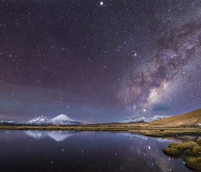
Accomodation
Culture & tradition.
- Responsible Tourism
- Community Homestay
- Gokyo Lakes
- sacred lakes
- langtang national park
- Sacred Himalayan Landscape
- E-magazines
The best of Inside Himalayas delivered straight to your inbox. Sign up for the latest stories.
Please leave this field empty.
Get the latest edition of Inside Himalayas on your doorstep.
Select Country Afghanistan Albania Algeria Andorra Angola Antigua and Barbuda Argentina Armenia Australia Austria Azerbaijan Bahamas Bahrain Bangladesh Barbados Belarus Belgium Belize Benin Bhutan Bolivia Bosnia and Herzegovina Botswana Brazil Brunei Bulgaria Burkina Faso Burundi Cabo Verde Cambodia Cameroon Canada Central African Republic (CAR) Chad Chile China Colombia Comoros Congo, Democratic Republic of the Congo, Republic of the Costa Rica Cote d'Ivoire Croatia Cuba Cyprus Czechia Denmark Djibouti Dominica Dominican Republic Ecuador Egypt El Salvador Equatorial Guinea Eritrea Estonia Eswatini (formerly Swaziland) Ethiopia Fiji Finland France Gabon Gambia Georgia Germany Ghana Greece Grenada Guatemala Guinea Guinea-Bissau Guyana Haiti Honduras Hungary Iceland India Indonesia Iran Iraq Ireland Israel Italy Jamaica Japan Jordan Kazakhstan Kenya Kiribati Kosovo Kuwait Kyrgyzstan Laos Latvia Lebanon Lesotho Liberia Libya Liechtenstein Lithuania Luxembourg Madagascar Malawi Malaysia Maldives Mali Malta Marshall Islands Mauritania Mauritius Mexico Micronesia Moldova Monaco Mongolia Montenegro Morocco Mozambique Myanmar (formerly Burma) Namibia Nauru Nepal Netherlands New Zealand Nicaragua Niger Nigeria North Korea North Macedonia (formerly Macedonia) Norway Oman Pakistan Palau Palestine Panama Papua New Guinea Paraguay Peru Philippines Poland Portugal Qatar Romania Russia Rwanda Saint Kitts and Nevis Saint Lucia Saint Vincent and the Grenadines Samoa San Marino Sao Tome and Principe Saudi Arabia Senegal Serbia Seychelles Sierra Leone Singapore Slovakia Slovenia Solomon Islands Somalia South Africa South Korea South Sudan Spain Sri Lanka Sudan Suriname Sweden Switzerland Syria Taiwan Tajikistan Tanzania Thailand Timor-Leste Togo Tonga Trinidad and Tobago Tunisia Turkey Turkmenistan Tuvalu Uganda Ukraine United Arab Emirates (UAE) United Kingdom (UK) United States of America (USA) Uruguay Uzbekistan Vanuatu Vatican City (Holy See) Venezuela Vietnam Yemen Zambia Zimbabwe
- 19 September, 2018
Trekking the Everest Three High Passes Trek Backwards
There are many reasons people choose to visit the Everest region of Nepal. The Everest Three High Passes Trek is one of the classic treks there. Many trekkers make it their mission to cross the infamous ‘high passes’ in addition to reaching Everest Base Camp. Stunning and unparalleled mountain views, including the giants of Everest, Ama Dablam and Lhotse, can be seen. The passes are challenging, and offer an opportunity to acclimatise before reaching Base Camp and Kalapathar.
Culture is found in abundance and trekkers are sure to enjoy Sherpa hospitality and potato pancakes, as well as a landscape dotted with Buddhist stupas and colourful prayer-flags. The region enjoys a unique balance between remoteness and comfort. There are no roads in the area (unlike the Annapurna or Mustang regions), yet the accessible trails traversed regularly by porters and yaks ensure that even in the higher regions, you can still get eggs for breakfast every morning and hot showers on demand. The Everest Three High Passes trek is both challenging yet possible. There is no shortage of information about why the trek is one of the most popular treks in the Himalaya. However, I’m going to explain why you should buck the trend and consider doing the Three High Passes Trek ‘backwards’.
The classic itinerary, the one you read about in most guidebooks, is anti-clockwise. Why? Touted as a ‘challenging trek’, it is thought to be somewhat easier to cross the passes anti-clockwise, as ascents tend to be slightly less steep that way around. Additionally, old habits die hard: there is now such a tradition of traversing anti-clockwise that few people seem to give much thought to completing it clockwise. When researching my itinerary I had also assumed that it must just be preferable to complete it clockwise. But some dedicated investigation both of literature and on the ground revealed the many merits of completing the circuit clockwise.

View of Gokyo Lake from the top of Renjo La Pass. Photo by Hannah Straw.
For most, the highlight of this trip is Everest Base Camp. Completing the Three High Passes Trek in a clockwise direction will mean that by the time you reach Gorakshep, the hopping-off point for Base Camp, you will have crossed two out of the three high passes. Therefore, you will be better acclimatised and more likely able to enjoy the stunning views at Kalapathar and Everest Base Camp. Additionally, if the ‘goal’ of your trek is Everest Base Camp, it can be difficult to muster the energy and enthusiasm to tackle two challenging 5000-plus-metre passes after you have achieved your main objective. Completing the trek in the clockwise direction means that each pass you accomplish puts you closer to your goal, both geographically and physically, as your blood thickens with oxygenated cells. The early-morning get up required to see the first shafts of light tickle Everest is much easier if you’re better acclimatised.
Another consideration is the alternative perspective the clockwise trek gives to the classic Everest-region views. For instance, the classic anti-clockwise route would have you climbing Renjo La with the glistening Gokyo Lake behind you, and then a perfectly decent but hardly spectacular view down the valley to Lumde once you’re over the pass. Turning the trek around, however, means you are rewarded with views of the main lake at Gokyo from the top of Renjo La. You can enjoy the descent all the way to your resting point in the village of Gokyo, as the lake’s sparkling waters appear to widen as you get ever closer. As your first ‘high pass’ of the trek, this is a really unbeatable view, and a perfect reward for a challenging yet accessible climb from Lumde. From Gokyo, take a stroll to the nearby Scoundrel’s Viewpoint for fantastic views of Everest, minus the crowds of Kalapathar. It’s a very worthwhile activity for filling a ‘rest day’ in Gokyo village.
There is an important practical reason for doing the Three Passes Trek in a clockwise direction. The movement of the glacier near Lobuche has dismantled parts of the path to and from the Kongma La, and tracks that appear on GPS or paper maps can become outdated very quickly. Anti-clockwise trekkers will find themselves crossing the glacier late in the afternoon, after a tiring day of ascending and descending Kongma La from Chukkung. Crossing the glacier in dwindling light and being unsure where the path actually leads can increase the risk and difficulty of the section. We heard about a group requiring rescue near midnight during our trek. A clockwise trek, however, will have you crossing the glacier directly out of Lobuche early in the morning, when you are fresh and have daylight to spare for the best visibility. You could also see if any guides in Lobuche are available for a few hours in the morning to help you find your way over the glacier.

View of Everest from Scoundrel’s Viewpoint, near Gokyo village. Photo by Hannah Straw.
Trekking clockwise and starting early, you should reach the top of Kongma La Pass by late morning. From the top, you will be greeted by majestic views of Ama Dablam, which will accompany you all the way to your resting point of Chukkung village. Taking the pass in the usual anti-clockwise direction, starting from Chukkung, would put these glorious views behind you. Don’t forget to climb Chukkung Ri early morning after sleeping in Chukkung, for views that are almost as good as Kalapathar!
Many people skip the accessible visit to Ama Dablam Base Camp in their rush to reach the more famous Everest Base Camp. Following the clockwise route, you could consider adding Ama Dablam Base Camp as a side trip to your itinerary on your way out of the region, when you are more relaxed for time. It can be achieved in a morning from Pangboche: leave your bags at the lodge and return for lunch before continuing to Tengboche. Ama Dablam Base Camp as part of a clockwise High Passes Trek is your final ‘big visit’ and a lovely way to say goodbye to the Himalaya.
The final argument for the clockwise route is that you can beat the crowds from this direction, or at least, meet them head-on. The Everest region can get very busy during peak tourist seasons, and it can be frustrating to end up stuck behind a large tour group, trying to find space to overtake. Taking the High Passes route in a clockwise direction means you tend to encounter these large groups head-on, which makes passing them much easier. Also, by taking the route clockwise, you may often end up at your sleeping location before the main crowds arrive from the other direction, giving you a greater choice of lodges.
A clockwise version of the Three Passes Tre is better completed by those who are already reasonably acclimatised, otherwise the crossing of Renjo La (your first pass on the clockwise route) can be rather challenging. Alternatively, you can build into your itinerary a rest day in Namche Bazar, from which some excellent side trails with views of Everest could be explored. You could also break your walk to Lumde by overnighting at a lodge en route.
In Nepal, temples and stupas are usually circumambulated in a clockwise direction, so you can think of your clockwise trek as a ‘kora’, or a pilgrimage of this fascinating and beautiful region.
Article by Hannah Straw.
Top image: Stefanos Nikologianis/Flickr
Tags: three high passes trekking in Everest region trekking in nepal
- AMY BARTLETT
- 22 November 2018 | 04:40
Thank you so much Hannah Straw. What an inspiration. We followed this itinerary recently in October and had a wonderful trek. So many beautiful sights! Thanks for your insight
- 24 September 2018 | 04:09
its amazing, i would go and feel the same as you are feeling. Its my dream to go once in whole life. Thanks for sharing good informative post.
- 22 September 2018 | 10:11
Awesome post sir…thanks for the information
Leave a reply
Your email address will not be published. Required fields are marked *
- submit comment
ISSUE 8 | 2024
Related articles.
- 23 May, 2024
Boudhanath Stupa
- 15 May, 2024
The Legendary Tale of Rato Machindranath Jatra
- 11 May, 2024
Breaking Down Barriers: Planeterra’s Global Community Tourism Network
- 02 May, 2024
Finding the Sacred Waters of Nepal
- 24 April, 2024
Biska Jatra Festival: An Iconic Chariot Tradition Uniting Thousands
- 15 April, 2024
Sustainable Tourism in Nepal: Inside the Mind of Shiva Dhakal
- 13 April, 2024
The Safest Asian Country for Rainbow Tourists
- 27 March, 2024
Hiti Tales: The stories behind Kathmandu’s ancient Water Spouts
- 17 March, 2024
Sustainable Development through Community-Based Tourism
- 18 February, 2024
Nepal: The Happiest Country
Everest High Passes Trek Clockwise - 18 Days

- Duration 18 Days
- Destination Nepal
- Trip Grade Challenging
- Starts at Kathmandu
- Ends at Kathmandu
- Meals Breakfast, Lunch, and Dinner During Trek
- Accommodation Tea House or Lodge During Trek
- Max. Altitude Kala Patthar (5555 Meters)
- Activity Everest Trekking
- Group Type Any
- Group Size 1 to 10
- Best Season Spring and Autumn
- Scenic flight from Kathmandu to Lukla
- Kongma La (5535m), Cho La (5420m), and Renjo La (5464m) provide awesome perspectives of the Himalayas
- Gokyo Valley's five frozen lakes with a stunning view of Gokyo Ri
- Exciting and most challenging experience ever, while crossing Everest high passes clockwise
- Gain an intimate understanding of the Sherpa culture in the Himalayas.
- Best views of Mount Everest along with Khumbu glacier (4900 meters) from Kalapatthar (5545 meters)
- Explore the mesmerizing prayer wheels, colorful flags, Mani stones, and huge suspension bridges
- Get amazed by the stunning diversity of flora and animals, including musk deer, colorful pheasants, snow leopards, and Himalayan Thar
- Get an opportunity to visit UNESCO World Heritage Sites along with ancient monastery
- Enjoy breathtaking views of Ama Dablam, Everest, Lhotse, Nuptse, Pumori, and other peaks of the Himalayas
The Everest High Passes Trek in a clockwise orientation is one of the most challenging treks in the world. The strenuous traveling will paint a vivid picture of the arid landscape, arctic conditions, and ongoing human struggle in high elevations. You can learn more about the Sherpa people's culture and way of life while on this trek; they are well-known for being world-class mountaineers.
The most challenging journey, Clockwise Everest High Passes Trek , combines the three high passes of the Everest region: Renjo La Pass, Cho La Pass, and Kongma La Pass. The most breathtaking views of the majestic towering mountains and stunning isolated valleys are offered by these three high passes. You may take in the breathtaking views of Mount Everest, Cho Oyo, Makalu, Amadablam, Lhotse, and many more peaks from these passes. Additionally, you will appreciate the views of Gokyo Valley and Gokyo Lake as well as glaciers like the Ngozumpa and Khumbu glaciers from the passes. You will pass through the thick rhododendron and pine forest, Dudh Koshi Valley, Sagarmatha National Park, waterfalls, and lovely Sherpa villages on this Everest High Passes Trek Clockwise .
A spectacular 45-minute flight from Kathmandu to Lukla kicks off your 18-day Everest High Passes Trek Clockwise . You will trek to Phakding after your flight. You will arrive in Namche Bazaar after crossing several suspension bridges. Your Everest High Passes Clockwise Trekking will continue after a day of relaxation in Namche by traveling to Thame and then Lumde via Marulung. Lumde will be left behind as you travel via Renjo La Pass to the Gokyo. You can view Cho Oyu, Lhotse, Makalu, and Everest from Gokyo Ri, which is reached by a short hike from Gokyo. You will then continue your trek from Gokyo to Thangnag by crossing Ngozumpa Glacier. After passing via Cho La Pass, you will arrive in Dzongla. You will see the memorial sculptures of climbers who died while ascending Everest as you continue from Dzongla to Lobuche. Your next stop will be Gorakshep, where you may walk to Everest Base Camp before continuing on to Lobuche. By bypassing Kongma La Pass, you will travel to Chhukung. To go to Lukla, you must first pass via Tengboche, Namche Bazaar, and Monjo. You will take a flight back to Kathmandu from Lukla. Your successful Everest High Passes Clockwise Trek concludes here.
Clockwise Everest High Passes Trekking is a package that Green Valley Nepal Treks is delivering at the best rates and with excellent services. We have a skilled staff of Sherpa guides and porters to help you on your journey. They are skilled in managing every aspect of your hiking trip while keeping in mind your fundamental requirements and preferences. So take advantage of this opportunity to travel to the Everest region in 2024 and 2025 with our professional crew.
Benefits of Booking Everest High Passes Trek Clockwise via Green Valley Nepal Treks
- Free International Airport Pickup And Drop Services
- Green Valley Nepal Trek Duffle Bag and T-Shirt as a souvenir
- Map of Everest High Passes Trek Clockwise
- An Oximeter to Check Blood Oxygen Saturation Levels.
- Medical Kits - Which May Be Necessary In Certain Cases.
- Free Excess Luggage Storing At Green Valley Nepal Store During The Trek
- Arrangement of sleeping bags and down jackets if you do not have your own
Preparation for Everest High Passes Trek Clockwise
It is essential to consider both your physical and mental well-being before starting the Everest High Passes Trek in Clockwise Direction . If you have never gone trekking before, you must start by cycling or running and taking morning walks for a few weeks or months before making a reservation with us. It will be beneficial if you have prior hiking and climbing experience for the Clockwise Everest High Passes Trek . Everest Base Camp, which is located at 5364 meters above sea level, is the trail's highest point. The path through terraced fields, and Sherpa villages, and has several ascents and descents. You must therefore be in excellent physical shape to walk for 5 to 6 hours every day. Trekkers also need to have a positive outlook because discomfort and worry are frequently caused by uncertainty. When you work with us to organize a vacation, we strongly advise that you speak with your doctor before you go about your respiratory condition and email us a copy of the report.
18 Days Everest High Passes Trek Clockwise Cost 2024 and 2025
Green Valley Nepal Treks offers Everest high passes clockwise trekking with different rates depending on the number of people in your group.
If you have any questions concerning the price of the Clockwise Everest Three Passes Trek, please contact us via WhatsApp (at any time).

Day 1: Arrival to Kathmandu (1400m)
With a sign that reads Green Valley Nepal Treks, our airport representative will be waiting for you outside the terminal of Tribhuvan International Airport in Kathmandu. After that, a private vehicle will take you to your hotel. When you are ready to know more about the trip planning details for the Everest High Passes Clockwise Trek , you may come to our office for a pre-trip meeting.
- 3 Star Hotel in Thamel
Day 2: Flight from Kathmandu (1400m) to Lukla (2840m) then trek to Phakding (2610m)
Your Everest High Passes Trek in Clockwise adventure will start early in the morning after you catch a 45-minute scenic flight to Lukla. You will be in wonder at the magnificent mountain ranges when you fly above them. Our experienced Sherpa team will meet you at Tenzing-Hillary Airport and begin the trip to Phakding. Following the Dudh Koshi on its east side will take you to Phakding once you descend the Kusum River. Since your body requires time to get used to the thin air, moving slowly will be the most crucial thing to remember. You will arrive in Phakding after a short excursion, and you will spend the night in a local Sherpa-run teahouse.
- Tea House or Lodge
- Breakfast, Lunch, and Dinner
- 3 to 4 hours
- 7.8 kilometers
Day 3: Trek from Phakding (2610m) to Namche Bazaar (3440m)
You will pass through gorgeous Sherpa communities like Bengkar, Monjo, and Jorsale on the way to Namche. The road from Phakding to Namche has a number of slopes in both directions. The fresh air, stunning views, and the desire to reach the summit will encourage you even though it could be quite exhausting. As you cross the Dudh Koshi River at Bengkar, you will get to see vistas of snow-capped mountains including Kusum Kanguru, Thamserku, and other summits. After passing through a few villages, you will come to the checkpoint at the entrance to Sagarmatha National Park, where your permits for the Clockwise Everest High Passes Trek will be examined. Next, move upstream along the bank until you reach the junction of the Dudh Koshi and Bhote Koshi rivers. By climbing one of the suspension bridges above the river, you may get to Namche Bazaar. From Namche Bazaar, you can see the Everest, Lhotse, Nuptse, Ama Dablam, and Taweche peaks in all their magnificence.
- 5 to 6 hours
- 10.4 kilometers
Day 4: Acclimatization Day in Namche Bazaar (3440m)
Today is a day of relaxation and acclimatization for the Clockwise Everest High Passes Trek in Namche. Namche Bazaar, in the Khumbu region, is a busy town. There are several different amenities including ATMs, Internet cafes, restaurants, and bakeries. You may quickly go to a viewpoint in the vicinity, such as Thame or Khunde, and then take a tour of the neighborhood, including the Tourist Visitor Center, where you can learn about Everest climbers, Sherpa people, and their traditions. A trek can also get you to the Everest View Hotel. From here, you may get a close-up view of numerous mountains, including Everest, Ama Dablam, Lhotse, Nuptse, Cho-Oyu, Thamserku, and many more. You will return to Namche for the evening after exploring the area for a while. Along the way, it's possible to view a museum, a gallery, and a few Sherpa villages.
Day 5: Trek from Namche Bazaar (3440m) to Thame (3820m)
As you go toward Thame today, following Bhote Koshi, you will pass through woods of rhododendron and pine. Namche Bazaar will be your starting point. The mud-plastered stupa at Phurte is another sight you will get to visit along the trip. The next stop on your Everest High Passes Clockwise Trek is Thamo and Thamo Gompa. From here, the trail descends sharply to Khumbu Hydroelectric Plant before ending in Thame, which is located at the mouth of Khumbu Valley. Peaks such as Teng Kangpoche and Kwangde may be viewed in breathtaking detail from Thame. Additionally, Nangpa La Pass, which leads to Tibet, is visible towards the north. Thame has a distinguished history of mountain climbers, from the late Tenzing Norgay, who made the first ascent of Mount Everest, to Appa Sherpa, who scaled the summit 21 times.
- 6.8 kilometers
Day 6: Trek from Thame (3820m) to Marulung (4210m)
Your clockwise Everest high passes trek starts today from Thame and travels north to Marulung. You will trek towards the first pass of the trip in the morning after seeing the monastery in Thame. The picturesque villages of Thambuteng, Hungmo, and Taranga are located along the path that leads to the Marulung hamlet above the Bhote Kosi River. You will travel through a wilderness area after passing through a number of villages, yak grazing fields, and sparsely vegetated landscapes before arriving at Marlung.
- 4 to 5 hours
- 5.8 kilometers
Day 7: Trek from Marulung (4210m) to Lumde (4368m)
Today's Everest Clockwise High Passes Trek continues to Lumde, which is close to an ancient route used for trading salt between Tibet and Khumbu. There will be a diversion on your way from the northeastern Tibet border road. Before reaching Lumde, you will cross a few authentic and ancient Himalayan settlements that blend into the surroundings almost subtly. To get to Lumde, you must climb all the way up. Throughout the climb, you will get fantastic views of the enormous Himalayan range all the way to Renjo La Pass, as well as the stunning vistas of Kyajo Ri. For a few more hours of walking, you will get to Lumde, a little settlement with stunning views of the high snow mountains all around.
- 2.4 kilometers
Day 8: Trek from Lumde (4368m) to Gokyo (4790m) via Renjo La Pass (5360m)
As you will be going across the first pass along the route, Renjo La Pass, it will be one of your most thrilling days. The hike begins easily but quickly becomes difficult as you get closer to the top of Renjo La. Lumde will be left behind as you continue your Everest High Passes Trek clockwise toward the Gokyo Lakes area. You may see a variety of human activities, including yak herding, depending on the season. The spectacular vistas of lofty peaks like Everest, Lhotse, Makalu, and Cho Oyu will be seen once you pass through the Renjo La Pass. You will descend to Dudh Pokhari, the third lake in the Gokyo valley, after crossing the pass, and then you will reach the settlement of Gokyo, which is situated next to the lake. After taking a short break, you may even ascend the ridge to see the world's highest freshwater lake system and some stunning views of the lakes.
- 7 to 8 hours
- 9 kilometers
Day 9: Trek from Gokyo (4790m) to Dragnag (4750m)
You will trek up to Gokyo Ri early in the morning for a breathtaking glimpse of the dawn. The views of Mount Everest and the surrounding Himalayan landscape are spectacular from the summit. You will go down to Gokyo for breakfast after having a terrific day up on Gokyo Ri. Everest High Passes Trek in clockwise orientation on the rocky slopes is strenuous. The lateral moraine is present at the other end of the glacier, where a lovely frozen lake serves as a landmark. Going up the scree slope of the moraine on a level area between the moraine and the mountain wall will take you to Thangnag if you continue along the route above the lake. After a few hours of walking past the second lake and along the moraines of the Ngozumba Glacier, you will arrive in Thangnag, where you will spend the night. This location is peaceful and ideal for crossing the Cho-La high pass.
- 4.43 kilometers
Day 10: Trek from Dragnag (4750m) to Dzongla (4830m) via Cho La Pass (5420m)
The Cho La Pass, which is the second high pass on Everest High Passes Clockwise Trek , will be crossed today. Although the pass is not very challenging to trek, it is steep and requires a glacier traverse on the eastern side. The terrain is treacherous and has frozen rocks that make it difficult for hikers to go. From Phedi, your route will continue to ascent in a constrained and rocky valley. The view grows more and more appealing as you rise. When you reach the top of the Cho La pass, which is decorated with prayer flags, you will travel beside the frozen lake. During the journey over the Pass, you will get views of prominent peaks such as Kyajo Ri, Tengkangpoche, Numbur, Kangchung, etc. After crossing through Cho La Pass, the path descends sharply towards Dzongla, crossing via pine trees and crevasses. You can see Lobuche, Mt. Cholatse, Mt. Ama Dablam, and the Pheriche settlement in the distance from Dzongla from a wide-angle perspective. You will reach Dzongla after a little more trek.
- 6 to 7 hours
- 9.4 kilometers
Day 11: Trek from Dzongla (4830m) to Gorakshep (5140m)
After a delicious breakfast, you will resume the Everest High Passes Trek Clockwise the next morning. Gorakshep is the destination for today. The moraine will be followed as you begin the day's descent near Chola Lake. The three passes path and the main Everest Base Camp trail will soon intersect. From the intersection, go north across a fragile moraine to Lobuche. You will pass several monuments honoring the climbers killed in this region while climbing Mount Everest. Following the Imja Khola Valley routes will provide a really delightful trip to Lobuche. Continue down the winding path that runs between the mountainside and the Khumbu Glacier's glacier moraine as you go past the Italian Pyramid and approach the Changri Glacier's terminal moraine. To get to Gorak Shep, which is at the base of Kala Patthar, you must cross the Changri Glacier's moraine on foot. Gorak Shep will let you admire the splendor of Pumori, Lingtren, Khumbutse, and Changtse. You will settle at the lodge in Gorak Shep and have the rest of the time to relax there.
- 10.8 kilometers
Day 12: Trek from Gorakshep (5140m) to Everest Base Camp (5364m) then Descend to Lobuche (4910m)
The highest point on Earth, Mount Everest's base camp, is where you'll climb today. The walk starts after a delicious breakfast in Gorakshep. You will first use the trail that follows the Khumbu Glacier's moraine to get back to it from Gorak Shep. To get to the base camp of Mount Everest, which is situated below the Khumbu Icefall, you will have to go over rocky terrain, tough routes, and the smoky air of the mountains. A moving prayer flag denotes the location of Mount Everest's base camp. You may make use of your free time before returning to Gorakshep to take photographs and soak in the beauty as you celebrate accomplishing the highest point of Everest High Passes Trek clockwise . Following the same route that you took to trek to Everest Base Camp, you will return to Gorakshep and then to Lobuche.
- 15 kilometers
Day 13: Trek from Lobuche (4910m) to Chhukung (4730m) via Kongma La Pass (5535m)
You will travel via the third and tallest pass of the clockwise Everest High Passes Trek , Kongma La Pass, today. Of the three passes, this one is regarded as the most challenging. Starting in Lobuche, the trip concludes at Chhukung. Your ascent to Kongma La Pass is easy since the trail is lined with frozen lakes. A crane wrapped in a mummy denotes this pass. You can view Lhotse, Lhotse Shar, Makalu, Baruntse, and Ama Dablam from the pass. From the Kongma La pass, you will descend to the eastern side of the Nigyang Khola Valley and enter Chhukhung Village. There is no permanent dwelling here; instead, Sherpas utilize it as a yak pasture. In recent years, this area has become more well-known as a hiking peak, and trekkers frequently visit Chhukhung for acclimatization. You are welcomed by Chhukhung with a breathtaking vista of Island Peak and Amphu Lapcha. You will arrive at the resort in Chhukung before dusk.
- 10.5 kilometers
Day 14: Trek from Chhukung (4730m) to Tengboche (3860m)
The trek continues from Chhukung after breakfast in the direction of Chubejung Kharka, where it rejoins the Everest High Passes Clockwise Trekking path after passing Bibre. Keeping along the Imja River's route, you will now proceed to Dingboche. The route leaves Dingboche by taking a turnoff to Pheriche and descends the valley to Orsho. To get to Somare, climb down from Orsho along the west bank of the Imja Khola. Following Pangboche, you will climb to Deboche by way of the monastery and a steep descent. You will now continue on a moderately climbing track through the forest to Tengboche. As soon as you arrive at Tengboche, you will check into the lodge. The rest of the day will be spent touring the stunning Tengboche Monastery and taking in the stunning views of Tawache, Everest, Nuptse, Lhotse, Ama Dablam, and Thamserku. Before dusk, you'll head back to the lodge.
- 12.9 kilometers
Day 15: Trek from Tengboche (3860m) to Monjo (2835m)
Today you will go back down the Dudh Koshi River via stunning waterfalls and a wonderful rhododendron woodland. The trip passes through a pine forest, where musk deer frequently feed early in the morning, just before you arrive in Namche. You could encounter Tibetans, highland Sherpas, and lowland porters when you arrive at Namche. Before you get to Larja Dobhan, you could have one more chance to glimpse Mount Everest and Lhotse. The path descends to Larja Dobhan from Namche via pine trees. After passing under the bridge at Larja Dobhan, the route briefly declines before continuing along the Dudh Koshi River. Recross the Dudh Koshi and go on a flat path to Jorsale. The Clockwise Everest High Passes Trekking path ascends a little after crossing the suspension bridge again beyond Jorsale and then climbs steeply for a short distance to Monjo.
- 10 kilometers
Day 16: Trek from Monjo (2835m) to Lukla (2840m)
The route descends from Monjo for a bit before crossing the Dudh Koshi on a suspension bridge and continuing for a short distance to Benkar. Following Benker, the route makes a few uphill and downhill turns in the Dudh Koshi valley to bring you to Phakding. After Phakding, the trail continues to travel for a short and sharp ascend, passing various Buddhist setups in Ghat village. Following a brief steep ascend to the Thado Koshi and a brief descent, you will cross the last lengthy suspension bridge of your Everest High Passes Clockwise Trek before climbing a short distance upward. After crossing the lengthy suspension bridge, the track goes upward till Chablung before diverging in the direction of Lukla. From there, the route continues through a scrub forest above the school and homes in the settlement of Chauri Kharka before making the final ascent of your walk, which takes around 30 minutes, to reach Lukla.
- 9.1 kilometers
Day 17: Flight Back from Lukla (2840m) to Kathmandu (1400m)
It's time to say goodbye to Nepal's Khumbu area. Your bags will be transported to the airport by Sherpas, and the guides will handle additional airport formalities. In the meantime, you may savor your final meal in Nepal's Khumbu Region. You will immediately board the airplane and take off for your return flight to Kathmandu once it has arrived. You will be transported to your accommodation in Kathmandu from the airport. You may make the most of your remaining time on the Everest High Passes Trek Clockwise by visiting Kathmandu's well-known marketplaces. You will gather for the goodbye meal in the evening, during which you will also talk about the trip and the feedback.
- 40 to 50 minutes
Day 18: Final Departure
Your Everest High Passes Trek on the clockwise route ends today. When your flight is scheduled to depart, one of our business employees will help you go to the airport. Green Valley Nepal Treks, however, can make the necessary preparations if you want to prolong your vacation. You can also go shopping to get a few presents for your friends and family if your flight is planned for a late evening.
Our team guides, porters and accompanying staff are locals with a broad knowledge about each and every location that we travel through.
- Pickup from Kathmandu international airport as your arrival date and time
- 2 nights’ accommodation in Kathmandu at 3 Star Hotel with Breakfast
- All necessary permits for Three High Passes Trek
- 15 nights of tea house accommodations during the trek (twin Sharing)
- 3 times meals a day (Breakfast, Lunch, and Dinner) during the trekking
- Trekking gear duffel bag for your trekking stuff
- Sleeping Bag and Down Jacket (return after the trip)
- First Aid and Eco trained English Speaking professionals to guide
- Flight ticket to Lukla including airprot transportation.
- Flight ticket to Kathmandu from Lukla including airport transportation
- Staffs insurance, well-paid salary, equipment, food, and Hotel
- Oximeter to check your pulse and oxygen saturation and heart rate( Very useful to check Altitude sickness symptoms)
- Purified drinking water (Ef-Chlor – water purification tablet)
- Free luggage stored at Green Valley Nepal Store During the Trek
- Certificate of achievement (If require)
- Farewell dinner in Nepali restaurant in Thamel before your departure from Nepal
- Airport transfer for your final departure as your departure date and time
- International airfare, Travel insurance and Nepal visa fee
- Lunch and Dinner in Kathmandu
- Porter If needed (One porter between two trekkers is recommended)
- Tips for Guide and Porter (it is expected)
At Green Valley Nepal Treks, we've been pioneering adventures for decades. As the competition intensifies, we're thrilled to introduce a range of exclusive add-ons to take your expedition to the next level!
How to Get Add-ons?
To get add-ons you can follow straightforward steps:
- Step 1: Select your departure date
- Step 2: Add number of travelers
- Step 3: Click Book Now or Add to Cart Button
- Step 4: Select required add-ons from the listed options
- Step 5: Proceed to payment
- We have daily departures for this trip from March to May and from mid-September to mid-December . You can type in the number of passengers to book a reservation and select a date that is convenient for you. Due to group size, we never cancel a trip once you've made a reservation . If you would rather join the group, we will add more travelers on the selected date. You can let us know once you make a reservation or earlier.
- If you want to cancel the trip for any reason, you can let us know at least 30 days in advance. We will refund your deposit . If you want to cancel the trip within a 30-day period, we will keep your deposit until you find out the next schedule.
Best Season for Everest High Passes Trek Clockwise
The Clockwise Everest High Passes Trek is best done in the spring (March to May) and fall (mid-September to November). These times of year are ideal for trekking and taking in unhindered mountain views since the weather is dry and clear. While the evenings are cold, the days are warm. However, because it is high season, the trails get busy and crowded. In the spring, rhododendron blossoms are especially abundant on the hillsides. Everest Base Camp has been transformed into a tent city packed with climbers and Sherpa guides because it is also climbing season. In the fall, trekking to Everest High Passes clockwise is quite popular. The end of the rainy monsoon season, which clears the sky of pollutants and dust, may allow you to experience views in crystal clarity during this time of year.
Food or Meals available on Everest High Passes Trek Clockwise
You may choose from a wide variety of foods on the tea house menus prepared and served by the locals while clockwise trekking in the Everest High Passes .
- Breakfast options include cereal, pancakes, and porridge with milk, muesli, Tibetan Breads, Chapati with Cheese, oatmeal, and a selection of hot beverages. French toast with jam, honey, and peanut butter is also offered.
- Lunch will feature a selection of sandwiches, pizza, spring rolls, burgers, pizza, thukpa (noodle soup), dal bhat, momos (dumplings), Tibetan bread and chapatti, macaroni, spaghetti, sherpa stew, a number of soups, steaks, potatoes, yak steak, and desserts.
- Dinner menus offer mouthwatering Momos (dumplings), a variety of Thukpa (noodle soup), Dahl and Bhat (a traditional Nepalese dish), Tibetan bread and chapatti, Macroni, Spaghetti, Sherpa Stew, a variety of soups, steaks, potatoes items, Sandwiches, Pizza, rice with curry, spring rolls, Raman soups, burgers and Pizza, yak steak, desserts items, and hot and cold drinks.
Accommodations available on Everest High Passes Trek Clockwise
On the mountain, lodging is provided in tea houses. The rooms often include just two or three single beds, as well as soft, warm blankets, cushions, comfortable mattresses, as well as nearby restrooms (though not always), and stunning views. However, throughout the walk, a solitary private room will be provided at no additional cost to female trekkers traveling alone. We will make sure you get the greatest accommodations available with breathtaking mountain and landscape views during the entire journey of Everest High Passes Clockwise Trekking.
Everest High Passes Trek Clockwise Difficulty Level
If you have never hiked before, especially in the Himalayas, the clockwise Everest High Passes trip may be challenging for you because you will be taking on a lot of risks and traveling on risky routes. On this trip, you must trek for at least 5 to 6 hours each day. There are multiple ups and downs on the difficult, steep terrain. For this journey, you must be in great physical and mental condition. Any trekking excursion to Nepal comes with a substantial risk of altitude sickness. Because the routes pass through areas with elevations of more than 4000 meters, trekkers are more likely to encounter altitude sickness. The Everest Clockwise High Passes trails will take you through challenging, impassable, mountainous, and harsh terrain. You must get beyond these challenges if you want to develop your abdominal muscles. The hikers will encounter a range of challenges along the trip, including steep cliffs, rocky terrain, meadows, deep valleys, and rough roads. Most hikers won't be able to complete these lengthy hikes. Going such a far distance for someone who has never hiked in these conditions may be too much.
Everest High Passes Trek Clockwise Travel Insurance
It is strongly advised that before starting Everest High Passes Trekking Clockwise , you must purchase travel insurance that includes medical evacuation and travel protection. Medical evacuation insurance is essential while traveling at high altitudes in a remote area of the world where there are no other accessible modes of transportation in case of AMS (Acute Mountain Sickness) or other causes at high elevations. In order to protect your travel investment from unforeseeable occurrences that could happen before, during, or after your trip, travel insurance is also strongly advised. It's a good idea to fully investigate the insurance and its coverages before making a decision. When traveling, carry your insurance documentation with you and give a copy to your family. You must verify that your insurance offers appropriate protection and that it protects the actions involved.
Altitude Sickness and Remedies on Everest High Passes Trek Clockwise
Altitude sickness is one of the concerns associated with hiking in the Everest Region, the highest trekking destination on earth. The air gets thinner as you ascend, making breathing challenging. Acute Mountain Sickness, or AMS, might occur if you try to move swiftly to reach your destination in less time. In moderate situations, Diamox and a restful night's sleep may be adequate. Aside from drinking enough water, keeping your body hydrated can help you stay nausea-free. To prevent the situation from getting worse, the necessary actions must be taken. You might need to shorten yourself and get medical attention if the symptoms get worse. Acclimatization is necessary before attempting a high-altitude trip like the Everest High Passes Clockwise Trek . Your body will be able to adjust to the thin air if you rest at a lower elevation before climbing to a higher elevation.
Everest High Passes Trek Clockwise Packing Checklist
Here's a general packing list of everything you should remember to carry on your Everest Clockwise High Passes Trekking :
- A sturdy pair of trekking boots with good ankle support
- Rucksack or daypack (30 liters) with a waterproof cover
- Trekking pants and waterproof trousers
- Sleeping bag liner
- Down jacket
- Wind/ waterproof light jacket
- Sun protection cream, wet wipes, and hand sanitizer
- Inner and outer gloves
- Towel, flip-flop or rubber sandal, toiletries
- Water bottles and water purification tablets
- T-shirts or shirts
- Fleece jumper or jacket
- Headlamp, power bank, and extra batteries
- Inner Thermal (top and trousers)
- Socks and underwear
- Sunglasses, sun hat, woolen cap, or balaclava
- 4 season Sleeping bag
These are only a few of the most important things to have. For a complete list: Recommended Packing List for Nepal Trekking
Everest High Passes Trek Clockwise Safety
We ensure our guests' safety throughout the Clockwise Trekking in Everest High Passes by adhering to all safety guidelines. Travel specialists and seasoned guides who have traveled this route numerous times have devised the Everest Clockwise High Passes Trek itinerary. The plan includes the right amount of rest days incorporated to prevent AMS. First aid supplies and a pulse oximeter are always carried by our tour guides. Your chosen guides have over ten years of experience and are aware of what to do in an emergency. They have received significant training in crisis management and outdoor first aid. An assistance guide will accompany a trekker with AMS who must descend to a lower elevation and follow safety precautions. He will carefully monitor the client's health and take the necessary precautions to keep him secure. If the client appears to be in good spirits after a good night's sleep, the guide will bring them back to the group. The patient may be transported to Lukla or flown to Kathmandu for medical attention if their health worsens.
Clockwise Everest High Passes Trekking Booking Procedure
Government-approved trek and tour operator company, Green Valley Nepal Treks has been offering these services for over ten years in Nepal. Both the Nepal Mountaineering Association (NMA) and the Trekking Agency Association of Nepal (TAAN) recognize us as members. As a result, you may confidently reserve an Everest High Passes Trek Clockwise . To reserve a trip, we need a deposit equal to 10% of the total cost. Within a week of making your reservation, please email us copies of essential papers you may have, such as your passport, passport-size photos, travel insurance, and arrival and departure flight information. You may make a payment on our website via bank transfer, western union, or online. You have three payment options when you land in Nepal: cash, bank transfer, and credit card. For your convenience, we will also email you payment information, including the method of payment and the total amount.
Wonderful Experience During The Everest High Passes Trek Clockwise
With Green Valley Nepal Trek I got a wonderful experience during the Everest high passes trek clockwise. Our guide and the company's owner, Arjun, were both incredibly kind and friendly. Before and after the hike, they made sure we had a comfortable stay in Kathmandu, and they promptly complied with our request to move our hotel reservation to a site closer to Thamel. Throughout the entire Everest high passes trek clockwise, our guide kept an eye on us to ensure that we were well and to brief us on the preparations for the following day. We asked him to return to Lukla as quickly as possible, but he skipped two rest days from our schedule without exhausting us physically.
Hiked Everest High Passes Trek Clockwise with Green Valley Nepal Treks
Since I was a child, I have had a strong hunger for challenging activities. I have always traveled counterclockwise, but this time I decide to hike the Everest high passes trek clockwise. Being surrounded by the tallest mountains in the world is really humbling. Our ascent will be one to remember thanks to Green Valley Nepal Trek's team's extensive local expertise and our readiness for the journey. This neighborhood outfitter is widely regarded for their attentive service. If we go back to Nepal, we will definitely book through Green Valley Nepal Trek.
Q1. Do I need previous experience to take part in Everest High Passes Trek Clockwise?
No prior trekking experience is necessary, however, you should be in reasonable physical shape, love walking, and be able to acclimatize to high-altitude circumstances. We firmly advise you to start preparing for the trip at least three months before the departure date by engaging in regular exercise, whether it be walking, running, or going to the gym. You will find hiking to be a more delightful experience if you are more physically fit. Our entire schedule was created with consideration for every detail and included enough time for acclimatization.
Q2. How is the drinking water in the trails to Everest High Passes Trek Clockwise?
On the trails, bottled water is widely and cheaply accessible, however, certain trek areas do not allow plastic bottles. Therefore, we advise you to take a water bottle that you may fill with boiling or filtered water. Additionally, we urge you to use water purification pills or drops, which you may either bring from your home country or purchase in Kathmandu.
Q3. Is there WIFI available on the Everest High Passes Trek Clockwise?
Yes, there are Wi-Fi hotspots on the path. But please be aware that the network may be unpredictable because of the steep terrain. The signal frequently disappears or has low power.
Q4. Can I eat vegetarian food while at Everest High Passes Trek Clockwise?
Yes, you can eat vegetarian cuisine with no issues as most lodges provide vegetarian dishes. To prevent food poisoning, we constantly advise our clients to consume vegetarian meals. Eating large, meat-based meals at a high altitude is not very healthy.
Q5. What If One Of Our Group Members get sick during Everest High Passes Trek Clockwise?
If someone gets sick on the route, your trekking guide will consider the situation and determine whether the sick individual should continue the trip or descend to a lower level and wait for the remainder of the group. If the person's condition is critical, he or she will be transferred to Kathmandu for specialist medical care via air ambulance. The sick individual will be looked after by an assistant, while the rest of the party will continue on their journey according to the schedule.
Q6. What should be the weight of bag for Everest High Passes Trek Clockwise?
We advise you to limit the weight of your trek luggage to no more than 15 kilograms. A maximum of 30 kilograms can be carried by each porter. We assign 1 porter to transport 2 duffel bags for clients. Please be aware that for the flight to Lukla, you are only permitted 15 kg of luggage, including your handbag. You will be charged extra for overage luggage.
Q7. What if my flight to and from Lukla is canceled or delayed during Everest High Passes Trek Clockwise?
To account for erratic weather, we advise you to add an extra 2 to 3 days to your hike. Flights from Lukla to Kathmandu and vice versa are canceled during bad weather. When this occurs, the flight is immediately changed to the next day. If you need to make sure you are on time for the journey or your flight back home but are on a very strict schedule, you can hire a helicopter. You will be responsible for paying for the helicopter charges.
Q8. What are the levels of Everest High Passes Trek Clockwise?
The Everest High Passes Treks are generally more difficult than the standard Everest Base Camp Treks. But when you travel with Green Valley Nepal Treks, you will be in the company of experts who can advise and help you with a variety of things, allowing you to take pleasure in your trip.
Q9. Can I make payment with credit card while Everest High Passes Clockwise trekking?
To make purchases on the route, you must have local cash. While there may some lodges in the Everest Region's Lukla and Namche that accept credit cards, we strongly advise bringing enough local currency with you to purchase any necessary products en route. You can exchange your money at any of the money exchange offices in Kathmandu, or you can receive local currency at the ATMs nearby by using your credit or debit card.
Q10. What sort of toilet facilities will be available on Everest High Passes Clockwise trek?
The teahouses throughout Everest High Passes Trek Clockwise have western-style restrooms. The rooms in upscale lodges and teahouses at lower elevations have hot showers and adjoining bathrooms. You might have to share a bathroom with other travelers if the facilities are more rudimentary at higher elevations. Please be aware that in extremely cold weather, the water in the toilet basin may freeze, forcing you to use an Asian-style restroom outside. Rolls of toilet paper should always be in your possession. While trekking, it's crucial to have a sufficient supply of toilet paper and hand sanitizer.

Everest Base Camp Trek - 14 Days

Sleep at Base Camp on Everest Trek - 15 Days

Luxury Everest Heli Trek - 6 Days
Ask a question.
Allow our experts to help you plan one of the most memorable vacations based on your interests. With their in-depth knowledge and expertise of the Himalayas, craft the journey of your dreams taking into account your preferred location, time frame, and budget. For a beautiful vacation on top of the globe, contact us.
We use cookies to ensure that we give you the best experience on our website.
IMAGES
VIDEO
COMMENTS
Nepal's Three Passes Trek is perhaps the greatest trekking adventure you can have in the Khumbu (Everest) region of Nepal. Also known as the Three High Passes, this loop trek wraps around Sagarmatha National Park, leading trekkers over the Khumbu passes of Kongma La at 5,550 m (18,209 ft), Cho La at 5,420 m (17,782 ft), and Renjo La at 5,360 m (17,560 ft).
This guide covers the clockwise variation of the Three Passes Trek circuit by providing a detailed itinerary, route maps as well as answering questions on cost, packing, best times to trek and more. The Three Passes Trek to Everest Base Camp is arguably the most complete trek in Nepal as it covers most of the Everest region on its circular route.
The primary reason for tackling the Three Passes trek in an anti-clockwise direction is to allow for proper acclimatisation. By aiming to cross Kongma La first, you can ascend to high altitude at a sensible rate and incorporate at least two acclimatisation hikes into your itinerary. This greatly minimises your chance of suffering from Acute ...
Clockwise Everest three passes trek is a fast way to complete the trek, but we at Mountain Rock Trek offer you the counter-clockwise route, which is far better than the clockwise route. This being said, you will follow the Everest three-passes trek map that takes you along the EBC trail up to Dingboche. You take another route from Dingboche to ...
The Three Passes trek is the ultimate Everest experience. This route takes in all the highlights—both in terms of mountain views and local Sherpa culture—and combines them into a complete journey through the Everest region. ... It is possible to go clockwise, as well, but not recommended due to the steep altitude gain of crossing the Renjo ...
The Three Passes Trek in Nepal is in the Everest Region (Sagarmatha National Park) and takes trekkers across three high passes, Kongma La (18,209 ft / 5,550 m), Cho La (17,782 ft / 5,420 m), and Renjo La (17,560 ft / 5,360 m) - hence, the Three Passes Trek. ... From here, hikers can choose to hike either clockwise or counterclockwise ...
EVEREST THREE PASSES TREK ITINERARY. We have outlined below what we feel is an ideal itinerary for the Everest Three Passes trekking route. This is a 19 day itinerary which includes flying to and from Lukla. We have noted the trekking distance and an approximate trekking time for each day (excluding lunch stops, breaks, etc), as well as stats ...
Kongma La is a challenging mountain pass that's actually higher in elevation than Everest Base Camp. It's also the easternmost and highest of the three passes that make up the EBC and Three Passes trek. With all that in mind, today is a very good day for concentration, crampons and trekking poles, as much of the route is rocky and uneven.
The Three Passes Trek is the most epic hike for amateur hikers in the Everest Region. Read how to prepare for the three high passes trek and also reach Everest Base Camp, Gokyo, and Kala Patthar! ... Each high pass you go over counter-clockwise will start with a long, gradual uphill, then a steep downhill on the other side, before reaching the ...
Clockwise vs. counter-clockwise: The clockwise direction is generally recommended for the Everest 3 Passes Trek, allowing for a more gradual ascent and better acclimatisation. Considering Side Trips: Island Peak: For truly adventurous climbers, incorporating Island Peak Climbing into the 3 Passes Trek itinerary is an exciting option.
The Three Passes Trek gets it name from the three high passes that trekkers make their way through on this circuit of Kongma La (18,209 ft / 5,550 m), Cho La (17,782 ft / 5,420 m), and Renjo La (17,560 ft / 5,360 m). ... - Do the passes counter-clockwise (many people got rescued in Gokyo because of AMS that tried the trek clockwise) - Take ...
The Three Pass Trek is one of the major parts of The Great Himalayan Trail. The GHT is a single long-distance trekking trail from east to west across Nepal and includes roughly 1,700 km of hiking paths. Check out this cool short video from Luca and Liz. Three Passes Trek and Everest Base Camp Trek in Nepal - 2018. Watch on.
The best options route is clockwise to do Everest high passes trek that summits Gokyo Ri at 5,420 m (17,782 ft), and Kala Patthar at 5,644 m (18,519 ft). Chhukung Ri 5,550 meters (18,209 ft) or Mhra peak without climbing permits, from these Trekking peaks, you can film - take photographs of beautiful mountains Mt. Everest, Mt. Pumori, Mt ...
The Three Passes Trek gets it name from the three high passes that trekkers make their way through on this circuit of Kongma La (18,209 ft / 5,550 m), Cho La (17,782 ft / 5,420 m), and Renjo La (17,560 ft / 5,360 m). Immerse yourself in the Everest region, surrounded by the world's highest peaks with endless views of landscapes carved by glaciers well above the tree-line.
A three-pass trek is an adventurous walk on the premises of Everest that goes along three passes: Renjo, Chola, and Kongmala. The first pass, Renjo La Pass, is 5,340 m, the second pass is Cho La Pass at 5420m, and the final pass is Kongma La Pass at 5,535m. What are the three passes in the Everest Base camp?
Three Passes Trek itinerary Clockwise. Day 19: you can finally take the flight from Lukla-Ramchep-Kathmandu. Note: Based on Alltrails GPS map Three Pass Trek total distance is about 111.87 miles/180km which is per day on average 6.2mil/9.9km per day.
The Everest Three High Passes Trek is a challenging and rewarding trek that takes you through the beautiful Khumbu region of Nepal. The Everest Three High Passes Trek covers three high mountain passes: Kongma La (5,535m), Cho La (5,420m), and Renjo La (5,360m). One of the main decisions you need to make when planning the Everest Three High Passes Trek is whether to do it in a clockwise or ...
The Three Passes Trek, often referred to as the Gokyo Three Passes, Gokyo Lakes Trek, or Everest Three Passes, is a challenging trekking route in the Everest region of Nepal. The trek boasts three main passes, fewer trekkers, and spectacular views. It encompasses the Everest Base Camp Trek and adds three high passes, making it an even more ...
Check out the outline Itinerary for Clockwise Everest Three Pass Trekking below: Day 1: Fly to Lukla (2840m) and Trek to Phakding (2610m). 3 hours. Day 2: Trek to Namche Bazaar (3440m) 6-7 hrs. Day 3: Rest in Namche Bazaar and hike to Hotel Everest View (3880m) for 4 hours. Day 4: Trek to Thame (3750m) 4-5 hrs.
Everest High Passes Trek is an exhilarating adventure in the Himalayas of Nepal. you can trek along the popular Everest trails discovering unique gems of the Khumbu region, its cultural heritages and its people's hospitability. During your trek, you could cross three high passes in the Everest region - Kongma La Pass (5,535/18,159ft), Cho ...
Nov 18 - Acclimatization day 3 - Sunder Peak hike till the point at about 4900m, where path should be easily walkable. Nov 19 - Thame - Lungden. Nov 20 - Acclimatization day 4 - Bhote Khosi valley hike towards Nangpa La till the glacier at about 4900-5000m. Nov 21 - Lungden - Renjo La - Gokyo.
Completing the Three High Passes Trek in a clockwise direction will mean that by the time you reach Gorakshep, the hopping-off point for Base Camp, you will have crossed two out of the three high passes. Therefore, you will be better acclimatised and more likely able to enjoy the stunning views at Kalapathar and Everest Base Camp. Additionally ...
The Clockwise Everest High Passes Trek is best done in the spring (March to May) and fall (mid-September to November). These times of year are ideal for trekking and taking in unhindered mountain views since the weather is dry and clear. While the evenings are cold, the days are warm.