299e9b 15f4ee --> --> TheFreeBird
Harihar fort trek ❤️ for the love of vertical stairs.
Images may take 30s to load,else refresh
Harihar fort has become famous because of the scary videos of its vertical stairs. In reality the vertical stairs can be difficult for some but are not as risky as portrayed on social media. When I had first seen the photos of Harihar fort I was not only smitten by the beauty of the stairs but was just amazed by the sheer skillsets possessed by our ancestors to build this architectural marvel with just hammers and chisels. This Harihar fort Trek blog captures my trek journey and will be your Harihar fort trek guide to plan this trek yourself. More adventures like Harihar fort at the end of this post .

How long is the Harihar fort trek ?
Niraj, how much time does it take to complete this Harihar fort trek ? With good stamina it takes about 90 minutes to reach the top from Nirgudnpada base village (even lesser from Harshewadi base village) & another 50 minutes to explore the top . More time would be required if are photographer as the rock cut stairs are really beautiful !
Is Harihar fort trek difficult for beginners ?
Niraj, what is the difficulty level for Harihar fort ? Harihar is a small fort & a simple trek. Only thing you can find difficult are the steep stairs. If you dont have a fear of heights then it should be as easy as climbing the stairs of a building since the stairs also have holds cut in the rock face for a proper grip. During monsoon it becomes risky due to slippery stairs.
What is the best time for Harihar Fort Trek ?
WINTER: The best time for Harihar fort trek is winter when the weather is cool & you can enjoy beautiful sunsets from top. Winter time just after monsoon also gives a clear weather where you spot many nearby forts which are mostly hidden throughout the year.
MONSOON: For adventure lovers monsoon provides such a thrilling time on stairs. Plus the view of stairs disappearing in the clouds makes it a exciting trek. However As Harihar fort has become extremely famous it is very crowded on monsoon weekends. With narrow slippery stairs as the only access route for Harihar fort & with more than 100 people waiting their turn to climb & descend from the same route makes it risky. Hence it is better to avoid on monsoon weekends. Monsoon weekdays seem to be a better option . Here are other sahyadri treks which you can choose to do otherwise.
SUMMER: Summer time is strictly for pro-trekkers who like trekking more than photos for social media. Early morning starts in summer are must if you dont want to face the wrath of the hot sun.
Food & Stay at Harihar Fort
On weekends you can find many food huts selling snacks throughout the trek route. Nirgudpada has plenty of bigger hotels. You can always camp on the fort or stay in the temple/schools at the base village. ( checkout my trek food & trek gear )
Harihar Fort History
Harihar, also called Harsh Fort, is 3676 feet above sea-level. It was one of the forts in the possession of the Ahemadnagar Sultans. In 1636 Harihar, Brahmagiri, Tringalvadi and a few other Pune forts were given by the Marathas to the Mughals. Harihar fort was one of the seventeen strong places that were surrendered to the British on the fall of Trimbak in 1818. This was one of the rare forts that was not destroyed by the British because of its beauty.
Things to see on Harihar Fort
Things to look out on/from the fort
- I know you are here mostly for the vertical stairs
- The main entrance & the secret entrance
- 2 lakes at top
- About 8 rock cut water tanks
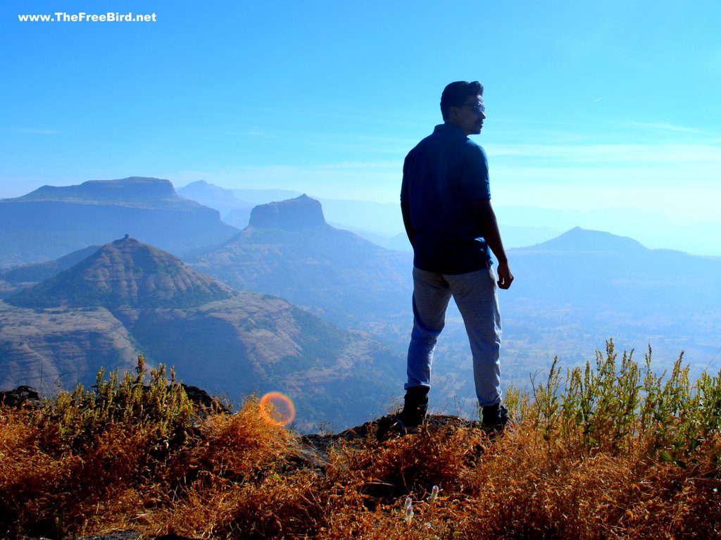
- View of Basgad fort , Utwad, Fani Hill, Brahma Hill, Kaapdya, Brahmagiri & Bhandardurg fort & many other forts in Kasara region
How to reach Harihar Fort from Mumbai & Pune?
Where is the Harihar fort located? Harihar fort lies in Nashik district of Maharashtra , India. Harihar fort is 60kms from Kasara/Igatpuri & 40 kms from Nashik. There are two routes to Harihar fort Nashik based on the following base village
- Nirgunpada is the most widely used base village near by Kasara/Igatpuri/Ghoti
- Harshewadi is another base location which is easier route for Harihar trek mostly preferred from Nashik/ Trimbak side
NEAREST RAILWAY STATION: Nashik & Igatpuri are the nearest big railway stations for Harihar fort. Kasara railway is slightly far away railway station as compared to Igatpuri but has better connectivity
Ways to reach Nirgunpada (Preferred for Igatpuri/ Kasara side)
- FROM KASARA STATION: There is no direct transport to Nirgunpada. One can share the jeep from Kasara to Khodala (Rs 50 approx.) and change vehicles to Nirgunpada ( bus or taxi). Takes around 90 minutes if you planning to travel in the morning. We had booked a complete taxi from Kasara to Nirgunpada ( jeep with Mr. Prakash – 9823986233 )
- FROM IGATPURI: One can board in a bus for Trimbakeshwar and alight at Nirgudpada ( confirm the bus route before hand as the bus have alternate routes bypassing Nirgudpada as well)
- FROM GHOTI: bus stand you can get bus as well as sharing jeeps / taxi to Nirgunpada
Ways to reach Harshewadi (Preferred for Nashik/Trimbak side)
- FROM IGATPURI : One can take the Igatpuri – Khodala-Trimbakeshwar bus and get down at Kasurli. From Kasurli village one has to climb a small hill to reach Harshewadi. But the frequency of this is pretty low.
- FROM NASHIK: better option is to reach Trimbakeshwar which has proper road connectivity through out the day from Nashik. From Trimbakeshwar you can bargain with an auto/ taxi to drop you to Harhsewadi (Rs 350-500 )
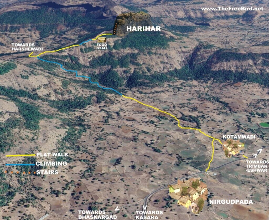
Harshewadi route for the Harihar fort trek is slightly easier as compared to the route from Nirgudpada and is mostly preferred if you have personal vehicle. Nirgudpada route is the most famous trail & I would be focusing on the Nirgudpada trail. The Harshewadi trail to Harihar is straight forward and well marked & meets the Nirgudpada trail at the plateau.
Harihar fort trek route map
Harihar trek Blog: TheFreeBird’s Story
Since the time I first saw Harihar fort stair photos I wanted to see the vertical stairs & to trek here on a rainy day. As fate it would have it I reached here on hot summer day. It was a hot after noon and we couldn’t have chosen a more difficult time for the climb. After we completed the Basgad fort in the morning we returned to Nirgudpada (which is the base village for both Harihar & Basgad trek).
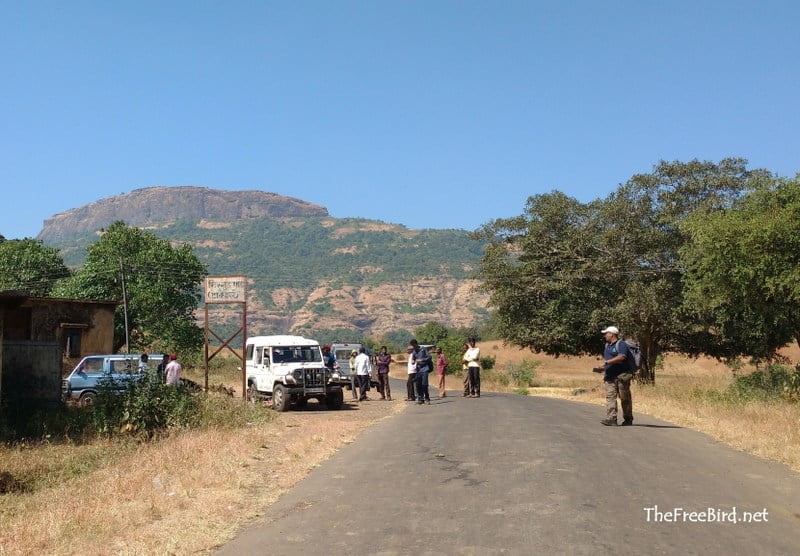
We refilled our bottles at well nearby & had lunch in the shadows of a big mango tree. Morning trek was tiring and the lunch made me drowsy. I would have dozed off, but just the idea of climbing those vertical stairs got me excited. We had two options either to walk to Kotamwadi nearby & then take the Harihar trail or take a short cut from Nirgudpada ( from a dhaba) to the meet the Kotamwadi trail midway. We decided to take the shortcut. Both the trails are almost same distance.
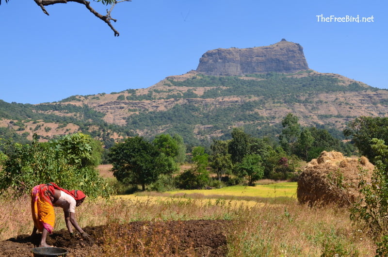
At that time when we visited there was just a small trail through the paddy fields which was quite confusing. As it has become a huge tourist destination now the route is well marked. Due to the heat we had to stop frequently but with couple of ORS we were charged up
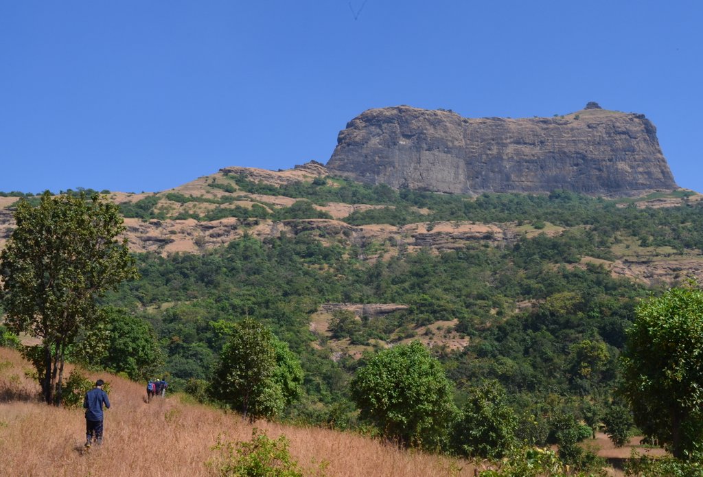
Initial trail is on flat land till we reach the base of Harihar fort hill. Here we took a left turn to start a small climb to reach a plateau. On this plateau another trail from Harshewadi merges. There is a small food hut which serves snacks & more importantly cold drinks. I have a thing for lemonade on hot trek days. On that day I would have even paid 1000 Rs for that cold lemon juice. I had three full glasses. Blessed.
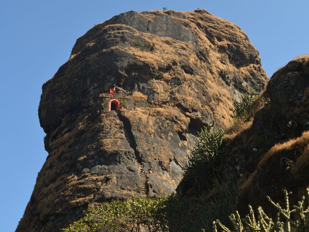
Recharged we started walking ahead. Soon Harihar fort became visible in all its glory. I have always admired these rock cut stairs on all the forts like Kothaligad , Bhairavgad , Bahulagad , kalavantin .. These Harihar stairs however would have been very risky to be build. Makes one realize that the skilled people who built this centuries ago with hammers & chisels indeed had a balls of titanium.
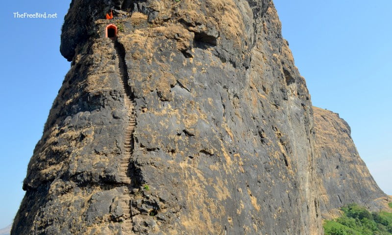
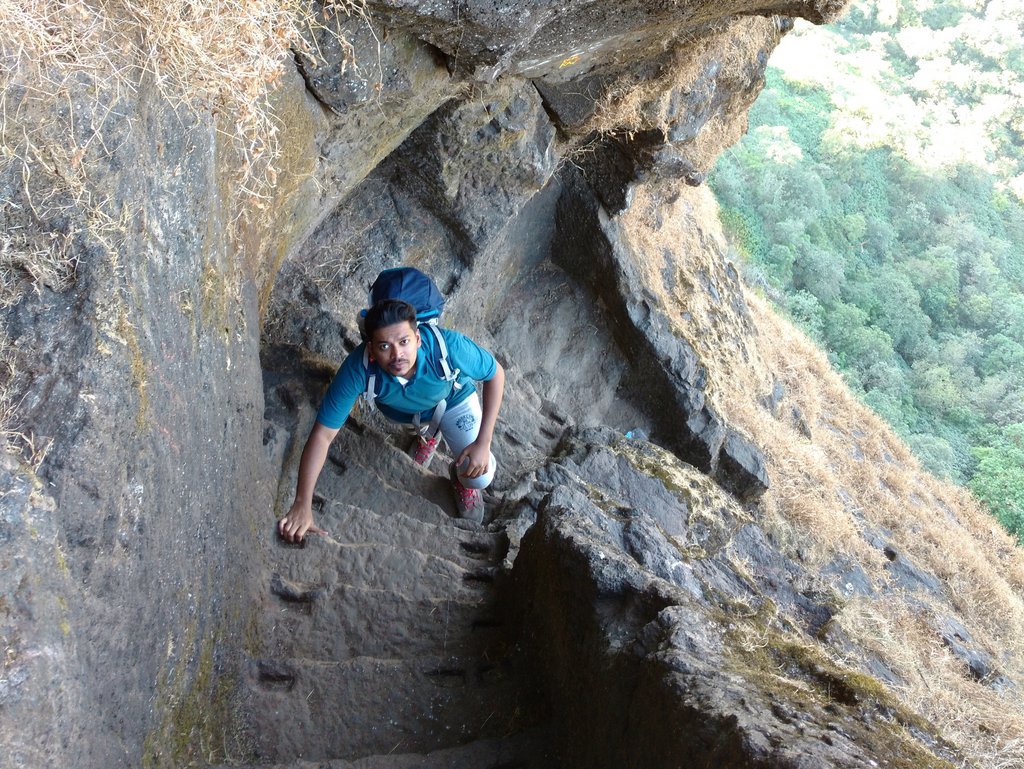
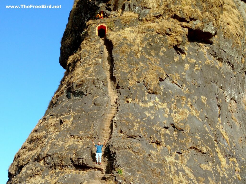
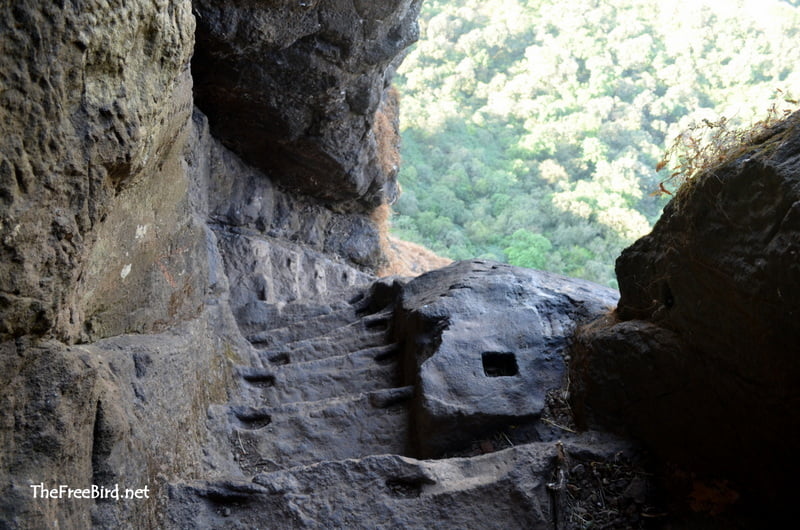
After taking lots of photos we started the climb. Every step has a notch carved for a good hand grip making it easier to climb. These stairs are much easier to climb than they appear in the picture. However If you are afraid of heights better not look back from this point

MUST HAVES ON TREKS
fire🔥starter
arm sleeves
sleeping bag
selfie stick & tripod
buff/bandana
mountain watch
costly shoes
backpack 30l
mountain books
Knee pain oil
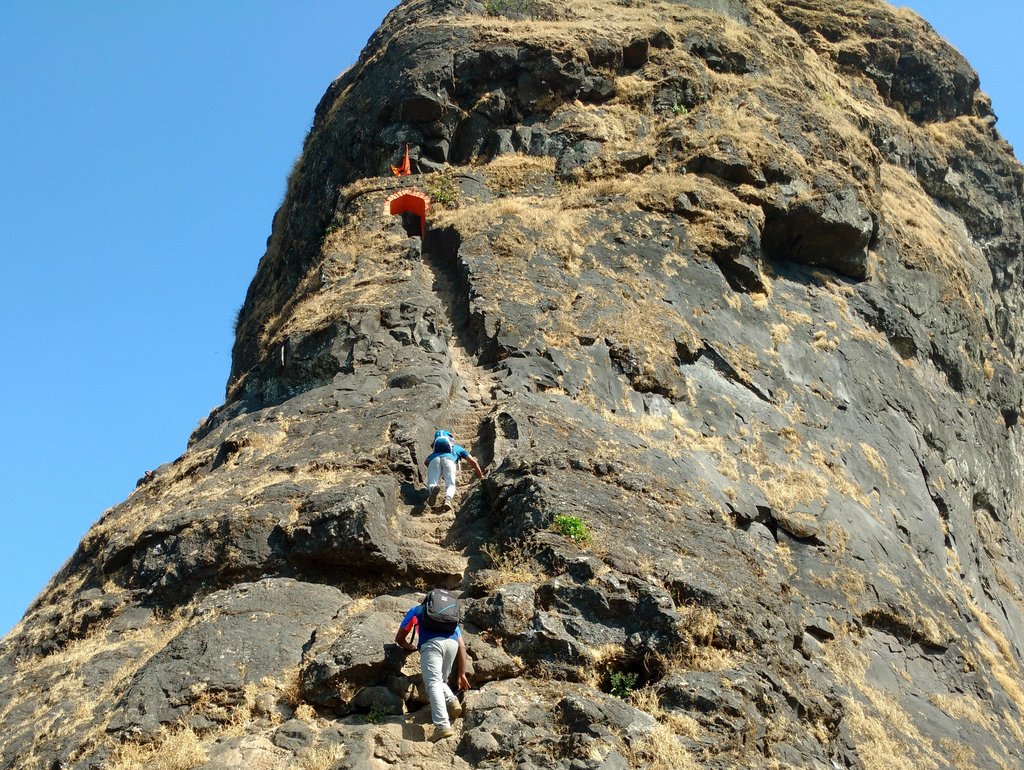
Few of my freinds who were new trekkers got scared with the sight of these stairs. But once they got the hang of it they quickly started climbing with ease & reached the top. Finally at the top of these stairs we heaved a sigh of relief as we got some much needed relief from the sun in the Harihar fort’s shadow..
Once pass the main entrance the route slithers to the top through the huge rock in a mesmerizing way. Harihar fort is a huge piece of rock where every route till the top is carved by hand. Such an architectural wonder.
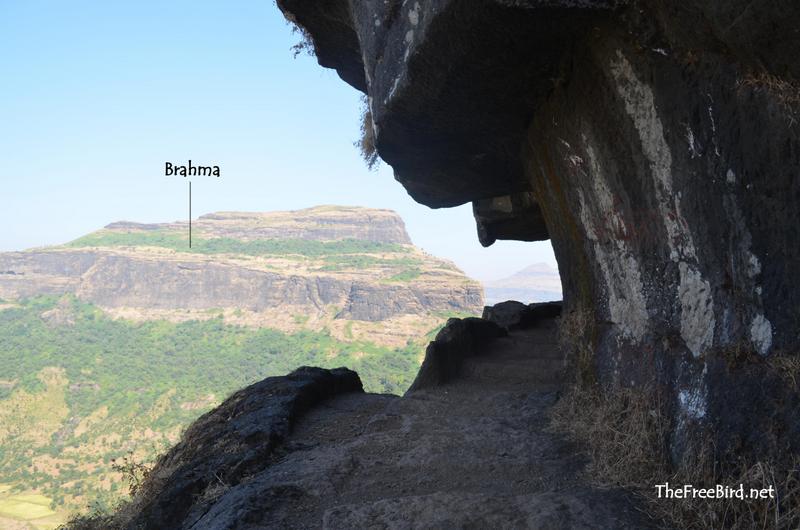
After this tunnel we reach two sets of stairs which zig zag to the top . These are not as famous as the main entrance but are equally beautiful.
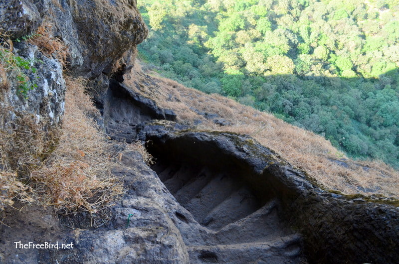
These second set of stairs have remained relatively unbranded as compared to the huge celebrity status of the main stairs. These stairs are much more stunning as they are curved like a slithering snake & are situated at a much higher place with a green jungle backdrop. The stairs reach a tunnel carved through the huge rock which reaches the second entrance of Harihar fort. These stair structure is similar to Kothaligad where stairs are carved through huge rocks & through tunnels.
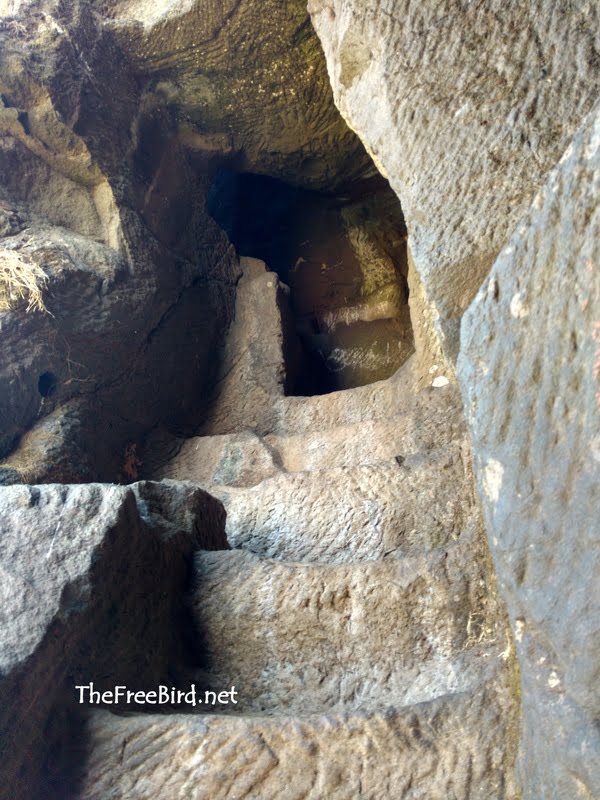
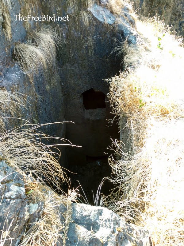
After a brief adventurous time at the stairs we reach the second door. Going through this second door on the left side is secret door. Some say it was a prison while others say it was a chor darwaja / secret entrance.
After the detour to secret door i went ahead to reach the huge plateau at the top. Here I saw a Hanuman temple, a lake ,few water tanks, remains of palace & flag at the highest point of Harihar fort.
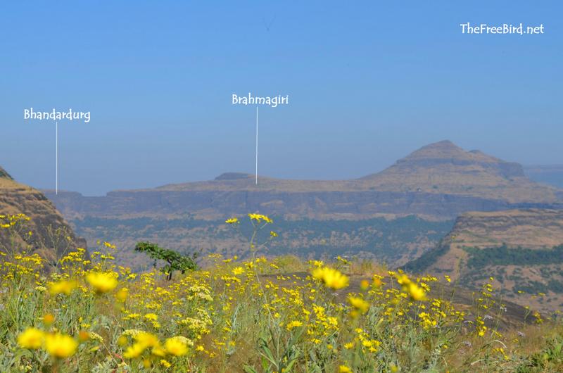
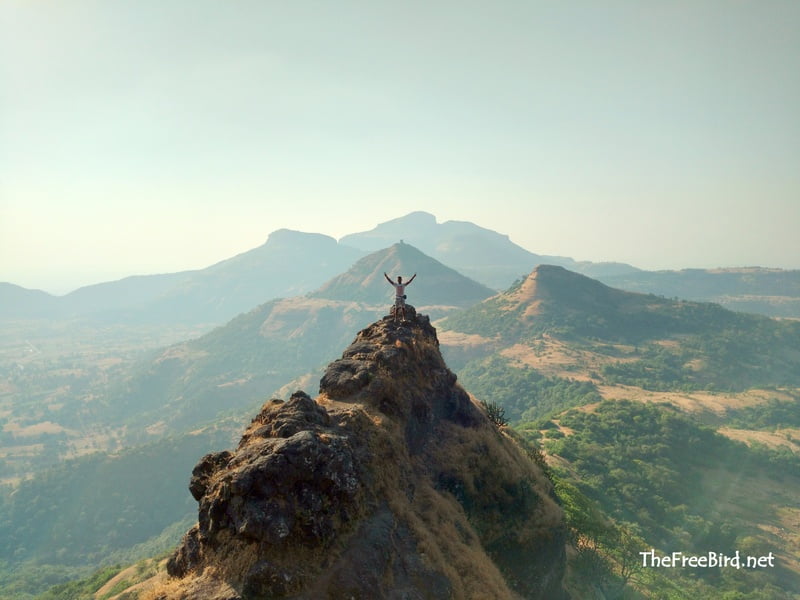
We get a beautiful 360 view from here which would have been used to keep track of all the enemy movements in the neighbouring area. Brahmagiri & Bhandardurg fort are visible from here. Brahamagiri is the origin of 3 rivers including Godavari while Bhandardurg has a stairs cut through entire rocks which lead to tunnels & rock bridges. Both of these are very unique forts & I would suggest to visit those if you liked Harihar stairs.
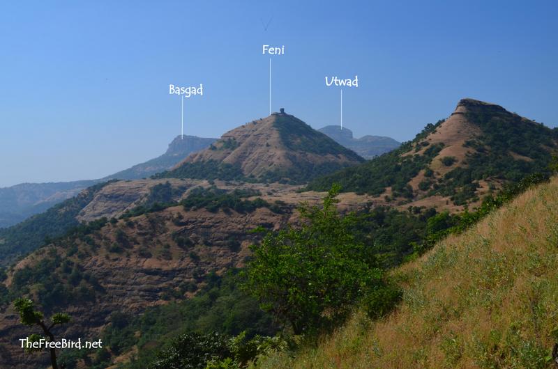
On the other side of the fort near the entrance we can see Basgad , Feni & Utwad. Many other forts from the Kasara range are visible if there is clear climate ( mostly after monsoon)
The highest point of Harihar fort is a ballekilla ( small fort within a fort) which has flag mounted on top. After spending 2 hours at the top of Harihar we started our descend via the zig zag stairs. Climbing the stairs was a huge adrenaline pump. But looking down at the same stairs gave me different feeling all together. As the mountain saying goes descending is much more difficult & riskier than the climb.
By the time I climbed down the stairs the climate had become cooler and the views had become more beautiful with the softer ambient lights. Wish i had waited at the top for the sunset.
Since we were already late for our train from Kasara we hurried our way to Nirgudpada. We breezed through the descent in half an hour, reached our jeep , had lemonades and hurried off to Kasara.
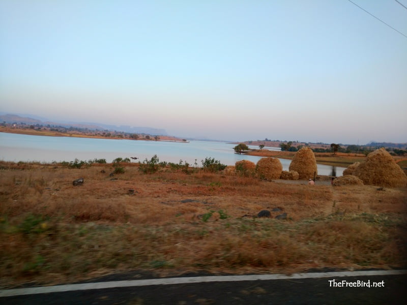
With a tired body and a mind full of memories we headed back to Mumbai. Till next time.
That’s it for the Harihar fort trek blog.
If you have any doubts add a comment at the end of this post or reach out to me on my social media channels(at the end of this page). I also create ambience sahyadri videos on youtube.
I've written blogs covering numerous Sahyadri treks, all accessible in the section below. Additionally, I create ambient Sahyadri videos on YouTube, featuring solely natural sounds such as birdsong, wind rustling through the trees, and the soothing patter of rain—the elements of nature that I hold dear.
SAHYADRI TREKS NEAR
famous treks
kp falls- railway bridge waterfall
kataldhar 400ft
kumbhe 400ft
nanemachi 500ft
kalu waterfall god valley 1200ft trending
Easy treks near mumbai- pune
kondana caves
nathbaba caves
Treks near kasara & nashik
bhandardurg/brahmagiri
bahulagad-closed
Treks near Malshej
Kalu waterfall God valley
bhairavgad moroshi
Konkan sea forts
murud Janjira
kolaba fort
korlai fort
Difficult treks
rajapuri caves
Matheran trekking routes from:
garbett plateau
rambaug point
one tree hill
sunset point
hashyachi patti
pisarnath ladder
beatrice cliff
If you have been trekking in sahyadris for a long time , upgrade your skills to climb Himalayas by training for mountaineering which includes rock climbing, ice climbing and all adrenaline pumping adventures we love. Here is a short intro for moving from trekking to mountaineering
- ← Kolaba Fort ❤️ Never be fooled by the low tides
- Kalavantin durg trek risky ? Trust me ❤️ Its easy →
7 thoughts on “Harihar Fort Trek ❤️ For the love of vertical stairs”
Excellent and detailed information on the fort.
तुम्हीं मला गुप्त दरवज्याचे स्थान कुठे आहें हे सांगु शकता का ???????
Payrya chadhun dusrya darvajya pudhe gelat ki left side la thodya velat disun yeil
How much cost for jeep from kasara-nirgudpada round trip???
You can hire a jeep for about 2500-3000. I have mentioned a number in the blog
How long does it take trek from Nashik side? Any closing time for the trek? How will be the crowd during weekdays?
The trek would take about 90 min from Nirgudpada & 60 min from Harshewadi trek. Both these base villages are about 40 kms from Nashik and take about 70mins to reach. THe road to Nirgudpada is better than Harshewadi but takes a longer trekking time. It depends on your comfort which route you choose . Weekdays crowd would be less but cant predict anything as a single bus of trekkers might crowd the place but is definitely preferred as against weekends. It would be better to start & complete the trek early
Leave a Reply Cancel reply
Your email address will not be published. Required fields are marked *
Save my name, email, and website in this browser for the next time I comment.
MY ADVENTURES
Get my latest travel updates in your inbox
When you see my updates, you'll be motivated to go out in nature and get some fresh air & peace
About Me -->
My Insta vibes !
Hate crowds ? Join my offbeat treks. Whatsapp “Notify” on 7507078470 for trek updates
Hello trekkers !
If you find my content useful, consider making a donation to support operational costs of the website. My upi id below.
TheFreeBird@icici
The ebook is absolutely FREE & any donation will be appreciated. My dream is to create a Indian mountain wikipedia & your generosity is keeping that dream alive
Download ebook
Kasa Kay ! Namaste ! Juley ! Vannakam ! Sasrikal ! Wassup !
If you’ve enjoyed TheFreeBird’s travel tips and trek guides & doing well in life consider donating . If you are interested in starting your investment /trading journey, you can open a trading account on Zerodha which will earn me comission for advertising, directly supporting website’s operational costs

TheFreeBird@upi
My dream is to create a Indian mountain wikipedia & your generosity is keping that dream alive
If you find my content useful, consider making a donation which will fund the operational costs of the website
My dream is to create a Indian mountain wikipedia & your generosity is keeping that dream alive
Hate crowds ? Join my offbeat treks. Whatsapp "Notify" on 7507078470 for upcoming trek updates
0 7 5 0 7 0 7 8 4 7 0


Harihar Fort Trek - The Iconic Climb In The Sahyadris
The hills on which the fort is built looks like a rectangular shape from the base village. But it is built on the triangular prism of rock during the Yadava dynasty. The edges of Harihar fort are almost vertical. It's almost 80 degrees vertically inclined. Harihar Fort Trek is filled with adventure, thrill and beauty that make it must to trek for every trekker.

How to Reach From Mumbai?
It totally depends on the route which you want to ascend Harihar fort. There are two routes to Harihar Fort. Base village for Harihar Fort Trek are:
Nirgunpada / Takeharsh. Nirgunpada is also one of the base village for Basgad Fort Trek. Igatpuri is the major town if you are planning to ascend from Nirgudpada side
Harshewadi is another base location which is an easier route for Harihar Fort Trek. Nashik is the major town if you are planning to ascend this fort from Harshewadi side
Both Igatpuri and Nashik are well connected to other towns via roadways and railways.
To Nirgunpada By Mumbai Local Train: The cheapest and most convenient way to reach Nirgunpada on the base village of Harihar Fort Trek for Mumbaikar is through Local Train (Central Railway). Take the Kasara bound last local train to reach Kasara from Mumbai. Make a quick move to take a sharing taxi/jeep to Nirgunpada. It will take around 90 minutes to reach the base village from Kasara Railway Station.
ProTip: If you are in a group of 6 to 7, hire a taxi from Kasara for a roundtrip. They charge you around Rs 2000-2500.
To Nirgunpada From Igatpuri Railway Station: Travel overnight by any express and take the first MSRTC bus for Trimbakeshwar and alight at Nirgudpada the base village of Harihar Fort Trek.
To Harshewadi from Igatpuri / Trimbakeshwar / Nashik: One can take the Igatpuri – Trimbakeshwar – Khodala bus and get down at Kachurli. From Kachurli village one has to climb a small hill to reach Harshewadi. But the frequency of this is pretty low. So better option is to reach Trimbakeshwar which has proper road connectivity throughout the day and from Trimbakeshwar you can bargain with an auto/ taxi to drop you to Harhsewadi. They will charge around Rs. 350-500 depending on the season.
Harshewadi route for the Harihar fort trek is easier as compared to the route from Nirgunpada is mostly preferred if you have a personal vehicle. Nirgunpada route is the most famous.
The Iconic Climb In The Sahyadris
What makes you travel to any particular place? Sometimes it's about a particular spot that you wish to see in person usually it's all about the overall experience. With a question in mind is climbing these rock-cut stairs of Harihar Fort is gone really scary? I started my journey.....

Harihar Fort also know as Harshagad Fort lies in Trimbakeshwar is an important fort that was constructed to look upon the trade route through Gonda Ghat. The peculiar rock-cut steps pulls in thousands of visitors every year. Every year with the onset of monsoons, thousands of trekkers turn up to this amazing fort. There is a huge risk involved in climbing the stairs section especially in the monsoon season and with such heavy crowd, it turns even riskier. What amazes me the most is that how tough it would have been to construct such structures in that era when only basic equipment and tools were available.

One of the fort's vertical sides facing the Nirgudpada Village got the name "Scottish Kada" because it was first climbed by "Doug Scott" in 1986. He was a popular Himalayan Mountaineer, who took about two days to ascend to the top of the cliff, which stands at 170m.
Nirgunpada village to the plateau (Before the iconic steps)
It was a cold morning of October and the fort was covered under clouds. The views of the surrounding hills from the Nirgunpada base village is fabulous. Trek from Nirgunpada towards the fort start through the routes besides the lovely paddy cultivation.

The fort looked close than it actually was. The trails start gradually climbing up once you cross those fields. From here you need to pass through forest and clearings where you can see the fort.

If you are trekking in the monsoon season, you get a small stream just after you cross those fields in the village. There are arrow marks painted on the rock. But during monsoon season it becomes difficult to spot them. After trekking for another 45 minutes on the same trail, you reach a plateau. The route from Harshewadi also joins here.
ProTip: Wear proper trekking shoes. Carry a pair of trekking poles as well if you have. These 2 trekking gears help you while trekking.
From here you can see the most challenging part of the trek, that is the Iconic steps. Observe how beautifully steps are carved on the almost 80 degrees vertical rock.

Plateau to the Harihar fort top via iconic steps
There is a small stall at the end of the plateau. Take a small break here. Prepare yourself for the very exciting and challenging trek that is awaiting in front of you.

ProTip: Do not turn back while climbing the steps if you are afraid of height. It looks very scary.
These rock-cut steps look scary but once you start climbing them, you have enough support there for your safety. So it is not scary as it looks from far. There are notches carved in for support. Make sure you take the complete advantage of them. Place your foot carefully. During monsoon season they become slippery because of the moss formation. There are around 90 steps before you reach the Mahadarvaja. They are maintained pretty well.

After the Mahadarvaja, the trail takes you to a left traverse. Here, your left is open to a valley and your right is the wall of the fort. You can see the Harshewadi village on your left.

ProTip: Watch out your head. You need to bend down and cross this stretch. This leg of the trek is very narrow. Only one person can proceed at a time.
Once you cross the traverse, you encounter another set of steep steps. You have to climb up around 100 steps to reach the top. After climbing those steep steps, you pass through a small cave. Almost an hour of an exciting climb, you reach the fort.

On the fort, you can see small ponds, a temple of Lord Hanuman and Shiva. You can also see a Balekilla which means the highest point of the fort. After exploring a bit on the fort, head to the highest point of the fort Balekilla. Another 10-15 minutes of a trek leads you to the highest point of the fort. The top is very small. Only a few people can stand there.

Take some time to get absorbed in the 360-degree view of the Sahyadri’s Trimbakeshwar region. Enjoy the mesmerizing view of all the famous peaks and forts completely immersed in lush green colour.
Bhaskargad or Basgad, Anjaneri fort, Brahmagiri, Utwad fort, Phani Dongar hill which has a needle-like structure and many other forts are around you. It is fun to identify all of the forts and peaks if you are in a group!
After spending an hour at the top, you can start to descend. It is the same route you have taken to climb up.
You need to be very careful while descending the iconic steps. Always have the “There point contact” while facing the mountain. Three-point contact is a safety technique where you use 2 hands and one foot.
Best Season to Visit Harihar Fort
The best time to do Harihar fort trek is from June to February. During this period you can see the spectacular views from Harihar fort.
Monsoon is the best season to see the lush green Sahyadris. All the fields in the villages and trails will be full of green grasses.

Post monsoon season offers a clear view of the famous forts and peaks from the Top. You can expect the pleasant weather during this time.
Listen To Me:
Carry some ready to eat food, atleast 2 litres of water and first aid box.
Talk to the native villagers gently and give respect to them. Cause you are their guests.
Carry an Id proof.
You won't find any fancy hotel or homestay place in the base village. So it advisable to take a local villager as a guide and pay him for your breakfast and lunch and also you can leave your bag at their place and carry only must required things.
Harihar fort trek is not recommended for beginners. The iconic stairs can be a bit scary if you are trekking for the first time. Any fit trekker who has prior trekking experience can attempt Harihar fort trek.
The ideal time to do Harihar fort is to start the trek from the base before the sun starts beating down. So that you reach the top before noon and descend for your late lunch. Make sure you come back to the starting point before 3 pm. If you are depending on public transport for your return journey, then after 3 pm, you have only a few options to go back.
Don't try to risk your life while trekking and always take a guide if you don't know the route.
Harihar Fort Trek Level: Easy to Moderate.
Base Village: Nirgunpada, Trimbak.
Altitude: 3676ft ASL
Time Required: 7-8 hours round way.
Region: Trimbakeshwar, Nashik
If this has inspired the explorer in you, you may also like to explore...

Like what you’re seeing and if you found the write up useful, would love to hear your feedback in the comment section. Do share, like and follow for more on Facebook , Instagram , Twitter , Telegram & Whatapp .
- Weekend Getaway From Mumbai
- Adventure Travel
Related Posts
Harishchandragad: The Magnificent Konkan Kada and Indravajra
10 Must Do Monsoon Trek Around Mumbai
Kashmir Great Lake (KGL): A Piece Of Heaven On Earth
Commentaires
Harihar Fort Trek
- Registration
- Train Timings
Harihar Fort, also called Harish Fort, is 6.43 km west of Trimbak and 1,120.44 metres (3,676 feet) above sea-level. Harihar Fort Trek is short yet tiring. The last 200 feet of the hike is a nerve-racking climb through steep rock cut stairs inclined at 80 degrees. The descent is particularly exhilarating as you have to climb down and at one point face a sheer 500 ft drop.The architecture of the stairs is so diverse and outstanding and offers spectacular and occasionally scary views of the valley below. The fort is situated amidst the huge Vaitarna dam and the Trimbakeshwar mountain ranges offer stunning views of the area around. It was of substantial importance in earlier days to keep watch on the route crossing the range connecting Maharashtra to Gujarat.
Information about the Harihar Fort Trek:
- Type: Hill Fort
- Height: 3676 Feet above MSL (Approx)
- Base Village: Trimbak
- Difficulty Level: Medium
- Endurance Level: Easy – Medium
The Descend
See you again, to register yourself,.
Deposit the Amount into the Following Account: Account Details: Bank Name: ICICI Bank Account Name: Treks And Hikes Account No: 641505000696 Account Type: Current IFS Code: ICIC0006415 Branch: Vile Parle (W)
UPI: pay2tah@icici
Google Pay (Tez): 8369457750
(Please drop an e-mail after transaction to confirm your registration)
Cancellation Policy:
Cancellations prior to 30days from the start of the trek — 90% refund., cancellation before 15 days to the start of the trek — 50% refund., cancellation a week to the start of the trek — no refund..
Keep visiting us at: https://www.treksandhikes.com/
Follow us at: https://www.facebook.com/TreksAndHikes/ https://www.facebook.com/TAHHyderabadHikers/ https://www.instagram.com/TreksAndHikes/
Terms and conditions: https://www.treksandhikes.com/terms-conditions/
We will be starting with the CST – Kasara fast local (time-table given below) CST: 10.50 pm Byculla: 10.57 pm Dadar: 11.05 pm Kurla: 11.13 pm Ghatkopar: 11.18 pm Mulund: 11.30 pm Thane: 11.34 pm Dombivli: 11.57 pm Kalyan: 00.07 am Kasara: 01.18 am
Take return tickets till Kasara Station. You may board the same train from the station of your convenience and meet us in the train directly. (Get into Any compartment Because Train Will be Crowded (Missing the train means missing the trek, So be on time)
You May Also Like

Velas Turtle Festival 2022

Rajmachi Fireflies Trek
Garbett Point Trek

IMAGES
VIDEO
COMMENTS
Harihar fort trek has two routes. Both the trails start from villages which are accessible by public transport as well as your vehicle. The base villages are: 1. Nirgudpada(Kotamwadi) 2. Harshewadi Both the …
Max Altitude: 3,676 Ft. Average Trekking Fees: ₹900 – ₹1,200. Distance: 4 – 5 kms. Difficulty: Moderate. Duration: 3 – 4 hours. Ideal For: Experienced Trekkers Only. Best …
Harihar Fort Trek, Nashik – Adventurous route at the 1120m elevation. Difficulty Level: Hard Type of a trek: One day trek Best time to visit Harihar Fort: Winter Season, November to February …
The Harihar fort trek route can be broken into two stages depending on the amount of toughness level. The base village is Nirgudpada; from here, the trek starts; you will pass …
Harihar, also called Harsh Fort, is 3676 feet above sea-level. It was one of the forts in the possession of the Ahemadnagar Sultans. In 1636 Harihar, Brahmagiri, Tringalvadi and a few other Pune forts were given by the …
Harihar Fort Trek is filled with adventure, thrill and beauty that make it must to trek for every trekker. The hills on which the fort is built looks like a rectangular shape from the base village. But it is built on the triangular prism of rock during the …
Harihar Fort Height is 3676 feet above sea level. Hari Har Gad Fort Region is Trymbakeshwar. Harihar Trek difficulty is tough. Harihargad Trek endurance is High. Harihar fort base village is Nirgudpada. Harihar Fort Nashik trek …
Harihar Fort, also called Harish Fort, is 6.43 km west of Trimbak and 1,120.44 metres (3,676 feet) above sea-level. Harihar Fort Trek is short yet tiring. The last 200 feet of the hike is a nerve-racking climb through steep rock cut stairs …