- Share full article
Advertisement
Supported by

Hurricane Hilary: What Travelers Need to Know
Flights and other travel plans may be disrupted by the powerful storm moving up the Baja California Peninsula and toward the southwestern United States.

By Christine Chung
As Hurricane Hilary headed toward the Baja California Peninsula and the southwestern United States on Sunday, meteorologists forecast heavy rain, flooding and even tornadoes in the region.
It’s unclear where Hilary will make landfall, but this severe weather has already disrupted travel and affected flights this weekend, particularly through Los Cabos International Airport in San José del Cabo, Mexico, and airports in Nevada and Southern California. Here’s what travelers need to know.
Where is the storm headed?
Hilary has been weakening to a Category 1 hurricane as it heads to land, but it is still expected to lash the Baja California Peninsula with extreme winds and rain. Currently, there is a hurricane watch in effect for most of the northern half of the Baja California Peninsula.
Forecasters predict up to 10 inches of rain through Sunday evening across the peninsula. Mexico’s national meteorological service said there could also be intense winds and hail, as well as landslides and flooding in low-lying areas.
When it hits the United States, the storm is forecast to weaken to a tropical storm . The National Weather Service has issued flood watches for Los Angeles and Ventura Counties, in effect from Sunday afternoon through Monday evening.
What are the airlines doing?
As of Sunday morning , more than 500 flights through airports within the southwestern United States, including airports serving San Diego and Los Angeles, were delayed or canceled.
Major carriers are waiving change fees for flights scheduled through this weekend to or from Los Cabos Airport. They are also waiving change fees for flights scheduled through Monday at a handful of airports in Southern California, Nevada and Arizona, with varying restrictions.
Changes on American Airlines must be booked by Aug. 20 for Los Cabos and Aug. 21 for select airports in the southwestern United States and completed within a year. Delta Air Lines and United Airlines are waiving fare differences for flights on or before Aug. 23.
And Delta, Southwest Airlines and JetBlue Airways are offering rebooking for customers traveling to or from Las Vegas.
Alaska Airlines ’s policy to allow no-fee flight changes and cancellations also applies to Loreto Airport, on the east coast of Baja California Sur.
Air travelers should monitor their flight status using their airline’s website or app. FlightAware , a flight tracking service, also provides timely insight into delays and cancellations at domestic and international airports.
What precautions are local hotels taking?
Lilzi Orci, president of the Los Cabos Hotel Association, said that each of the association’s 93 hotels had an “action plan” to keep visitors safe, including a “certified place” to serve as a temporary refuge for guests. She said that hotels were preparing for the storm by taking steps such as clearing lawns of debris, locking down garden furniture and monitoring power regulators.
“We are always in communication with the San José del Cabo International Airport so we can know the status of the flights and to be able to inform the guests,” she said. “In this way we also prevent them from going outside if their flight is canceled.”
Hilton is waiving cancellation penalties through Aug. 23 at its properties in Baja California Sur, including the Beach and Golf Resort in Los Cabos and the Waldorf Astoria Pedregal, a hotel spokesperson said.
Marriott International is also waiving cancellation fees for guests who have stays booked at its properties “in the path of Hurricane Hilary,” said Kerstin Sachl, a spokeswoman for the hotel brand.
What about the beaches?
Ms. Orci said that Mexican authorities had already closed the ports and beaches in Los Cabos.
Over the next few days, the coast of southwestern Mexico and the Baja California Peninsula could see large swells “likely to cause life-threatening surf and rip current conditions,” according to an advisory from the National Weather Service in the United States.
A storm surge, accompanied by “destructive waves,” is likely to cause coastal flooding along the western Baja California Peninsula, the Weather Service said. On the Baja California Sur coast, these waves could rise to 22 feet, Mexico’s meteorological service said .
California has temporarily closed all state beaches in Orange and San Diego Counties , as well as some inland parks. “Reservation holders are being contacted and refunds will be provided,” according to the state’s parks and recreation department.
Are any cruise ships sailing?
Two Carnival cruise ships, the Radiance and the Panorama , were scheduled to depart in separate sailings from Long Beach, Calif., to Mexico on Friday and Saturday.
Because of the storm, the cruise line modified the itinerary for the Panorama, canceling a port call to Mazatlán, Mexico, and changing the date for a port call to Puerto Vallarta, Mexico, to one day earlier.
“We are continuing to monitor the storm and factor in guidance from the National Hurricane Center, U.S. Coast Guard and the local port authorities to provide timely updates to our guests as more information becomes available,” Carnival said in a statement on Sunday.
Ceylan Yeginsu and Emiliano Rodríguez Mega contributed reporting.
Follow New York Times Travel on Instagram and sign up for our weekly Travel Dispatch newsletter to get expert tips on traveling smarter and inspiration for your next vacation. Dreaming up a future getaway or just armchair traveling? Check out our 52 Places to Go in 2023 .
An earlier version of this story misspelled the name of a hotel in Mexico. It is the Waldorf Astoria Pedregal, not the Waldorf Astoria Pedegral.
How we handle corrections
Christine Chung is a travel reporter for The Times. She previously covered breaking news. She joined The Times in November 2021. More about Christine Chung
Explore Our Weather Coverage
Extreme Weather Maps: Track the possibility of extreme weather in the places that are important to you .
Tornado Alerts: A tornado warning demands instant action. Here’s what to do if one comes your wa y.
Flash Flooding: Fast rising water can be deadly. Here’s what to do if you’re caught off guard , and how to prepare for a future flooding event.
Evacuating Pets: When disaster strikes, household pets’ lives are among the most vulnerable. You can avoid the worst by planning ahead .
Climate Change: What’s causing global warming? How can we fix it? Our F.A.Q. tackles your climate questions big and small .
Hilary updates: Over 1 foot of rain hits San Bernardino as LA avoids catastrophe
Hilary soaked Southern California, flooding roads and knocking out power.
All tropical storm warnings have been canceled across Southern California as the remnants of Hilary, which no longer meet the threshold of a tropical cyclone, track north.
Once a Category 4 hurricane, Hilary tore through Southern California with historic rainfall on Sunday, flooding roads and knocking out power.
Latest headlines:
Hilary's record-breaking stats, tropical storm warnings canceled across southern california, la schools expected to reopen on tuesday.
- LA residents should stay vigilant for mudslides, downed wires
Hilary, the first tropical storm to move into Southern California since 1997, marked the first time ever that tropical storm watches were issued in the region.
Sunday set a new record for the wettest August day ever in Palm Springs, San Diego and downtown Los Angeles.
Hilary's highest rain total was in Upper Mission Creek in San Bernardino County, where 13 inches of rainfall was recorded.
-ABC News' Melissa Griffin
Rescue teams work to evacuate hundreds of people
In Forest Falls, California, about 700 people are sheltering in place after mud and debris flow cut a road off from the rest of the community, according to the San Bernardino County Fire Department. No injuries were reported and crews are working to restore road access, the fire department said.
In nearby Seven Oaks, another 30 people are sheltering in place after flash floods struck several cabins in the area, the fire department said. Crews are working to access the residents and evacuate them, the department said.
All tropical storm warnings have been canceled across Southern California as the remnants of Hilary, which no longer meet the threshold of a tropical cyclone, track north, according to Ariel Cohen, meteorologist in charge at the National Weather Service Los Angeles.
Residual mudslides and rockslides are still a threat in California from the weekend rain.
The moisture from Hilary is now moving through the Rockies. On Monday, the flooding threat will be from the Sierra Nevada mountains into the northern Rockies in Idaho and eastern Oregon.
Los Angeles "avoided a potentially catastrophic set of conditions" from Hilary, LAUSD Superintendent Alberto Carvalho said Monday.
Carvalho defended the decision to close LA's public schools on Monday citing reasons including that many students walk to school and many employees live outside of LA.
"It would have been reckless for us to make a different decision" on Sunday, he said.
Schools appear to be in good condition, he said, noting that about 24 schools don't have phone or internet access and one elementary school that serves students with disabilities appears to have been impacted by a mudslide.
Carvalho said students should expect to resume their regular school day on Tuesday.
Nearly 1,000 flights canceled ahead of storm
Airlines have canceled 944 flights so far as Tropical Storm Hilary approaches the West Coast, according to FlightAware .
The majority of the affected airports are in the West.
Southwest Airlines has cancelled 683 flights, the most flights of all U.S. airlines.
The airline has canceled all flights in and out of Palm Springs International Airport until at least Monday.
-ABC News' Sam Sweeny
Top Stories
What are the potential outcomes of trump's hush money trial, iran's president raisi dead in helicopter crash, iranian state media reports, trump trial live updates: michael cohen back on the stand for cross-examination, blue origin launches historic flight to space, diddy apologizes after video of alleged assault surfaces: 'i hit rock bottom'.
Watch CBS News
Hilary moves into Southern California after making landfall in Mexico's Baja California peninsula
By Kerry Breen
Updated on: August 21, 2023 / 12:56 PM EDT / CBS News
Tropical Storm Hilary moved into Southern California on Sunday evening just hours after making landfall in the northern part of Mexico's Baja California Peninsula. Officials warned of " catastrophic and life-threating flooding " in Mexico and the southwestern U.S.
Hilary was downgraded to a tropical storm a few hours before making landfall, as rain from the storm started spreading in Southern California, the National Weather Service said . Then it was downgraded again, to a post-tropical cyclone early Monday morning. The system was expected to dissipate later in the day but still produce heavy rainfall, significant flooding and gusty winds across the western U.S.
As of 8 a.m. PDT Monday, Hilary was about 115 miles west-northwest of Elko, Nevada, and racing north-northeast at 24 mph with maximum sustained winds of 35 mph.
It was the first time ever that the National Hurricane Center issued a tropical storm warning for Southern California, and California Gov. Gavin Newsom declared a state of emergency ahead of the storm.
More than half a year's worth of rain fell in the desert city of Palm Springs, California, CBS News correspondent Carter Evans reports. Mount Wilson in Angeles National Forest recorded over 8.5 inches of rain as of 7 a.m. PDT, the top amount reported by the National Weather Service's Los Angeles office. Beverly Hills recorded 4.8 inches, and downtown LA recorded nearly 3 inches.
"We are ready," Los Angeles Mayor Karen Bass told "Face the Nation" on Sunday.
Tropical storm conditions began Sunday in the southwestern U.S., with gusty winds spreading well inland. The National Hurricane Center said large swells are expected to effect portions of the Baja California peninsula as well as Southern California over the next several days. The California Department of Parks and Recreation on Saturday ordered a temporary closure of all San Diego and Orange County state beaches and several state parks.
- Latest storm coverage from CBS Los Angeles
Disneyland announced Saturday that the parks would be closing early on Sunday, with Disney California Adventure Park closing at 9 p.m., Disneyland Park closing at 10 p.m. and the Downtown Disney District will close at 11 p.m.
Other parts of the southwestern U.S. were preparing, with the National Weather Service in Las Vegas warning on Sunday that strong winds were likely, as well as flash flooding. A state of emergency was declared in Nevada and in Clark County, where Las Vegas is located.

By the time it reached California, Hilary had been downgraded to a tropical storm, which is defined as having winds of at least 39 mph, according to the National Weather Service.
However, it was still packing a punch. Widespread "moderate to heavy" rain was expected into early Monday for Southern California, with a high risk of flash flooding that could include "landslides, mudslides and debris flow" in mountains and deserts, according to the National Weather Service in San Diego .
The weather service forecast that some areas had at least a 70% chance of experiencing flash flooding.
By Monday morning, all coastal warnings had been discontinued, the hurricane center said. However, the National Weather Service's Weather Prediction Center said flood watches were in effect for Southern California, northwest Arizona, much of Nevada, southwest Utah, eastern Oregon, western and central Idaho and southeast Washington. A flood watch means flooding is possible in those areas.
LA County officials had advised all residents and visitors on California's Catalina Island to leave as soon as possible ahead of the storm's arrival.

A White House spokesperson said that President Biden had been briefed on Hilary and that his team was working "with state and local agencies ahead of the storm." The president and his family are vacationing in Lake Tahoe in Northern California. The president and first lady Jill Biden are slated to travel to Hawaii Monday to survey the destruction from the Maui wildfires .
- How to prepare for hurricane season, according to weather experts

"It is rare — indeed nearly unprecedented in the modern record — to have a tropical system like this move through Southern California," said Greg Postel, a hurricane and storm specialist at the Weather Channel who has a doctorate in atmospheric sciences.
Postel said there will likely be "damaging wind gusts," especially at higher elevations, in the area, and swells along the coast.
California was drenched by a historic amount of rain this winter after being hit with an unprecedented number of atmospheric rivers. Chris Heiser, emergency services director for the city of San Diego, told CBS News on Friday that those storms may have helped prepare officials for what is to come from Hilary.
"That really allowed us to get a feel for what the impact of heavy rains and winds are," Heiser said. "But this one's got some unique features. The amount of rainfall is substantial, especially up in the mountains. And the majority of the population of San Diego is at the base of those mountains."
"We're looking at this to be a significant storm, possibly one of those that sets records, and so we're preparing accordingly," he added.
The Navy moved vessels out of San Diego Bay on Saturday to avoid damage from the storm. Ships and submarines left Naval Base San Diego, Naval Base Coronado and Naval Base Point Loma and will remain at sea until Hilary passes over the region, the Navy said in a news release .
"In order to ensure the safety of our Sailors and ships, we are taking all necessary measures to mitigate potential damage to infrastructure and Third Fleet vessels caused by the storm," said Vice Adm. Michael Boyle, commander, U.S. Third Fleet, in the news release. "Safety remains our top priority, and putting all capable ships to sea makes it easier for us to manage the situation ashore."
California State Parks announced that all state beaches in San Diego and Orange counties would be closed Sunday and Monday, while the National Park Service closed the popular Joshua Tree National Park, located east of Palm Springs, through Monday evening over fears of flash flooding.
The city of San Diego followed suit with all city beaches and public buildings.
Los Angeles County Sheriff Robert Luna said in a news briefing that "swift water rescue personnel and rescue aircraft are on alert and ready for immediate response."
LA County officials also asked the homeless to stay away from waterways and river channels during the storm.
Pasadena Unified School District and Los Angeles Unified School District, the second largest school district in the country, both said all public schools would be closed Monday.
In San Bernardino County, located about 70 miles east of LA, officials issued evacuation alerts for several mountain communities.
Nevada Gov. Joe Lombardo announced late Friday that 100 National Guard troops had been activated ahead of Hilary. He declared a state of emergency Sunday.
The San Diego Padres, Los Angeles Dodgers and Los Angeles Angels all had home games scheduled for Sunday. However, those games were shifted to Saturday double-headers in anticipation of the storm.
Capistrano Beach in the Orange County city of Dana Point Friday was one of several where crews built berms to protect the coastal community from high surf.
"We're getting ready now ahead of this event as it makes landfall to make sure we're prepared," said Chris Dargan, a spokesperson for California Governor's Office of Emergency Services.

-Alex Sundby contributed reporting.
- Weather Forecast
- Hurricane Hilary
Kerry Breen is a reporter and news editor at CBSNews.com. A graduate of New York University's Arthur L. Carter School of Journalism, she previously worked at NBC News' TODAY Digital. She covers current events, breaking news and issues including substance use.
More from CBS News

At least 68 dead in Afghanistan after flash floods caused by heavy rain

Mayoral candidate, young girl among 6 shot dead in Mexico

3 moves to avoid as gold's price rises

These California college students live in RVs to afford cost of education
Official website of the State of California
Resources for California
- Key services
- Health insurance or Medi-Cal
- Business licenses
- Food & social assistance
- Find a CA state job
- Vehicle registration
- Digital vaccine record
- Traffic tickets
- Birth certificates
- Lottery numbers
- Unemployment
- View all CA.gov services
- Popular topics
- Building California
- Climate Action
- Mental health care for all
California Mobilizes Ahead of Hurricane Hilary, Urges People in Southern California to Prepare
Published: Aug 18, 2023
WHAT YOU NEED TO KNOW: As the state mobilizes resources and support for communities, Californians in the storm’s path are urged to take precautions now ahead of the storm.
SACRAMENTO – With Hurricane Hilary forecasted to be the wettest tropical cyclone in state history and the first-ever Tropical Storm Watch issued for California, the state is mobilizing to protect people from the storm and reminding everyone in the storm’s path to take steps now to prepare.
Hurricane Hilary – currently a powerful Category 4 storm – is forecast to track into Southern California over the weekend and into early next week, bringing moderate to heavy showers, thunderstorms and possibly stronger winds to Southern California. Some parts of Southern California could receive a year’s worth of rain from this storm. The location and intensity of precipitation and winds will be variable as the hurricane approaches California.
What Governor Newsom said: “We should never underestimate the power of Mother Nature. California is coordinating with federal and local governments to support communities as they prepare for this unprecedented storm. Heed warnings from local authorities, be ready and stay informed.”
Governor Newsom is headed to Southern California and will be there for the next several days as the storm makes landfall.
At the direction of Governor Gavin Newsom, the State Operations Center at the Governor’s Office of Emergency Services (Cal OES) is currently activated and the state is closely monitoring incoming impacts from rain, wind, and potential flash flooding and power outages. The State Operations Center is actively coordinating across state agencies to provide resources in preparation for potential impacts and to support response and recovery efforts.
In coordination with locals, the state is prepositioning resources including swift water rescue teams, California National Guard teams, and flood fighting tools while also working closely with community-based organizations to protect vulnerable unhoused people. Additionally, California is staffing highway maintenance crews 24 hours a day and taking proactive steps to maintain roadway safety.
Here are the top 5 things you can do to stay safer during the storm:
- Stay connected. Californians are reminded to dial 3-1-1 to get help or ask questions. If you have a critical emergency, call 911. Stay informed by signing up for emergency alerts including warnings and evacuation notices. Go to CalAlerts.org to sign up to receive alerts from your county officials. Check in with loved ones and neighbors.
- Travel safely. Avoid non-essential travel during the peak of the storm expected Sunday and Monday. If you must drive, download the QuickMap app or visit QuickMap (ca.gov) to learn up-to-the-minute information on road conditions, traffic, closures, and more. Do not walk, swim or drive through flood waters. Turn Around, Don’t Drown! Remember, just six inches of moving water can knock you down, and one foot of moving water can sweep your vehicle away.
- Be ready in case of power outages . Take inventory of the items you need that rely on electricity. Keep your devices charged. Plan for batteries and other alternative power sources to meet your needs if the power goes out such as a portable charger or power bank. Have flashlights for every household member. Also, plan accordingly for the potential of water outages.
- Listen to local authorities. Always follow the guidance of your local authorities, including evacuation orders, road closures and other official notices.
Hurricane Hilary 2023: Category 4 storm path has California bracing for heavy rain, floods
Hurricane Hilary is rapidly intensifying in the Pacific Ocean and could bring heavy rain and flash flooding to southern California and Nevada by the weekend, forecasters said.
The hurricane could potentially bring “significant impacts” to parts of the Baja California Peninsula and the southwestern United States this weekend, including rainfall of up to 12 inches in the Southern California mountains, according to the National Hurricane Center .
As of Friday morning, Hilary had maximum sustained winds of 145 mph and had reached Category 4 status, according to the hurricane center . It is forecast to be near or over the central Baja coast Sunday. Rain is forecast to begin arriving in Southern California starting Sunday night.
Friday updates: Hurricane Hilary tracker, map as storm moves toward U.S.
Hilary could be the first tropical storm to make landfall in California since 1939, according to federal weather officials. Tropical Storm Kay brought heavy rain and flooding to Southern California last year despite not making landfall.
"The combination of heavy rainfall, the potential for flash flooding, and strong winds could very well make this a high impact event for Southern California," Samantha Connolly, a National Weather Service meteorologist in San Diego, wrote in a Thursday morning forecast.
The hurricane center doesn't rule out a landfall farther in California.
"Although there is fairly high confidence in the track prediction, Hilary's oblique angle of approach to the west coast of the Baja California peninsula makes it nearly impossible to know at this point if the center will remain just offshore or move over the peninsula before reaching the southwestern United States," Richard Pasch, a senior hurricane specialist at the center wrote in a Thursday forecast.
How much rainfall could Hurricane Hilary bring?
Hilary is expected to bring a risk of flash flooding and heavy rainfall in southern California, southern Nevada and western Arizona, the hurricane center said. Here's the weather service rain forecast for California, in inches.
- Coast/Valleys: 2-2.5
- Mojave Desert: 3-5
- Mountains: 4-10, with up to 12 inches on the eastern mountain slopes
- Lower Deserts: 4-7
The most rainfall ever recorded during the month of August in San Diego was 2.13 inches in 1977, the weather service said Thursday.
Daniel Swain, a climate scientist at the Institute of the Environment and Sustainability at the University of California, Los Angeles, said he is "increasingly concerned" regarding the potential for widespread and potentially severe flash flooding across interior portions of southern California and Nevada on Sunday and Monday.
The greatest concern would be east-facing slopes, but even lower deserts could see "extremely heavy rainfall," Swain posted on X, formerly Twitter.
Here's a look at Hurricane Hilary's expected path:
Hurricane Hilary path tracker 2023
Hurricane hilary sphagetti model.
Hurricane Hilary: State of emergency declared in California as millions brace for life-threatening flooding
The storm underwent rapid intensification in the pacific ocean, strengthening from a tropical storm to a large category 4 hurricane in less than 48 hours. now, a weakening trend has started with landfall expected on the mexican coast within the next 24 hours, according to the nhc..
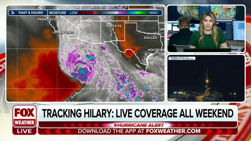
Hurricane Hilary continuing to weaken off the coast of Mexico
Even though Hurricane Hilary is weakening off the coast of Mexico, life-threatening flooding is expected to develop on Sunday in California and the Desert Southwest.
As of Sunday at 7:00 A.M. ET, Hurricane Hilary is a Category 1 Hurricane closing in on California and the Southwestern U.S. Continuous coverage has moved here.
Hurricane Hilary has prompted historic weather alerts in California as millions across the Southwest begin to see initial impacts from the storm, with the worst to come over the next 48 hours, as the cyclone unleashes catastrophic, life-threatening flooding.
By Sunday afternoon, the center of Hilary is expected to move over Southern California after it nears the west-central coast of the Baja California peninsula, according to the National Hurricane Center (NHC). The hurricane weakened to a Category 1 cyclone and is expected to be a tropical storm when it reaches California.
California Gov. Gavin Newsom declared a State of Emergency for Southern California ahead of the storm's worst impacts.
More than 42 million people are under the first-ever Tropical Storm Warning that has been issued in Southern California . It covers areas along the coast from Los Angeles to the U.S.-Mexico border, including San Diego. It also extends inland to places such as Victorville, San Bernardino, Palm Springs and Mount Laguna.
Parts of the Southwest were already being impacted Saturday by moisture from Hurricane Hilary, resulting in the issuance of Flash Flood Warnings and the closure of some roadways.
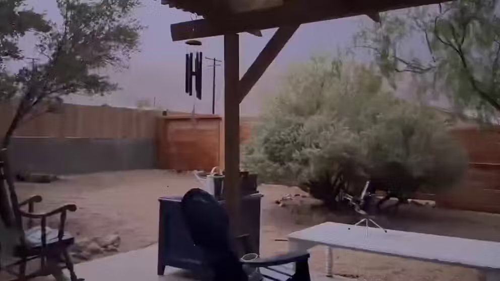
Watch: Lightning, thunder roar near Los Angeles as Hurricane Hilary approaches
Listen as lightning and thunder roll over Twentynine Palms, California, on Saturday morning Hurricane Hilary churns toward Southern California.
Heavy rain has already caused problems Saturday. The California Department of Transportation closed Highway 98 in Ocotillo, near San Diego, due to flooding and debris on the road.
In Palm Springs, California, firefighters say they distributed 20,000 more sand bags to residents as preparations continue. Authorities said residents living along the flood channel there have been repeatedly cautioned about the imminent risk to their lives by police helicopters circling every 90 minutes Friday.
In anticipation of the heavy rainfall, the San Bernardino County Sheriff's Office issued evacuation notices for residents in Oak Glen, Forest Falls, Mountain Home Village, Angelus Oaks, and NE Yucaipa.
These areas are known to flood during heavy rainfall events and have been the recipients of debris flows and mudslides.
Additionally, the Los Angeles County Sheriff's Office has asked residents and visitors to leave Catalina Island ahead of rough seas and high winds.
Some sandbag locations ran low on supplies in San Diego, but CAL FIRE pledged to keep preparation efforts going as long as possible.
MAP ROOM: LIVE TRACKING OF HURRICANE HILARY
The Air Force Reserve "Hurricane Hunters," assigned to the 403rd Wing at Keesler Air Force Base in Mississippi, departed Saturday morning to fly weather reconnaissance missions into Hurricane Hilary to collect weather data that improves NHC's forecasts.
"By flying into the storm, crews are able to locate the low-pressure center of the storm and collect data that assists with movement and intensity forecasts," said Lt. Col. Steve Burton, 53rd WRS mission commander for the weather deployment. "The data we collect can improve a forecast by anywhere from 15-25%."
The unit will continue to fly missions into the storm throughout the weekend and possibly into Monday, said Burton.
HOW TO WATCH FOX WEATHER
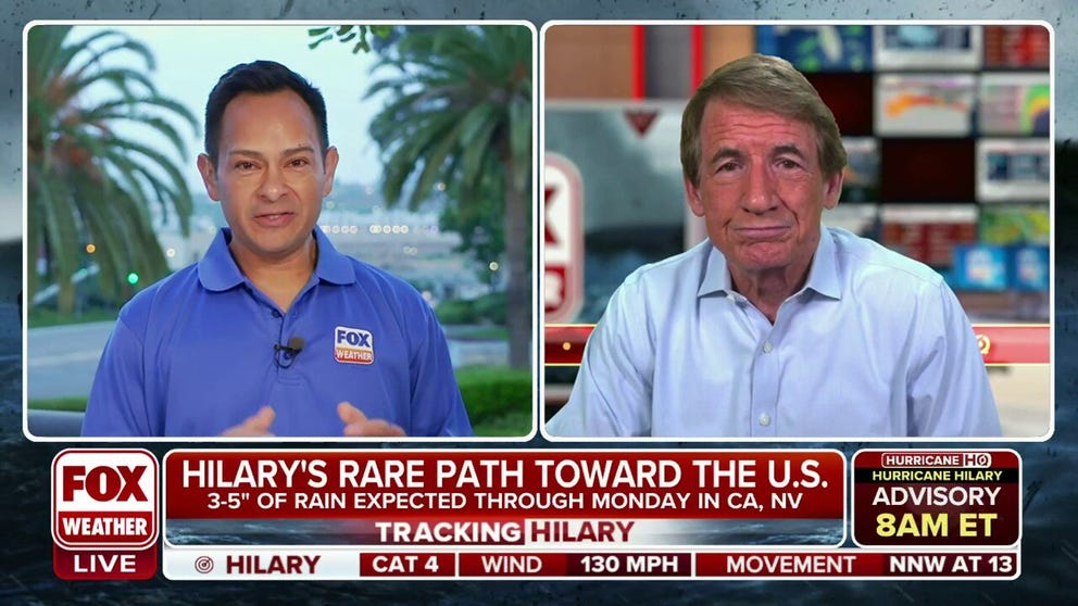
Bryan Norcross: Latest on Hurricane Hilary's rare path toward US
As FOX Weather continues to track Hurricane Hilary movement towards the Southwest, hurricane specialist Bryan Norcross has the latest.
"A lot of folks who will be impacted by the storm may not have a lot of experience with tropical cyclones," FEMA Deputy Assistant Administrator Colt Hagmaier told FOX Weather.
Most deaths from hurricanes and tropical storms occur due to inland flooding , especially when people drive through flooded streets.
"So it's really important that people have a plan of how to get out if they need to, that they listen to their local officials, and they don't drive through standing water," Hagmaier said.
The State of California say it has pre-positioned swift water rescue teams and vehicles to respond where flooding could be the worst.
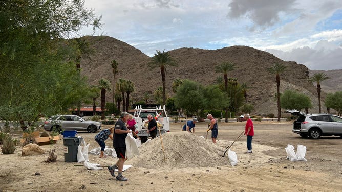
Filling sand bags in the California desert ahead of Hilary's arrival. (@Shermanscorner)
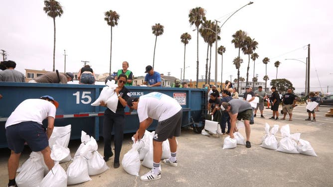
BELMONT SHORE, CA - AUGUST 19, 2023 - Belmont Shore and Long Beach residents fill sandbags in preparation for Hurricane Hilary in the Claremont parking lot in Belmont Shore on August 19, 2023. (Genaro Molina / Los Angeles Times via Getty Images)
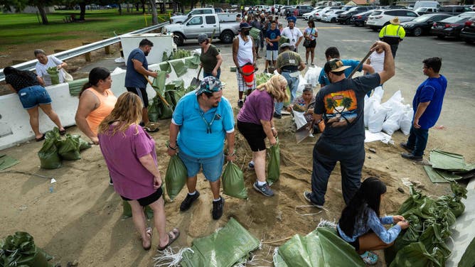
Preparation for the approaching Hurricane Hilary, residents of San Bernardino fill sandbags at Wildwood Park on Saturday, Aug. 19, 2023, with a line forming as they await their turn. (Photo by Watchara Phomicinda/MediaNews Group/The Press-Enterprise via Getty Images)

Customers buy plastic tarps from the nearly empty shelves of a Los Angeles store in preparation for rains from Hurricane Hilary in Los Angeles, California, on August 19, 2023. Hilary strengthened into a Category 4 hurricane on August 18, 2023 and was expected to further intensify before approaching Mexico's Baja California peninsula over the weekend, the US National Hurricane Center (NHC) said. In the US, parts of southern California and southern Nevada could see heavy rain through early next week, the NHC said. (Photo by CHRIS DELMAS/AFP via Getty Images)

The California National Guard prepositioning resources in Southern California ahead of Hilary (The California National Guard)
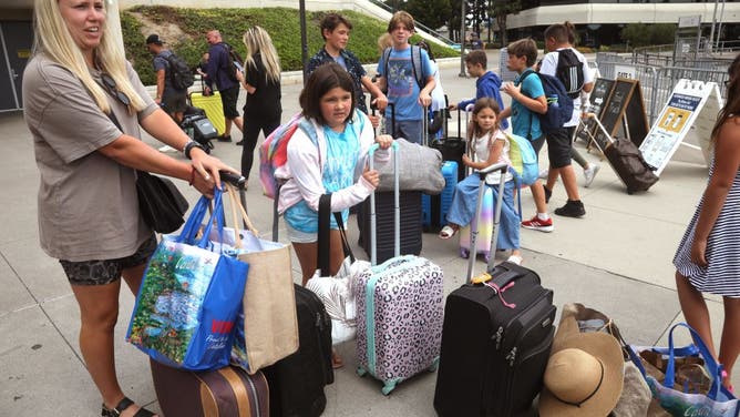
LONG BEACH, CA - AUGUST 19, 2023 - Members of the McMullen, Biegler and Northcut families arrive in Long Beach after having to evacuate from Catalina Island due to Hurricane Hilary on August 19, 2023. They've been on the island since Thursday. (Genaro Molina / Los Angeles Times via Getty Images)
Where is Hurricane Hilary?
The center of Hurricane Hilary is currently located less than 385 miles from San Diego . The storm is moving toward the north-northwest at 21 mph, increasing speed since Saturday.
CALIFORNIA GETTING HIT BY TROPICAL SYSTEMS IS EXTREMELY RARE
Are there any weather alerts because of Hurricane Hilary?
A Tropical Storm Warning has been issued for from near Los Angeles to the U.S.-Mexico border, including Catalina Island. According to the NHC, this is the first time the agency has issued a warning for this region.
Much of San Diego , Riverside, Orange, San Bernardino, Los Angeles and Ventura counties are included in the warning. The inland alerts cover cities such as Riverside, Palm Springs , San Bernardino, Victorville, Pine Valley, and Santa Clarita.
WHEN WAS LAST TIME CALIFORNIA WAS HIT BY HURRICANE?

A Tropical Storm Warning is issued when tropical-storm-force winds (sustained winds of 39 to 73 mph) are expected within the alerted area within 36 hours.
Hilary has also prompted the Mexican government to issue a series of watches and warnings for the entire Baja California Peninsula and parts of mainland Mexico.
A Hurricane Warning is issued when hurricane-force winds (sustained winds of 74 mph or greater) are expected within the watch area, within 36 hours.
These winds may be accompanied by storm surge, coastal flooding and/or river flooding.
HOW TO PREPARE FOR HURRICANE SEASON

What is the forecast for Hurricane Hilary?
Maximum sustained winds are at 85 mph with higher gusts. Weakening began Saturday, but Hilary will still be a hurricane when it approaches the west coast of the Baja California peninsula Sunday morning, the NHC said.
Hilary is expected to weaken to a tropical storm by midday Sunday, before it reaches southern California.

Hurricane-force winds extend outward up to 45 miles from the center, and tropical-storm-force winds extend outward up to 230 miles. A sustained wind of 44 mph and a gust to 63 mph were recently reported at the Cabo San Lucas Marina, the NHC reports.
What are the impacts of Hurricane Hilary?
Hurricane Hilary is expected to bring 3-6 inches of rainfall and up to 10 inches in isolated areas across parts of Baja California by Sunday night, warned the NHC. Catastrophic flash flooding may occur. Across portions of the western U.S., rainfall totals of 1-3 inches are expected, but forecast models show upwards of 5 inches is possible in some areas through Wednesday.
Heavy rainfall associated with Hilary may produce areas of flash flooding and result in landslides over portions of the Baja California Peninsula until late Sunday, the NHC said.
Rainfall impacts from Hilary within the southwestern U.S. are expected to peak this weekend into Monday. Flooding is expected with the potential for significant, life-threatening impacts.

NOAA's Weather Prediction Center has issued a rare High Risk for excessive rainfall in Palm Springs, the Coachella Valley and Las Vegas , Nevada. This is the first time such a risk has been given for the low desert regions of Southern California to the east of the mountain ranges.
The threat of hurricane-force wind impacts is increasing along the west-central coast of the Baja California Peninsula, where a Hurricane Watch is in effect. Tropical storm conditions are expected to begin across the southern portion of the Baja California Peninsula later Friday and then spread north through the weekend.
HURRICANE HILARY WILL IMPACT SOUTHERN CALIFORNIA'S SUPPLY CHAIN, EXPERT SAYS

The threat of significant wind impacts continues to increase for the northern portions of the Baja California Peninsula and the southwestern U.S., especially in areas of mountainous terrain.
Large swells from Hilary will spread north along southwestern Mexico and the Baja California Peninsula. These swells will reach the Gulf of California and northern portions of the Baja California peninsula later this weekend.
Airlines issue travel waivers for passengers flying to Mexico, California
Several U.S. airlines have announced travel waivers for passengers flying either to Mexico or California.
Jet Blue, American, Alaska, Delta and United are encouraging passengers to check their itinerary for changes before flying to the region.
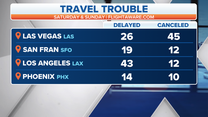
(FOX Weather)
United Airlines has expanded travel waivers for cities throughout the Golden State which included: Bakersfield (BFL), Burbank (BUR), Los Angeles (LAX), Ontario (ONT) Palm Springs, (PSP), San Diego (SAN), Santa Barbara (SBA), San Luis Obispo (SBP) and, Orange County (SNA).
Sporting events, space launch impacted by Hilary's threats
Major League Baseball adjusted game times in LA and San Diego to avoid Sunday matches. The National Football League is monitoring weather for a preseason game between New Orleans Saints and LA Chargers at SoFi Stadium .
SpaceX postponed the launch of a Falcon 9 rocket with Starlink satellites due to the hurricane's proximity to the water off Southern California. The event was expected to take place on Friday morning, but the private space company said it would attempt another launch next week if weather conditions improved.
- International edition
- Australia edition
- Europe edition

As Hurricane Hilary prepares to land, California and Mexico brace for impact
Southern California gets first tropical storm warning as conditions could potentially affect Baja California peninsula late Friday
- Hilary live updates: tropical storm brings warnings from National Hurricane Center – latest news
Hurricane Hilary, which quickly grew to category 4 strength off Mexico’s Pacific coast, whipping up 145mph winds, could become the first tropical storm to make landfall in southern California in 84 years.
As the hurricane barrels northward, officials have issued the first ever tropical storm watch for the US west coast. Hurricane watches and tropical storm warnings have also been issued for parts of Baja California and mainland Mexico , where fierce winds and rain could cause flooding and landslides.
No tropical storm has made landfall in southern California since 25 September 1939, according to the National Weather Service. The watch warned of numerous potential threats to life and property including extreme flooding, mudslides and tornados.
The storm’s angle made it difficult to judge where exactly it would hit land. It was expected to gain strength on Friday as it approached the Baja California peninsula, before slightly slowing over the region’s cooler waters. It could come ashore in Baja California on Sunday before hitting southern California, or skim past Baja and land as a tropical storm somewhere between Los Angeles and San Diego.
Regardless, officials have warned that hammering rains could cause flash floods and landslides across the region. Parts of Baja California and the north-western coast of mainland Mexico could experience gale force winds by Friday night, as well as “life-threatening” rip current conditions by the coast, the hurricane center warned. A “dangerous storm surge” could hit western Baja California, officials said, or other parts of Mexico, depending on where the storm makes landfall.
In Baja California Sur, police were patrolling beaches and schools were shut in anticipation of the storm surge.
Montserrat Caballero Ramírez, the mayor of Tijuana, said the city was tracking the storm closely, as the hilly city of 1.9 million is at heightened risk for landslides. Dozens of people camping outdoors, including migrants looking to enter the US at its southern border, were especially vulnerable and Caballero Ramírez said the city was setting up shelters in high risk zones.
“We are a vulnerable city being on one of the most visited borders in the world and because of our landscape,” she said.
Mexico has also put 18,000 soldiers on alert to assist in emergency response.
As the storm moves north, it is expected to bring up to eight inches of rain to southern California’s mountain regions and deserts. In Death Valley national park, where a heatwave last month brought near record temperatures, rains could transform the sizzling desert landscape into a lake, meteorologists warned. Desert regions could see two to three years worth of rain fall within two or three days.
Flood watches were in effect over the Los Angeles and San Diego metro areas, across California’s south-eastern desert areas and south-western Arizona. In Los Angeles, sheriffs department officers were driving through services roads with warnings, urging unhoused people to move to shelters before the storm hits.
These conditions will be especially dangerous for unhoused people across the region, advocates warn. In San Diego, which is bracing for monsoonal moisture this weekend, thousands live outside in a city where roughly 25 shelter beds are available on a given day. Local officials are bringing sandbags to outdoor encampments and are “working to determine” the capacity of inclement weather shelter providers during a time of the year when the region normally does not expect cold or wet conditions.
The National Blend of Models (NBM) is forecasting 3.79" of rain for Death Valley, California, over a 3-day period. None of the climate stations in Death Valley National Park have ever recorded even 50% of that amount in a 3-day period in over a century of records. pic.twitter.com/MWrVzj36QN — Brian Brettschneider (@Climatologist49) August 18, 2023
The storm was being driven by two weather systems – a heat dome over the central US, which will bring extreme heat to the central plains and midwest, and a low pressure area off the California coast – which were helping drive the storm northward at alarming speeds, that could bring an overwhelming amount of precipitation to the US west and south-west.
after newsletter promotion
Parts of the US west could see up to three inches of rain an hour, and up to seven inches within 24 hours, “which would be exceeding rare for the region from a tropical cyclone, potentially unique for Nevada”, the National Weather Service said.
Across a large swath of southern California’s deserts, Hilary could cause catastrophic flooding, said the UCLA climate scientist Daniel Swain. “We’re talking about the type of flooding that will be life threatening that could severely disrupt or even destroy critical infrastructure including roads and highways,” he said.
The remarkable force and speed of the storm is an omen of what is to come as the planet warms, scientists say. Hurricanes are becoming more powerful due to the climate crisis, research shows. Studies have found that that the rapid intensification of storms has become more common in a warming world. Hilary intensified by about 75mph in just 24 hours, according to the National Hurricane Center.
There has not been much study of how global heating might affect tropical cyclone hazards in California specifically, Swain said – mostly because such storms are uncommon in the region, where ocean temperatures generally aren’t warm enough to fuel powerful hurricanes.
However, the likelihood of intense winter storms, extreme heatwaves and severe wildfires in California is increasing due to the climate crisis. And its plausible hurricanes in the eastern Pacific more broadly will intensify due to hotter ocean temperatures, Swain said.
This article was amended on 21 August 2023 to correct that Hilary was the first tropical storm to make landfall in California in 84 years, rather than the first tropical storm the state has experienced in that time. In 1997, Hurricane Nora made landfall in Mexico before entering California.
- Tropical Storm Hilary
Most viewed
3 dead as storm pummels California, causing flooding and dozens of mudslides in L.A. area
What to know as a severe storm system moves into california.
- The severe storm system began moving through California on Sunday, marking the start of what's expected to be days of heavy rain and snow.
- About 38 million people are covered by flood alerts because of a weather system that the National Weather Service said could be "potentially historic."
- At least three people have died in fallen tree incidents associated with the severe weather.
- About 250,000 homes and businesses are without power in California, mostly in the northern and central parts of the state.
- Heavy rain led to mandatory evacuations for parts of Santa Barbara and Ventura counties Sunday, and firefighters rescued 16 people from a single street in Los Angeles as mudslides caused havoc. The orders were canceled for Santa Barbara County and downgraded for Ventura County this afternoon.
- NBC News' Liz Kreutz, Dana Griffin, Elwyn Lopez and Sam Brock are reporting from California.
Flood watch remains for Los Angeles area until Tuesday afternoon
Phil Helsel
While officials have said the heaviest part of the storm is over, the Los Angeles area remained under a risk of significant flooding through 4 p.m. tomorrow, according to forecasters.
More than 7 inches of rain fell in downtown Los Angeles, and some areas got 11 inches. The Los Angeles region was under a flood watch.
The slow-moving storm will stay over the region through tomorrow or even Wednesday, the National Weather Service said. Freeways could still flood, creating dangerous conditions and mudslides, and other debris flows remain a threat in hillside communities and around burn areas, the agency said.
“While the risk for flash flooding has decreased slightly since the Sunday night peak and most of the additional rain will be light to moderate in intensity, the threat for additional enhancement with heavy downpours and rain rates of 0.5 to 1.0 inches per hour remains,” the weather service said in a statement .
Rain still to fall in San Diego area tomorrow
The rain that has hit Southern California and San Diego will not be over when drivers go to work tomorrow, forecasters said.
“Tomorrow on Tuesday, especially during the commute, it’s still going to be raining. And then the storm is not over with Tuesday afternoon,” National Weather Service Meteorologist Alex Tardy said in a video update this afternoon.
Thunderstorms could be possible, and off-and-on rain will fall in the area through Thursday, Tardy said.
San Onofre Beach in northern San Diego County, closer to Los Angeles, got around 4 inches of rain over two days, the weather service said . Oceanside got a little more than 2 inches. Rainfall totals in San Diego through tomorrow night could be 2 inches, according to the weather service.
More than 250,000 customers without power in California
While the rain has eased in some parts of California, more than 250,000 customers in the state remained without electricity tonight, according to tracking website poweroutage.us .
Many of those were in Northern California and near the San Francisco Bay Area as of 8 p.m. Earlier today, around 350,000 customers had been reported without power. Customers are the number of homes and businesses, and not the same as the number of people affected.
Pacific Gas & Electric called the storm, in the terms of number of outages, among the most damaging single-day weather events on record. High winds knocked down trees or threw other objects into power lines, the company said. It said it had around 3,000 people working on restoration efforts.
Firefighters rescue woman in San Bernardino
Anthony Correia
Firefighters rescued a woman from a homeless encampment that became surrounded by floodwater in the Santa Ana River during a rainstorm in San Bernardino today.

Parts of Los Angeles got more than 11 inches of rain
A little more than 11 inches of rain had fallen in the Bel Air section of Los Angeles as of this afternoon, the National Weather Service said.
Sepulveda Canyon also had gotten more than 11 inches of rain as of 4:30 p.m. local time, as had part of Topanga, the NWS said.
Downtown Los Angeles got more than 7 inches of rain, the weather service said in a statement , and Beverly Hills got almost 8 inches.
In the San Francisco Bay Area, winds lashed the region over the weekend. The top wind report there was at Pablo Point, at 102 mph. Point Reyes, north of San Francisco, recorded 89 mph, the weather service for the region said .
Santa Barbara Airport reopens after flooding
Santa Barbara Airport reopened earlier today, after “significant flooding" occurred at the airfield. The airport resumed normal operations at 1 p.m. local time, it said.
A flood advisory remained in effect until 12:45 a.m. overnight, the National Weather Service said. Moderate and locally heavy rain could return there this evening, the agency said.
A flood watch was in place until 4 p.m. tomorrow.
Risk of additional landslides in Los Angeles remains ‘very high’
Even if the rain appears to slacken following 6 to 11 inches that have fallen in the Los Angeles area, it will take very little to cause additional mudslides and other debris flows, a National Weather Service meteorologist warned this evening.
Ariel Cohen, the meteorologist in charge of the weather service office for Los Angeles, said that the storms were historic and that it was “one of the wettest storm systems to impact the greater Los Angeles area since the history of records of weather have been made, going back to the 1870s.”
Light to moderate rain will continue to intermittently affect the Los Angeles area over the next several hours, Cohen said at a news conference around 5:30 p.m.
“The ground is extremely saturated — supersaturated. It’s not able to hold any additional water before sliding,” Cohen said. “It’s not going to take much rain for additional landslides, mudslides, rockslides and other debris flows to occur.”
“The risk for additional landslides remains very high, and everyone needs to remain at a high state of readiness as we head through the overnight hours,” he said.
Biden via phone tells L.A., ‘We’ll get any help on the way as soon as you guys request it’
In a cellphone call during a news conference in Los Angeles tonight, President Joe Biden said that the federal government would provide whatever assistance is needed following a major storm that caused mudslides.
Los Angeles Mayor Karen Bass held the phone to a microphone during the news conference, which had begun before the call.
“We’ll get any help on the way as soon as you guys request it,” Biden said. "So just let me know. That's why I'm calling."
Biden said he also had just spoken with California Gov. Gavin Newsom. Biden said the Federal Emergency Management Agency was well-positioned to provide assistance.
Bass said earlier that she also spoke with Vice President Kamala Harris, who represented California in the Senate.
‘Tough day’ for Los Angeles, mayor says
The storms that have pounded Los Angeles and caused mudslides has affected people all over the city, including around 100 unhoused people living in a tiny home community, the mayor said.
The people in that community, which flooded, were being moved to a nearby shelter, Mayor Karen Bass said.
There have been more than 120 mudslides and debris flows in the city because of the rain that has saturated hillsides, Los Angeles Fire Chief Kristin Crowley said this evening. Around 6 to 11 inches of rain has fallen over the region, she said.
“As this storm continues, there are many water-soaked hillsides that have the potential to slide,” Crowley said.
Bass said some homeowners have been devastated by the damage caused by mudslides. “This has been a tough day for our city, a tough day for Angelenos,” she said.
She added that people should remain off the roads and that the weather situation is not over.
Firefighters airlift man who jumped into rushing river to save dog
Return of rain extends flood advisories in ventura, l.a. counties.
The return of rain to parts of Southern California, already drenched by heavy precipitation, prompted the extensions of flood advisories for Ventura and Los Angeles counties, forecasters said.
The flood advisories for both were extended until 9 p.m. local time, the National Weather Service office for the region said on X.
4 people found safe after avalanche in Nevada, authorities say
Antonio Planas
Four people were found safe after an avalanche north of Las Vegas, authorities said today.
The avalanche was reported in Lee Canyon, about 50 miles northwest of downtown Las Vegas, Clark County officials said.
Las Vegas police said on X the avalanche triggered a search-and-rescue effort after “several” people were reported missing. Police said later that four people were reported missing.
“Everyone has been located and is safe. We are currently assisting people off the mountain,” police said.
The Lee Canyon ski resort area has recorded 11½ inches of snow in the last 24 hours, according to its website.
The storm system that has dumped snow in the area is the same one impacting California today. The area has also received nearly 3 feet of snow in the last week thanks to two atmospheric rivers .
Traffic held in Sierra Nevada after spinouts on Donner Summit
The California Highway Patrol this afternoon was temporarily holding traffic on parts of Interstate 80 after “multiple spin outs over Donner Summit,” the agency’s Truckee office said .
Traffic was being held eastbound at Cisco, the CHP said.
It was snowing in the Donner Summit area this afternoon, according to the National Weather Service. In a first storm, over a foot of new snow had fallen in that area as of Saturday morning, the agency has said. The area was under a winter watch until 10 o’clock tonight.
The summit and pass are named after the famous Donner-Reed migrant party, which became stranded in the snow by Truckee Lake in 1846. Some of them ate the dead to survive.
Los Angeles mayor warns people to stay inside, says ‘crisis is not over’
LOS ANGELES — Standing near the aftermath of a mudslide that damaged homes and destroyed vehicles, L.A. Mayor Karen Bass urged residents to stay home this afternoon.
“Even when the rains die down, there’s still possibilities of significant damage,” Bass said as she toured damage in the Studio City area. “And we want people to, one, stay inside. This crisis is not over with yet.”
A debris flow last night on Lockridge Road significantly damaged two homes, the Los Angeles Fire Department said. In all. nine homes were evacuated, and there were no injuries. Bass pointed to two cars that were destroyed.
Fire Chief Kristin Crowley said: "This is still an active storm event. You can see the running water and how much power can come behind this."
Outages among the worst for a single-day storm, California utility says
The chief operating officer of California utility Pacific Gas & Electric said the storm that hit the state yesterday was one of the most damaging single-day storms on record in terms of outages.
Sumeet Singh said the storm that hit its service area, which covers a huge area of the state from Northern to near Southern California, yesterday was “intense.”
“In terms of outage totals, this was one of the top three most damaging single day storms on record,” he said.
As of 9 a.m. today, about 440,000 of the utility's 5.5 million electric customers were without service, Singh said.
Wind gusts in Marin and Santa Clara counties, which are in the San Francisco Bay Area, and in Kern County, north of Los Angeles, were higher than 80 mph, he said.
“The strong winds caused trees and other objects to fly into our equipment and take out power,” Singh said.
San Francisco Mayor London Breed said this afternoon that the worst of the storm has passed but that crews were still clearing debris and assessing damage.
Climate change most likely intensified rainfall, UCLA scientist says
Climate change is warming the atmosphere and the ocean, and both dynamics most likely contributed to a more intense atmospheric river storm’s battering Los Angeles today, said Daniel Swain, a climate scientist at UCLA and the National Center for Atmospheric Research.
Atmospheric rivers are streams of water vapor in the sky. Swain said the moisture for this storm system originated about 1,000 miles south of Hawaii.
“In a warming atmosphere and as oceans warm along with the atmosphere, the ceiling on how intense atmospheric rivers can become and the ceiling on how intense precipitation can become increases pretty rapidly with warming,” Swain said in a YouTube briefing . “There’s fingerprints of human-caused warming all over events like this.”
California has warmed by more than 3 degrees Fahrenheit since preindustrial times, and Swain said the atmosphere can hold 3% to 4% more water vapor for every degree Fahrenheit of warming.
Ocean temperatures off California have been 2 to 5 degrees Fahrenheit above average this season, and that additional heat has most likely boosted the storm and contributed to intense rainfall in this “historic and record-breaking rainfall event," Swain said.
Evacuation order in Ventura County downgraded to an evacuation warning
Erick Mendoza
Mirna Alsharif
An evacuation order in Ventura County was downgraded today to an evacuation warning, according to the Ventura County Sheriff’s Office of Emergency Services .
The order was downgraded for "Matilija Canyon/North Fork/Camino Cielo (Unincorporated Ojai)," but there is still no access to the area "due to storm damage to the fair weather crossing," the department said.
Evacuation notifications for the Ventura RV Resort, Foster Park community and Old Creek Road areas were also lifted today.
"Ventura County may see an additional ½ inch of rain in coasts and valleys and up to 2 inches in the mountain areas," the Ventura County emergency services office warned. "The storm is still capable of producing thunderstorms and widespread shower activity is expected through Tuesday."
All evacuation orders for Santa Barbara County canceled
All the evacuation orders for Santa Barbara County have been canceled as of 12 p.m. PT today.
"Several roads and trails may be inaccessible or closed throughout the county due to storm impacts," the county warned in a news release. "Ground saturation may cause continued rock falls, minor debris flows and landslides, and tree falls even if it is not raining."
Man dies after tree falls on him in Sacramento County
A 41-year-old man died in Sacramento County yesterday when a tree fell on him during a storm system that brought heavy rain and strong winds to the region.
Chad Ensey of Carmichael died at his home from blunt force injuries, a county spokesperson said.
It is the third weather-related death in California connected to the storms.
Disney parks close early for inclement weather
Two Disney parks in Anaheim closed early yesterday and will do so again tonight, Disneyland officials said.
Disneyland Park and Disney California Adventure Park closed an hour early yesterday, at 10 p.m. and 9 p.m., respectively, according to the officials.
The neighboring parks will both close at 8 o'clock tonight because of the inclement weather, officials said.
Over 130 flooding incidents and nearly 50 mudslides reported since start of storm in L.A. area
Marlene Lenthang
LOS ANGELES — Fire officials have responded to over 130 flooding incidents and 49 mud and debris flows, extinguished half a dozen structure fires, and conducted several water rescues for stranded motorists since the storm began this weekend, Los Angeles Fire Department Chief Kristin M. Crowley said today.
Los Angeles police have also responded to over 65 traffic collisions resulting in injuries since the storm began, Crowley said.
She stressed that "the hazards of this storm have not passed" and said the city is anticipating "another wave of heavy rain this afternoon."
Today, the LAFD evacuated 16 residents from Lockridge Road in Studio City due to mudslides that caused “significant damage” to two homes, and authorities are responding to a mudslide on Beverly Drive in the Hollywood Hills. Meanwhile, an evacuation order for La Tuna Canyon remains in effect.
She noted that this morning the LAFD received unconfirmed reports of a victim in the Pacoima Wash, which feeds into the Los Angeles River, but searches yielded no results.
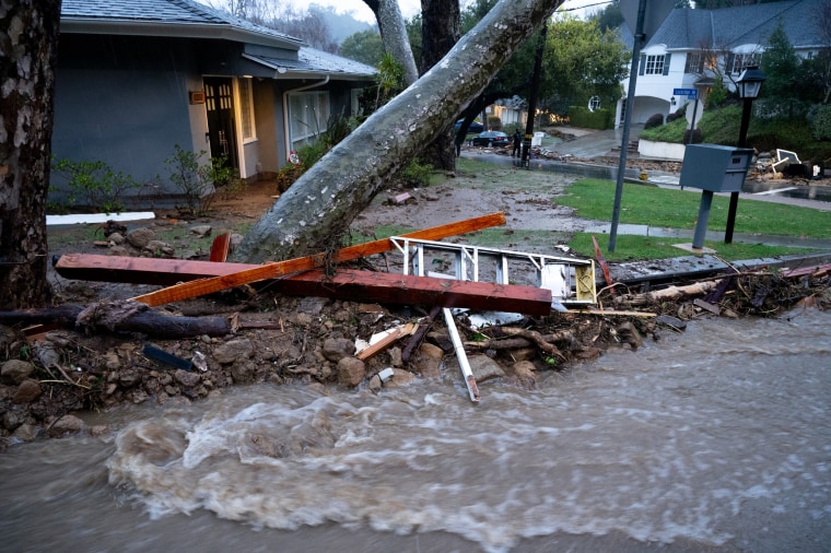

Santa Barbara Airport remains closed
Santa Barbara Airport remains closed “until further notice,” according to an update on the airport's website.
The airfield was hit with “significant flooding” in the storms rolling through California and cleanup efforts are underway.
Swift water rescue teams and fire engines pre-positioned across California
Fire personnel and swift water rescue teams have been pre-positioned across California as the powerful atmospheric river system continues to batter the state, the California Governor’s Office of Emergency Services announced today.
In Los Angeles County, 10 fire engines are at the ready, two dozers, rescue swimmers, four swift water rescue teams, and other assets. In Orange County, five engines are pre-positioned along with two dozers, two swift water rescue teams and a helicopter with a rescue swimmer. Meanwhile, San Mateo County is prepared with 10 engines and two government dispatchers.
A breakdown of assets assigned to each county can be found here .
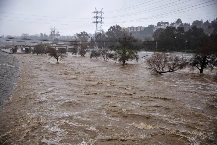
Debris flow causes ‘significant’ damage to 5 California homes
Debris flow early Monday caused “significant damage” to five homes in Beverly Crest, a neighborhood in the Santa Monica mountains, the Los Angeles Fire Department said.
No one was trapped in the flow, but 10 people were displaced by it. Firefighters assisted in evacuations, the department said.
The city’s Department of Building and Safety will assess and red tag any “seriously compromised structures.”
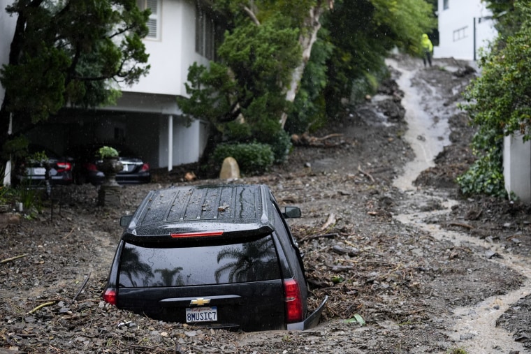
Map: How much rain has fallen in California so far
Preliminary data from the National Weather Service shows just how much rain has fallen in California since Saturday morning.
Person dies after tree topples onto Northern California home
A person died Sunday after a tree fell into a home in Boulder Creek, California, a mountain community in the Santa Cruz mountains about 30 miles southwest of San Jose, authorities said.
The Santa Cruz County Sheriff’s Office told NBC News that deputies responded to the home just before 3:30 p.m. local time and found one resident had made it out of the house, but another was trapped inside.
“Unfortunately, the resident inside sustained injuries from the tree falling into the home and was pronounced deceased at the scene,” a sheriff’s office spokesperson said. The identity of the victim was not released, pending family notification.
The Boulder Creek fatality appears to be the second in the state connected to the severe weather that hit Sunday.
Rescue crews save several people from dangerous San Jose flooding
Rescue crews were able to pull several people, three dogs and nine puppies from flooding along the Guadalupe River. KNTV’s Marianne Favro reports.
Top rainfall totals so far in California
Kathryn Prociv
In this weekend's deluge, 9.94 inches of rain was recorded near the University of California, Los Angeles; 6.33 inches north of Culver City; and 3.35 inches in Santa Barbara.
Meanwhile, a top wind gust of 138 mph was clocked in Ward Peak near Lake Tahoe, 120 mph in Upper Bull at Patterson Mountain, and 94 mph in Grapevine, California.
Today, 38 million people remain under flood alerts across much of California and into parts of southern Arizona, 34 million are under wind alerts and 1 million under winter alerts.
Three to 5 more inches of rain are anticipated through Wednesday morning in Los Angeles, 2 to 4 inches in San Diego, and 7 to 10 inches in the mountains. Up to 4 to 6 feet of snow is possible in the Sierra through Tuesday.
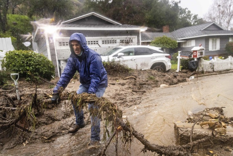
Los Angeles metro area at high risk for flash flooding, greatly increasing chance of death and damages
High-risk outlook days are rare, yet account for a majority of flood-related damages and a large percentage of flood-related deaths.
For the second day in a row, a high risk for heavy rainfall is in effect for portions of Southern California. A high risk is the highest-designation flood risk issued by the Weather Prediction Center. Marginal, slight and moderate risks are the lower categories often issued before a high risk is considered. A high risk means there is a 70% chance that rainfall amounts and/or rates will spark flash flooding.
According to NOAA’s Weather Prediction Center , between 2010 and 2020 high-risk days accounted for more than 80% of flood-related damages and nearly 40% of flood-related fatalities.
When Los Angeles was included in the high-risk area Sunday, it was the first time that the Los Angeles metro, specifically, was ever placed under a high risk for excessive rainfall that could cause flash flooding. Monday became the second day in a row for Los Angeles.
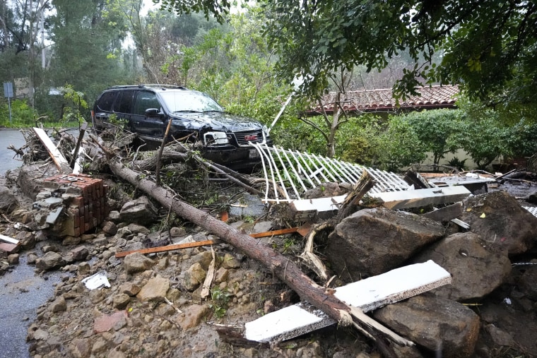
Man dies after tree falls on him in Yuba City
A man died Sunday after a tree fell on him in Yuba City in Northern California, police said. The area was hit with heavy rain and wind yesterday by an atmospheric river.
Yuba City police responded to an address on Tres Picos Drive around 7 p.m. local time and found the man underneath “a very large redwood tree in his backyard.” Lifesaving measures were administered, but he could not be revived.
Police said it appeared the man was possibly using a ladder to try to clear the tree away from his home when it fell. A neighbor, who called authorities, said they last saw the man around 3 p.m. and believe they heard the tree fall around 5 p.m.
The man was not identified.
Over 500,000 without power in California
As rain continues to batter the Golden State, over 529,000 homes and businesses are without power as of 6:30 a.m. local time (9:30 a.m. ET).
Most of the outages are concentrated in Northern and central California, with Mendocino County reporting over 23,400 customers without power, over 38,000 in Sonoma County, and over 54,000 out in San Mateo County.
In Los Angeles, more than 4,000 out of 2 million customers are experiencing outages.
Another day of high risk for flash flooding for California
The high risk for flash flooding continues Monday for California — after the UCLA area clocked nearly 10 inches of rain and a month’s worth of rain fell in downtown Los Angeles on Sunday.
About 80% of flood-related damages and 40% of flood-related fatalities occur on days when high-risk warnings for heavy rainfall and flash flooding are issued by the NOAA’s Weather Prediction Center .
As of Monday morning, torrential rain is drenching Southern California, and flash flooding and debris flows have been reported the Hollywood Hills area.
The highest flash flood risk stretches from Los Angeles to Long Beach and inland toward Big Bear Lake. The downpour will continue Tuesday from Los Angeles to San Diego and move into parts of Arizona, and showers will linger into Wednesday.
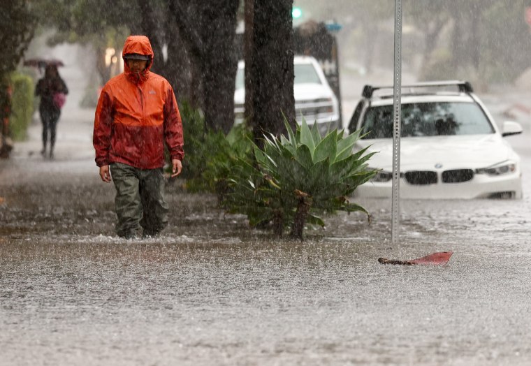
3 rescued from tree in rapid floodwaters in San Bernadino County
Three people were rescued from a tree in San Bernardino County early Monday after the car they were in got “submerged in rapid flood waters,” fire officials said.
A swift water rescue team responded to the three stranded people around 12:30 a.m. at Keenbrook Road west of Cajon Boulevard, San Bernardino County Fire said.
All three were successfully rescued, the department in an update after 2 a.m. They did not suffer any injuries but were being evaluated for hypothermia.
Creek overtops bridge in Santa Barbara during California storm
Eyewitness video captured the Mission Creek starting to overtop a road bridge in Santa Barbara during yesterday’s storm.
Police go door-to-door to evacuate people from flooded downtown Santa Barbara
Patrick Smith
SANTA BARBARA, Calif. — Residents who had stayed put in downtown Santa Barbara were being urged to leave their homes by police who were going door-to-door in an armored vehicle last night.
An entire intersection was underwater and creeks had overflowed. Santa Barbara County Sheriff Bill Brown converted Friday night’s evacuation warnings for two areas to mandatory evacuations effective early Saturday afternoon.
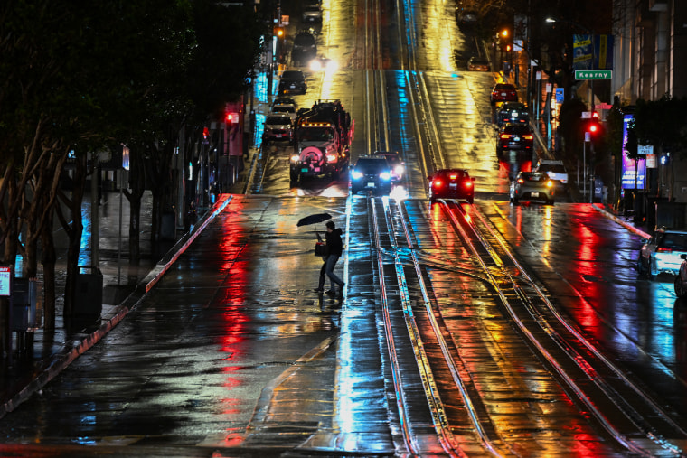
Wet roads in San Francisco
Max Butterworth
Lights are reflected along a wet street in San Francisco, as atmospheric river storms approached yesterday.
Flood warnings continue as 14 inches of rain expected in 48 hours, weather service warns
The total rainfall for parts of Southern California could reach between 8 and 14 inches over a 48-hour period, deepening the risk of flooding as the atmospheric river moves over the state, the National Weather Service said in an updated forecast at 12 a.m. PT (3.a.m ET) today.
"Ongoing showers and thunderstorms will continue to produce very heavy rainfall," the update said, adding that a high risk of excessive rainfall was likely to continue, with 5 to 8 inches possible today alone.
"Increasingly saturated conditions and ongoing flooding will be further exacerbated by this additional rainfall, continuing the threat for life-threatening, locally catastrophic flash, urban, and small stream flooding, as well as a threat for debris flows and mudslides," the NWS said.
Meanwhile, 2 to 3 inches of rain are expected in mountainous regions higher than 5,000 feet, with winds of up to 60 mph creating hazardous whiteout conditions.
Sunday beats Downtown L.A. rain record for February with 4.1 inches
The deluge of rain falling on Los Angeles is officially record-breaking: Downtown LA received 4.1 inches of rain yesterday, smashing the previous daily record for February of 2.55 inches, set way back in 1927, the city's National Weather Service station said on X.
It was the third wettest day for February since 1877 and tied for the 10th wettest day overall. The actual wettest day ever was in 1938 when 5.88 inches fell.
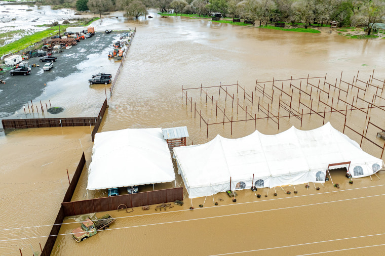
A flooded pumpkin patch in Petaluma
Vehicles and farm equipment are flooded at the Mickelson Pumpkin Patch in Petaluma, Calif., yesterday.
Heavy rain and snow set to continue, NBC News meteorologist warns
The extreme weather events battering much of California ARE set to continue throughout today and beyond, according to NBC News Meteorologist Michelle Grossman.
Speaking on Early Today this morning, she said: "This continues to be a really tough situation. We're looking at that life-threatening flash flooding continuing throughout tomorrow, continuous rain, heavy snow — we're going to be measuring the snow in feet."
She continued: "And we're looking at the chance of more mudslides, evacuations and power outages because those winds are going to be gusting."
Some 38 million people are affected by flood warnings while in higher areas moving into Nevada and Utah some 30 million are under wind alert warnings, she said.
Tomorrow will bring more heavy rain across southern California and more snow in the mountains.
California storm brings down trees across Sacramento
Toppled trees have brought down power lines, wrecked cars and damaged homes in Sacramento, California. KCRA’s Lee Anne Denyer reports.
Almost 700,000 customers without power across California
Some 680,000 homes and businesses were without power in the early hours of this morning, according to the poweroutage.us website, which tracks power connectivity nationally.
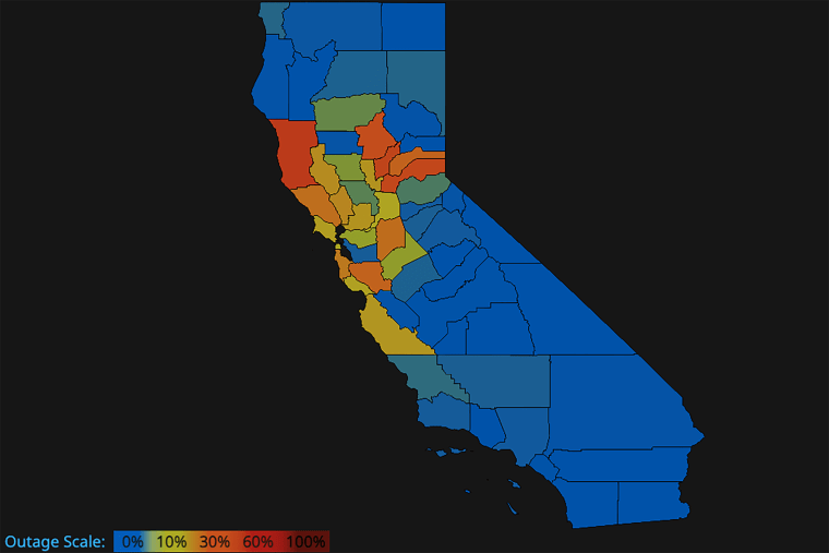
The worst affected counties were Mendocino, Yuba, Butte and Placer where 51,000 out of 146,000 customers were cut off.
The overall number of disconnections is falling however, from an overnight high of more than 780,000.
16 people rescued as debris flow causes havoc in L.A.
Firefighters rescued 16 people from Studio City, Los Angeles, late last night after debris carried by heavy rainfall caused significant damage to two homes.
All nine homes on Lockridge Road were evacuated, including pets, the Los Angeles Fire Department said in an update. "Thankfully, no one was injured and there are no medical needs," the statement said.
Emergency shelter is being offered to the displaced residents if needed. The homes are others in the area are now being assessed by the LA Department of Building and Safety, the Department of Water and gas suppliers.
Between 4 and 8 inches of rain have been forecast overnight.
Rough seas in Santa Barbara
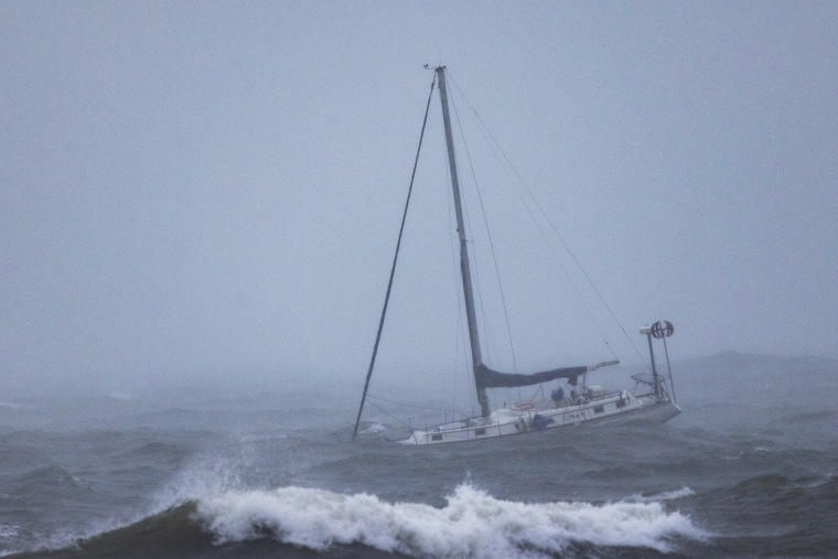
A boat moored offshore is tossed by rough waters as the second and more powerful of two atmospheric river storms arrives to Santa Barbara, Calif., on Sunday.
San Bernardino County declares state of emergency
Rudy Chinchilla
San Bernardino County tonight declared a state of emergency due to "extreme" rain and snow expected through Wednesday.
The declaration clears the way for federal and state aid that will likely be needed during and after the storm, the county said in a press release.
"The National Weather Service has predicted catastrophic and life-threatening flooding for the San Bernardino valley and coastal slopes of the San Bernardino mountains tonight through Tuesday with showers chances lasting through Friday," the press release said. "Travel and commuting will be difficult."
Residents were also warned of small stream and urban flooding, as well as rising rivers.
The county "is taking all available steps to keep our residents safe and we are making preparations to meet their needs during and after the storms," county board chair and Third District Supervisor Dan Rowe said in the press release.
Cal State LA tells students to stay home
Dennis Romero
Cal State Los Angeles doesn't want students, faculty and staff members risking life and limb to get to its campuses tomorrow, so it's instructing them to stay put and learn online.
In a letter to the Cal State LA community, President Berenecea Johnson Eanes said that classes tomorrow will be held remotely and that faculty and staff members can work from home if their roles allow it.
Monday events at the main campus on the eastern edge of the city and at Cal State LA Downtown are canceled, and student services will be unavailable, she said.
The president said holding classes exclusively online was "the safest course of action."
Flooding, vehicle rescues reported in San Fernando Valley area of L.A.
An intersection in the San Fernando Valley region of Los Angeles flooded tonight, stranding several vehicles and those inside them to await rescue, a Los Angeles Fire Department spokesperson said.
The intersection of Oxnard Street and Donna Avenue in the Tarzana neighborhood was put under 2 to 3 feet of water amid heavy rain, the spokesperson, Nicholas Prange, said in an LAFD email alert.
LAFD swiftwater rescue teams were working to pull those people, who were not injured, out of those vehicles, he said. The motorists and any passengers did the right thing by staying put, he said.
"Thankfully the vehicle occupants have remained in their vehicles and not risked going out into the deep water with unpredictable terrain and currents below the surface," Prange said.
CSU San Bernardino shutters classes tomorrow
California State University, San Bernardino, said classes at its main campus, as well as those at its campus in Palm Desert, would be closed tomorrow.
"Faculty are encouraged to move instruction to virtual modalities and to communicate with students as soon as possible," the institution said in a notice to staff members and students. "Students should check with their faculty."
The two campuses will technically remain open, but for "essential operations only," the school said.
"Those staff who can telecommute are encouraged to do so," it said.
Nearly 1 million without power in California
Josh Cradduck
Nearly 1 million people in California were without power as the Pacific storm battered the Bay Area and set its sights on Southern California.
Most of the outages were in Santa Clara County, south of San Francisco, where 134,104 electricity customers were in the dark tonight, according to utility tracker PowerOutage.us.
The total number of homes, businesses and facilities without electricity went down from 913,283 to 893,420 as the night progressed, according to the tracker. However, a vast majority of Los Angeles County's 10 million residents were warned of imminent flash flooding, which could boost the number again.
Los Angeles County residents warned of likely flash flooding
A flash flood warning is in effect tonight for most of Los Angeles County's 10 million residents, including those in the cities of L.A., Long Beach, Pasadena and Pomona, according to the National Weather Service.
A warning means flooding is imminent or already underway. The warnings were also sent to cellphones of residents who allow wireless emergency alerts.
The warning urges residents to "move immediately to higher ground" and avoid walking or driving through floodwaters.
Among the storm's perils: waves
Flash flooding and hurricane-force winds are in the forecast for this Pacific storm, but it's also making waves offshore — big waves.
The National Weather Service said today that waves as large as 23 feet were looming off the Central California coast, with waves along the coast south of the Channel Islands, including Ventura, Los Angeles, Orange and San Diego counties, reaching 19 feet offshore.
The forecast from the weather service's Ocean Prediction Center is aimed at boaters and did not estimate waves at the shoreline. It warns that mariners could encounter even larger waves in the open seas: "Individual waves may be more than twice the significant wave height," the forecast said.
A high surf advisory for San Luis Obispo and Santa Barbara counties, effective through tomorrow night, says waves as high as 20 feet could break along the coast. A high surf advisory means waves have the potential to threaten life and property.
The advisory came with a coastal flooding advisory for Port San Luis, Avila Beach, Oceano and Cayucos, where flooding was expected, the weather service said.
The swell is coming from an odd direction for this time of year: the southwest, more associated with summer waves. But this parallels the storm's counterclockwise swing and its atmospheric river, a vapor trail that has soaked up tropical precipitation near Hawaii and swept it northeast to California.
A high surf advisory for Orange and San Diego counties calls for waves as high as 10 feet along beaches, and it is also in effect through tomorrow night.
Creek rises into backyards in Santa Barbara
Kurt Chirbas
Video posted to X showed Mission Creek in Santa Barbara overflowing onto people's backyards.
Santa Barbara County was one of the counties for which Newsom declared an emergency, allowing for the activation of the National Guard and the facilitation of faster recovery efforts if needed.
Inches of rain begin falling over Southern California
LOS ANGELES — Several inches of rain fell over parts of Southern California tonight as a powerful storm began barreling into the region.
Top two-day rainfall totals as of 6 p.m. were over 5 inches in some areas, the National Weather Service's office in Los Angeles/Oxnard reported. The highest total so far was recorded in Matilija Canyon, in Ventura County, which got 5.91 inches, according to the weather service.
Farther south in Los Angeles' San Fernando Valley, Agoura Hills got 3.41 inches and Woodland Hills got 2.28 inches.
Heavy rain was expected to continue falling in the Los Angeles area through the night.
UC Santa Barbara, Cal State campuses in Northridge, Fullerton shutter in-person classes
Colin Sheeley
Some California universities are telling students to stay home tomorrow as they expect the effects of the storm to make it difficult, if not perilous, to make it to class.
Among them are the University of California, Santa Barbara, which serves a community expected to be hit hard by rain, wind and floodwaters. Chancellor Henry T. Yang said in a notice to the campus community that instructors have been told to conduct virtual classes if possible.
Cal State Northridge in Los Angeles' San Fernando Valley is keeping its campus open, but all classes have been canceled and all events are to be rescheduled, its police chief, Alfredo B. Fernandez, said in a notice to the campus community. Instruction may still be held virtually, on a class-by-class basis, he said.
Cal State Fullerton in Orange County, south of L.A., said in a statement that classes would be conducted remotely, and staff members were encouraged to work from home if possible.
Cal Poly San Luis Obispo, California State University Channel Islands and Cal State Long Beach all said they planned to be open but encouraged flexibility among instructors who may have students who can't make it to campus. Virtual learning was a class-by-class possibility for the Channel Islands and Long Beach institutions, spokespeople for the campuses said.
Trees downed in El Granada
Several people, dogs, rescued from rising guadalupe river in san jose, california braces as dangerous storm system set to deliver ‘life threatening flooding’ and heavy snow.
SAN DIEGO — A strong Pacific storm system is expected to bring “life threatening flooding” and heavy snow to California today and early into the week, according to the National Weather Service .
On Sunday, Gov. Gavin Newsom declared a storm-related state of emergency as federal forecasters said an atmospheric river of precipitation drawn from waters north of Hawaii was producing a firehose of rain and snow for the state.
Read the full story here.

- Tropical Cyclone Products
- Tropical Weather Outlooks
- Marine Products
- Audio/Podcasts
- GIS Products
- Alternate Formats
- Tropical Cyclone Product Descriptions
- Tropical Cyclone Product Examples
- Marine Product Descriptions
- Satellite Imagery
- Radar Imagery
- Aircraft Reconnaissance
- Tropical Analysis Tools
- Experimental Products
- Lat/Lon Distance Calculator
- Blank Tracking Maps
- Be Prepared! NWS Hurricane Prep Week
- NWS Hurricane Safety
- Outreach Documents
- Storm Surge
- Watch/Warning Breakpoints
- Climatology
- Tropical Cyclone Names
- Records and Facts
- Historical Hurricane Summaries
- Forecast Models
- NHC Publications
- NHC Glossary
- Frequent Questions
- Tropical Cyclone Advisories
- Tropical Cyclone Reports
- Tropical Cyclone Forecast Verification
- Atlantic Current Season Summary
- E. Pacific Current Season Summary
- C. Pacific Current Season Summary
- NHC News Archive
- Other Archives: HURDAT, Track Maps, Marine Products, and more
- National Hurricane Center
- Central Pacific Hurricane Center
- Mission & Vision
- Virtual Tour
- Visiting NHC
NWS All NOAA
- Director Ken Graham will host the next Facebook Live update on Barry at 4:30pm CDT
- Marine warnings are in effect for the Atlantic and Eastern North Pacific
- Marine warnings are in effect for the Atlantic
- Marine warnings are in effect for the Eastern North Pacific
- July 25, 2018 2:00 PM EDT: The National Hurricane Center website is experiencing network problems. Some products may be missing or delayed until this is resolved.
- Local info on Ophelia: Newport/Morehead City , Wakefield , Baltimore/Washington
- Please see your local NWS office at www.weather.gov for more information about wind and flooding hazards associated with Michael.
- Audio podcasts regarding Ida are currently available
- National Hurricane Preparedness Week: May 5-11, 2024
- NHC New Products and Services for the 2024 Hurricane Season
- NHC Cone Graphic Change Announcement
- A Public Information Statement has been issued for the delay in the storm surge watch graphic
- Can we detect a change in Atlantic hurricanes today due to human-caused climate change?
US Dept of Commerce National Oceanic and Atmospheric Administration National Hurricane Center 11691 SW 17th Street Miami, FL, 33165 [email protected]
Central Pacific Hurricane Center 2525 Correa Rd Suite 250 Honolulu, HI 96822 [email protected]
Disclaimer Information Quality Help Glossary
Privacy Policy Freedom of Information Act (FOIA) About Us Career Opportunities
- Skip to main content
- Keyboard shortcuts for audio player
The huge solar storm is keeping power grid and satellite operators on edge

Geoff Brumfiel
Willem Marx

NASA's Solar Dynamics Observatory captured this image of solar flares early Saturday afternoon. The National Oceanic and Atmospheric Administration says there have been measurable effects and impacts from the geomagnetic storm. Solar Dynamics Observatory hide caption
NASA's Solar Dynamics Observatory captured this image of solar flares early Saturday afternoon. The National Oceanic and Atmospheric Administration says there have been measurable effects and impacts from the geomagnetic storm.
Planet Earth is getting rocked by the biggest solar storm in decades – and the potential effects have those people in charge of power grids, communications systems and satellites on edge.
The National Oceanic and Atmospheric Administration says there have been measurable effects and impacts from the geomagnetic storm that has been visible as aurora across vast swathes of the Northern Hemisphere. So far though, NOAA has seen no reports of major damage.

The Picture Show
Photos: see the northern lights from rare, solar storm.
There has been some degradation and loss to communication systems that rely on high-frequency radio waves, NOAA told NPR, as well as some preliminary indications of irregularities in power systems.
"Simply put, the power grid operators have been busy since yesterday working to keep proper, regulated current flowing without disruption," said Shawn Dahl, service coordinator for the Boulder, Co.-based Space Weather Prediction Center at NOAA.
NOAA Issues First Severe Geomagnetic Storm Watch Since 2005

- LISTEN & FOLLOW
- Apple Podcasts
- Google Podcasts
- Amazon Music
- Amazon Alexa
Your support helps make our show possible and unlocks access to our sponsor-free feed.
"Satellite operators are also busy monitoring spacecraft health due to the S1-S2 storm taking place along with the severe-extreme geomagnetic storm that continues even now," Dahl added, saying some GPS systems have struggled to lock locations and offered incorrect positions.
NOAA's GOES-16 satellite captured a flare erupting occurred around 2 p.m. EDT on May 9, 2024.
As NOAA had warned late Friday, the Earth has been experiencing a G5, or "Extreme," geomagnetic storm . It's the first G5 storm to hit the planet since 2003, when a similar event temporarily knocked out power in part of Sweden and damaged electrical transformers in South Africa.
The NOAA center predicted that this current storm could induce auroras visible as far south as Northern California and Alabama.
Extreme (G5) geomagnetic conditions have been observed! pic.twitter.com/qLsC8GbWus — NOAA Space Weather Prediction Center (@NWSSWPC) May 10, 2024
Around the world on social media, posters put up photos of bright auroras visible in Russia , Scandinavia , the United Kingdom and continental Europe . Some reported seeing the aurora as far south as Mallorca, Spain .
The source of the solar storm is a cluster of sunspots on the sun's surface that is 17 times the diameter of the Earth. The spots are filled with tangled magnetic fields that can act as slingshots, throwing huge quantities of charged particles towards our planet. These events, known as coronal mass ejections, become more common during the peak of the Sun's 11-year solar cycle.
A powerful solar storm is bringing northern lights to unusual places
Usually, they miss the Earth, but this time, NOAA says several have headed directly toward our planet, and the agency predicted that several waves of flares will continue to slam into the Earth over the next few days.
While the storm has proven to be large, predicting the effects from such incidents can be difficult, Dahl said.
Shocking problems
The most disruptive solar storm ever recorded came in 1859. Known as the "Carrington Event," it generated shimmering auroras that were visible as far south as Mexico and Hawaii. It also fried telegraph systems throughout Europe and North America.

Stronger activity on the sun could bring more displays of the northern lights in 2024
While this geomagnetic storm will not be as strong, the world has grown more reliant on electronics and electrical systems. Depending on the orientation of the storm's magnetic field, it could induce unexpected electrical currents in long-distance power lines — those currents could cause safety systems to flip, triggering temporary power outages in some areas.
my cat just experienced the aurora borealis, one of the world's most radiant natural phenomena... and she doesn't care pic.twitter.com/Ee74FpWHFm — PJ (@kickthepj) May 10, 2024
The storm is also likely to disrupt the ionosphere, a section of Earth's atmosphere filled with charged particles. Some long-distance radio transmissions use the ionosphere to "bounce" signals around the globe, and those signals will likely be disrupted. The particles may also refract and otherwise scramble signals from the global positioning system, according to Rob Steenburgh, a space scientist with NOAA. Those effects can linger for a few days after the storm.
Like Dahl, Steenburgh said it's unclear just how bad the disruptions will be. While we are more dependent than ever on GPS, there are also more satellites in orbit. Moreover, the anomalies from the storm are constantly shifting through the ionosphere like ripples in a pool. "Outages, with any luck, should not be prolonged," Steenburgh said.

What Causes The Northern Lights? Scientists Finally Know For Sure
The radiation from the storm could have other undesirable effects. At high altitudes, it could damage satellites, while at low altitudes, it's likely to increase atmospheric drag, causing some satellites to sink toward the Earth.
The changes to orbits wreak havoc, warns Tuija Pulkkinen, chair of the department of climate and space sciences at the University of Michigan. Since the last solar maximum, companies such as SpaceX have launched thousands of satellites into low Earth orbit. Those satellites will now see their orbits unexpectedly changed.
"There's a lot of companies that haven't seen these kind of space weather effects before," she says.
The International Space Station lies within Earth's magnetosphere, so its astronauts should be mostly protected, Steenburgh says.
In a statement, NASA said that astronauts would not take additional measures to protect themselves. "NASA completed a thorough analysis of recent space weather activity and determined it posed no risk to the crew aboard the International Space Station and no additional precautionary measures are needed," the agency said late Friday.

People visit St Mary's lighthouse in Whitley Bay to see the aurora borealis on Friday in Whitley Bay, England. Ian Forsyth/Getty Images hide caption
People visit St Mary's lighthouse in Whitley Bay to see the aurora borealis on Friday in Whitley Bay, England.
While this storm will undoubtedly keep satellite operators and utilities busy over the next few days, individuals don't really need to do much to get ready.
"As far as what the general public should be doing, hopefully they're not having to do anything," Dahl said. "Weather permitting, they may be visible again tonight." He advised that the largest problem could be a brief blackout, so keeping some flashlights and a radio handy might prove helpful.
I took these photos near Ranfurly in Central Otago, New Zealand. Anyone can use them please spread far and wide. :-) https://t.co/NUWpLiqY2S — Dr Andrew Dickson reform/ACC (@AndrewDickson13) May 10, 2024
And don't forget to go outside and look up, adds Steenburgh. This event's aurora is visible much further south than usual.
A faint aurora can be detected by a modern cell phone camera, he adds, so even if you can't see it with your eyes, try taking a photo of the sky.
The aurora "is really the gift from space weather," he says.
- space weather
- solar flares
- solar storm
A .gov website belongs to an official government organization in the United States.
A lock ( ) or https:// means you've safely connected to the .gov website. Share sensitive information only on official, secure websites.
- Hurricanes or Other Tropical Storms
- Preparedness and Safety Messaging for Hurricanes, Flooding, and Similar Disasters (Second Edition | 2022)
- Natural Disasters and Severe Weather
About Hurricanes and Other Tropical Storms
- Hurricane season starts on May 15 in the north Pacific and June 1 in the Atlantic and the Caribbean. It ends on November 30.
- Know what to do to keep yourself and your loved ones safe before, during, and after the storm.
Be prepared for hurricanes
Hurricane season starts on May 15 in the north Pacific and June 1 in the Atlantic and the Caribbean. It ends on November 30. Before hurricane season each year, make sure you and your family are prepared by planning ahead.
Learn more:
- Preparing for Hurricanes or Other Tropical Storms
Stay safe after the storm
The storm might be over, but that doesn't mean the danger is. Keep yourself and your loved ones safe after the storm by following our safety tips.
- Safety Guidelines: After a Hurricane or Other Tropical Storm
- Floods and Your Safety
- Hurricanes | Ready.gov
- Hurricane Preparedness | Red Cross
- National Hurricane Center (noaa.gov)
Know what to do to keep yourself and your loved ones safe before, during, and after a hurricane or other tropical storm.
For Everyone
Public health.
Wildfire weather is increasing in California and much of the U.S., report finds
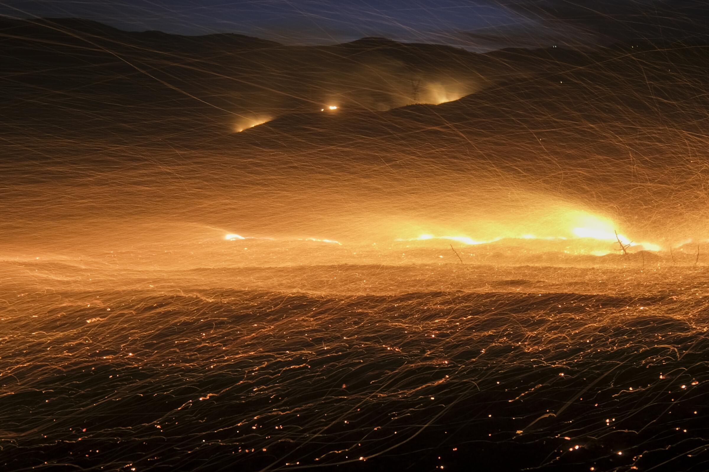
- Show more sharing options
- Copy Link URL Copied!
Wildfire weather has become more frequent in the Western United States over the past five decades, with some of the largest jumps in California, according to a new report by Climate Central , a nonprofit news outlet that reports on climate change.
The report looks at three key weather conditions — heat, dryness and wind — that, when combined, load the dice for wildfires to spread quickly and grow large, said Kaitlyn Trudeau, senior research associate with Climate Central.

Aggressive and impactful reporting on climate change, the environment, health and science.
“We’re really talking about days when the stage is set for prime wildfire growth,” she said. “All three conditions are working together to make for really dangerous meteorological conditions.”
The report serves as a good reminder that the Western U.S. has become warmer and drier in ways that tend to promote more large wildfires, said Park Williams, climate scientist and professor in the UCLA Department of Geography, who was not involved in the analysis.
“We’ve seen in tons of academic research over the last decade that fire weather is increasing in the U.S. — and most of the increase has been in the West — over the last half-century or so,” he said. “So this report is very much in line with that general conclusion.”
The burning of fossil fuels has ratcheted up fire danger by increasing global temperatures , Trudeau said. Because warmer air can hold more water, the atmosphere has become thirstier , pulling more moisture from plants and soils and making them burn more readily, she said.
“Because we can attribute that warming to climate change, and because of the relationship between relative humidity and temperature, we know that we can attribute some of this to climate change,” she said.

Climate & Environment
Joshua Tree’s celebrity rattlesnake wrangler wants to change how you see reptiles
Danielle Wall has transformed how locals interact with rattlesnakes. Her work has earned her a front-row seat to reshaping of California’s High Desert.
May 5, 2024
The researchers analyzed hourly observation data from 476 weather stations across the lower 48 states to calculate how many fire weather days were recorded at each station, on average, for each of the last 51 years. They defined a fire weather day as one when temperatures, relative humidity and sustained wind speeds simultaneously reached certain thresholds for at least two of the 24 hours.
The report found the average annual number of fire weather days is increasing throughout the majority of California, especially in interior areas of the state. The southern interior, the state’s portion of the Southwest Desert Basin, saw the biggest jump with an increase of 61 fire weather days per year, on average, between 1973 and last year.
Generally speaking, an increase in fire weather would tend to have the smallest effect on this already very dry, sparsely-vegetated desert region as the warming and drying of the atmosphere doesn’t necessarily promote more fire there, Williams said.
“Instead, actually giving the land some water in order to grow new fuels is the first thing you need for more fire,” he said.
But higher-elevation desert areas that have received healthy doses of precipitation over the last year or two may have enough connected vegetation to sustain a large fire. The basin region includes a corner of the eastern Mojave Desert where the York fire became California’s largest blaze last year .
How large fires are altering the face of California’s Mojave Desert
Last year’s York fire has sparked discussion about how to deal with conflagrations in the Mojave National Preserve.
March 19, 2024
California’s San Joaquin and Sacramento drainages saw smaller, albeit notable, increases in average annual fire weather days of 14 and 13, respectively, since 1973, according to the Climate Central report.
Parts of New Mexico, Texas and Arizona saw large jumps in average annual fire weather days. By contrast, parts of North and South Dakota, where spring has been cooling slightly, saw a decline, the report found.
There were some drawbacks to doing a nationwide analysis, Trudeau said. There are different ways to define fire weather depending on an area’s local climate, and it was a challenge to come up with a range of criteria that could be used across the U.S., she said.
Toward a more sustainable California
Get Boiling Point, our newsletter exploring climate change, energy and the environment, and become part of the conversation — and the solution.
You may occasionally receive promotional content from the Los Angeles Times.
“Because of that, there are certain parts of this analysis that don’t fully represent the story,” she said.
For example, researchers decided to use regionally specific relative humidity thresholds based on criteria set by the National Oceanic and Atmospheric Administration and National Weather Service’s Storm Prediction Center, which is less than or equal to 20% for a broad swath of the West, including the California coast, Trudeau said.
As a result, the report calculates relatively small increases in average annual fire weather days for California’s regional coasts — four days for the Central Coast, three for the south coast and one for the north.
“It’s not necessarily the biggest picture, because we’re basically asking a coastal area to meet this threshold that is very hard to meet when you’re right next to a large body of water,” Trudeau said.
Still, she said, the fact that there were days when the California coast did get that dry, and that the frequency of those days is increasing even modestly, is meaningful.
“It actually does pick up that these parts of California do experience really bad conditions, where it does get extremely dry even when you’re right by the ocean,” she said.

Yes, beavers can help stop wildfires. And more places in California are embracing them
Beavers create unburned islands where plants and animals can shelter from megafires, research has confirmed. A movement is afoot to reintroduce the rodents to the state’s waterways.
March 26, 2024
Trudeau also noted that the report does not account for the profound changes in vegetation that have taken place over the last 50 years, as portions of California’s forests were altered by fire suppression, the quashing of Indigenous cultural burning and industrial logging. Nor does it consider the incidence of dry lightning bursts , which have ignited some of the state’s biggest fires, or the extent to which development has pushed into wildland areas, putting more people and properties at risk, she said.
“Our analysis should definitely not be taken as a comprehensive be-all, end-all of what fire risk is in California, or fire weather risk, because there are so many other variables,” she said. “But it gives you a piece of the puzzle.”
Trudeau took a personal interest in the research. She grew up in Placerville, a small town in the Sierra Nevada foothills between Sacramento and Lake Tahoe, and has seen firsthand how warming temperatures have reshaped the landscape. “I’ve seen the seasons change, I’ve seen the fires come, I’ve seen how we got a lot less snow, a lot less rain,” she said.
“Just being a Californian and spending most of my life out here, the results really follow what we’re seeing, and follow my experience living in this awesome part of the world that has, unfortunately, a really immense and growing risk.”

Climate change supercharged a heat dome, intensifying 2021 fire season, study finds
North America’s 2021 fire season, including massive Northern California blazes, was made worse by a supercharged heat dome. What did the supercharging? Climate change.
April 22, 2024

Alex Wigglesworth is an environment reporter who covers wildfire and forestry for the Los Angeles Times.
More From the Los Angeles Times

Company Town
What happened to Silicon Beach? Why L.A.’s tech sector hasn’t lived up to the hype
May 20, 2024
Cloudy with a chance of rage: Climatologists fume over relocation of L.A. weather station
May 17, 2024
California is changing how big power companies charge for electricity. What to expect on your bill
May 16, 2024

Travel & Experiences
The 101 best West Coast experiences

COMMENTS
Hilary has been weakening to a Category 1 hurricane as it heads to land, but it is still expected to lash the Baja California Peninsula with extreme winds and rain. Currently, there is a hurricane ...
San Diego officials and the National Weather Service asked residents to stay home as the worst of Tropical Storm Hilary has yet to hit the county. High winds and heavy rain are expected to ...
Mexican authorities have lifted the tropical storm warning for the west coast of Baja California and the east coast of the peninsula south of San Felipe. The warning has also been discontinued ...
Hilary weakened from a Category 1 hurricane to a tropical storm before it made landfall over the northern Baja California Peninsula early Sunday. At least one death is already attributed to the storm.
Tropical Storm Hilary's impact lingers throughout Southern California on Monday. The powerful weather event brought heavy rain to the area, forcing trash to flow down local streams and rivers, as ...
Hilary continued to lose muscle as the storm aimed for Southern California Saturday night, weakening from a Category 2 to a Category 1 hurricane, according to the National Hurricane Center's ...
Hurricane and tropical storm categories are based on wind speed. The main threat from Hilary is related to rain, not wind. (10:20 a.m. ET) Hilary Already Generating Rain Over California
California Gov. Gavin Newsom on Saturday proclaimed a state of emergency Saturday for a large portion of Southern California, as the state prepares for a historic hurricane expected to cause ...
Hilary updates: Over 1 foot of rain hits San Bernardino as LA avoids catastrophe. Hilary soaked Southern California, flooding roads and knocking out power. By Nadine El-Bawab, Meredith Deliso ...
Hurricane Hilary, rapidly intensifying off Mexico's west coast, was upgraded to a Category 4 storm Friday morning, with forecasters warning that the storm will likely hit Southern California by ...
Evacuees from Catalina Island arrive in Long Beach, California, after leaving due to Hurricane Hilary. Aug. 19, 2023. ... Nearly 1.3 million Michigan residents expected to travel for Memorial Day ...
Just how much rain did Southern California get? The National Weather Service Los Angeles said at 3 a.m. local time that "virtually all rainfall daily records have been broken thus far.". Among ...
WHAT YOU NEED TO KNOW: California continues to mobilize ahead of Hurricane Hilary's projected landfall in Southern California.People are urged to take all necessary precautions today. SACRAMENTO - Today, Governor Gavin Newsom proclaimed a state of emergency for much of Southern California to support Hurricane Hilary response and recovery efforts as the state continues mobilizing and ...
WHAT YOU NEED TO KNOW: As the state mobilizes resources and support for communities, Californians in the storm's path are urged to take precautions now ahead of the storm. SACRAMENTO - With Hurricane Hilary forecasted to be the wettest tropical cyclone in state history and the first-ever Tropical Storm Watch issued for California, the state is mobilizing to protect people from the storm ...
A tropical storm watch for Southern California was changed tonight to a tropical storm warning, the National Hurricane Center said in a 11 p.m. ET (8 p. m. PT) advisory.. The tropical storm ...
Emergency declaration and urgent warnings as Southern California storm gains ferocity. Feb. 4, 2024. "That's a lot of water, people. I mean, that's a lot," meteorologist Ryan Kittell of ...
As of Friday morning, Hilary had maximum sustained winds of 145 mph and had reached Category 4 status, according to the hurricane center. It is forecast to be near or over the central Baja coast ...
Hurricane Hilary has prompted historic weather alerts in California as millions across the Southwest begin to see initial impacts from the storm, with the worst to come over the next 48 hours, as the cyclone unleashes catastrophic, life-threatening flooding.. By Sunday afternoon, the center of Hilary is expected to move over Southern California after it nears the west-central coast of the Baja ...
Hurricane Hilary, which quickly grew to category 4 strength off Mexico's Pacific coast, whipping up 145mph winds, could become the first tropical storm to make landfall in southern California in ...
The latest news and live updates on the storm system pounding California. 3 dead as storm pummels California, causing flooding and dozens of mudslides in L.A. area IE 11 is not supported.
The Atlantic hurricane season runs from June 1st through November 30th. Eastern North Pacific (East of 140°W) Tropical Weather Outlook ( en Español ) 1100 PM PDT Fri May 17 2024. Tropical Weather Discussion. 1005 UTC Sat May 18 2024. There are no tropical cyclones in the Eastern North Pacific at this time. Central North Pacific (140°W to 180 ...
The NOAA center predicted that this current storm could induce auroras visible as far south as Northern California and Alabama. Extreme (G5) geomagnetic conditions have been observed! pic.twitter ...
Before hurricane season each year, make sure you and your family are prepared by planning ahead. Hurricane season starts on May 15 in the north Pacific and June 1 in the Atlantic and the Caribbean. It ends on November 30. Before hurricane season each year, make sure you and your family are prepared by planning ahead. Learn more:
Fire weather days have increased in Western U.S. over the last 50 years, with some of the largest jumps in California, according to a new report by Climate Central, a nonprofit news outlet that ...